Pembroke is a city and county seat in Bryan County, Georgia, United States. As of the 2020 census, the population of the city was 2,513. It is located approximately 35 miles west of Savannah, Georgia, and approximately 20 miles south of Statesboro, Georgia.
| Name: | Pembroke city |
|---|---|
| LSAD Code: | 25 |
| LSAD Description: | city (suffix) |
| State: | Georgia |
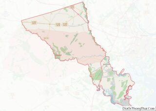
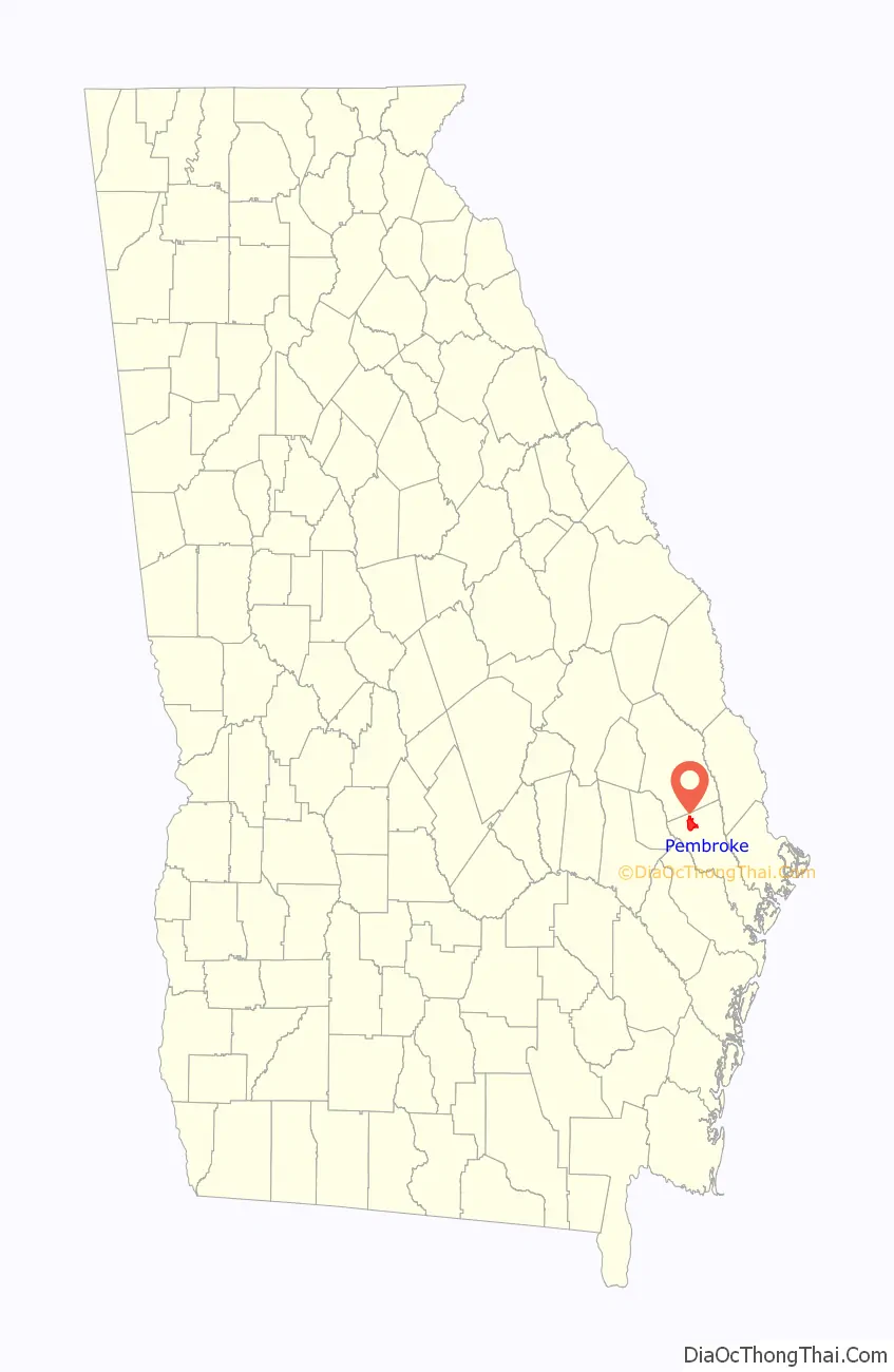
| County: | Bryan County |
| Elevation: | 92 ft (28 m) |
| Total Area: | 7.69 sq mi (19.90 km²) |
| Land Area: | 7.64 sq mi (19.79 km²) |
| Water Area: | 0.04 sq mi (0.11 km²) |
| Total Population: | 2,513 |
| Population Density: | 330/sq mi (130/km²) |
| ZIP code: | 31321 |
| Area code: | 912 |
| FIPS code: | 1360004 |
| Website: | pembrokega.net |
Online Interactive Map
Click on ![]() to view map in "full screen" mode.
to view map in "full screen" mode.
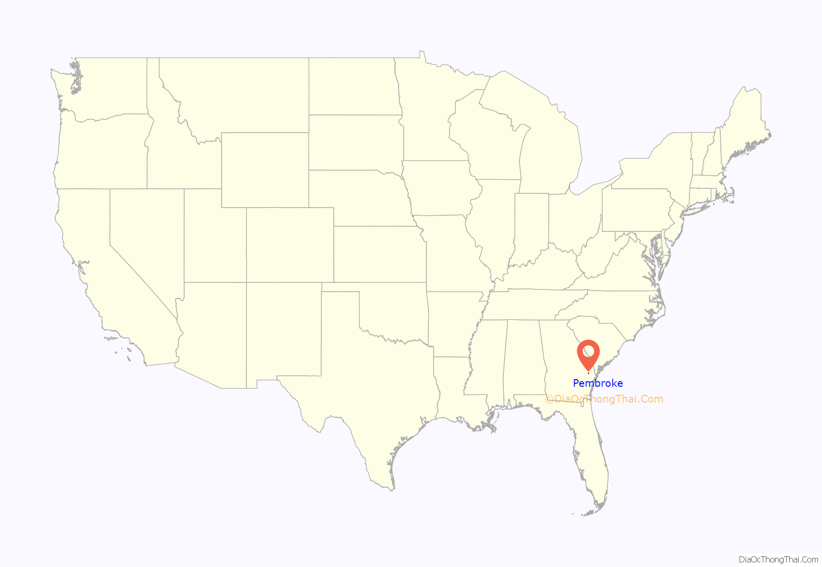
Pembroke location map. Where is Pembroke city?
History
Pembroke was founded in 1892 as a railroad town and turpentine shipping center. It was named after early resident Pembroke Whitfield Williams. It was incorporated in 1905. The county seat was voted to be moved from Clyde to Pembroke in 1935, with the first County Commissioners session in Pembroke taking place on February 15, 1937.
On April 9, 1998, a F3 tornado damaged the city. It killed two people and injured 17 others along its path.
On April 5, 2022, an EF2 tornado struck the town, causing heavy damage to many structures, trees, and power lines. The tornado would later strengthen to EF4 intensity in Black Creek, causing catastrophic damage, killing one person, and injuring 12 others.
The Pembroke Historic District is listed in the National Register of Historic Places.
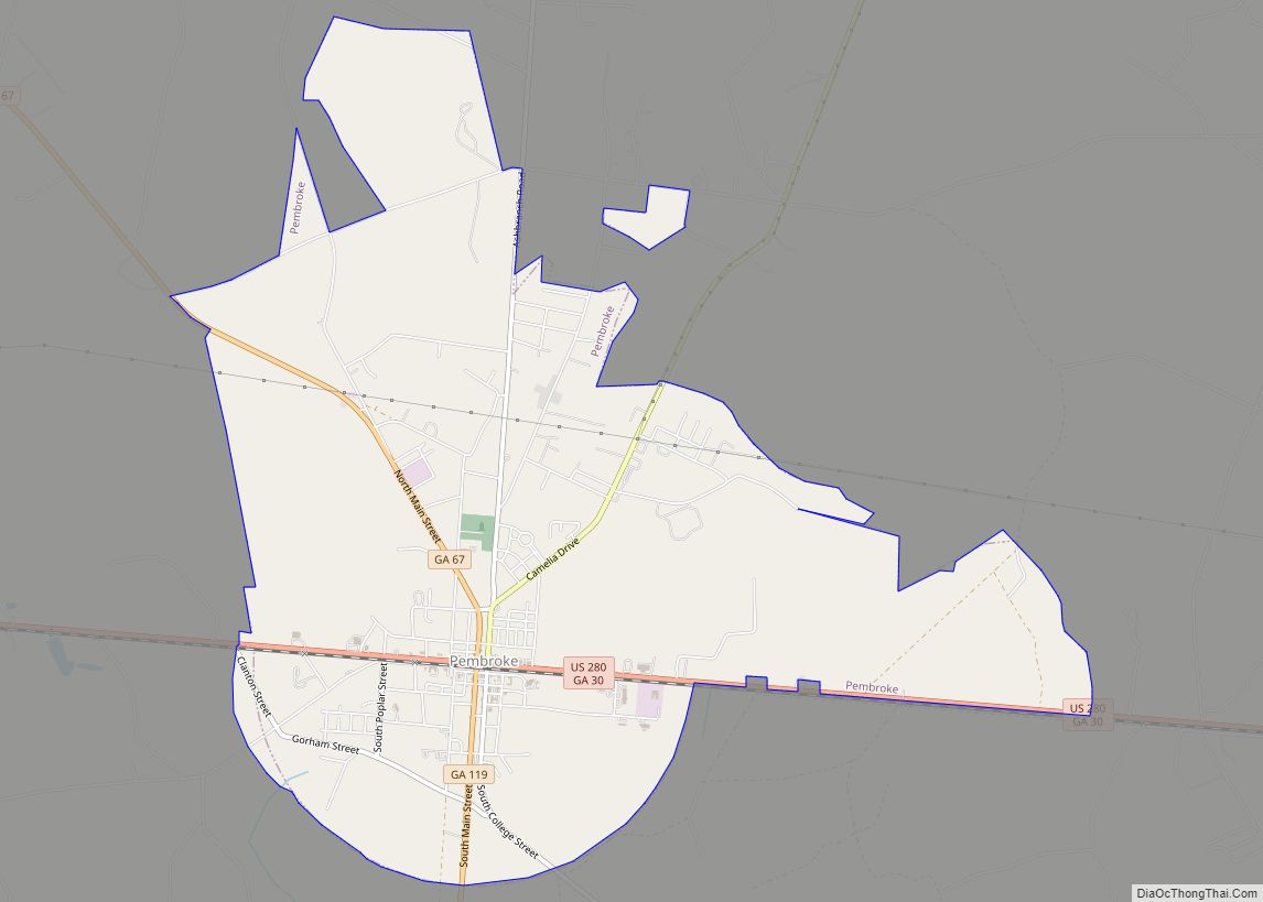
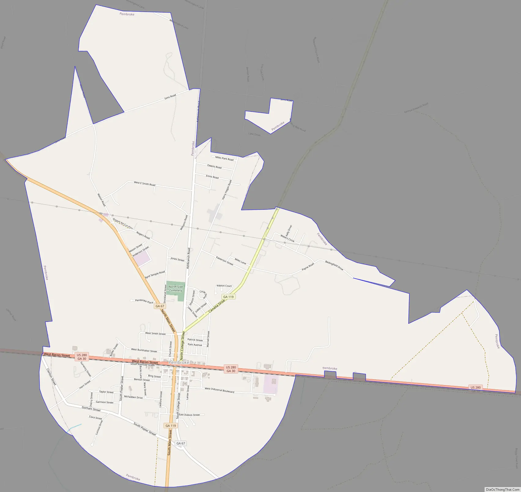
Pembroke Road Map
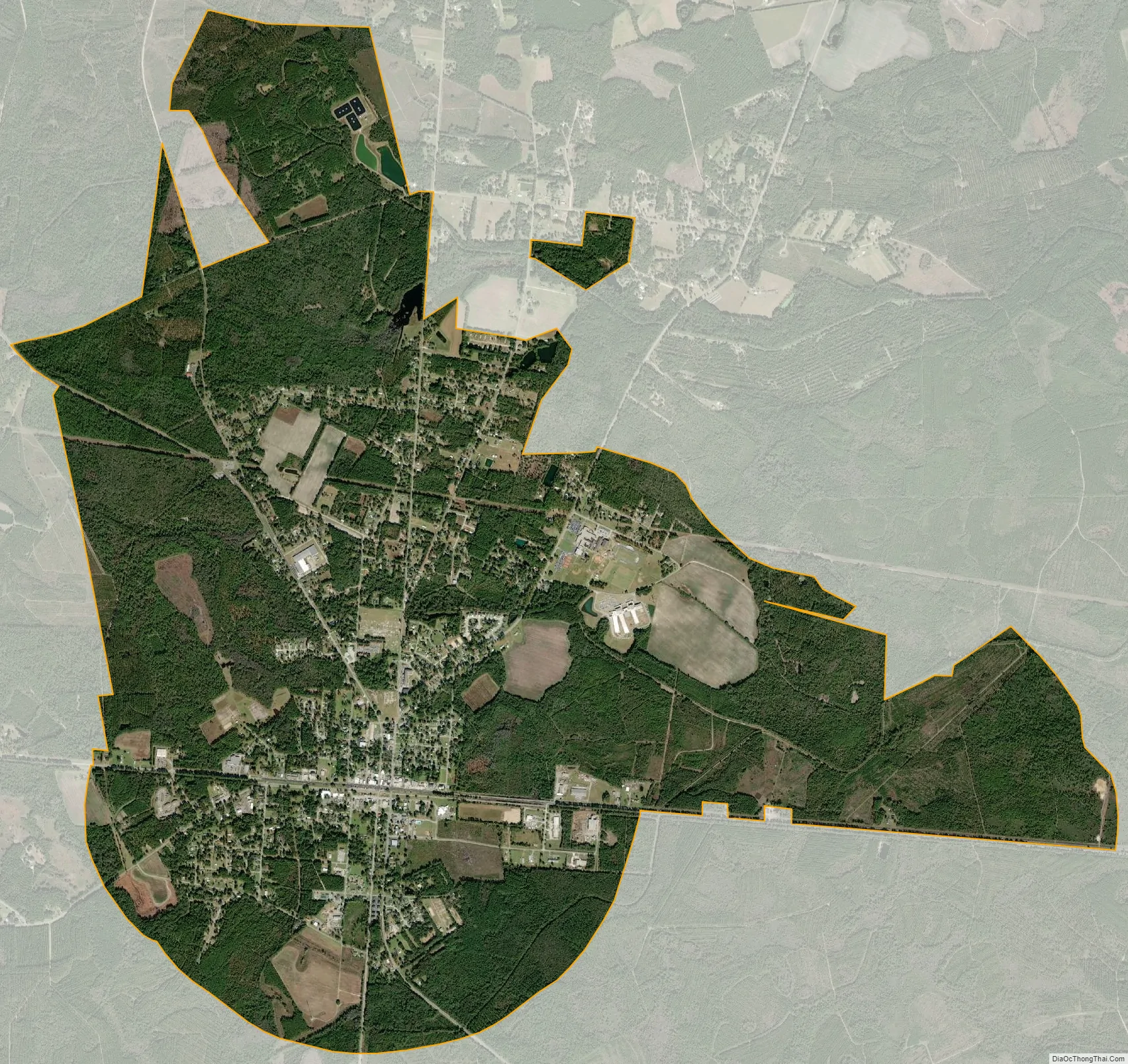
Pembroke city Satellite Map
Geography
Pembroke is located in northern Bryan County at 32°08′24″N 81°37′25″W / 32.139892°N 81.623553°W / 32.139892; -81.623553. U.S. Route 280 passes through the center of the city, leading east 10 miles (16 km) to Interstate 16 and 35 miles (56 km) to Savannah. Claxton is 16 miles (26 km) to the west.
According to the United States Census Bureau, Pembroke has a total area of 7.7 square miles (19.9 km), of which 7.6 square miles (19.6 km) is land and 0.077 square miles (0.2 km), or 1.17%, is water.
See also
Map of Georgia State and its subdivision:- Appling
- Atkinson
- Bacon
- Baker
- Baldwin
- Banks
- Barrow
- Bartow
- Ben Hill
- Berrien
- Bibb
- Bleckley
- Brantley
- Brooks
- Bryan
- Bulloch
- Burke
- Butts
- Calhoun
- Camden
- Candler
- Carroll
- Catoosa
- Charlton
- Chatham
- Chattahoochee
- Chattooga
- Cherokee
- Clarke
- Clay
- Clayton
- Clinch
- Cobb
- Coffee
- Colquitt
- Columbia
- Cook
- Coweta
- Crawford
- Crisp
- Dade
- Dawson
- Decatur
- DeKalb
- Dodge
- Dooly
- Dougherty
- Douglas
- Early
- Echols
- Effingham
- Elbert
- Emanuel
- Evans
- Fannin
- Fayette
- Floyd
- Forsyth
- Franklin
- Fulton
- Gilmer
- Glascock
- Glynn
- Gordon
- Grady
- Greene
- Gwinnett
- Habersham
- Hall
- Hancock
- Haralson
- Harris
- Hart
- Heard
- Henry
- Houston
- Irwin
- Jackson
- Jasper
- Jeff Davis
- Jefferson
- Jenkins
- Johnson
- Jones
- Lamar
- Lanier
- Laurens
- Lee
- Liberty
- Lincoln
- Long
- Lowndes
- Lumpkin
- Macon
- Madison
- Marion
- McDuffie
- McIntosh
- Meriwether
- Miller
- Mitchell
- Monroe
- Montgomery
- Morgan
- Murray
- Muscogee
- Newton
- Oconee
- Oglethorpe
- Paulding
- Peach
- Pickens
- Pierce
- Pike
- Polk
- Pulaski
- Putnam
- Quitman
- Rabun
- Randolph
- Richmond
- Rockdale
- Schley
- Screven
- Seminole
- Spalding
- Stephens
- Stewart
- Sumter
- Talbot
- Taliaferro
- Tattnall
- Taylor
- Telfair
- Terrell
- Thomas
- Tift
- Toombs
- Towns
- Treutlen
- Troup
- Turner
- Twiggs
- Union
- Upson
- Walker
- Walton
- Ware
- Warren
- Washington
- Wayne
- Webster
- Wheeler
- White
- Whitfield
- Wilcox
- Wilkes
- Wilkinson
- Worth
- Alabama
- Alaska
- Arizona
- Arkansas
- California
- Colorado
- Connecticut
- Delaware
- District of Columbia
- Florida
- Georgia
- Hawaii
- Idaho
- Illinois
- Indiana
- Iowa
- Kansas
- Kentucky
- Louisiana
- Maine
- Maryland
- Massachusetts
- Michigan
- Minnesota
- Mississippi
- Missouri
- Montana
- Nebraska
- Nevada
- New Hampshire
- New Jersey
- New Mexico
- New York
- North Carolina
- North Dakota
- Ohio
- Oklahoma
- Oregon
- Pennsylvania
- Rhode Island
- South Carolina
- South Dakota
- Tennessee
- Texas
- Utah
- Vermont
- Virginia
- Washington
- West Virginia
- Wisconsin
- Wyoming