Richmond Hill is a city in Bryan County, Georgia, United States. The population was 16,633 at the 2020 U.S. Census, an increase of almost 80% from the 2010 population of 9,281. Richmond Hill is part of the Savannah Metropolitan Statistical Area.
| Name: | Richmond Hill city |
|---|---|
| LSAD Code: | 25 |
| LSAD Description: | city (suffix) |
| State: | Georgia |
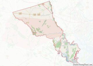
| County: | Bryan County |
| Incorporated: | 1962 |
| Elevation: | 20 ft (6 m) |
| Total Area: | 24.60 sq mi (63.72 km²) |
| Land Area: | 23.78 sq mi (61.59 km²) |
| Water Area: | 0.82 sq mi (2.13 km²) |
| Population Density: | 699.45/sq mi (270.06/km²) |
| ZIP code: | 31324 |
| Area code: | 912 |
| FIPS code: | 1365044 |
| GNISfeature ID: | 0342353 |
| Website: | www.richmondhill-ga.gov |
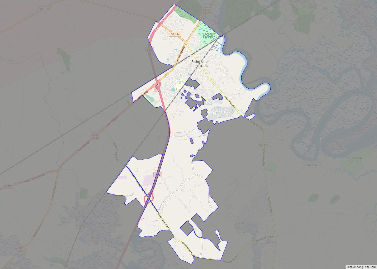
Online Interactive Map
Click on ![]() to view map in "full screen" mode.
to view map in "full screen" mode.
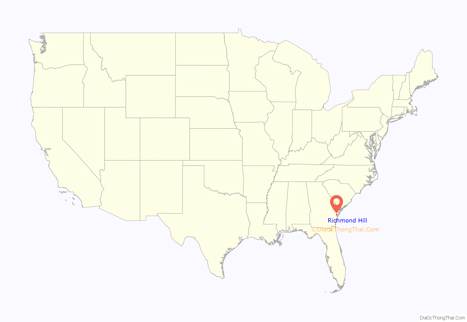
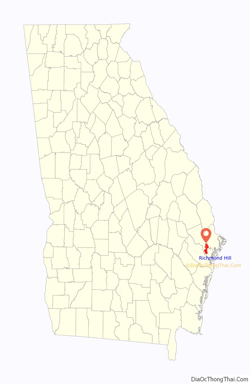
Richmond Hill location map. Where is Richmond Hill city?
History
Richmond Hill has a historical connection to industrialist Henry Ford. Ford used the town, formerly known as Ways Station, as a winter home and philanthropic social experiment, building the complex known as the Ford Farms along the Ogeechee River in the 1930s. After just one visit he chose this area as his winter home. Ford’s dwelling was built on the site of Richmond Plantation, which was burned by elements of General William T. Sherman’s army at the conclusion of the “March to the Sea”. Ford’s holdings eventually totaled 85,000 acres (340 km) of agricultural and timber lands, most of which is now owned by the State of Georgia or ITT Rayonier, a timber company. Ford was also responsible for the construction of a number of public buildings, including a kindergarten, which now houses the museum of the Richmond Hill Historical Society, and a chapel which now houses St. Anne’s Catholic Church. Both are located on Georgia S.R. 144, also known as Ford Avenue within the Richmond Hill city limits. The Ford Plantation has now been redeveloped as a luxury resort, with vacation cottages, a clubhouse, tennis, and golf. When it was suggested that the town be renamed “Ford”, he declined, and instead Ways Station was renamed “Richmond Hill” after the site of Ford’s home on the banks of the Ogeechee River.
Another plantation, Myrtle Grove, has been used in several movie and television productions.
Richmond Hill was incorporated as a city in 1962. The current mayor is Russ Carpenter. The previous mayor, Richard Davis served in that capacity since 1989. The city is governed by a mayor and a four-member city council.
Richmond Hill was the location of the discovery in 2004 of Benjaman Kyle, a man who suffers from retrograde amnesia as a result of a severe beating. In 2015, he was identified as William Burgess Powell.
Development
Real estate development in Richmond Hill has generally followed trends represented in the United States as a whole. Post-Civil War populations remained relatively stable until the arrival of industrialist Henry Ford in the 1930s. In the early 1970s, subdivisions began to spring up, and began a settlement trend that has continued steadily until the present. Subdivisions of varying quality, ranging from starter homes to exclusive, gated golf communities, have emerged. Locals attribute population growth to the nearest military base, Fort Stewart.
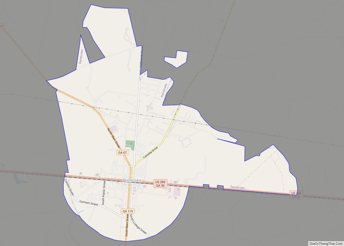
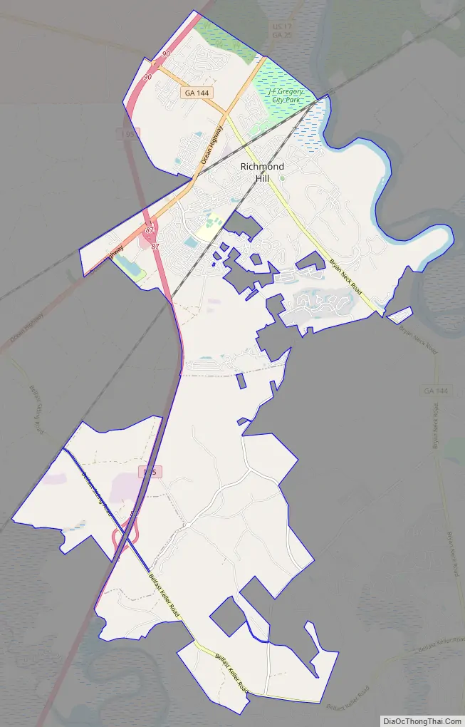
Richmond Hill Road Map
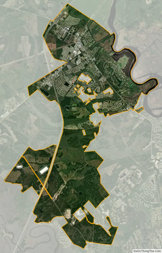
Richmond Hill city Satellite Map
Geography
Richmond Hill is located along the eastern border of Bryan County. The Ogeechee River forms the eastern edge of the city (and the county line); an outlying portion of the city of Savannah is on the opposite side of the river.
U.S. Route 17 (Ocean Highway) passes through the city north of the original downtown. Interstate 95 passes through the western edge of the city, with access from Exit 87 (US 17) and Exit 90 (Georgia State Route 144/Ford Avenue). Downtown Savannah is 21 miles (34 km) to the north, and Brunswick is 58 miles (93 km) to the south.
According to the United States Census Bureau, Richmond Hill has a total area of 14.6 square miles (37.9 km), of which 14.4 square miles (37.4 km) is land and 0.19 square miles (0.5 km), or 1.42%, is water.
See also
Map of Georgia State and its subdivision:- Appling
- Atkinson
- Bacon
- Baker
- Baldwin
- Banks
- Barrow
- Bartow
- Ben Hill
- Berrien
- Bibb
- Bleckley
- Brantley
- Brooks
- Bryan
- Bulloch
- Burke
- Butts
- Calhoun
- Camden
- Candler
- Carroll
- Catoosa
- Charlton
- Chatham
- Chattahoochee
- Chattooga
- Cherokee
- Clarke
- Clay
- Clayton
- Clinch
- Cobb
- Coffee
- Colquitt
- Columbia
- Cook
- Coweta
- Crawford
- Crisp
- Dade
- Dawson
- Decatur
- DeKalb
- Dodge
- Dooly
- Dougherty
- Douglas
- Early
- Echols
- Effingham
- Elbert
- Emanuel
- Evans
- Fannin
- Fayette
- Floyd
- Forsyth
- Franklin
- Fulton
- Gilmer
- Glascock
- Glynn
- Gordon
- Grady
- Greene
- Gwinnett
- Habersham
- Hall
- Hancock
- Haralson
- Harris
- Hart
- Heard
- Henry
- Houston
- Irwin
- Jackson
- Jasper
- Jeff Davis
- Jefferson
- Jenkins
- Johnson
- Jones
- Lamar
- Lanier
- Laurens
- Lee
- Liberty
- Lincoln
- Long
- Lowndes
- Lumpkin
- Macon
- Madison
- Marion
- McDuffie
- McIntosh
- Meriwether
- Miller
- Mitchell
- Monroe
- Montgomery
- Morgan
- Murray
- Muscogee
- Newton
- Oconee
- Oglethorpe
- Paulding
- Peach
- Pickens
- Pierce
- Pike
- Polk
- Pulaski
- Putnam
- Quitman
- Rabun
- Randolph
- Richmond
- Rockdale
- Schley
- Screven
- Seminole
- Spalding
- Stephens
- Stewart
- Sumter
- Talbot
- Taliaferro
- Tattnall
- Taylor
- Telfair
- Terrell
- Thomas
- Tift
- Toombs
- Towns
- Treutlen
- Troup
- Turner
- Twiggs
- Union
- Upson
- Walker
- Walton
- Ware
- Warren
- Washington
- Wayne
- Webster
- Wheeler
- White
- Whitfield
- Wilcox
- Wilkes
- Wilkinson
- Worth
- Alabama
- Alaska
- Arizona
- Arkansas
- California
- Colorado
- Connecticut
- Delaware
- District of Columbia
- Florida
- Georgia
- Hawaii
- Idaho
- Illinois
- Indiana
- Iowa
- Kansas
- Kentucky
- Louisiana
- Maine
- Maryland
- Massachusetts
- Michigan
- Minnesota
- Mississippi
- Missouri
- Montana
- Nebraska
- Nevada
- New Hampshire
- New Jersey
- New Mexico
- New York
- North Carolina
- North Dakota
- Ohio
- Oklahoma
- Oregon
- Pennsylvania
- Rhode Island
- South Carolina
- South Dakota
- Tennessee
- Texas
- Utah
- Vermont
- Virginia
- Washington
- West Virginia
- Wisconsin
- Wyoming