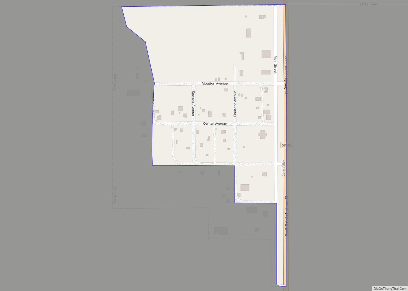
Buffalo County is a county in the U.S. state of South Dakota. As of the 2020 census, the population was 1,948. Its county seat is Gann Valley which, at 14 people, is the least populous county seat in the United States. The county was created in 1864, and was organized in 1871 as part of the Dakota Territory.
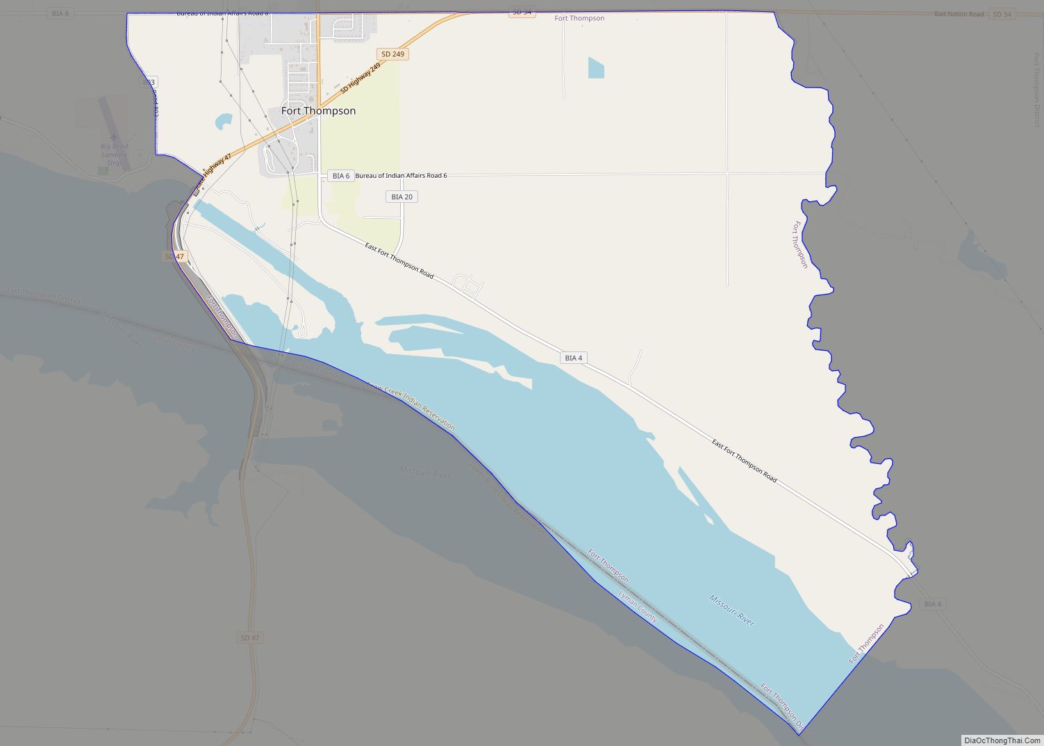
In 2010, the center of population of South Dakota was located in eastern Buffalo County. The Crow Creek Indian Reservation, inhabited by the Crow Creek Sioux Tribe, makes up the majority of Buffalo County.
According to the 2013 Small Area Income and Poverty Estimates of the US Census Bureau, about 41% of county residents live in poverty, making it the fifth-poorest county in South Dakota. This is a far higher poverty rate than the national poverty rate of 15.8%. Median household income in 2013 was $21,572, making it the lowest-earning county in South Dakota and the United States.
In March 2019, the county unemployment rate was 3.9%; its ten-year peaks occurred in December 2006 (18.1%) and December 2009 (17.2%). As of 2002, many homes lack kitchens and indoor plumbing.
| Name: | Buffalo County |
|---|---|
| FIPS code: | 46-017 |
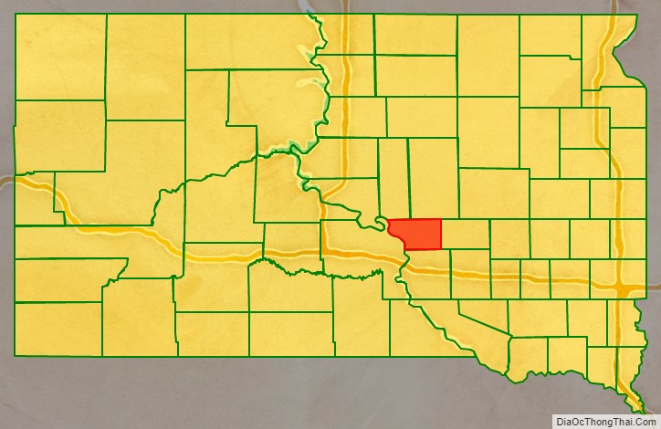
| State: | South Dakota |
| Founded: | 1873 |
| Named for: | American buffalo |
| Seat: | Gann Valley |
| Total Area: | 488 sq mi (1,260 km²) |
| Land Area: | 471 sq mi (1,220 km²) |
| Total Population: | 1,948 |
| Population Density: | 4.0/sq mi (1.5/km²) |
| Time zone: | UTC−6 (Central) |
| Summer Time Zone (DST): | UTC−5 (CDT) |
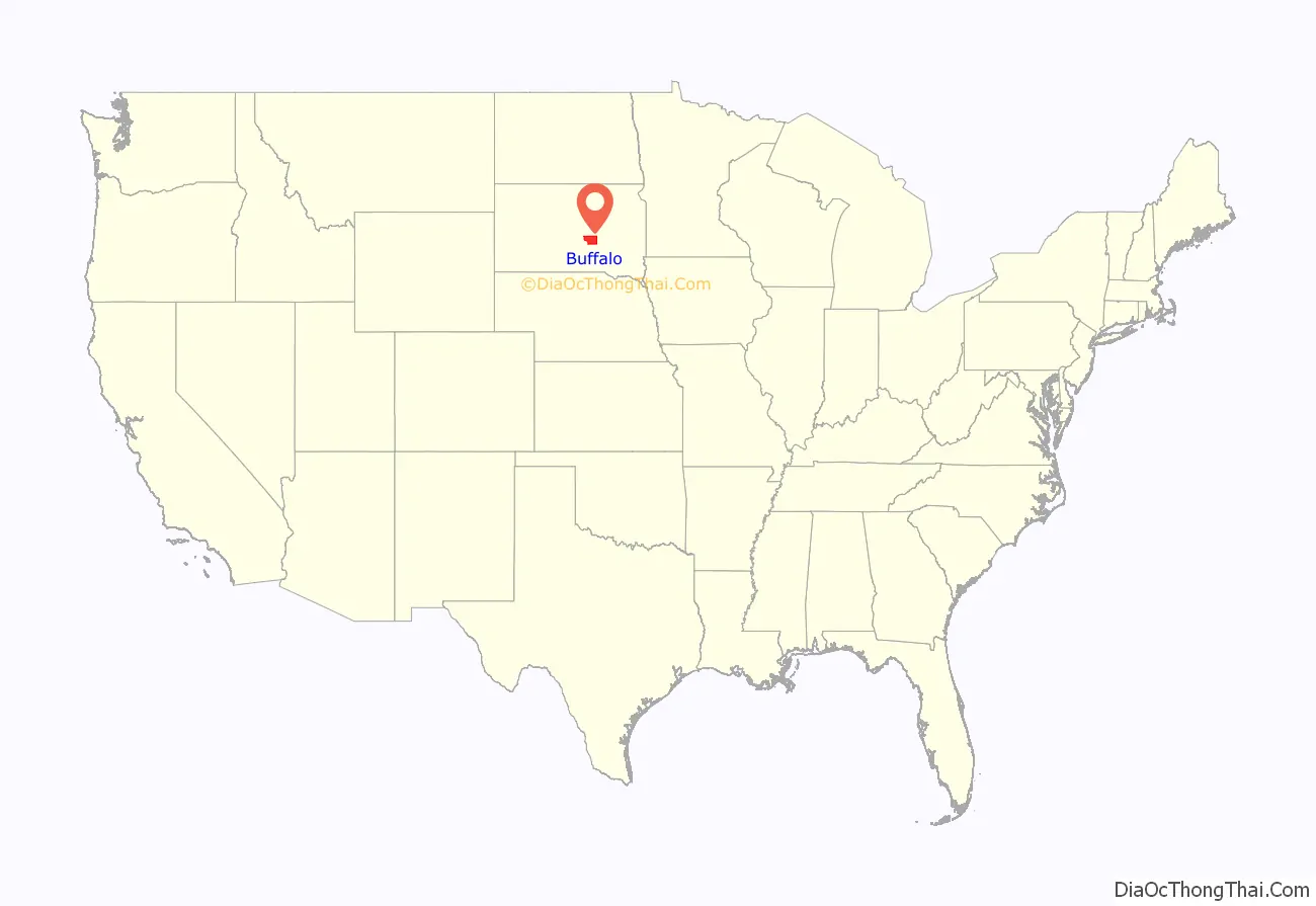
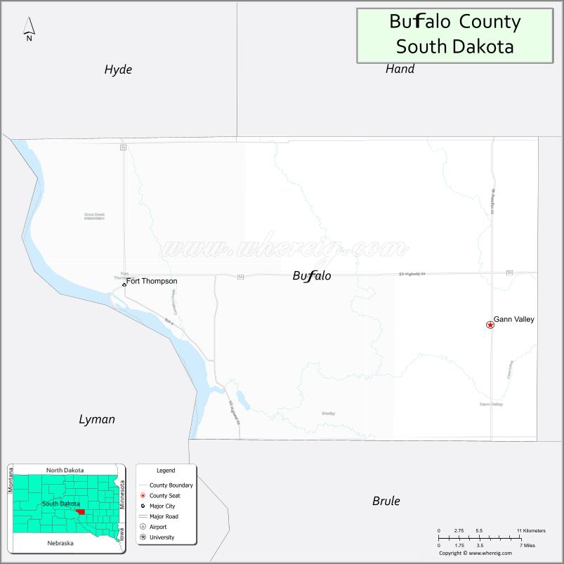
Buffalo County location map. Where is Buffalo County?
History
As first organized, the county occupied an extensive area, bounded on the north by Canada, southwest and west by the Missouri River, having Montana for a part of its northwest boundary, and comprising a large portion of the “Plateau du Coteau du Missouri”, and a part of the Miniwakan or Devil’s Lake. Thus, its original boundary also contained a portion of the future North Dakota, which became a separate unit when the Dakota Territory was admitted into the Union in 1889 as two separate states.
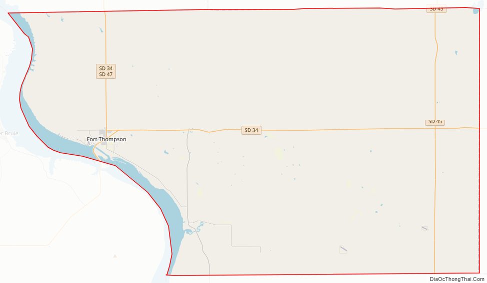
Buffalo County Road Map
Geography
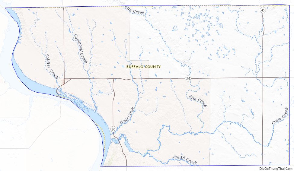
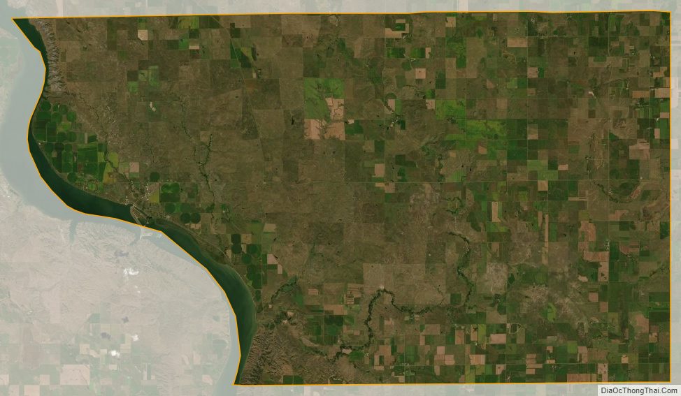
The Missouri River flows southerly along the county’s western boundary. The county terrain consists of semi-arid rolling hills, generally sloping to the south and east. Some area is devoted to agriculture. The south and west parts of the county are drained by Crow Creek, which discharges into the river at the county’s SW corner. The county has a total area of 488 square miles (1,260 km), of which 471 square miles (1,220 km) is land and 16 square miles (41 km) (3.4%) is water.
Major highways
- South Dakota Highway 34
- South Dakota Highway 45
- South Dakota Highway 47
- South Dakota Highway 50
Adjacent counties
Protected Areas
- Pease State Game Production Area
Lakes
- Bedashosha Lake
- Lake Francis Case (part)
- Lake Sharpe (part)
Buffalo County Topographic Map
Buffalo County Satellite Map
Buffalo County Outline Map