Hand County is a county in the U.S. state of South Dakota. As of the 2020 census, the population was 3,145. Its county seat is Miller.
| Name: | Hand County |
|---|---|
| FIPS code: | 46-059 |
| State: | South Dakota |
| Founded: | 1873 |
| Named for: | George A. Hand |
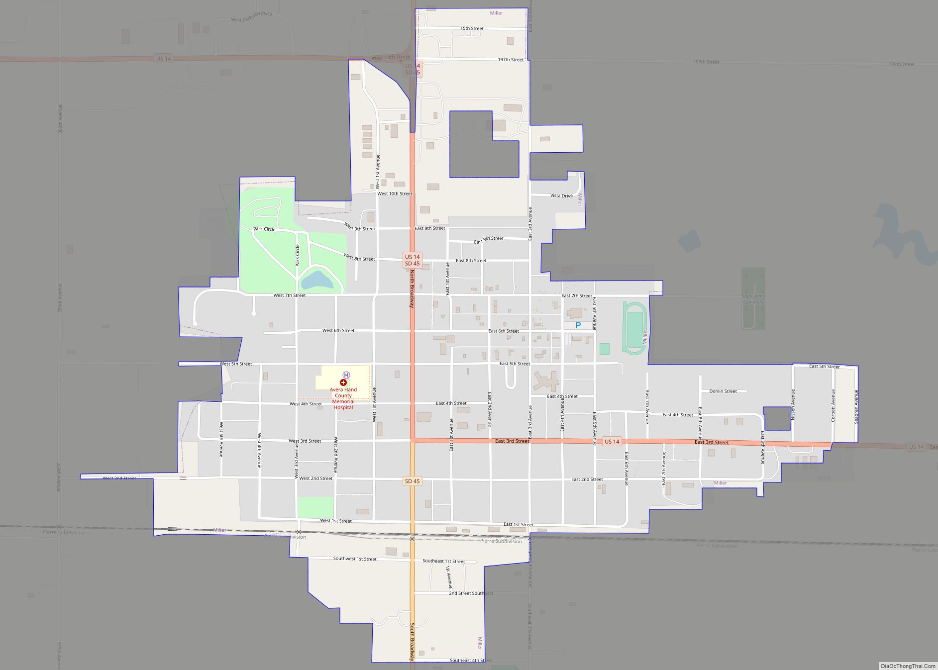
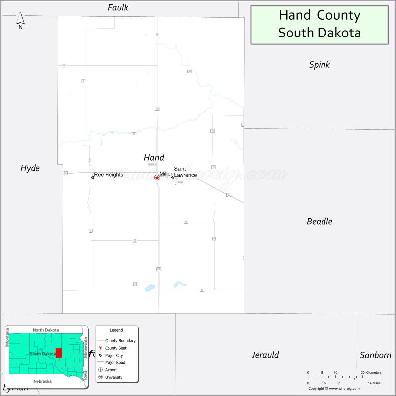
| Seat: | Miller |
| Largest city: | Miller |
| Total Area: | 1,440 sq mi (3,700 km²) |
| Land Area: | 1,437 sq mi (3,720 km²) |
| Total Population: | 3,145 |
| Population Density: | 2.2/sq mi (0.84/km²) |
| Time zone: | UTC−6 (Central) |
| Summer Time Zone (DST): | UTC−5 (CDT) |
| Website: | hand.sdcounties.org |
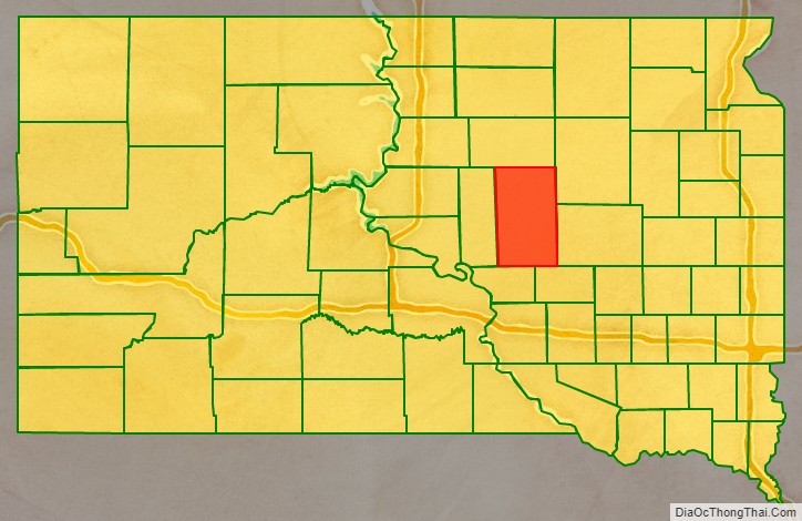
Hand County location map. Where is Hand County?

History
Hand County was named for George A. Hand, territorial secretary. It was created in 1873 by the Dakota territorial legislature. The boundaries were finalized in 1882, the year it was organized.
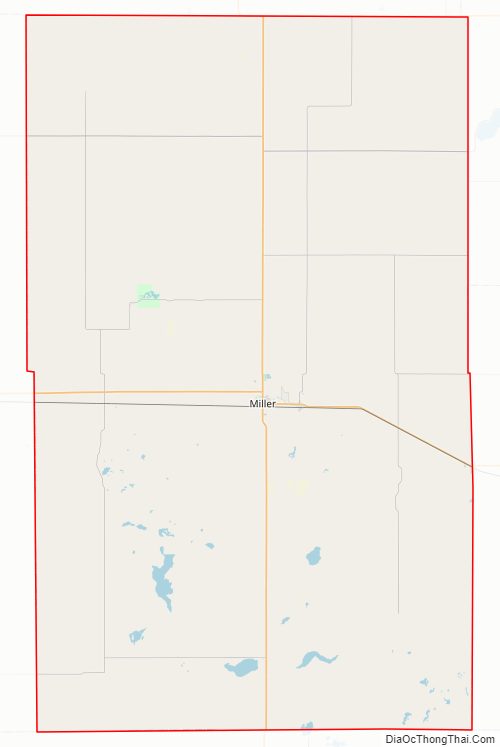
Hand County Road Map
Geography
The terrain of Hand County consists of rolling hills, dotted with infrequent ponds and small lakes. Most of the area is devoted to agriculture. The terrain slopes to the east and northeast; its highest point is on the lower part of the county’s west boundary line, at 2,080′ (634m) ASL. The county contains a total area of 1,440 square miles (3,700 km), of which 1,437 square miles (3,720 km) is land and 3.6 square miles (9.3 km) (0.2%) is water.
Major highways
- U.S. Highway 14
- U.S. Highway 212
- South Dakota Highway 26
- South Dakota Highway 45
Adjacent counties
- Faulk County – north
- Spink County – northeast
- Beadle County – east
- Jerauld County – southeast
- Buffalo County – southwest
- Hyde County – west
Protected areas
- Collins State Game Production Area
- Dakota State Game Production Area
- East Pearl State Game Production Area
- Hawkins State Game Production Area
- Lake Jones State Game Production Area
- Lake Louise State Game Production Area
- Lake Louise State Recreation Area
- Lechtenberg State Game Production Area
- Reinhardt State Game Production Area
- Rosehill State Game Production Area
- Spring Lake State Game Production Area
- West Pearl State Game Production Area
Lakes
- Costigan Slough Lake
- Jones Lake
- Lake Louise
- Matter Lake
- Spring Lake
- Wall Lake
Hand County Topographic Map
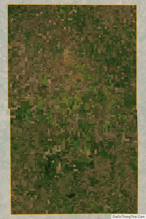
Hand County Satellite Map
Hand County Outline Map