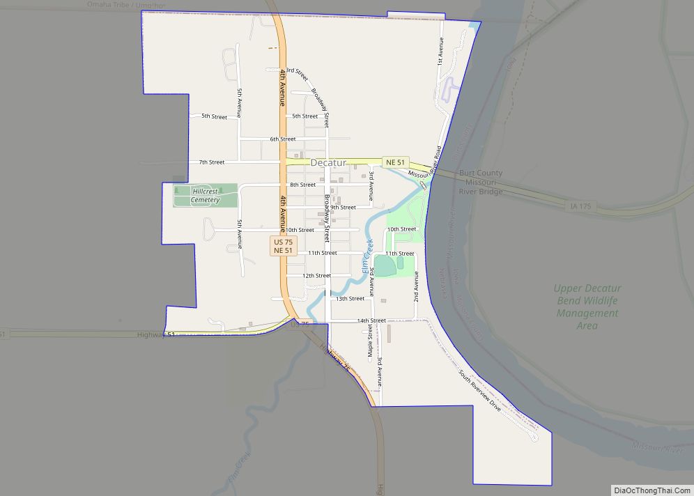
Decatur is a village in Burt County, Nebraska, United States, adjacent to the upper Missouri River. The population was 481 at the 2010 census. This town is named after one of its incorporators, Stephen Decatur. It developed around a trading post established by Colonel Peter Sarpy, the namesake for Sarpy County in the state.
| Name: | Decatur village |
|---|---|
| LSAD Code: | 47 |
| LSAD Description: | village (suffix) |
| State: | Nebraska |
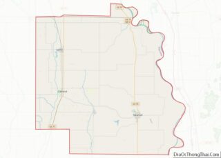
| County: | Burt County |
| Elevation: | 1,070 ft (330 m) |
| Total Area: | 1.02 sq mi (2.65 km²) |
| Land Area: | 1.02 sq mi (2.64 km²) |
| Water Area: | 0.00 sq mi (0.00 km²) |
| Total Population: | 410 |
| Population Density: | 401.57/sq mi (155.06/km²) |
| ZIP code: | 68020 |
| Area code: | 402 |
| FIPS code: | 3112525 |
| GNISfeature ID: | 0828631 |
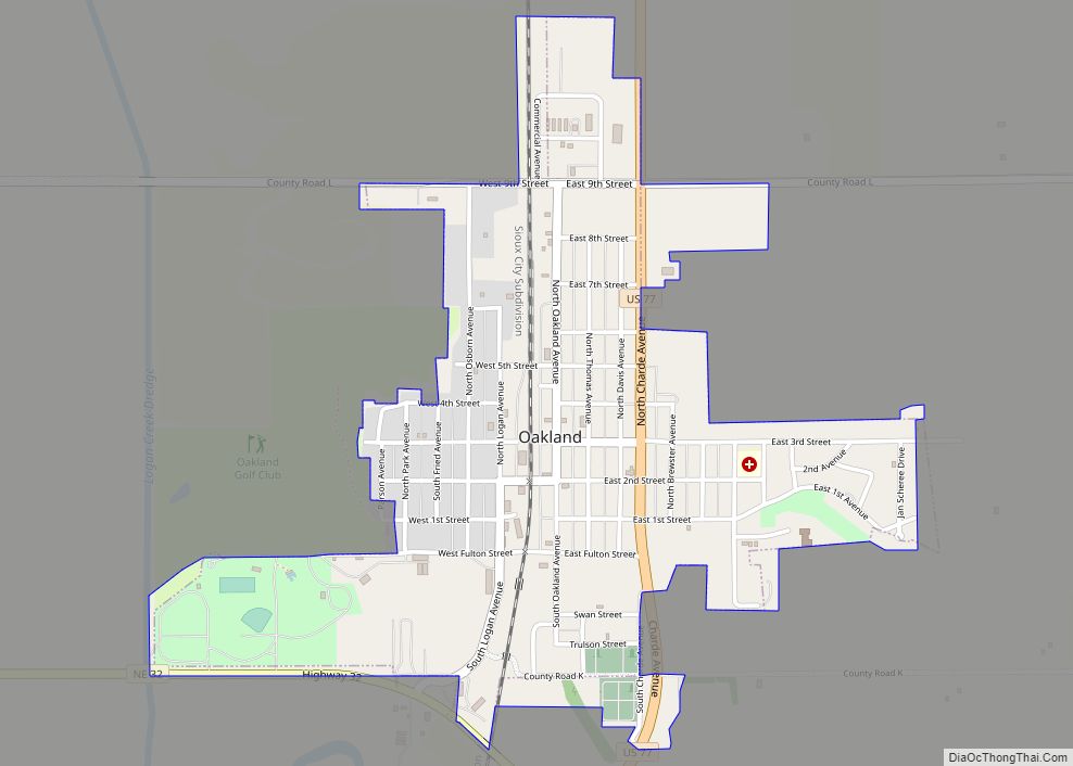
Online Interactive Map
Click on ![]() to view map in "full screen" mode.
to view map in "full screen" mode.
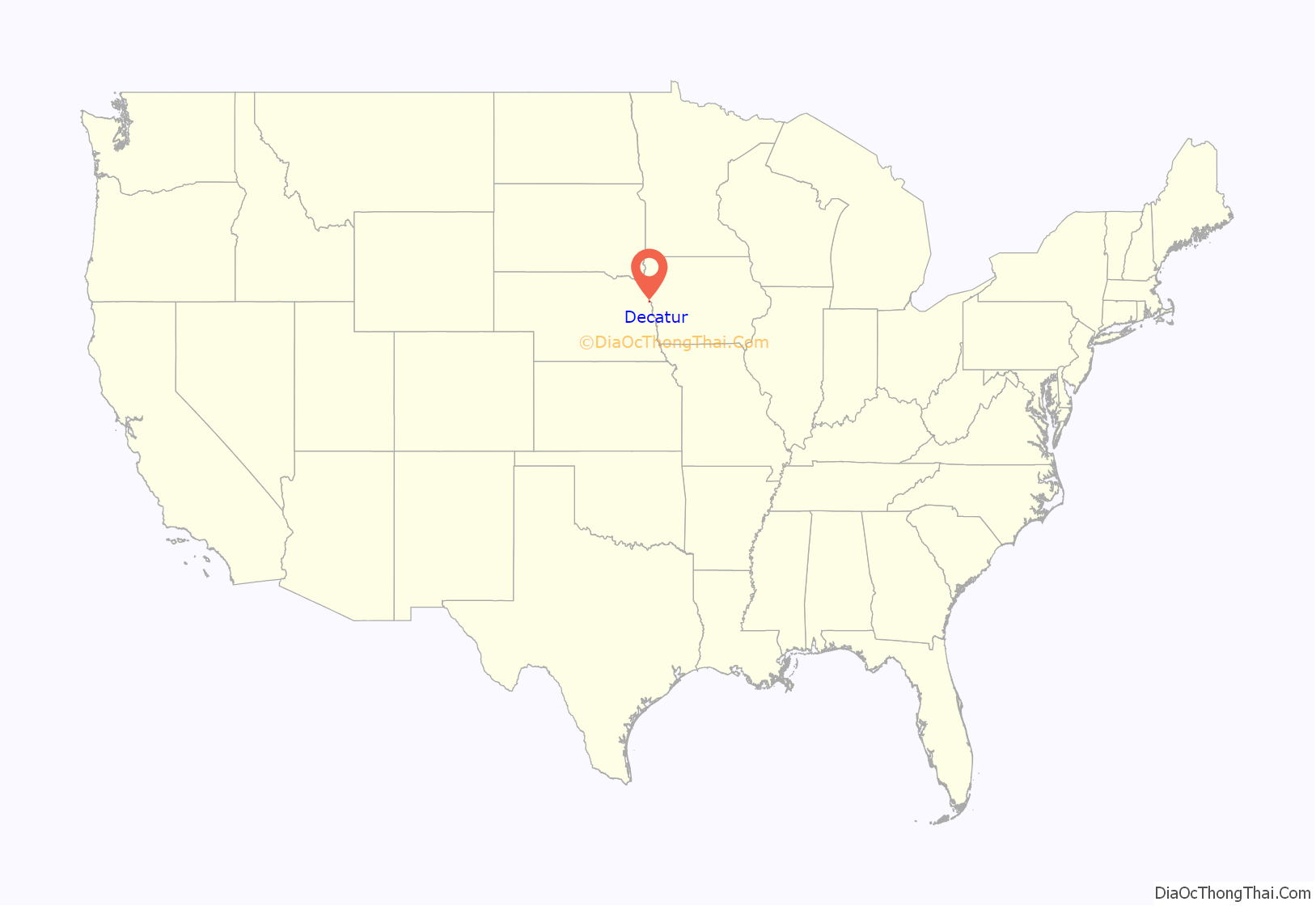
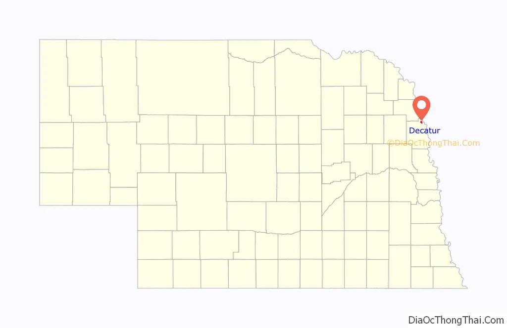
Decatur location map. Where is Decatur village?
History
The area was long occupied by the Omaha Native Americans, who settled along the creeks and river Explorers Meriwether Lewis and William Clark passed through the area in 1804 as their expedition traveled via the upper Missouri River on their way to and from the Pacific Coast, in their exploration of the Louisiana Purchase.
The first European settler in the area was a man named Woods, who settled at the mouth of Wood Creek (his namesake) in 1837. Stephen Decatur arrived in the area in 1841. A former schoolteacher in New Jersey and New York, he had abandoned his wife and two children when he migrated to the West. Here he changed his name, dropping his former surname of “Bross.” His farm was called Decatur Springs, after a spring which supplied water to the village for the next century.
In 1854, the U.S. Commissioner of Indian Affairs purchased 300,000 acres of land from the Omaha, including the area which is now Decatur. The town of Decatur was incorporated in 1856 under the name “The Decatur Townsite & Ferry Company.” The other incorporators included Thomas Whiteacre, T. H. Hineman, George Mason, and Herman Glass. Peter Sarpy helped lay out the town, which developed around his Indian trading post at the mouth of Wood Creek. He also owned Fontenelle’s Post and is the namesake for Sarpy County.
The patents for the town were granted by the legislature on May 1, 1862. Following the dissolution of the Decatur Townsite and Ferry Company, the town was renamed Decatur Village in 1858.
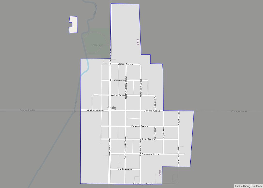
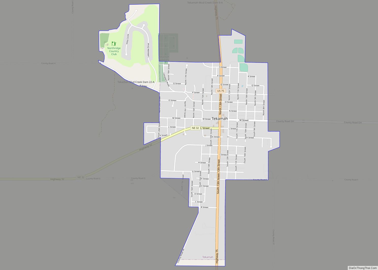
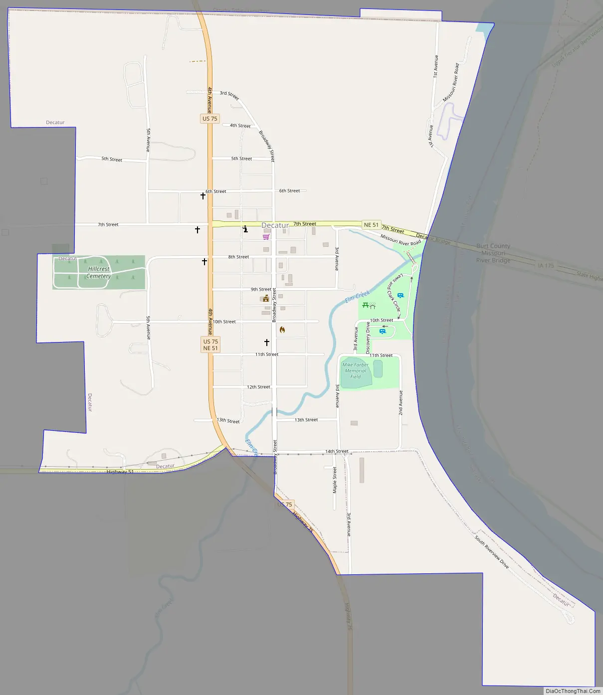
Decatur Road Map
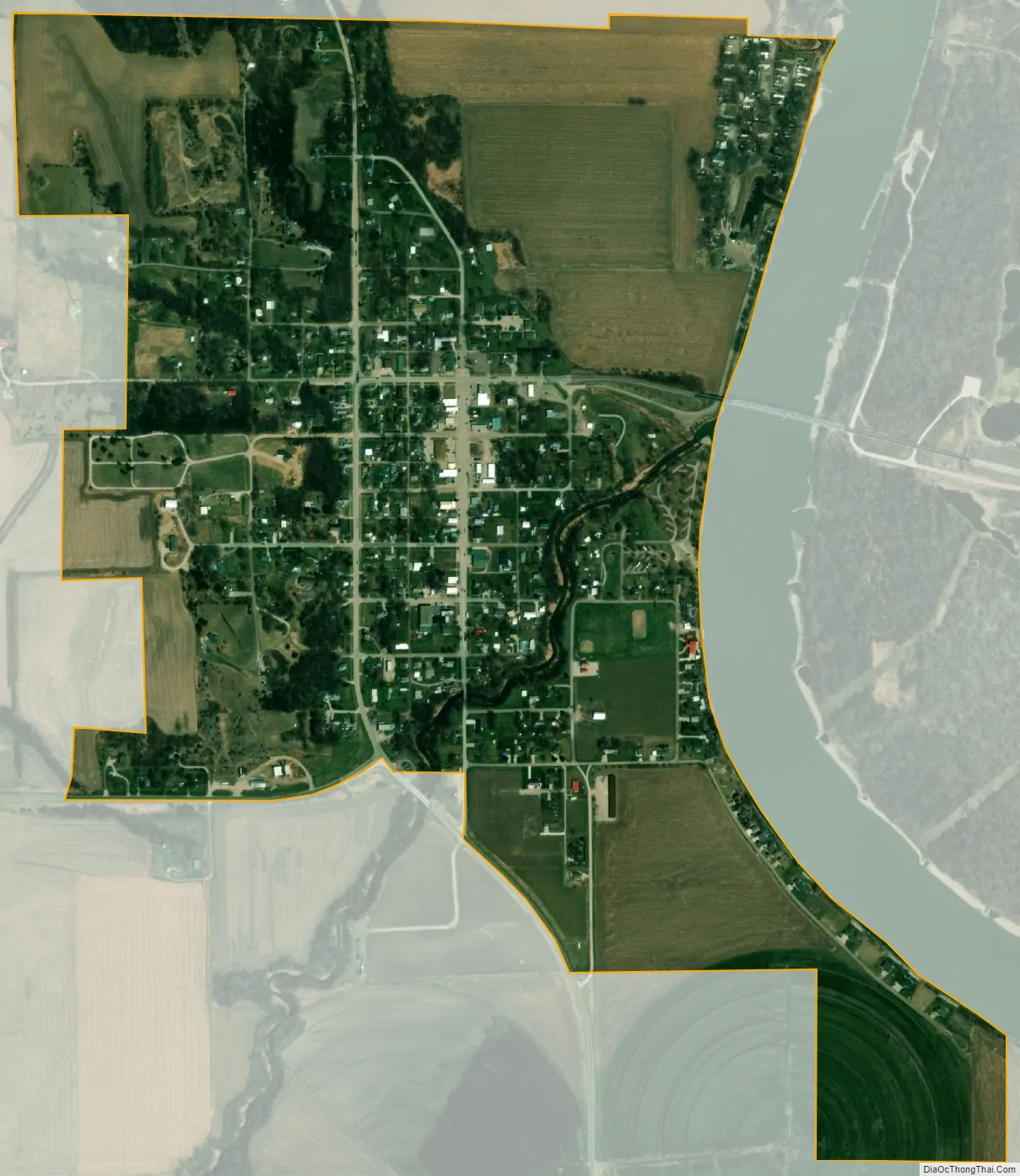
Decatur city Satellite Map
Geography
Decatur is located at 42°0′22″N 96°15′4″W / 42.00611°N 96.25111°W / 42.00611; -96.25111 (42.006018, -96.250982).
According to the United States Census Bureau, the village has a total area of 0.90 square miles (2.33 km), all land.
See also
Map of Nebraska State and its subdivision:- Adams
- Antelope
- Arthur
- Banner
- Blaine
- Boone
- Box Butte
- Boyd
- Brown
- Buffalo
- Burt
- Butler
- Cass
- Cedar
- Chase
- Cherry
- Cheyenne
- Clay
- Colfax
- Cuming
- Custer
- Dakota
- Dawes
- Dawson
- Deuel
- Dixon
- Dodge
- Douglas
- Dundy
- Fillmore
- Franklin
- Frontier
- Furnas
- Gage
- Garden
- Garfield
- Gosper
- Grant
- Greeley
- Hall
- Hamilton
- Harlan
- Hayes
- Hitchcock
- Holt
- Hooker
- Howard
- Jefferson
- Johnson
- Kearney
- Keith
- Keya Paha
- Kimball
- Knox
- Lancaster
- Lincoln
- Logan
- Loup
- Madison
- McPherson
- Merrick
- Morrill
- Nance
- Nemaha
- Nuckolls
- Otoe
- Pawnee
- Perkins
- Phelps
- Pierce
- Platte
- Polk
- Red Willow
- Richardson
- Rock
- Saline
- Sarpy
- Saunders
- Scotts Bluff
- Seward
- Sheridan
- Sherman
- Sioux
- Stanton
- Thayer
- Thomas
- Thurston
- Valley
- Washington
- Wayne
- Webster
- Wheeler
- York
- Alabama
- Alaska
- Arizona
- Arkansas
- California
- Colorado
- Connecticut
- Delaware
- District of Columbia
- Florida
- Georgia
- Hawaii
- Idaho
- Illinois
- Indiana
- Iowa
- Kansas
- Kentucky
- Louisiana
- Maine
- Maryland
- Massachusetts
- Michigan
- Minnesota
- Mississippi
- Missouri
- Montana
- Nebraska
- Nevada
- New Hampshire
- New Jersey
- New Mexico
- New York
- North Carolina
- North Dakota
- Ohio
- Oklahoma
- Oregon
- Pennsylvania
- Rhode Island
- South Carolina
- South Dakota
- Tennessee
- Texas
- Utah
- Vermont
- Virginia
- Washington
- West Virginia
- Wisconsin
- Wyoming