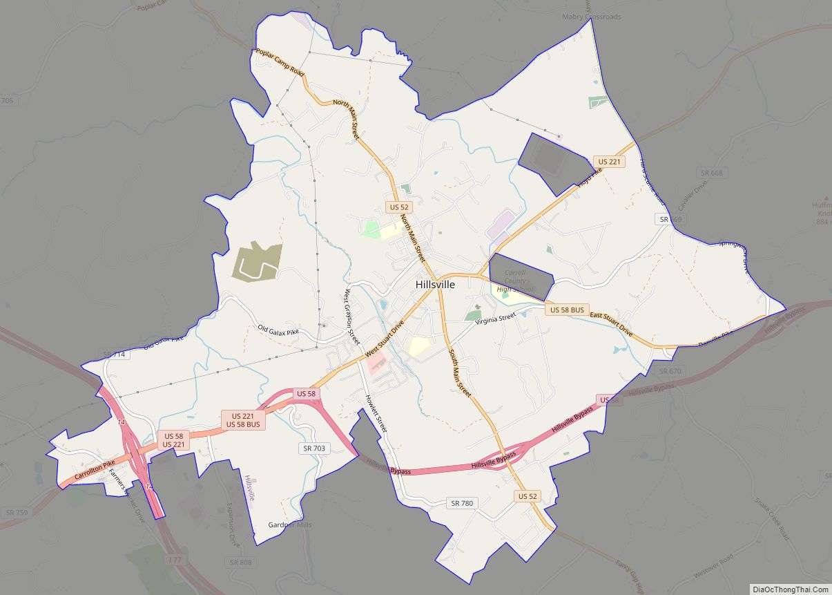
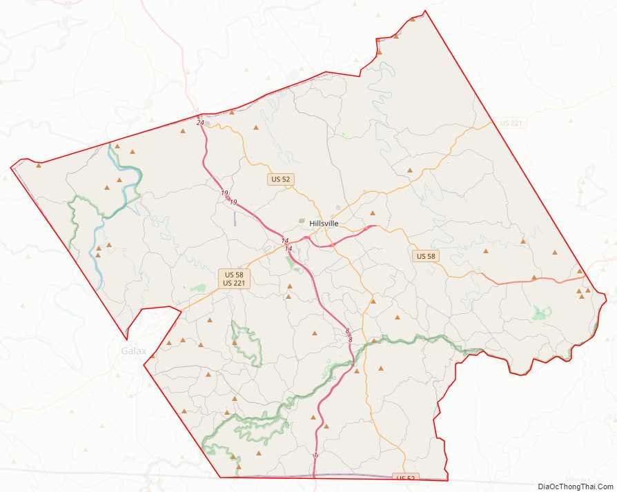
Carroll County is a United States county located in the southwestern part of the Commonwealth of Virginia. Roughly one fifth of the county lies in the Virginia Piedmont region, while the rest is part of the Appalachian Mountains. The county seat and largest town is Hillsville.
The county was established in 1842 from part of Grayson County, and was officially named in honor of Charles Carroll, a signer of the Declaration of Independence. The borders of Carroll County were later expanded by including land from Patrick County.
The total size of the county is 478 square miles (1,238 km2), and, as of the 2020 census, the population was 29,155.
| Name: | Carroll County |
|---|---|
| FIPS code: | 51-035 |
| State: | Virginia |
| Founded: | 1842 |
| Named for: | Charles Carroll |
| Seat: | Hillsville |
| Largest town: | Hillsville |
| Total Area: | 478 sq mi (1,240 km²) |
| Land Area: | 475 sq mi (1,230 km²) |
| Total Population: | 29,155 |
| Population Density: | 61/sq mi (24/km²) |
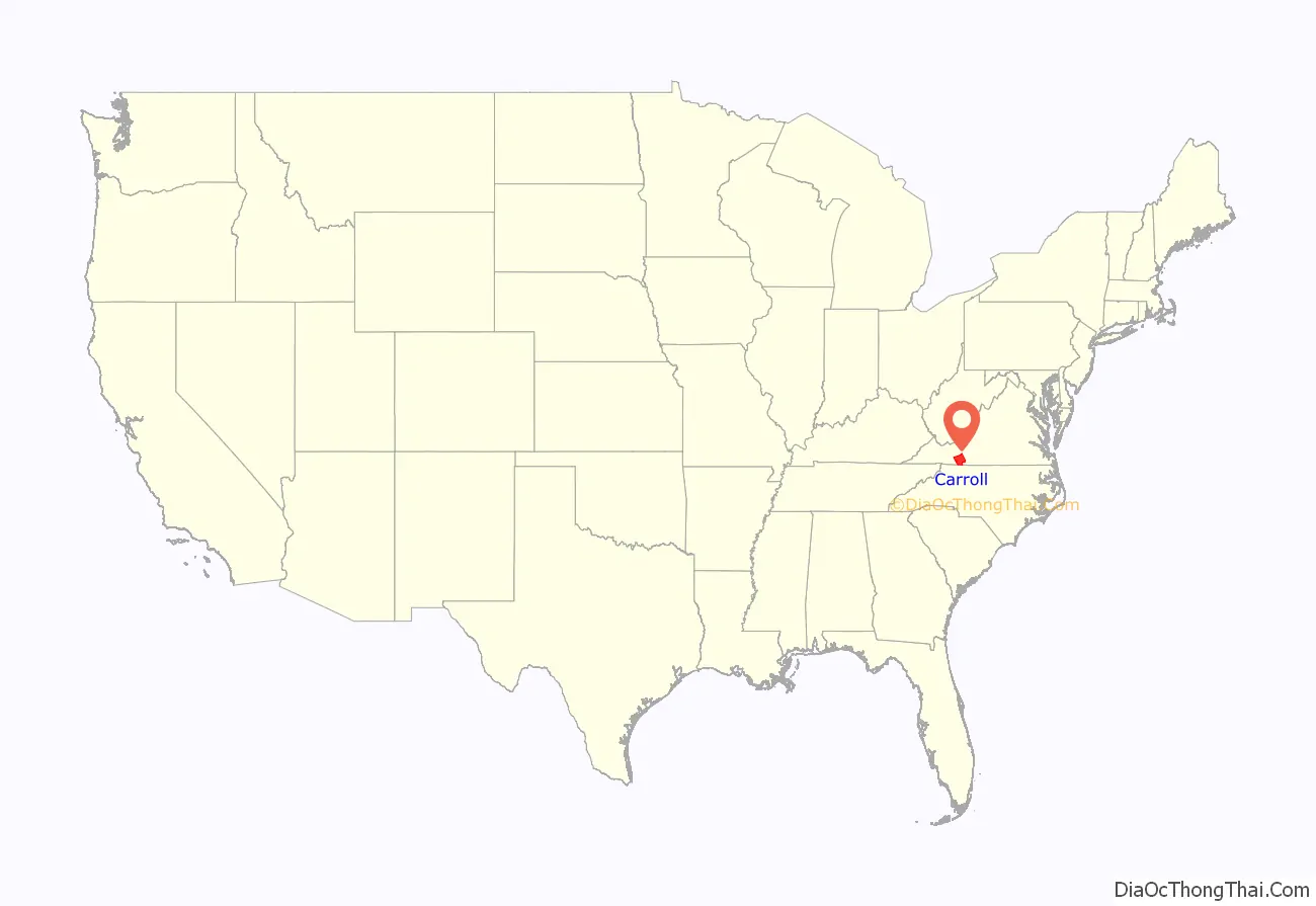
Carroll County location map. Where is Carroll County?
History
The first European settlers arrived in the region in the mid 18th century. These were primarily Scotch-Irish pioneers, who were used to high mountain altitudes. However, early settlement was slow, mostly due to the poor agricultural soil of the area. As a result, lead mining was one of the first economic activities in the region.
As the area’s population density increased, Carroll County was created in 1842 from part of Grayson County. The new county was officially named for Charles Carroll, a signer of the Declaration of Independence, from Maryland. However, other accounts assert that John Carroll, a Virginia state legislator, had named the county in his own honor, but was blocked by a political rival who had it officially named for Charles Carroll instead.
Parts of Patrick County were added later to increase the size of Carroll County. The first piece was taken in 1845, and another part, which would later become the Fancy Gap District, was added in 1854.
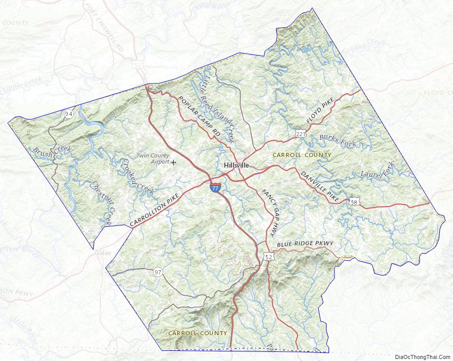
Carroll County Road Map
Geography
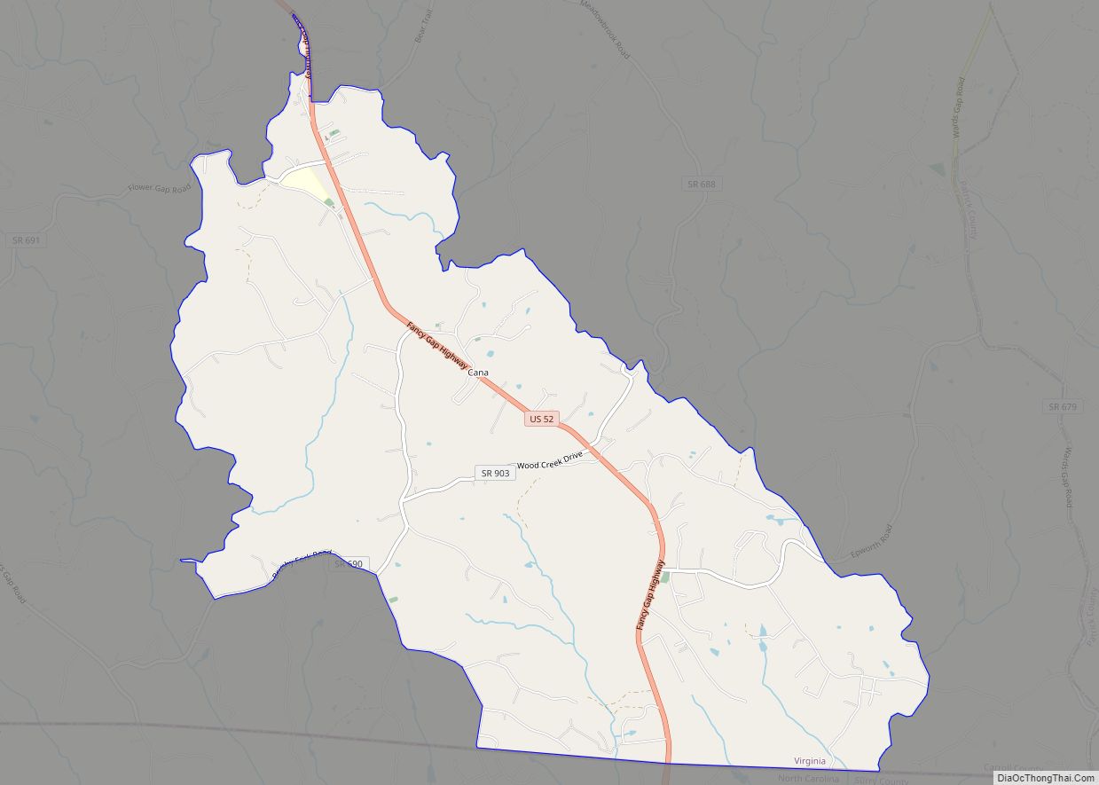
It is the only county in Virginia with Piedmont topography of roughly one fifth in the southeast part of the county and mountain topography of roughly four fifths elsewhere of the county. The Blue Ridge escarpment usually defines the county lines in both North Carolina and Virginia. The CDP community of Cana is in the Virginia Piedmont while the rest of the county is in the Appalachian Mountains.
According to the U.S. Census Bureau, the county has a total area of 478 square miles (1,240 km), of which 475 square miles (1,230 km) is land and 3 square miles (7.8 km) (0.6%) is water.
Adjacent counties / Independent city
- Galax, Virginia – west
- Grayson County, Virginia – west
- Wythe County, Virginia – northwest
- Pulaski County, Virginia – north
- Floyd County, Virginia – northeast
- Patrick County, Virginia – southeast
- Surry County, North Carolina – south
Protected areas
- Blue Ridge Parkway (part)
- Jefferson National Forest (part)
- Mount Rogers National Recreation Area (part)
- Devil’s Den Nature Preserve
Major highways
- I-74 (future)
- I-77
- US 52
- US 58
- US 221
- SR 94
- SR 100
- SR 148
Carroll County Topographic Map
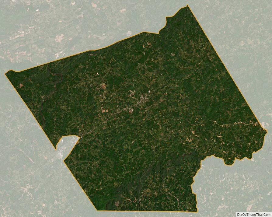
Carroll County Satellite Map
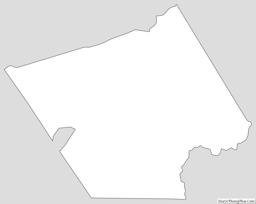
Carroll County Outline Map