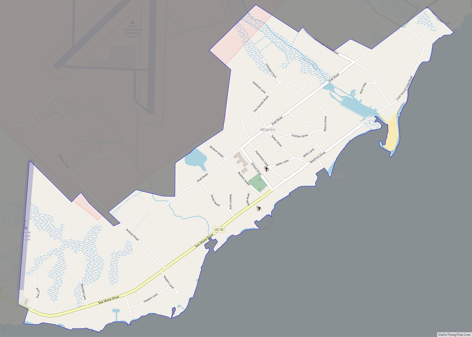
Atlantic is an unincorporated community and census-designated place in eastern Carteret County, North Carolina, United States. As of the 2010 census it had a population of 543. It is situated along Core Sound, located in what was known to early settlers of the area as Hunting Quarters. It is the location of US 70’s eastern terminus and the ferry terminal for journeys to North Core Banks in the Cape Lookout National Seashore.
The community is located east of the United States Marine Corps installation MCOLF Atlantic which is primarily used for helicopter and aggressor force exercises. The installation sees limited use but is staffed around the clock by a security unit from MCAS Cherry Point.
Atlantic is home to Luther L. Smith and Son Seafood, the last operating fish house in the town. Drum Inlet Marina, the most suitable location to embark to the Outer Banks, is a full-service harbor. Commercial fishing has long been the primary means of earning a living in this community.
Atlantic had the first public high school in Carteret County. It was an incorporated community from 1905 until 1920. It had three different mayors during this time.
| Name: | Atlantic CDP |
|---|---|
| LSAD Code: | 57 |
| LSAD Description: | CDP (suffix) |
| State: | North Carolina |
| County: | Carteret County |
| Elevation: | 10 ft (3 m) |
| Total Area: | 0.94 sq mi (2.43 km²) |
| Land Area: | 0.92 sq mi (2.38 km²) |
| Water Area: | 0.02 sq mi (0.05 km²) |
| Total Population: | 468 |
| Population Density: | 508.70/sq mi (196.46/km²) |
| ZIP code: | 28511 |
| Area code: | 252 |
| FIPS code: | 3702480 |
| GNISfeature ID: | 1018873 |
Online Interactive Map
Click on ![]() to view map in "full screen" mode.
to view map in "full screen" mode.
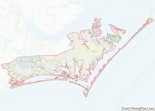
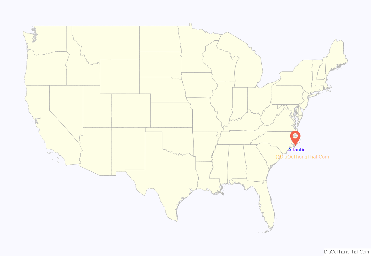
Atlantic location map. Where is Atlantic CDP?
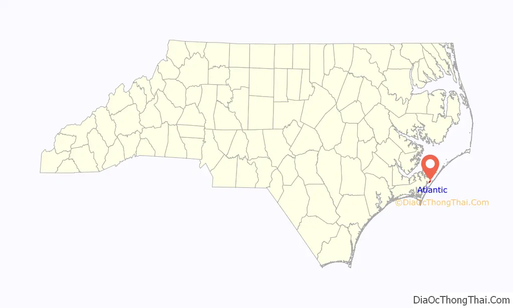
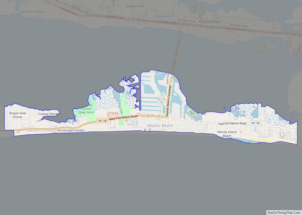
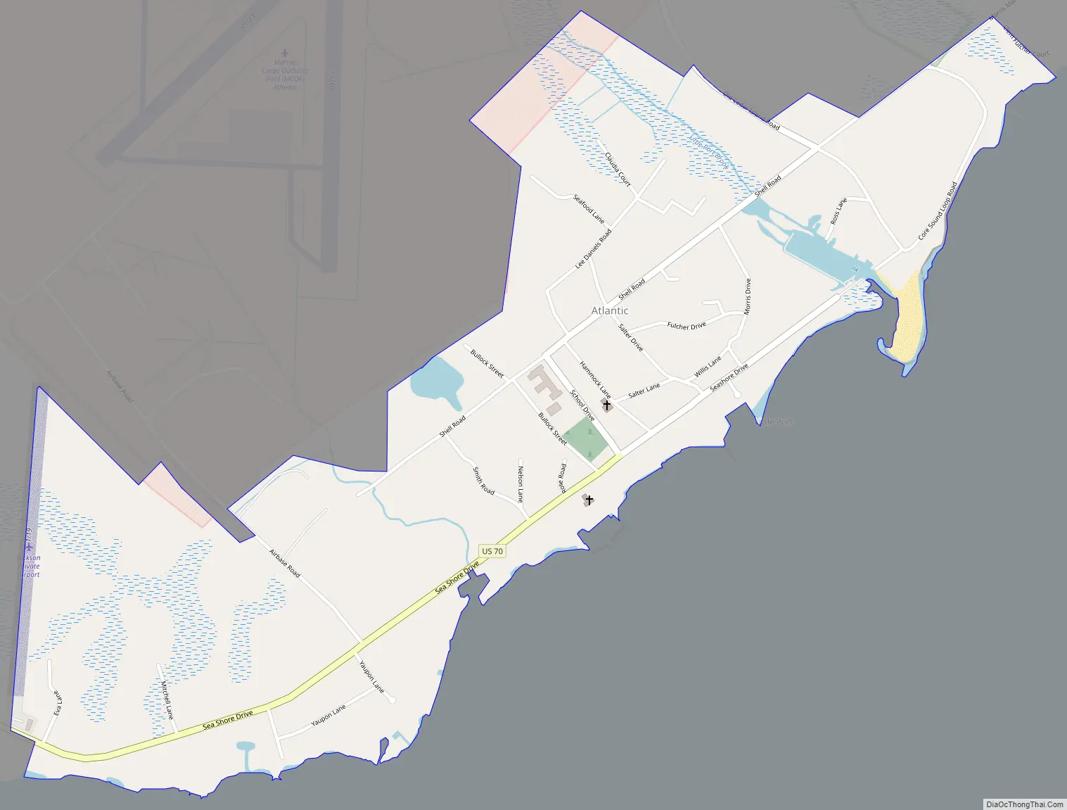
Atlantic Road Map
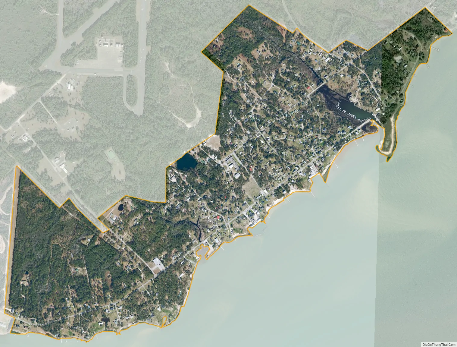
Atlantic city Satellite Map
Geography
The Atlantic CDP has a total area of 0.93 square miles (2.4 km), of which 0.02 square miles (0.05 km), or 2.00%, is water. Little Port Brook separates two roads (Old US 70) from the other side, so it results in a dead end coming from both directions. Many believe that there used to be an old bridge where the harbor is today, since the road aligns, but it was taken out when the marina was put in. Now, US 70% ends before the separation, at the corner of Morris Dr and Seashore Dr, about 2500 feet away from the harbor.
By the Core Sound Loop Rd, near the White Point Take Out, (On the other side), there is also a dead end sign facing south towards the harbor as well.
See also
Map of North Carolina State and its subdivision:- Alamance
- Alexander
- Alleghany
- Anson
- Ashe
- Avery
- Beaufort
- Bertie
- Bladen
- Brunswick
- Buncombe
- Burke
- Cabarrus
- Caldwell
- Camden
- Carteret
- Caswell
- Catawba
- Chatham
- Cherokee
- Chowan
- Clay
- Cleveland
- Columbus
- Craven
- Cumberland
- Currituck
- Dare
- Davidson
- Davie
- Duplin
- Durham
- Edgecombe
- Forsyth
- Franklin
- Gaston
- Gates
- Graham
- Granville
- Greene
- Guilford
- Halifax
- Harnett
- Haywood
- Henderson
- Hertford
- Hoke
- Hyde
- Iredell
- Jackson
- Johnston
- Jones
- Lee
- Lenoir
- Lincoln
- Macon
- Madison
- Martin
- McDowell
- Mecklenburg
- Mitchell
- Montgomery
- Moore
- Nash
- New Hanover
- Northampton
- Onslow
- Orange
- Pamlico
- Pasquotank
- Pender
- Perquimans
- Person
- Pitt
- Polk
- Randolph
- Richmond
- Robeson
- Rockingham
- Rowan
- Rutherford
- Sampson
- Scotland
- Stanly
- Stokes
- Surry
- Swain
- Transylvania
- Tyrrell
- Union
- Vance
- Wake
- Warren
- Washington
- Watauga
- Wayne
- Wilkes
- Wilson
- Yadkin
- Yancey
- Alabama
- Alaska
- Arizona
- Arkansas
- California
- Colorado
- Connecticut
- Delaware
- District of Columbia
- Florida
- Georgia
- Hawaii
- Idaho
- Illinois
- Indiana
- Iowa
- Kansas
- Kentucky
- Louisiana
- Maine
- Maryland
- Massachusetts
- Michigan
- Minnesota
- Mississippi
- Missouri
- Montana
- Nebraska
- Nevada
- New Hampshire
- New Jersey
- New Mexico
- New York
- North Carolina
- North Dakota
- Ohio
- Oklahoma
- Oregon
- Pennsylvania
- Rhode Island
- South Carolina
- South Dakota
- Tennessee
- Texas
- Utah
- Vermont
- Virginia
- Washington
- West Virginia
- Wisconsin
- Wyoming