Daviess County (/ˈdeɪvɪs/ “Davis”), is a county in Kentucky. As of the 2020 census, the population was 103,312. Its county seat is Owensboro. The county was formed from part of Ohio County on January 14, 1815.
Daviess County is included in the Owensboro, KY Metropolitan Statistical Area. Daviess County also shares its namesake with another nearby Daviess County of Indiana. Both Counties are in the Illinois-Indiana-Kentucky Tri-State Area.
| Name: | Daviess County |
|---|---|
| FIPS code: | 21-059 |
| State: | Kentucky |
| Founded: | January 14, 1815 |
| Named for: | Joseph Hamilton Daveiss |
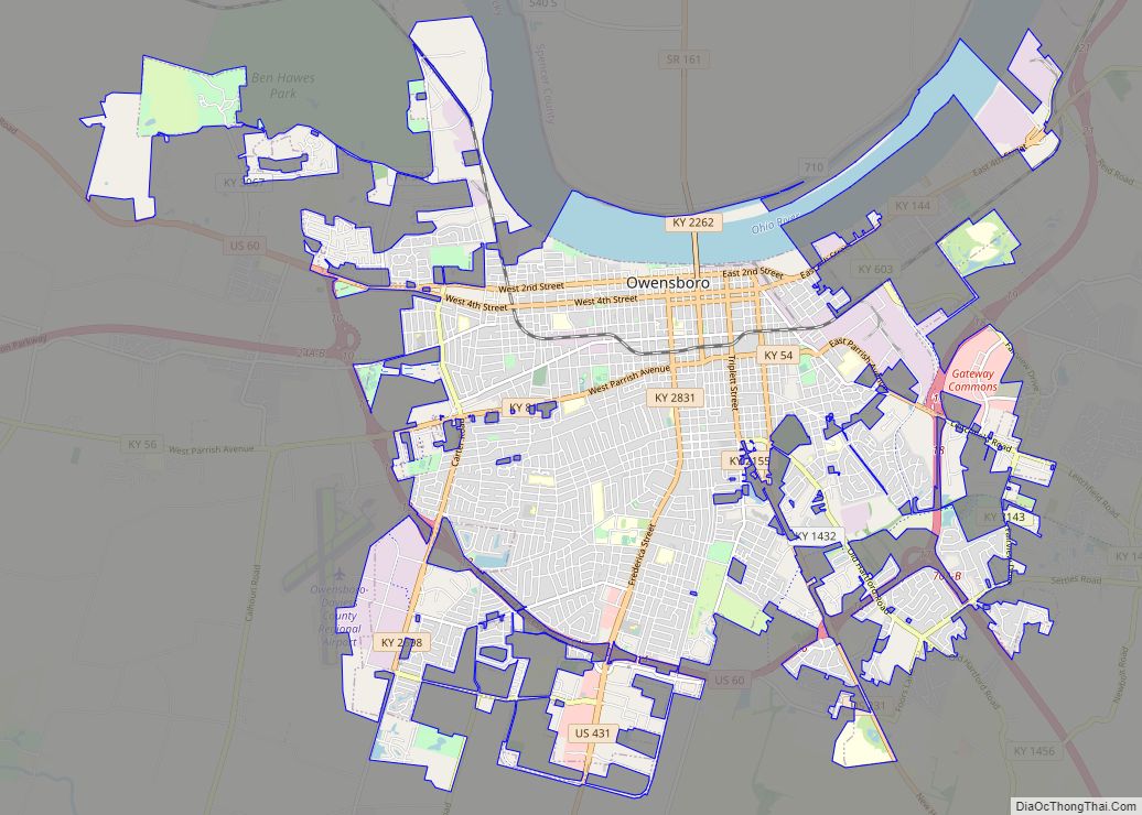
| Seat: | Owensboro |
| Largest city: | Owensboro |
| Total Area: | 477 sq mi (1,240 km²) |
| Land Area: | 458 sq mi (1,190 km²) |
| Total Population: | 103,312 |
| Population Density: | 220/sq mi (84/km²) |
| Time zone: | UTC−6 (Central) |
| Summer Time Zone (DST): | UTC−5 (CDT) |
| Website: | www.daviessky.org |
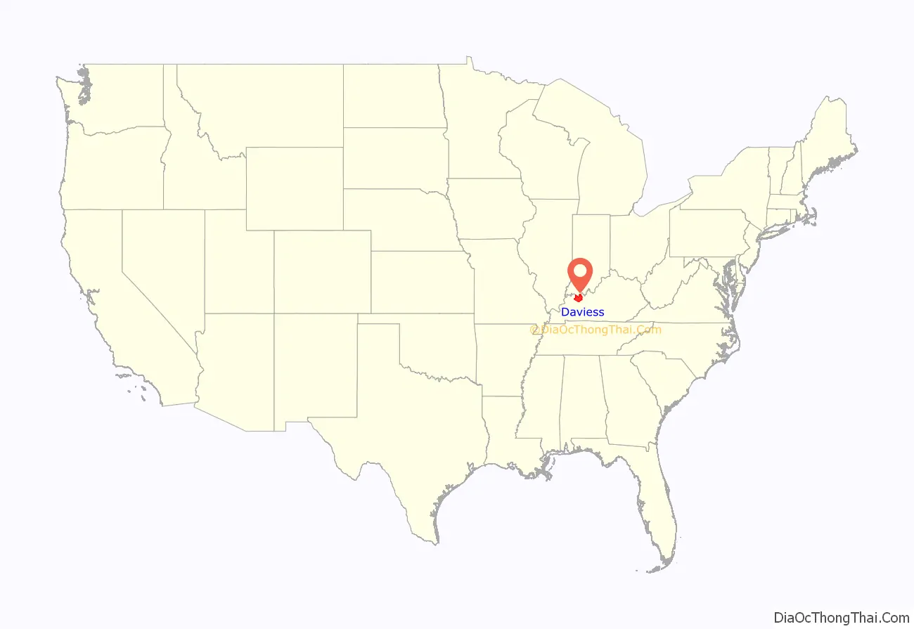
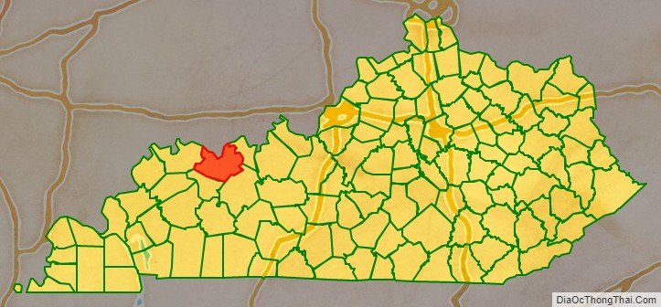
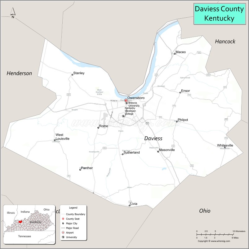
Daviess County location map. Where is Daviess County?
History
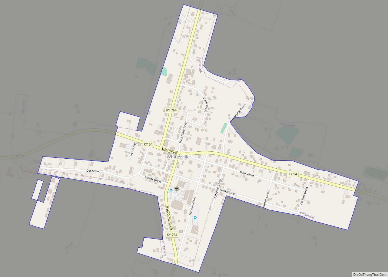
Daviess County was established in 1815. The county is named for Major Joseph Hamilton Daveiss (a recording error in the State Clerk’s office accounts for the error in spelling, which was never corrected), the United States Attorney who unsuccessfully prosecuted Aaron Burr. The county’s borders were altered in 1829 to form Hancock County, in 1830 to absorb a small area surrounding Whitesville, in 1854 to cede land to McLean County, and finally in 1860 to annex 44 square miles (110 km) from Henderson County.
The courthouse was burned in January 1865 during the American Civil War, but the county records were spared destruction because they had been transferred to a church.
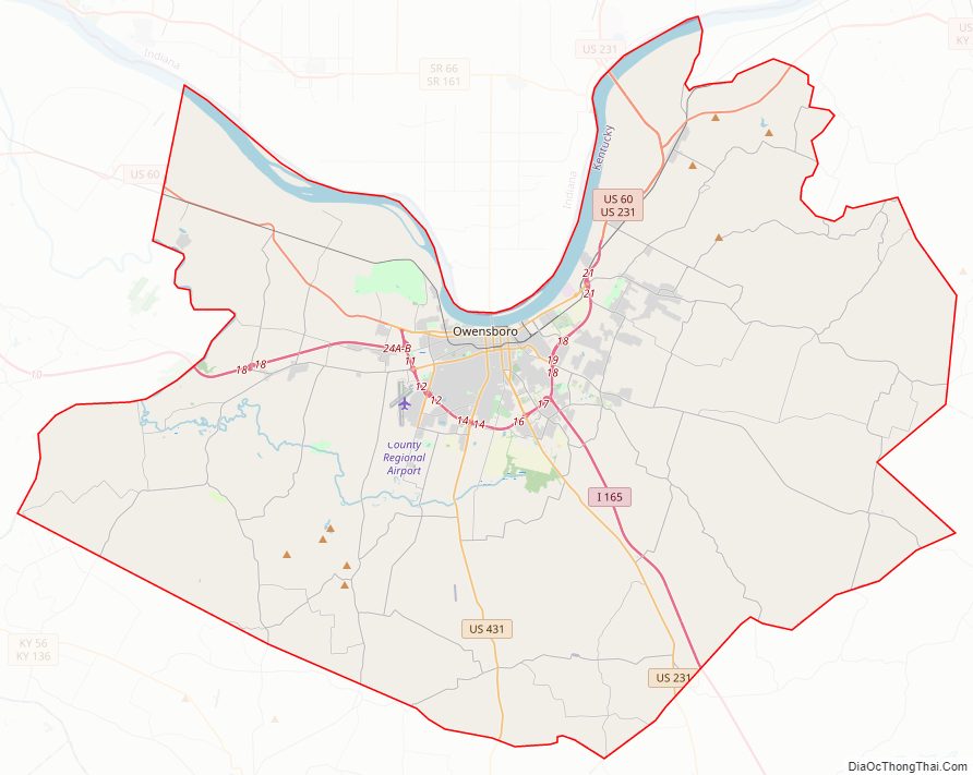
Daviess County Road Map
Geography
According to the United States Census Bureau, the county has a total area of 477 square miles (1,240 km), of which 458 square miles (1,190 km) is land and 18 square miles (47 km) (3.8%) is water. The northern half of the county along the Ohio River is relatively flat, with a few rolling hills dotting the landscape. The southern portion is mostly rolling hills mixed with flat valleys. The southern portion was mined for coal in the past, especially in the rolling hills along Panther Creek and other streams.
Adjacent counties
- Warrick County, Indiana (northwest)
- Spencer County, Indiana (northeast)
- Hancock County (east)
- Ohio County (southeast)
- McLean County (southwest)
- Henderson County (west)
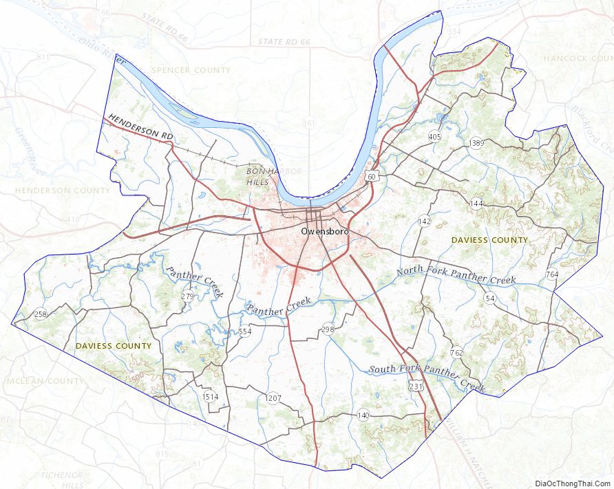
Daviess County Topographic Map
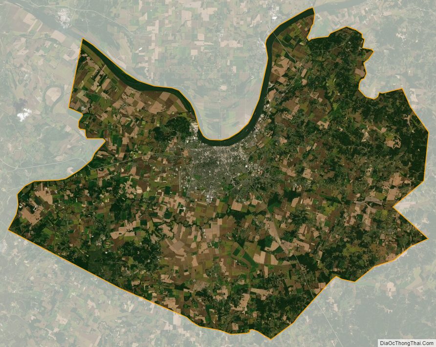
Daviess County Satellite Map
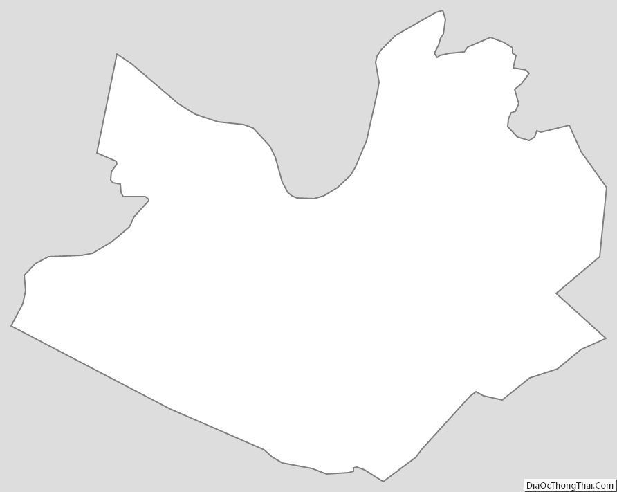
Daviess County Outline Map