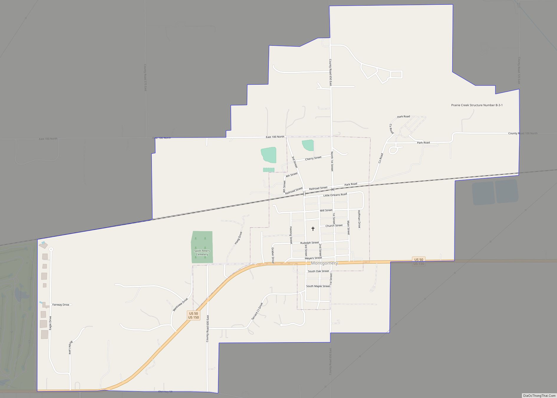
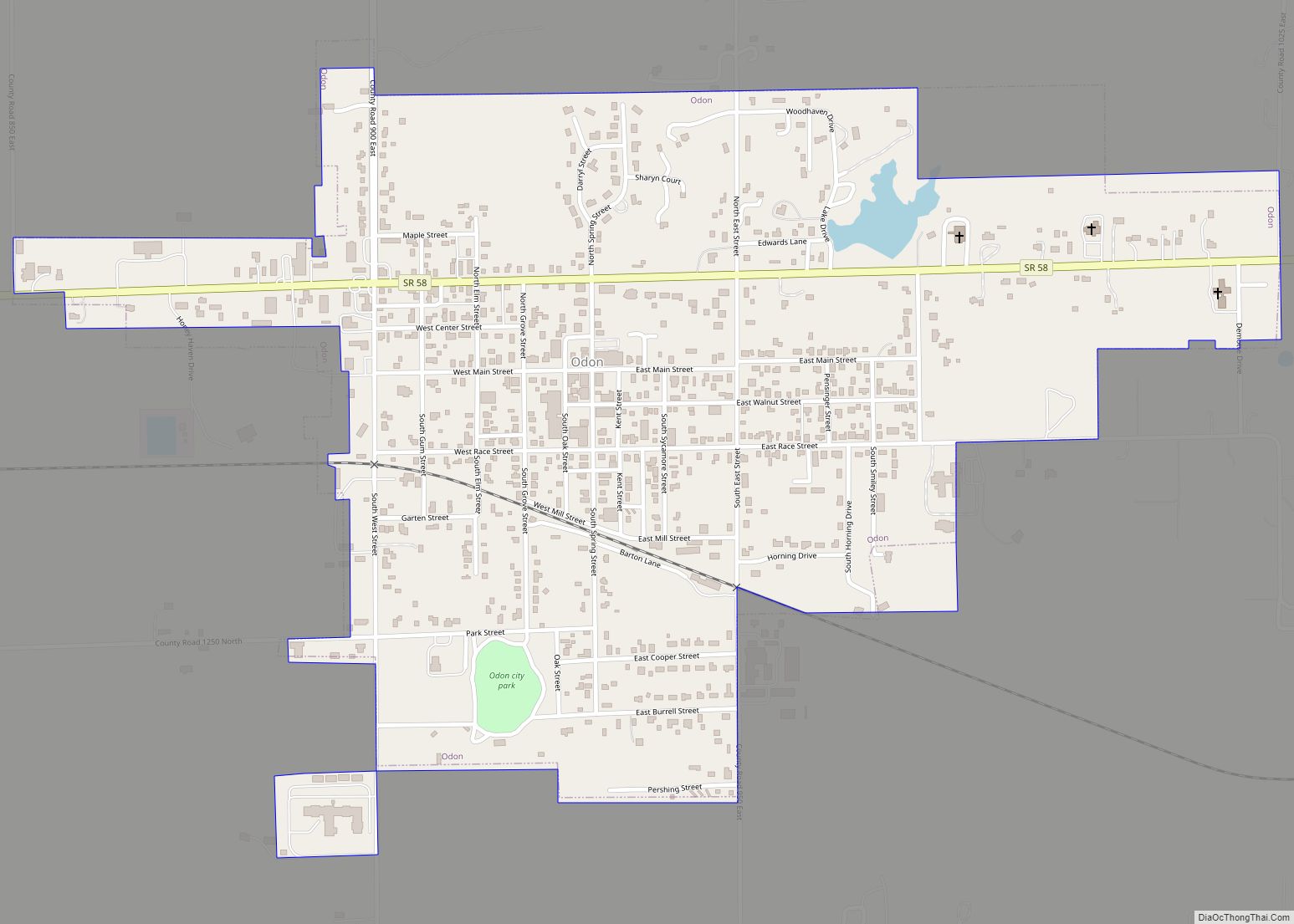
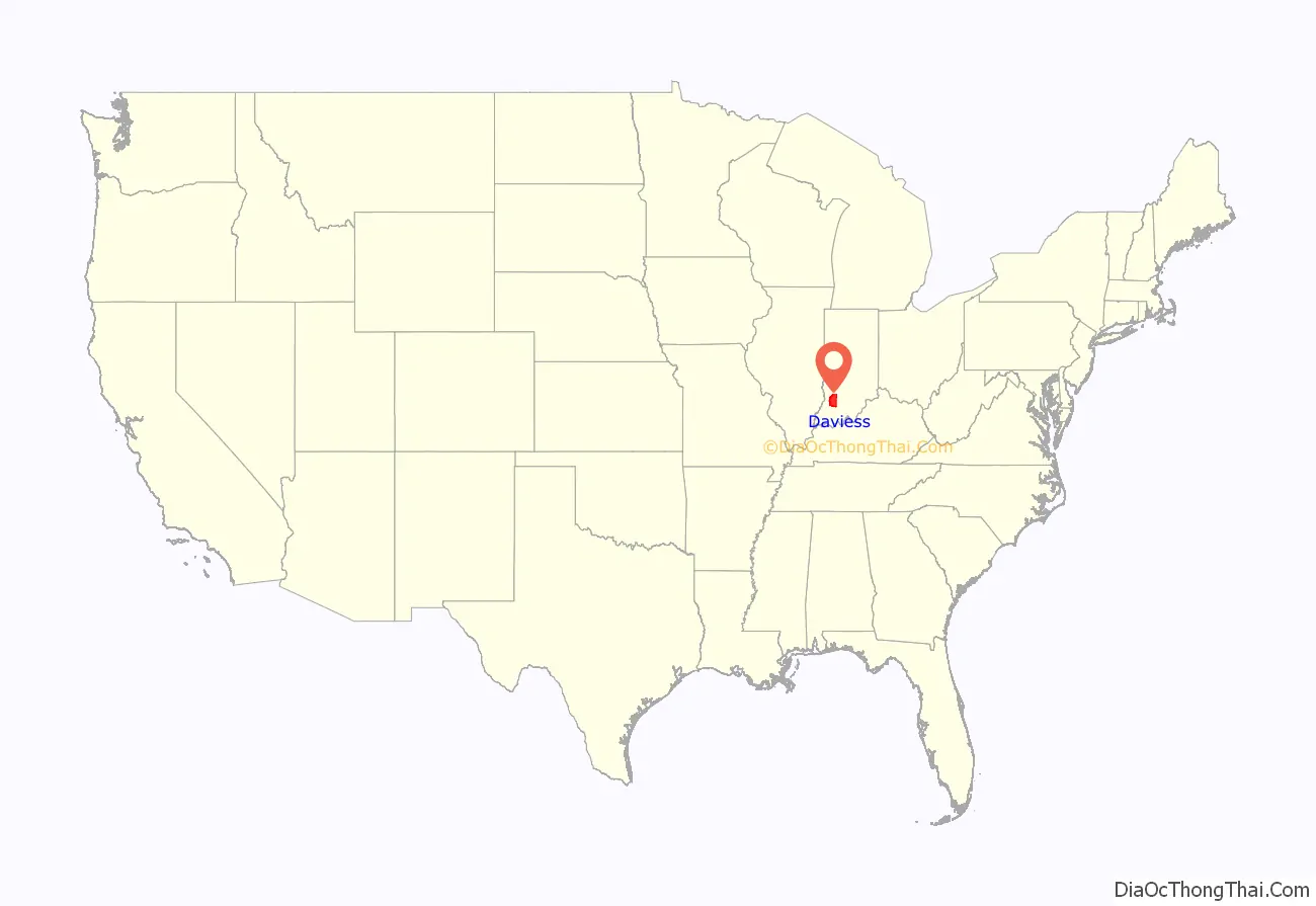
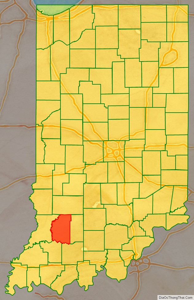
Daviess County /ˈdeɪviːz/ is a county in the U.S. state of Indiana. As of the 2010 United States Census, the population was 31,648. The county seat is Washington. About 15% of the county’s population is Amish of Swiss origin, as of 2017.
| Name: | Daviess County |
|---|---|
| FIPS code: | 18-027 |
| State: | Indiana |
| Founded: | February 2, 1818 |
| Named for: | Joseph Hamilton Daveiss |
| Seat: | Washington |
| Largest town: | Washington |
| Total Area: | 436.87 sq mi (1,131.5 km²) |
| Land Area: | 429.49 sq mi (1,112.4 km²) |
| Total Population: | 33,381 |
| Population Density: | 76/sq mi (30/km²) |
Daviess County location map. Where is Daviess County?
History
After the American Revolutionary War was settled, the fledgling nation created the Northwest Territory, tentatively divided into two counties. The area that would become the state of Indiana in 1816 was included in the original Knox County. As the area became more settled, Knox was partitioned into smaller counties, the last of which was the present-day Daviess, authorized on 2 February 1818. The boundaries of Daviess were reduced on 21 December 1818 by the formation of Owen County, and on 17 January 1820 by the formation of Martin County. It has retained its present boundary since 1820.
Daviess County was named for Major Joseph Hamilton Daveiss, U.S. District Attorney for Kentucky, killed at the Battle of Tippecanoe in 1811. The earliest settlements were along the White River, which allowed crops and timber to be transported to distant markets. The northeast part of the county was heavily forested, and timber industry flourished in the first half of the nineteenth century. Daviess County shares its namesake with another nearby Daviess County of Kentucky. Both Counties are in the Illinois-Indiana-Kentucky Tri-State Area.
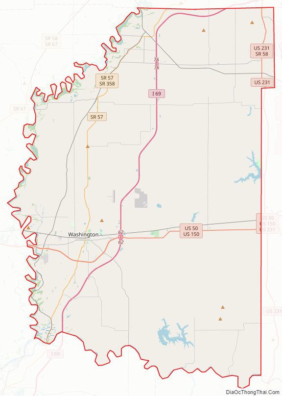
Daviess County Road Map
Geography
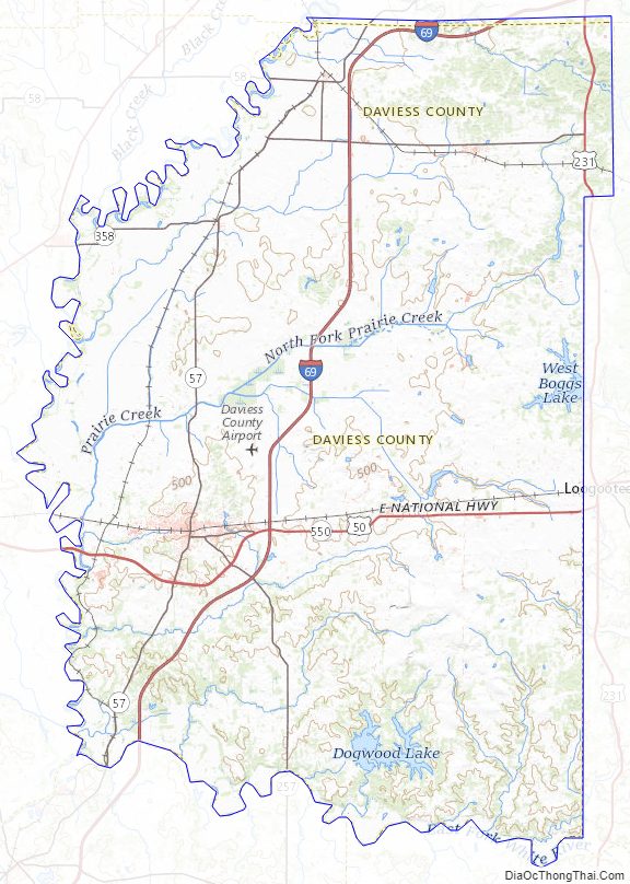
The terrain of Daviess County is hilly, with its area completely devoted to agriculture or urban development. Its highest elevation (740’/266 meters ASL) is a rise one mile (1.6 km) NNE of Farlen. The county is drained by the White River flowing to the southwest, whose two main forks (East White and West White) come together at the county’s SW corner. The county’s west boundary is defined by the West White River’s course and its south boundary is defined by the East White River’s course; their confluence defines the county’s corner point.
According to the 2010 census, Daviess County has a total area of 436.87 square miles (1,131.5 km), of which 429.49 square miles (1,112.4 km) (or 98.31%) is land and 7.39 square miles (19.1 km) (or 1.69%) is water.
Adjacent counties
- Greene County – north
- Martin County – east
- Dubois County – southeast
- Pike County – southwest
- Knox County – west
Major highways
- I-69
- US 50
- US 150
- US 231
- SR 57
- SR 58
- SR 257
- SR 358
- SR 558
- SR 645
Daviess County Topographic Map
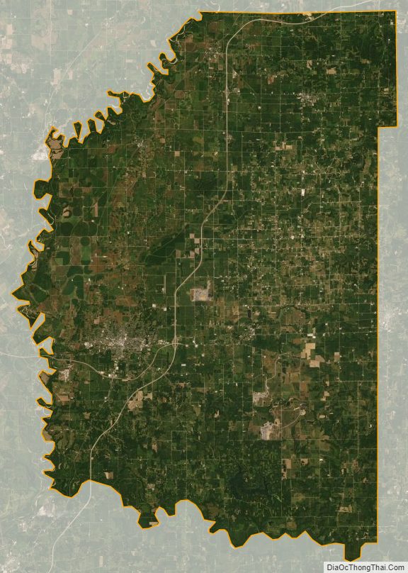
Daviess County Satellite Map
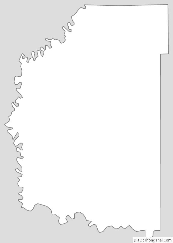
Daviess County Outline Map