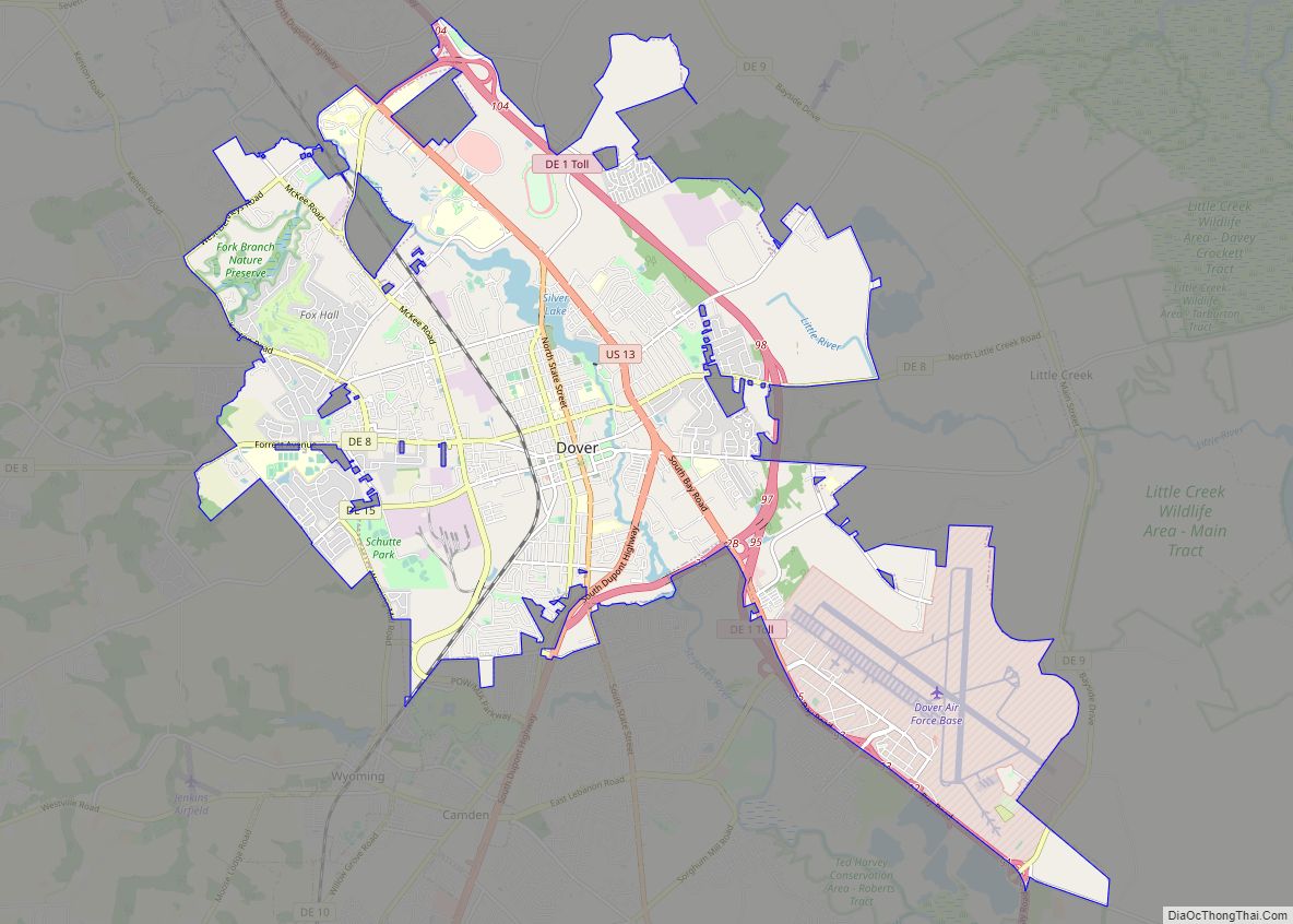
Dover (/ˈdoʊvər/) is the capital and second-most populous city of the U.S. state of Delaware. It is also the county seat of Kent County and the principal city of the Dover metropolitan statistical area, which encompasses all of Kent County and is part of the Philadelphia–Wilmington–Camden, PA–NJ–DE–MD, combined satistical area. It is located on the St. Jones River in the Delaware River coastal plain. It was named by William Penn for Dover in Kent, England (for which Kent County is named). As of 2020, its population was 39,403.
| Name: | Dover city |
|---|---|
| LSAD Code: | 25 |
| LSAD Description: | city (suffix) |
| State: | Delaware |
| County: | Kent County |
| Founded: | 1683 |
| Incorporated: | 1717 |
| Elevation: | 30 ft (9 m) |
| Land Area: | 23.67 sq mi (61.30 km²) |
| Water Area: | 0.30 sq mi (0.79 km²) |
| Population Density: | 1,664.82/sq mi (642.79/km²) |
| Area code: | 302 |
| FIPS code: | 1021200 |
| GNISfeature ID: | 217882 |
| Website: | www.cityofdover.com |
Online Interactive Map
Click on ![]() to view map in "full screen" mode.
to view map in "full screen" mode.
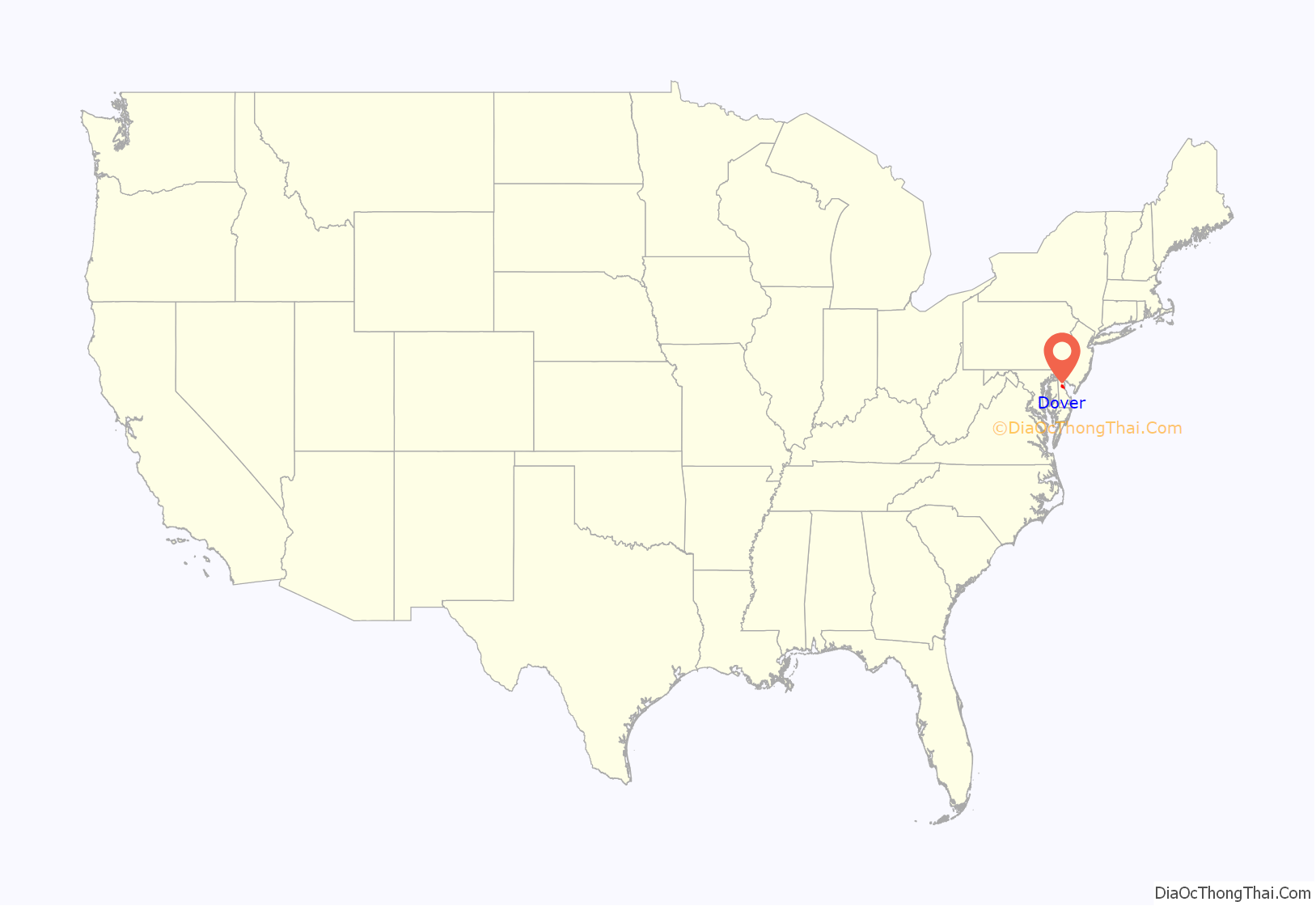
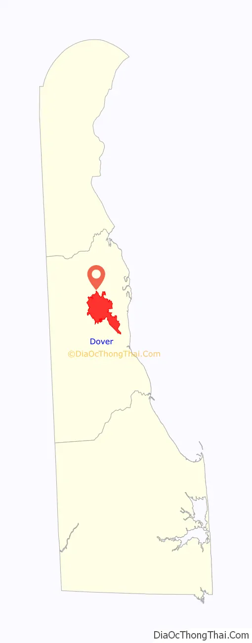
Dover location map. Where is Dover city?
History
Dover was founded as the court town for newly established Kent County in 1683 by William Penn, the proprietor of the territory generally known as the “Lower Counties on the Delaware.” Later, in 1717, the city was officially laid out by a special commission of the Delaware General Assembly. The capital of the state of Delaware was moved here from New Castle in 1777 because of its central location and relative safety from British raiders on the Delaware River. Because of an act passed in October 1779, the assembly elected to meet at any place in the state they saw fit, meeting successively in Wilmington, Lewes, Dover, New Castle, and Lewes again, until it finally settled down permanently in Dover in October 1781. The city’s central square, known as The Green, was the location of many rallies, troop reviews, and other patriotic events. To this day, The Green remains the heart of Dover’s historic district and is the location of the Delaware Supreme Court and the Kent County Courthouse.
Dover was most famously the home of Caesar Rodney, the popular wartime leader of Delaware during the American Revolution. He is known to have been buried outside Dover, but the precise location of his grave is unknown. A cenotaph in his honor is erected in the cemetery of the Christ Episcopal Church near The Green in Dover.
Dover and Kent County were deeply divided over the issue of slavery, and the city was a “stop” on the Underground Railroad because of its proximity to slave-holding Maryland and free Pennsylvania and New Jersey. It was also home to a large Quaker community that encouraged a sustained emancipation effort in the early 19th century. There were very few slaves in the area, but the institution was supported, if not practiced, by a small majority, who saw to its continuation.
The Bradford-Loockerman House, Building 1301, Dover Air Force Base, John Bullen House, Carey Farm Site, Christ Church, Delaware State Museum Buildings, John Dickinson House, Dover Green Historic District, Eden Hill, Delaware Governor’s Mansion, Greenwold, Hughes-Willis Site, Loockerman Hall, Macomb Farm, Mifflin-Marim Agricultural Complex, Old Statehouse, Palmer Home, Town Point, Tyn Head Court, and Victorian Dover Historic District are listed on the National Register of Historic Places.
On August 4, 2020, Hurricane Isaias produced an EF2 tornado that struck the city. Trees were significantly damaged, including some that fell on homes, roofing was blown off a middle school, a warehouse had metal walls torn off, some tractor trailers were blown over and a garage was severely damaged. Damage in Dover was rated EF1. The tornado would be on the ground for tracked 35.78 miles (57.58 km), becoming the longest-tracked tornado in the state, but there were no casualties.
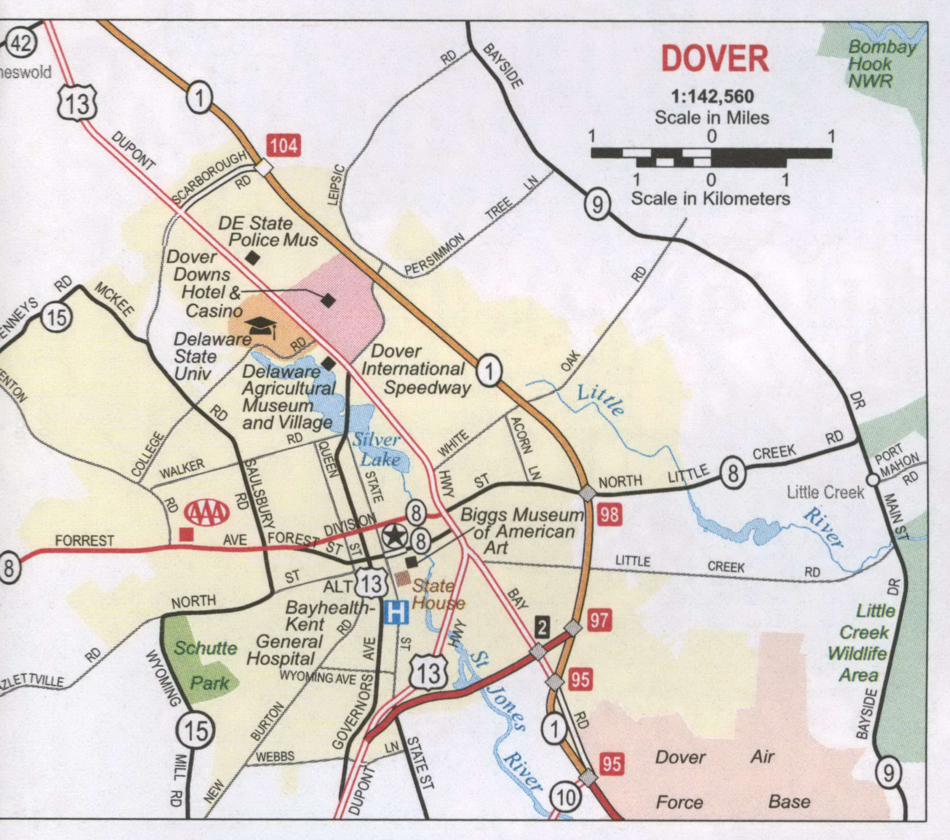
Dover Road Map

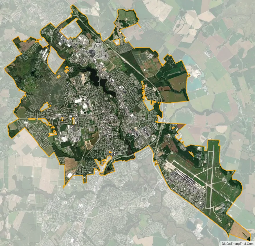
Dover city Satellite Map
Geography
Dover is located at 39°09′29″N 75°31′28″W / 39.15806°N 75.52444°W / 39.15806; -75.52444 (39.1581680, −75.5243682).
According to the United States Census Bureau, the city has a total area of 22.7 square miles (59 km), of which 22.4 square miles (58 km) is land and 0.3 square miles (0.78 km), or 1.32%, is water.
Climate
Dover has a warm temperate climate or humid subtropical climate (Köppen Cfa). Summers are hot and humid, with 25 days per year reaching or surpassing 90 °F (32 °C). Brief, but heavy summer thunderstorms are common. Winters are moderated by the Delaware Bay and the partial shielding of the Appalachians, though there are normally 8−9 days when the daily high remains below freezing and 15 nights with lows below 20 °F (−7 °C). Snow is typically light and sporadic, averaging only 13.2 inches (34 cm) per year, and does not usually remain on the ground for long. The hardiness zone is 7b in the city and 7a in the suburbs. Spring and autumn provide transitions of reasonable length and are similar, though spring is wetter. The monthly mean temperature ranges from 36.0 °F (2.2 °C) in January to 77.9 °F (25.5 °C) in July. The annual total precipitation of around 47.61 inches (1,209.3 mm) is spread rather evenly year-round.
See or edit raw graph data.
See also
Map of Delaware State and its subdivision: Map of other states:- Alabama
- Alaska
- Arizona
- Arkansas
- California
- Colorado
- Connecticut
- Delaware
- District of Columbia
- Florida
- Georgia
- Hawaii
- Idaho
- Illinois
- Indiana
- Iowa
- Kansas
- Kentucky
- Louisiana
- Maine
- Maryland
- Massachusetts
- Michigan
- Minnesota
- Mississippi
- Missouri
- Montana
- Nebraska
- Nevada
- New Hampshire
- New Jersey
- New Mexico
- New York
- North Carolina
- North Dakota
- Ohio
- Oklahoma
- Oregon
- Pennsylvania
- Rhode Island
- South Carolina
- South Dakota
- Tennessee
- Texas
- Utah
- Vermont
- Virginia
- Washington
- West Virginia
- Wisconsin
- Wyoming