New Castle is a city in New Castle County, Delaware, United States. The city is located six miles (10 km) south of Wilmington and is situated on the Delaware River. As of 2020, the city’s population was 5,551.
| Name: | New Castle city |
|---|---|
| LSAD Code: | 25 |
| LSAD Description: | city (suffix) |
| State: | Delaware |
| County: | New Castle County |
| Founded: | 1640 |
| Elevation: | 10 ft (3 m) |
| Total Area: | 3.52 sq mi (9.12 km²) |
| Land Area: | 3.48 sq mi (9.01 km²) |
| Water Area: | 0.04 sq mi (0.11 km²) |
| Total Population: | 5,551 |
| Population Density: | 1,596.03/sq mi (616.23/km²) |
| ZIP code: | 19720-19721, 19726 |
| Area code: | 302 |
| FIPS code: | 1050800 |
| GNISfeature ID: | 214379 |
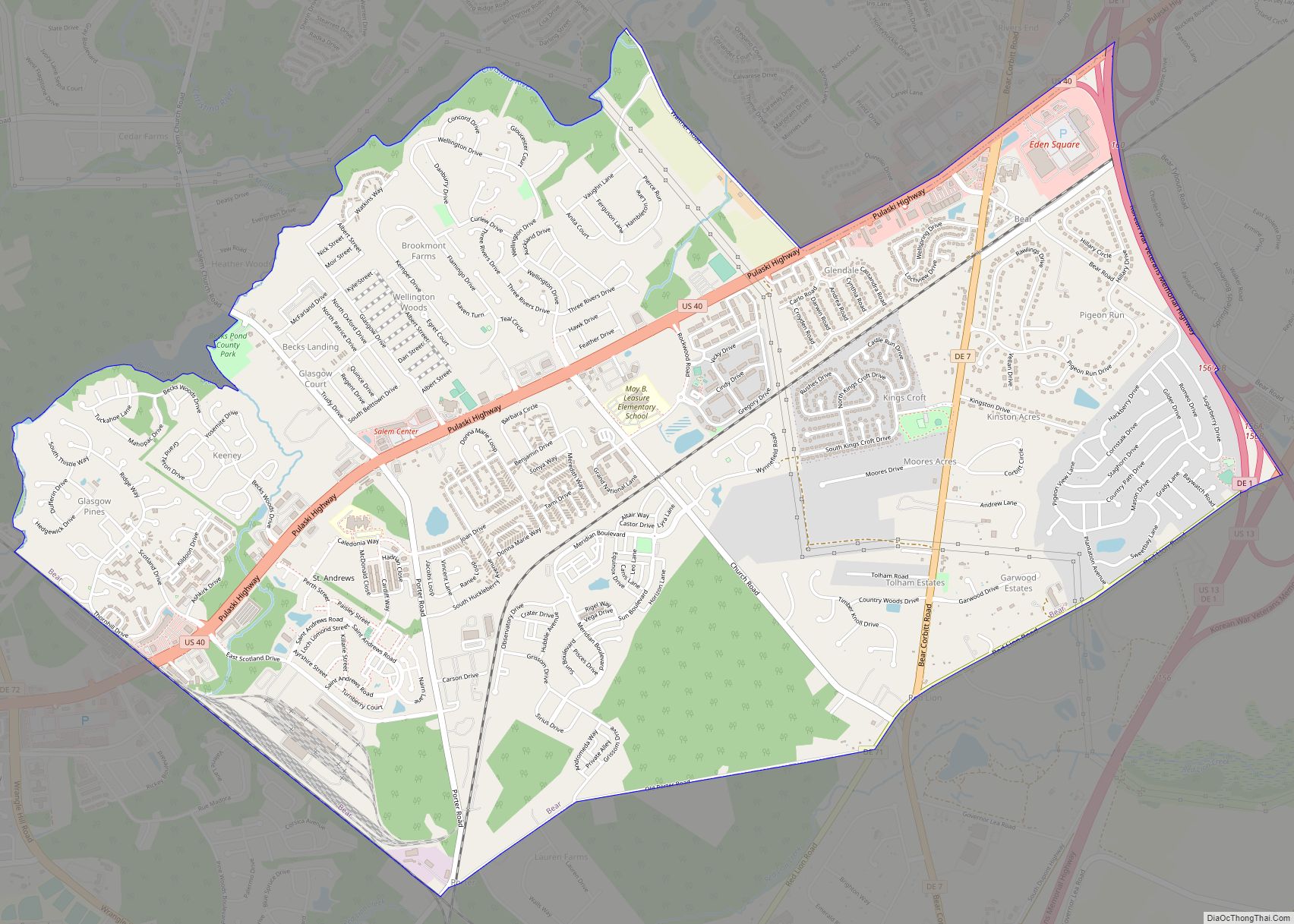
Online Interactive Map
Click on ![]() to view map in "full screen" mode.
to view map in "full screen" mode.
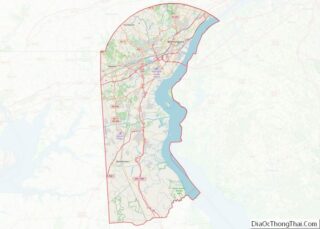
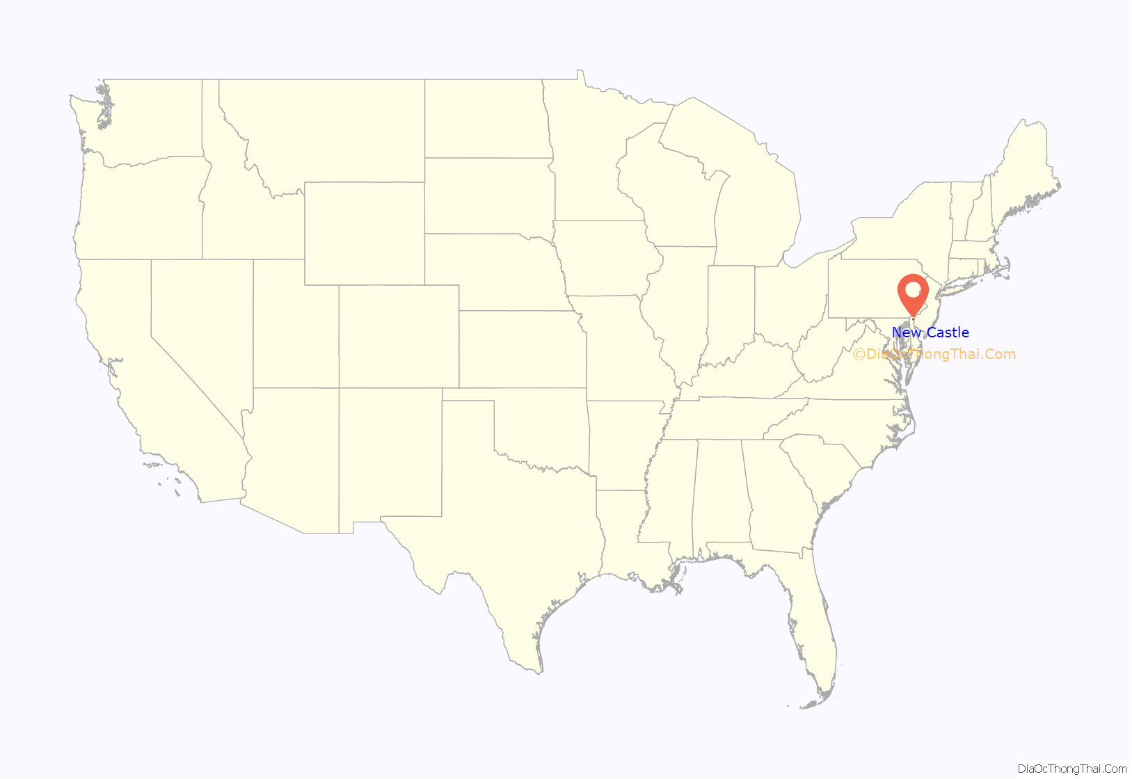
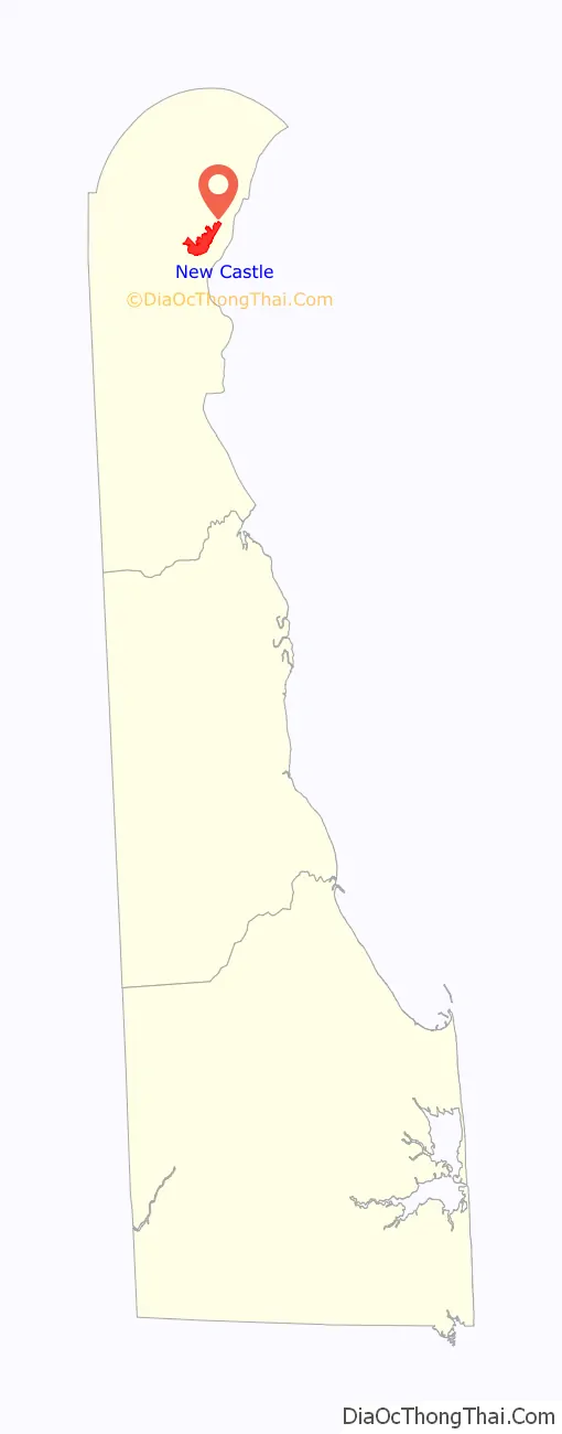
New Castle location map. Where is New Castle city?
History
17th century
New Castle was originally settled by the Dutch West India Company in 1651 under the leadership of Peter Stuyvesant on the site of a former aboriginal village, “Tomakonck” (“Place of the Beaver”), to assert their claim to the area based on a prior agreement with the aboriginal inhabitants of the area. The Dutch originally named the settlement Fort Casimir, but this was changed to Fort Trinity following its seizure by the colony of New Sweden on Trinity Sunday in 1654. The Dutch conquered the entire colony of New Sweden the following year and rechristened the fort as Nieuw-Amstel, named afte the Amstel. This marked the end of the Swedish colony in Delaware as an official entity, but it remained a semi-autonomous unit within the New Netherland colony and the cultural, social, and religious influence of the Swedish settlers remained strong. As the settlement grew, Dutch authorities laid out a grid of streets and established a common green in the town’s center, which continues to this day.
In 1664, the English seized the entire New Netherland colony in the Second Anglo-Dutch War. They changed the name of the town to “New Castle” and made it the capital of their Delaware Colony. The Dutch regained the town in 1673 during the Third Anglo-Dutch War but it was returned to Great Britain the next year under the Treaty of Westminster. In 1680, New Castle was conveyed to William Penn by the Duke of York by livery of seisin and was Penn’s landing place when he first set foot on American soil on October 27, 1682. This transfer to Penn was contested by Lord Baltimore and the boundary dispute was not resolved until the survey conducted by Mason and Dixon, now famed in history as the Mason–Dixon line.
18th century
Prior to the establishment of Penn’s Philadelphia, New Castle was a center of government. After being transferred to Penn, Delaware’s Swedish, Dutch, and English residents became accustomed to the relaxed culture of the Restoration monarchy and grew uncomfortable with the more conservative Quaker influence, so Delaware petitioned for a separate legislature, which was finally granted in 1702. Delaware formally broke from Pennsylvania in 1704. New Castle again became the seat of the colonial government, thriving with the various judges and lawyers that fueled the economy. Many smaller houses were torn down and replaced in this era. In February, 1777, John McKinly was elected the first President of Delaware, a title later renamed “Governor”. During the Revolution, when New Castle was besieged by William Howe, the government elected to move its functions south to Dover in May, 1777. McKinley was captured by the British and held prisoner for several months. New Castle remained the county seat until after the Civil War, when that status was transferred to Wilmington. Three of the 56 signers of the Declaration of Independence were from New Castle: Thomas McKean, George Read, and George Ross.
19th century
The 16-mile (26 km) portage between the Delaware River and Chesapeake Bay saved a 400-mile (640 km) trip around the Delmarva Peninsula, so this brought passengers, goods, and business to New Castle’s port. In the years following the Revolution, a turnpike was built to facilitate travel between the two major waterways. Later, New Castle became the eastern terminus of the New Castle and Frenchtown Railroad, the second-oldest rail line in the country, launched in 1828 with horse-drawn rail cars, then converting to steam power when an engine was purchased from Great Britain in 1832. The line traversed the Delmarva Peninsula, running to the Elk River, Maryland, from where passengers changed to packet boats for further travel to Baltimore and points south. This helped the New Castle economy to further boom; however, by 1840, rail lines were in place between Philadelphia and Baltimore, which had a stop in Wilmington, thus leaving New Castle to deal with a substantial decline in traffic and revenue.
The decline in New Castle’s economy had the long-range fortunate effect of preventing most residents from making any significant structural changes to their homes. The many buildings of historic New Castle have largely not been upgraded or restored and appear much as they did in the Colonial and Federal periods.
20th century
Since 1927, New Castle has offered tours of historical homes, churches, and gardens, which are typically held annually on the third Saturday of May. Householders dress in colonial costumes and an admittance fee, used toward the maintenance of the town’s many historic buildings, is charged. Annually in June, New Castle holds its annual Separation Day celebration.
On April 28, 1961, an F3 tornado hit the north side. Although no fatalities or injuries occurred, it was the only tornado of this magnitude ever recorded in Delaware during the Fujita scale area.
21st century
A tornado rated EF3 hit the city on April 1, 2023.
New Castle Road Map
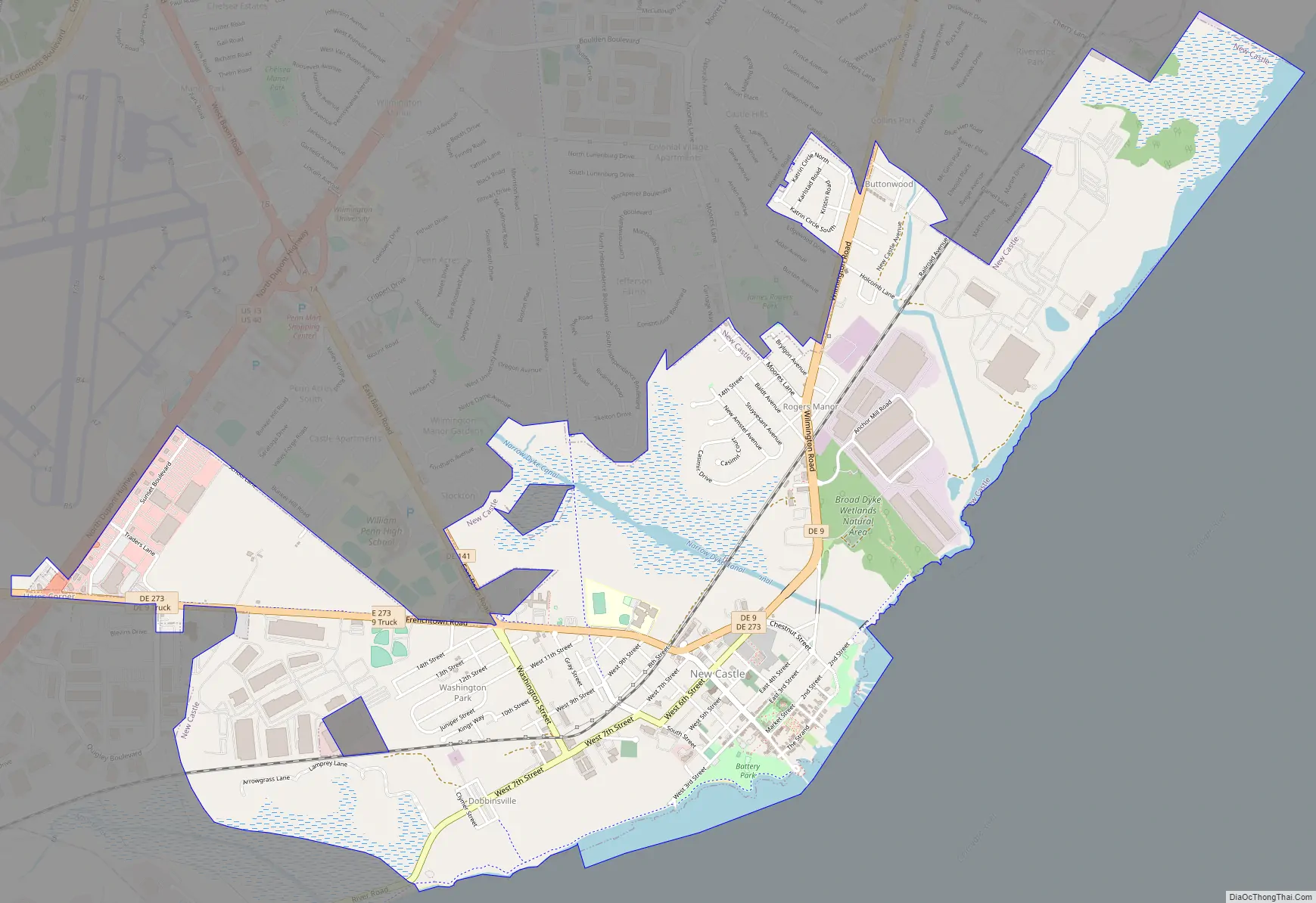
New Castle city Satellite Map

Geography
According to the U.S. Census Bureau, the city has a total area of 3.2 square miles (8.2 km), of which 3.0 square miles (7.9 km) of it is land and 0.1 square miles (0.3 km) of it (3.79%) is water.
The city is the home of Broad Dyke, the first dyke built in the United States.
The cupola of the court house is the center of the “Twelve-Mile Circle” that defines much of the border between Delaware and Pennsylvania. The circle also forms a small portion of the border between Delaware and New Jersey and Delaware and Maryland.
See also
Map of Delaware State and its subdivision: Map of other states:- Alabama
- Alaska
- Arizona
- Arkansas
- California
- Colorado
- Connecticut
- Delaware
- District of Columbia
- Florida
- Georgia
- Hawaii
- Idaho
- Illinois
- Indiana
- Iowa
- Kansas
- Kentucky
- Louisiana
- Maine
- Maryland
- Massachusetts
- Michigan
- Minnesota
- Mississippi
- Missouri
- Montana
- Nebraska
- Nevada
- New Hampshire
- New Jersey
- New Mexico
- New York
- North Carolina
- North Dakota
- Ohio
- Oklahoma
- Oregon
- Pennsylvania
- Rhode Island
- South Carolina
- South Dakota
- Tennessee
- Texas
- Utah
- Vermont
- Virginia
- Washington
- West Virginia
- Wisconsin
- Wyoming