Oelwein is a city in Fayette County, Iowa, United States. The population was 5,920 at the time of the 2020 census, a decrease of 11.5% from the 2000 census. The largest community in Fayette County, it is located at the junction of State Highways 3 and 150.
| Name: | Oelwein city |
|---|---|
| LSAD Code: | 25 |
| LSAD Description: | city (suffix) |
| State: | Iowa |
| County: | Fayette County |
| Elevation: | 1,047 ft (319 m) |
| Total Area: | 4.85 sq mi (12.55 km²) |
| Land Area: | 4.81 sq mi (12.47 km²) |
| Water Area: | 0.03 sq mi (0.08 km²) |
| Total Population: | 5,920 |
| Population Density: | 1,229.75/sq mi (474.81/km²) |
| ZIP code: | 50662 |
| Area code: | 319 |
| FIPS code: | 1958620 |
| GNISfeature ID: | 0459805 |
| Website: | http://www.cityofoelwein.org/main |
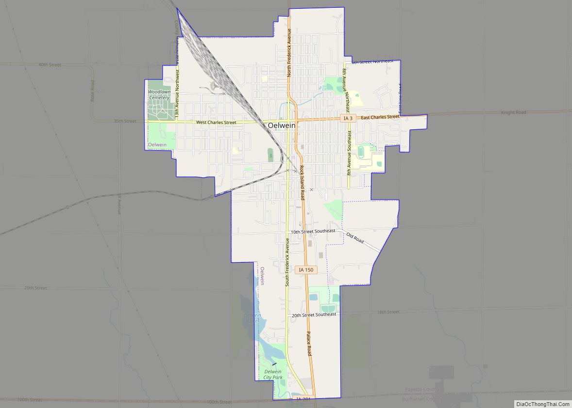
Online Interactive Map
Click on ![]() to view map in "full screen" mode.
to view map in "full screen" mode.
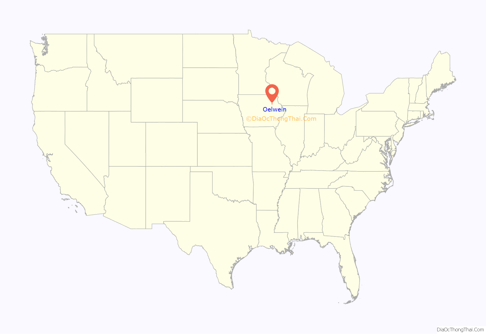
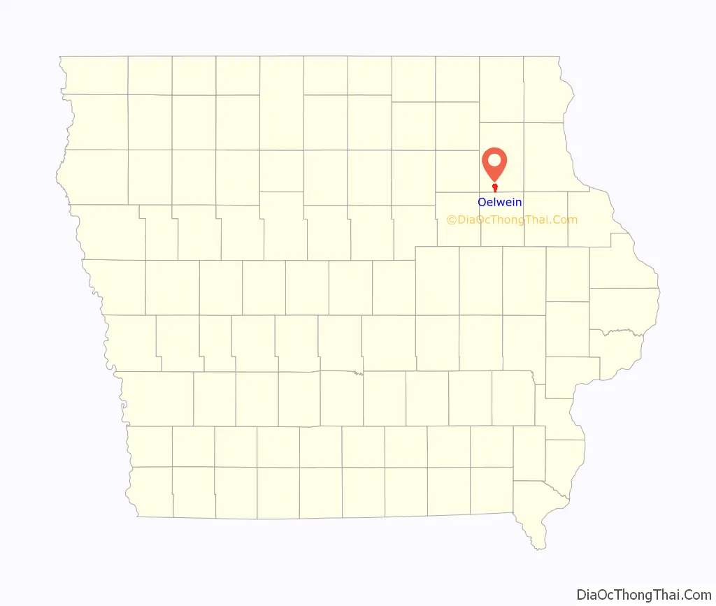
Oelwein location map. Where is Oelwein city?
History
The town of Oelwein was laid out in a corn field purchased from pioneer settler Gustav Oelwein on the coming of the Burlington, Cedar Rapids and Minnesota Railroad (later called the Rock Island) in 1872. Some years later the two dividing streets of Oelwein were named after his sons, Frederick and Charles.
Oelwein’s present site was entered in 1852 by J. B. Burch. The hamlet of Oelwein was instituted in 1873, and was incorporated as a town in 1888, with Dr. Israel Pattison becoming its first mayor. The town suffered its chief setback in 1887, when nearly all of the old Main Street business district (now First Avenue SE) was destroyed by fire. In 1890 the census gave the population as 830.
By January 1892, Oelwein was chosen to become the center of the Chicago Great Western Railway; the CGW made the town the site of their locomotive and car repair shop. Clearing the land for the shops began in June 1894. The shops were completed and put into operation in May 1899. Thus, Oelwein became known as the “Shop City” and later the “Hub City” because of the rail lines coming into town and the repair shops located here.
By 1895 the population had increased to 1,928, and in 1897 Oelwein was incorporated as a city. In 1900, Oelwein had 5,142 people within the city limits, of whom 789 were foreign-born. Oelwein was one of few Iowa towns to experience an influx of Italian immigrants who were employed in the railroad industry. In 1910, the population was 6,028, and in 1940, 7,801.
In 1968, the town suffered another setback when a tornado swept through the main business district. 68 homes were destroyed, including some in F5 damage, 132 sustained major damage and 600 sustained less damage. Every business in the district suffered damage including 51 that were destroyed. Two churches, an elementary school, and the middle school were destroyed. Extensive damage was also done in nearby Maynard. Along the path, 5 people died (one in Oelwein), 156 were injured, and $21 million worth of ($18 million in Oelwein) damage was done, inflated to $130.4 million today.
Oelwein remained a “railroad town” until the early 1980s when most of the railroad tracks to the East, North and then West directions were abandoned. Transco Railway Products exists in Oelwein today. That business employs about 70 people repairing railroad cars. Transco employees donated their time to refurbish a Chicago Great Western EMD FP7 diesel locomotive that is displayed near the Hub City Heritage Museum, 26 2nd Avenue SW, the museum of railroad memorabilia.
Methland controversy
The 2009 book Methland: The Death and Life of an American Small Town by Nick Reding (Bloomsbury Press) documents the drug culture and how it ties into larger issues of rural flight and small town economic decline placed in the historic context of the drug trade. While Reding’s book received positive reviews from the New York Times Sunday Book Review and Washington Post’s Book World, it was severely criticised by local columnist Laura Behrens, who wrote, “it is so ridden with errors of basic reporting that the credibility of its larger premises is crippled”, pointing out several factual errors.
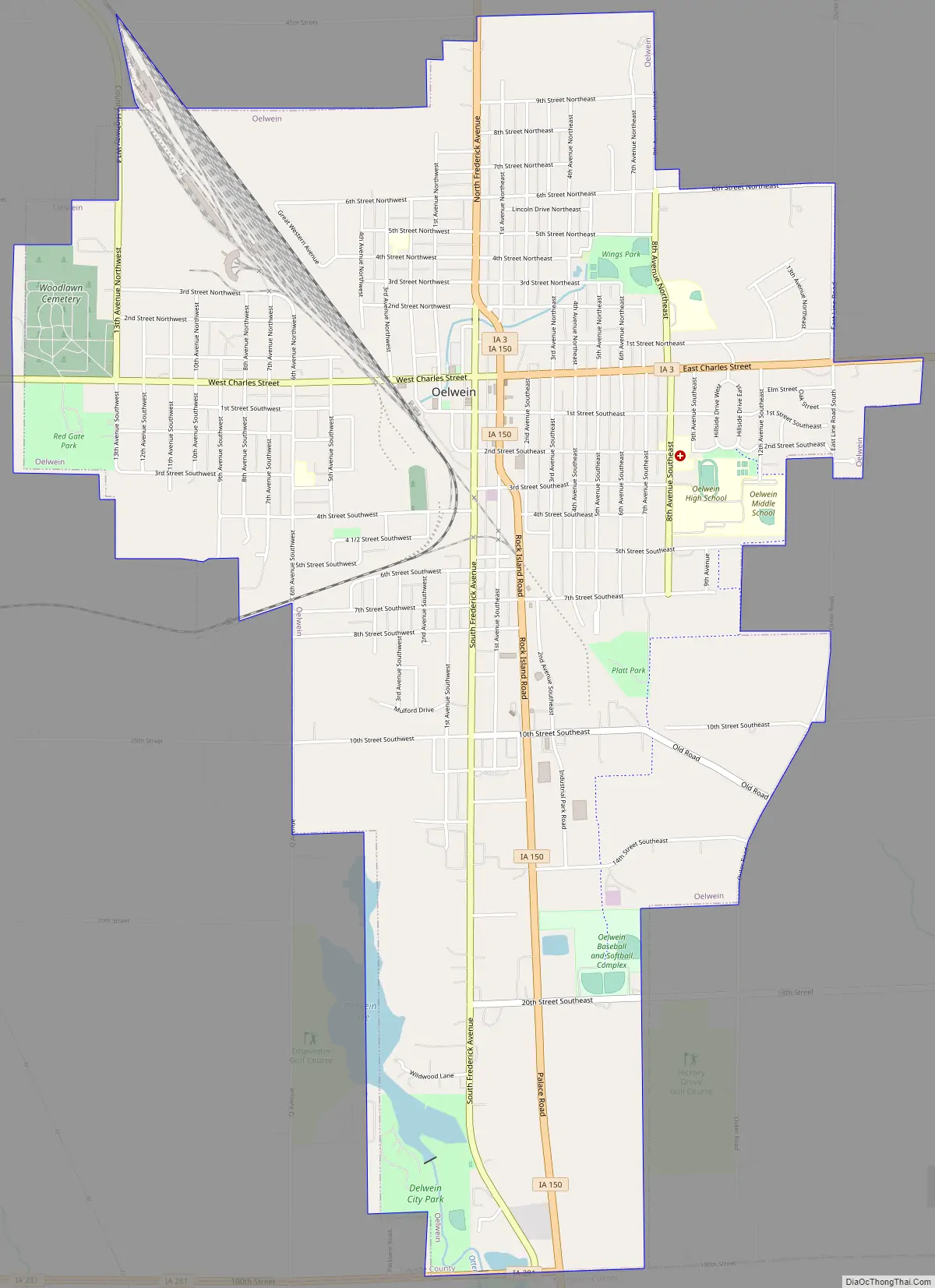
Oelwein Road Map
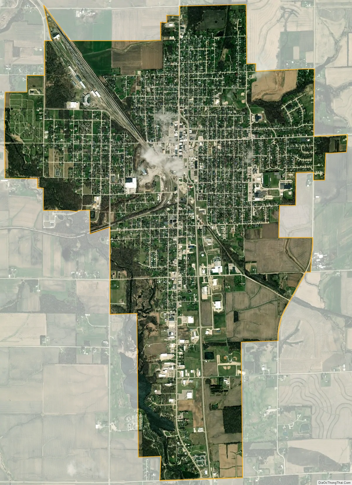
Oelwein city Satellite Map
Geography
Oelwein’s latitude and longitude coordinates in decimal form are 42.676996, −91.915745.
According to the United States Census Bureau, the city has a total area of 4.86 square miles (12.59 km), of which 4.81 square miles (12.46 km) is land and 0.05 square miles (0.13 km) is water.
See also
Map of Iowa State and its subdivision:- Adair
- Adams
- Allamakee
- Appanoose
- Audubon
- Benton
- Black Hawk
- Boone
- Bremer
- Buchanan
- Buena Vista
- Butler
- Calhoun
- Carroll
- Cass
- Cedar
- Cerro Gordo
- Cherokee
- Chickasaw
- Clarke
- Clay
- Clayton
- Clinton
- Crawford
- Dallas
- Davis
- Decatur
- Delaware
- Des Moines
- Dickinson
- Dubuque
- Emmet
- Fayette
- Floyd
- Franklin
- Fremont
- Greene
- Grundy
- Guthrie
- Hamilton
- Hancock
- Hardin
- Harrison
- Henry
- Howard
- Humboldt
- Ida
- Iowa
- Jackson
- Jasper
- Jefferson
- Johnson
- Jones
- Keokuk
- Kossuth
- Lee
- Linn
- Louisa
- Lucas
- Lyon
- Madison
- Mahaska
- Marion
- Marshall
- Mills
- Mitchell
- Monona
- Monroe
- Montgomery
- Muscatine
- O'Brien
- Osceola
- Page
- Palo Alto
- Plymouth
- Pocahontas
- Polk
- Pottawattamie
- Poweshiek
- Ringgold
- Sac
- Scott
- Shelby
- Sioux
- Story
- Tama
- Taylor
- Union
- Van Buren
- Wapello
- Warren
- Washington
- Wayne
- Webster
- Winnebago
- Winneshiek
- Woodbury
- Worth
- Wright
- Alabama
- Alaska
- Arizona
- Arkansas
- California
- Colorado
- Connecticut
- Delaware
- District of Columbia
- Florida
- Georgia
- Hawaii
- Idaho
- Illinois
- Indiana
- Iowa
- Kansas
- Kentucky
- Louisiana
- Maine
- Maryland
- Massachusetts
- Michigan
- Minnesota
- Mississippi
- Missouri
- Montana
- Nebraska
- Nevada
- New Hampshire
- New Jersey
- New Mexico
- New York
- North Carolina
- North Dakota
- Ohio
- Oklahoma
- Oregon
- Pennsylvania
- Rhode Island
- South Carolina
- South Dakota
- Tennessee
- Texas
- Utah
- Vermont
- Virginia
- Washington
- West Virginia
- Wisconsin
- Wyoming