Preston is a city in Fillmore County, Minnesota, United States. The population was 1,325 at the 2010 census. It is the county seat of Fillmore County. The Root River runs through it, and Mystery Cave State Park is nearby. It bills itself as “America’s Trout Capital,” with a 20-foot trout placed along Minnesota State Highway 16.
| Name: | Preston city |
|---|---|
| LSAD Code: | 25 |
| LSAD Description: | city (suffix) |
| State: | Minnesota |
| County: | Fillmore County |
| Elevation: | 958 ft (292 m) |
| Total Area: | 2.46 sq mi (6.38 km²) |
| Land Area: | 2.46 sq mi (6.38 km²) |
| Water Area: | 0.00 sq mi (0.00 km²) |
| Total Population: | 1,322 |
| Population Density: | 536.31/sq mi (207.11/km²) |
| ZIP code: | 55965 |
| Area code: | 507 |
| FIPS code: | 2752450 |
| GNISfeature ID: | 0649730 |
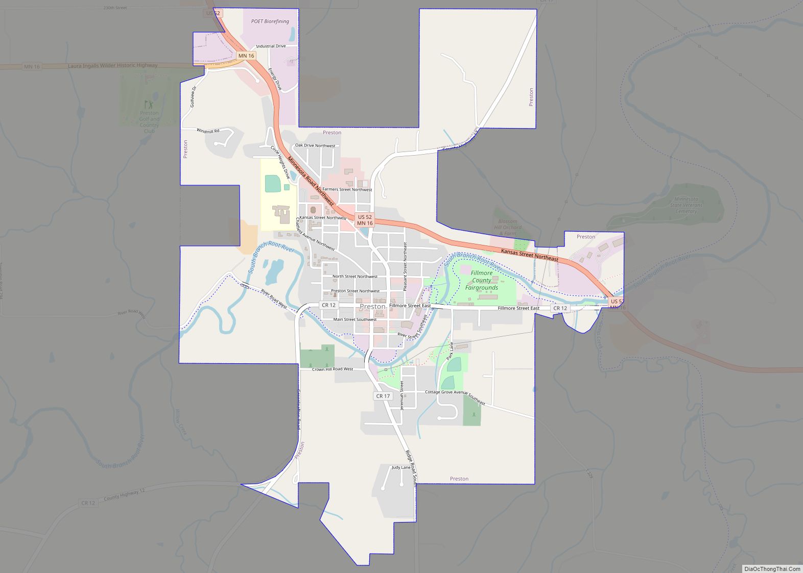
Online Interactive Map
Click on ![]() to view map in "full screen" mode.
to view map in "full screen" mode.
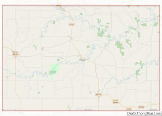
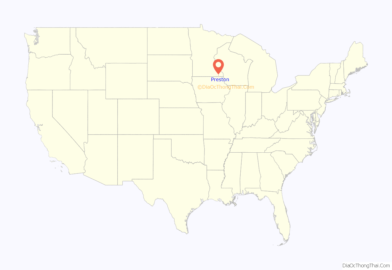
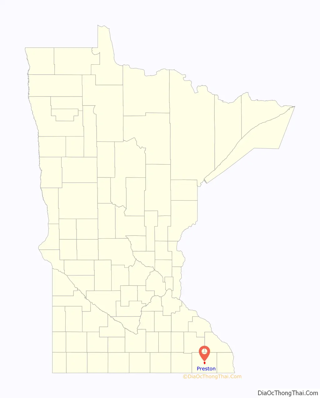
Preston location map. Where is Preston city?
History
Preston was platted in 1855. The community was named for Luther Preston, a millwright and postmaster. The old Preston grain elevator used to be known as the Milwaukee Elevator Company Grain Elevator. It was built around 1890 for holding grain for shipment by railroad to the Eastern cities of the United States. The elevator was last used in the 1980s. It was built with “cribbed” construction, which has to do with interlocking bins. At the time it was a lot stronger and a lot more expensive to build it this way than to build it in stud construction. Now the Preston Historical Society is trying to restore the structure.
The Preston Overlook was built in 1937 by the Minnesota Department of Highways under the program of Federal Relief Construction during the New Deal. A site was chosen on the highest point on the bluffs above the Root River, 90 feet below. The Preston Overlook was listed on the National Register of Historic Places in 2003.
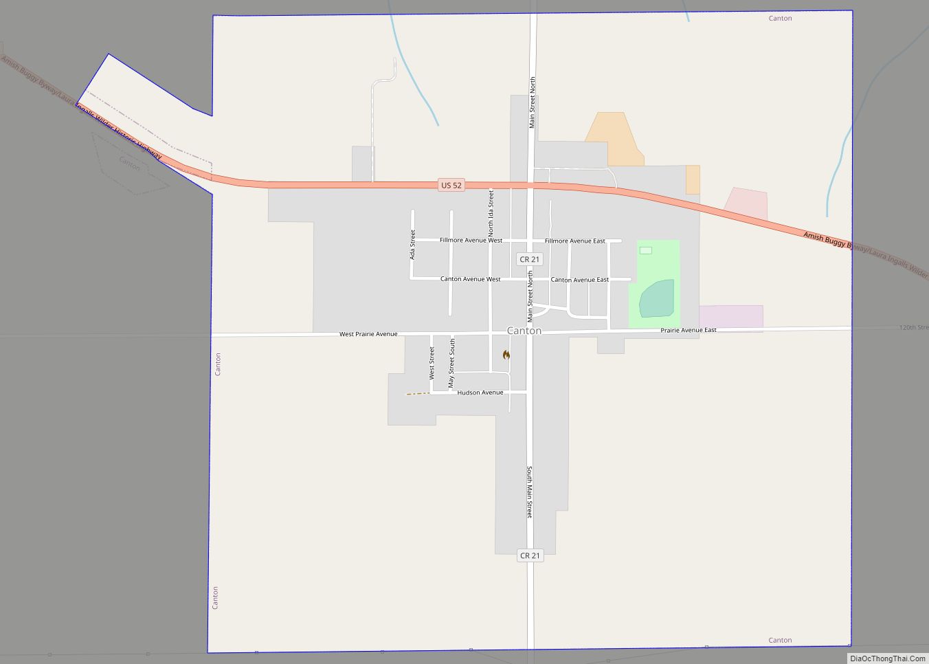
Preston Road Map
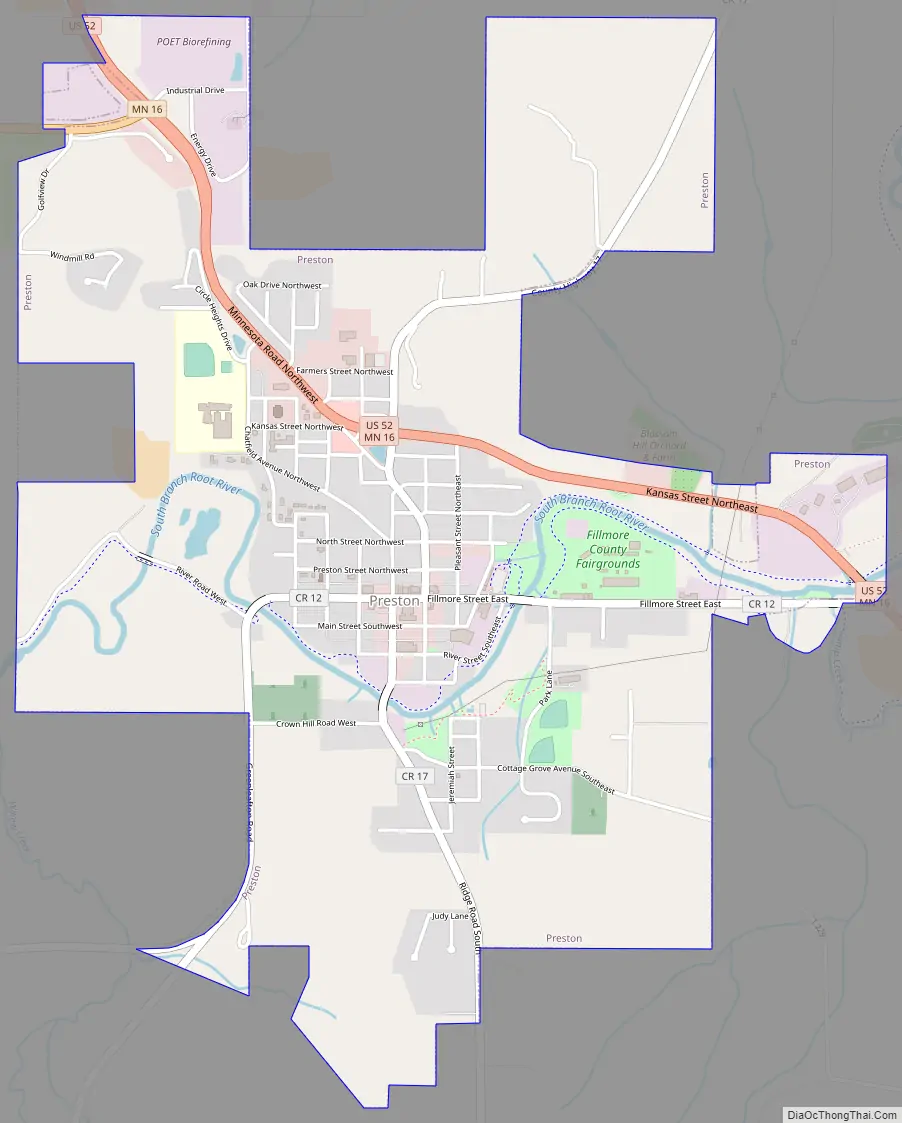
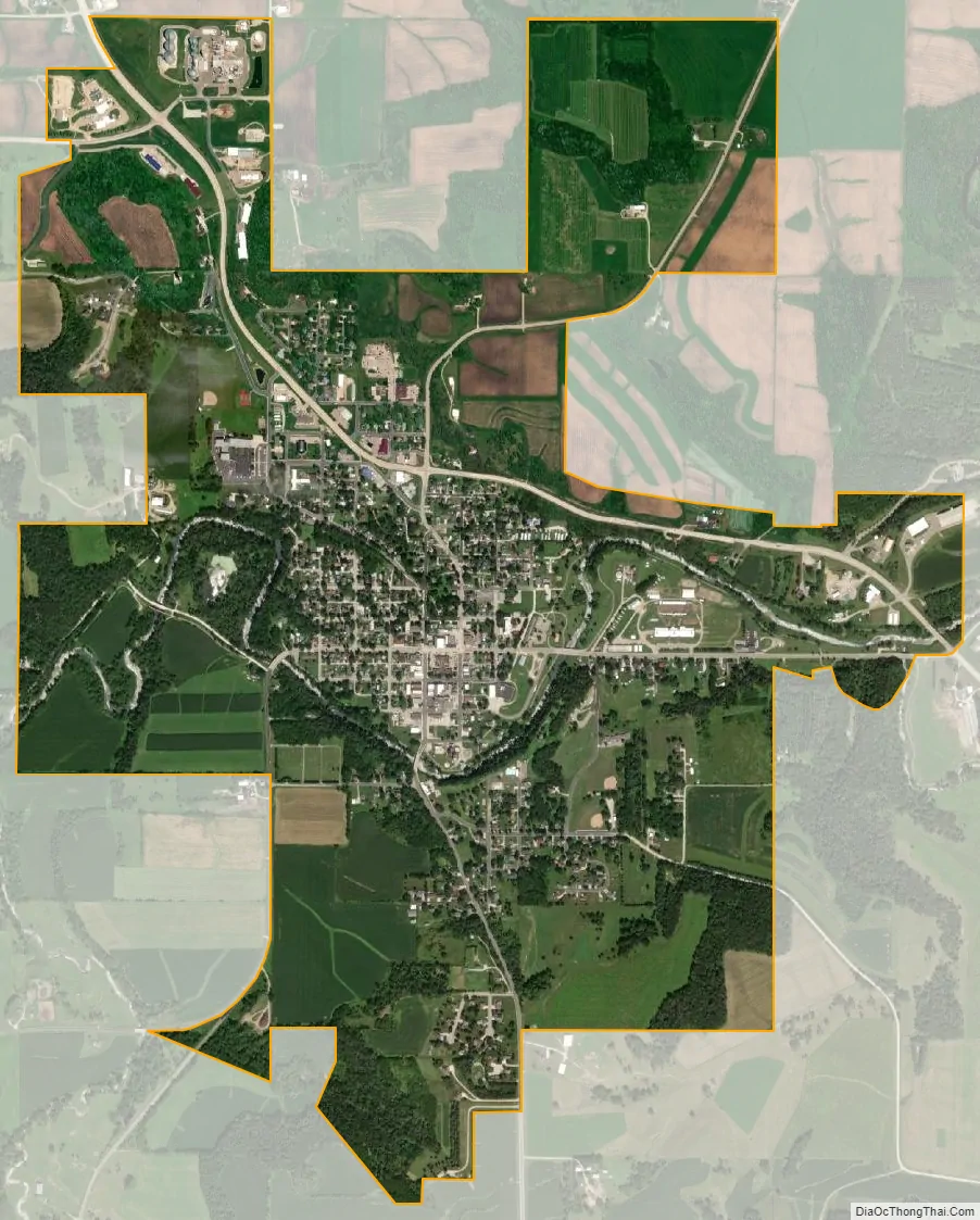
Preston city Satellite Map
Geography
According to the United States Census Bureau, the city has a total area of 2.45 square miles (6.35 km), all land. The South Branch of the Root River snakes through the city.
U.S. Highway 52 and Minnesota Highway 16 are two of the main routes in the city.
Climate
According to the Köppen Climate Classification system, Preston has a warm-summer humid continental climate, abbreviated “Dfb” on climate maps. The hottest temperature recorded in Preston was 101 °F (38.3 °C) on July 18, 1964, August 2, 1964, July 14, 1995, and July 7, 2012, while the coldest temperature recorded was −45 °F (−42.8 °C) on February 3, 1996 and February 1, 2019.
See also
Map of Minnesota State and its subdivision:- Aitkin
- Anoka
- Becker
- Beltrami
- Benton
- Big Stone
- Blue Earth
- Brown
- Carlton
- Carver
- Cass
- Chippewa
- Chisago
- Clay
- Clearwater
- Cook
- Cottonwood
- Crow Wing
- Dakota
- Dodge
- Douglas
- Faribault
- Fillmore
- Freeborn
- Goodhue
- Grant
- Hennepin
- Houston
- Hubbard
- Isanti
- Itasca
- Jackson
- Kanabec
- Kandiyohi
- Kittson
- Koochiching
- Lac qui Parle
- Lake
- Lake of the Woods
- Lake Superior
- Le Sueur
- Lincoln
- Lyon
- Mahnomen
- Marshall
- Martin
- McLeod
- Meeker
- Mille Lacs
- Morrison
- Mower
- Murray
- Nicollet
- Nobles
- Norman
- Olmsted
- Otter Tail
- Pennington
- Pine
- Pipestone
- Polk
- Pope
- Ramsey
- Red Lake
- Redwood
- Renville
- Rice
- Rock
- Roseau
- Saint Louis
- Scott
- Sherburne
- Sibley
- Stearns
- Steele
- Stevens
- Swift
- Todd
- Traverse
- Wabasha
- Wadena
- Waseca
- Washington
- Watonwan
- Wilkin
- Winona
- Wright
- Yellow Medicine
- Alabama
- Alaska
- Arizona
- Arkansas
- California
- Colorado
- Connecticut
- Delaware
- District of Columbia
- Florida
- Georgia
- Hawaii
- Idaho
- Illinois
- Indiana
- Iowa
- Kansas
- Kentucky
- Louisiana
- Maine
- Maryland
- Massachusetts
- Michigan
- Minnesota
- Mississippi
- Missouri
- Montana
- Nebraska
- Nevada
- New Hampshire
- New Jersey
- New Mexico
- New York
- North Carolina
- North Dakota
- Ohio
- Oklahoma
- Oregon
- Pennsylvania
- Rhode Island
- South Carolina
- South Dakota
- Tennessee
- Texas
- Utah
- Vermont
- Virginia
- Washington
- West Virginia
- Wisconsin
- Wyoming