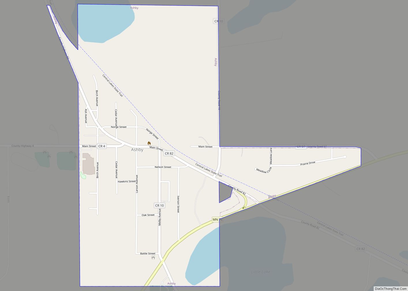
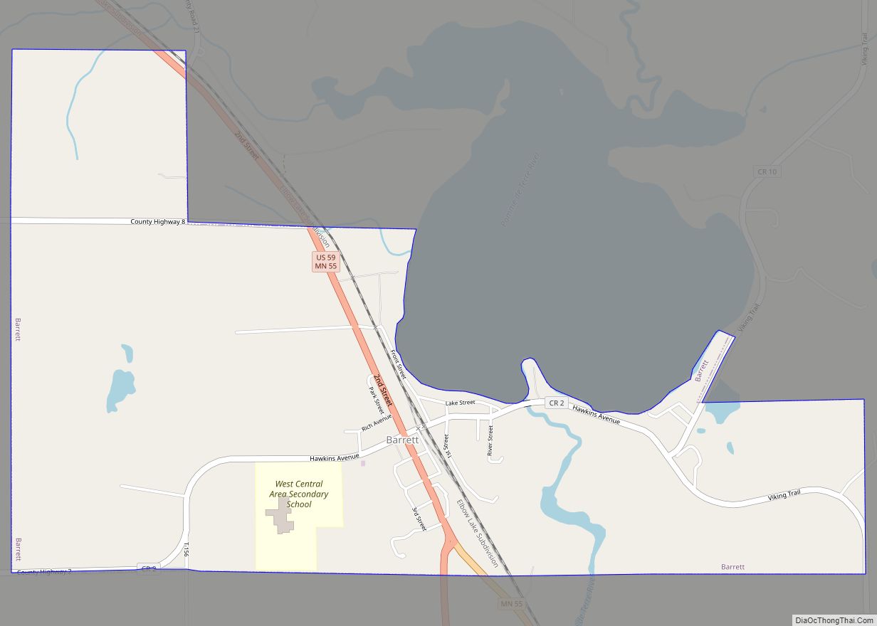
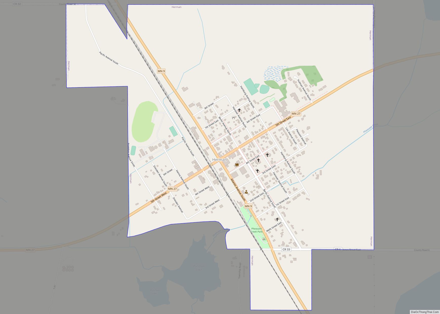
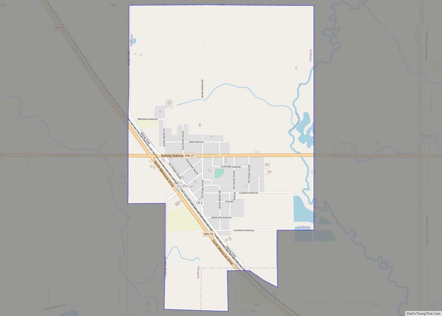
Grant County is a county in the U.S. state of Minnesota. As of the 2020 census, the population was 6,074. Its county seat is Elbow Lake.
| Name: | Grant County |
|---|---|
| FIPS code: | 27-051 |
| State: | Minnesota |
| Founded: | 1868 |
| Named for: | Ulysses S. Grant |
| Seat: | Elbow Lake |
| Largest city: | Elbow Lake |
| Total Area: | 575 sq mi (1,490 km²) |
| Land Area: | 548 sq mi (1,420 km²) |
| Total Population: | 6,074 |
| Population Density: | 11.1/sq mi (4.3/km²) |
| Time zone: | UTC−6 (Central) |
| Summer Time Zone (DST): | UTC−5 (CDT) |
| Website: | www.co.grant.mn.us |
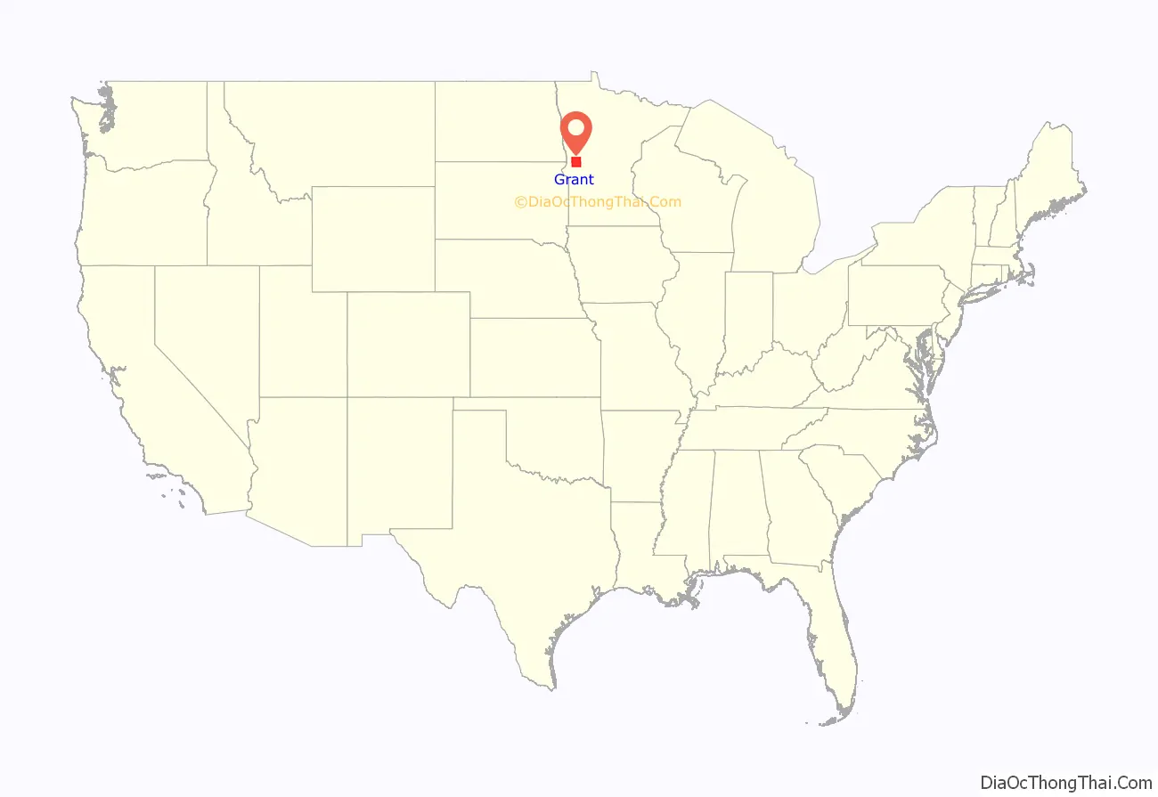
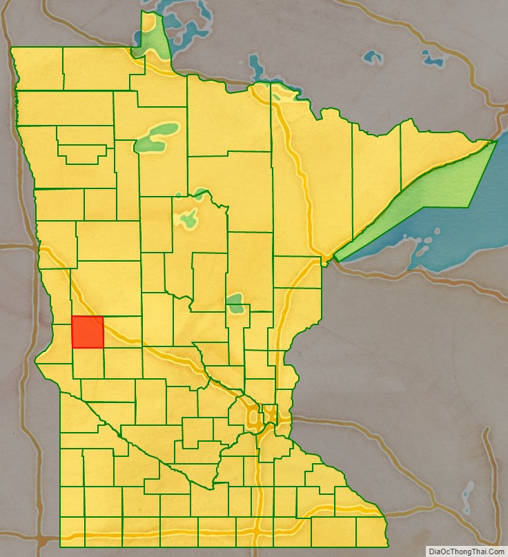
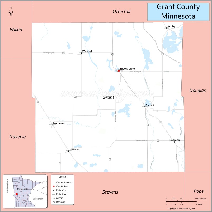
Grant County location map. Where is Grant County?
History
The county was created on March 6, 1868. It was named for Civil War General and US President Ulysses S. Grant. Its government was organized in 1874.
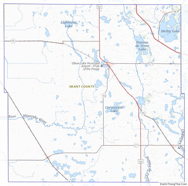
Grant County Road Map

Geography
The Chippewa River flows generally southward through the eastern part of Grant County. The Mustinka River flows south and then west-southwest through the upper and central parts of western Grant County. The terrain consists of low rolling hills dotted with lakes, its usable areas devoted to agriculture. The terrain generally slopes to the south and east; its highest point is on its upper eastern border, at 1,375′ (409m) ASL. The county has an area of 575 square miles (1,490 km), of which 548 square miles (1,420 km) is land and 27 square miles (70 km) (4.7%) is water.
Major highways
- Interstate 94
- U.S. Highway 52
- U.S. Highway 59
- Minnesota State Highway 9
- Minnesota State Highway 27
- Minnesota State Highway 55
- Minnesota State Highway 78
- Minnesota State Highway 79
Adjacent counties
- Otter Tail County – north
- Douglas County – east
- Pope County – southeast
- Stevens County – south
- Traverse County – southwest
- Wilkin County – northwest
Protected areas
- Alvstad State Wildlife Management Area
- Berksow State Wildlife Management Area
- Chippewa State Wildlife Management Area
- Helsene State Wildlife Management Area
- Isaacson State Wildlife Management Area
- Kube-Swift State Wildlife Management Area
- Malsville State Wildlife Management Area
- Marple State Wildlife Management Area
- Mustinka State Wildlife Management Area
- Storm-Bordson State Wildlife Management Area
- Wilts State Wildlife Management Area
Grant County Topographic Map
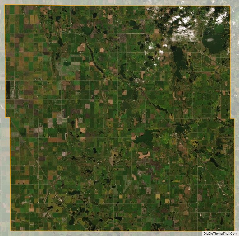
Grant County Satellite Map
Grant County Outline Map