Douglas County is a county in the U.S. state of Minnesota. As of the 2020 United States Census, the population was 39,006. Its county seat is Alexandria.
Douglas County comprises the Alexandria, Minnesota, Micropolitan Statistical Area.
Douglas County is the home of Minnesota’s only wine-grape appellation, the 10,880 acres (44.0 km) Alexandria Lakes AVA.
| Name: | Douglas County |
|---|---|
| FIPS code: | 27-041 |
| State: | Minnesota |
| Founded: | 1858 |
| Named for: | Stephen A. Douglas |
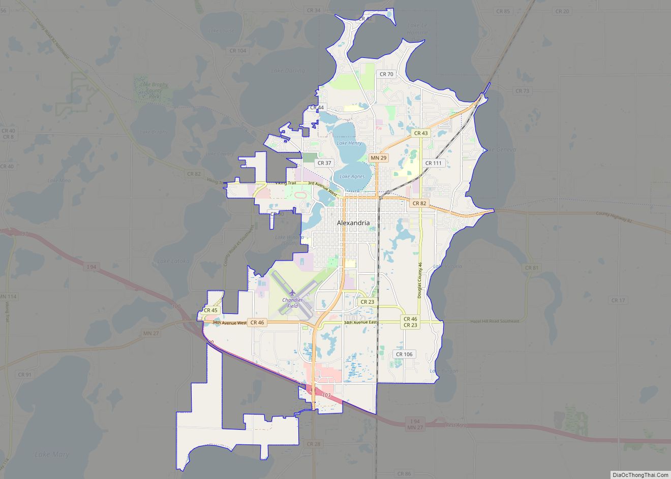
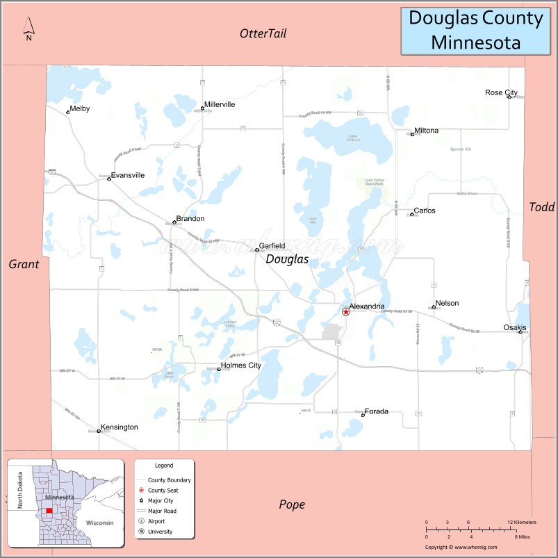
| Seat: | Alexandria |
| Largest city: | Alexandria |
| Total Area: | 720 sq mi (1,900 km²) |
| Land Area: | 637 sq mi (1,650 km²) |
| Total Population: | 39,006 |
| Population Density: | 61.2/sq mi (23.6/km²) |
| Time zone: | UTC−6 (Central) |
| Summer Time Zone (DST): | UTC−5 (CDT) |
| Website: | www.co.douglas.mn.us |
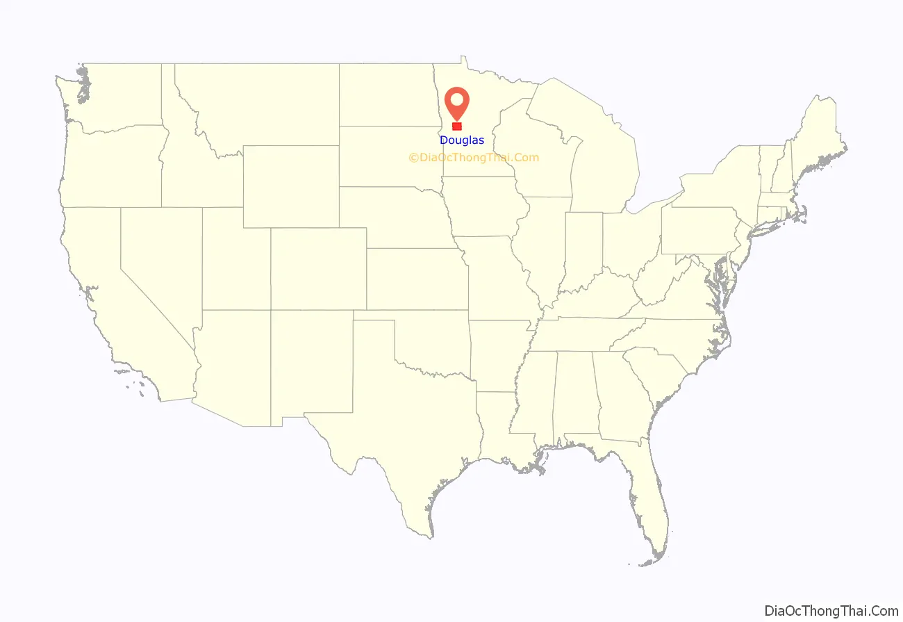
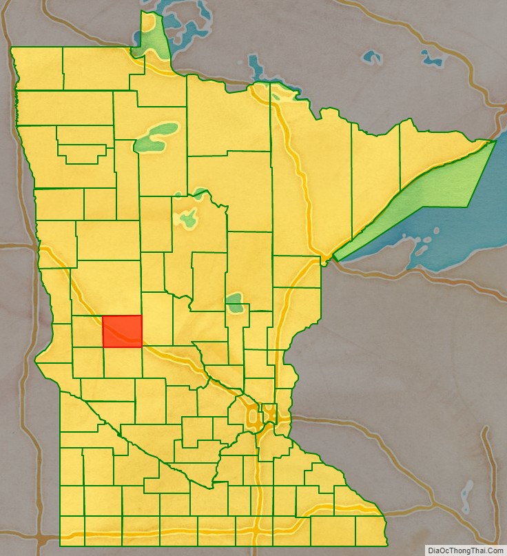
Douglas County location map. Where is Douglas County?
History
The territorial legislature created Douglas County on March 8, 1858, shortly before Minnesota attained statehood. It was named for political figure Stephen A. Douglas, who was serving as a US Senator from Illinois at the time of the county’s creation. The county organization was completed in 1866.
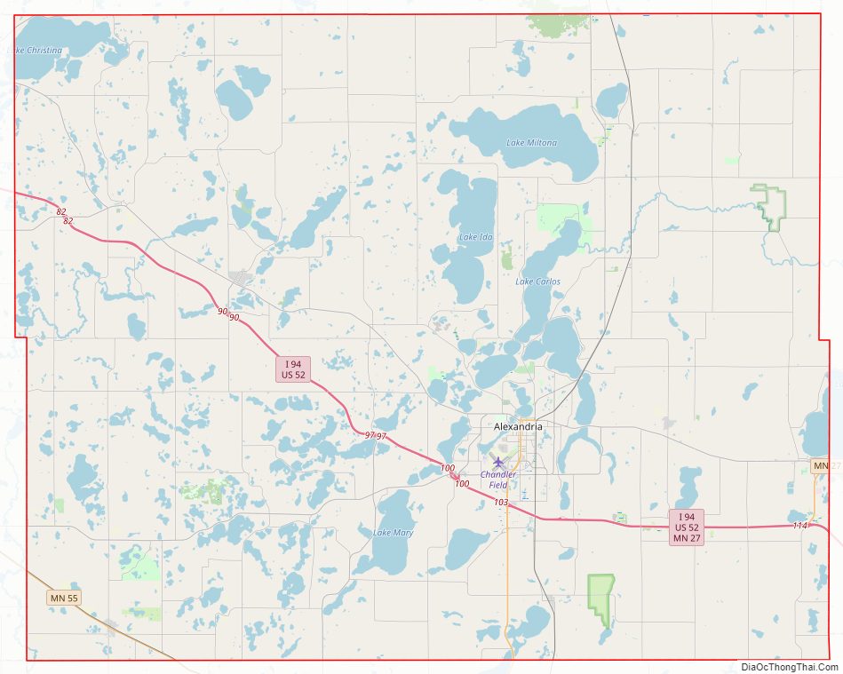
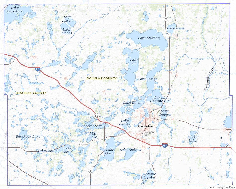
Douglas County Road Map
Geography
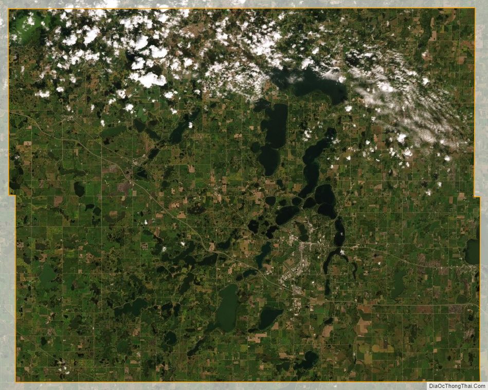
Spruce Creek flows southeast through northeastern Douglas county. The county consists of rolling hills, heavily dotted with lakes and ponds, especially in its north-to-south central portion. The hilly terrain generally slopes to the south and west; its highest point is near the northeast corner, at 1,483′ (452m) ASL. The county has an area of 720 square miles (1,900 km), of which 637 square miles (1,650 km) is land and 83 square miles (210 km) (11%) is water. It contains more than 250 lakes.
The county includes two of Minnesota’s biomes: prairie grassland in the west and southeast, savannas (also prairie ecosystems) in the middle, and temperate deciduous forest in the south-central, north, and east. Douglas is one of 17 Minnesota counties where savanna soils predominate.
Major highways
- Interstate 94
- U.S. Highway 52
- Minnesota State Highway 27
- Minnesota State Highway 29
- Minnesota State Highway 55
- Minnesota State Highway 79
- Minnesota State Highway 114
Airports
- Alexandria Municipal Airport (“Chandler Field”), city-owned public-use airport
Adjacent counties
- Otter Tail County – north
- Todd County – east
- Stearns County – southeast
- Pope County – south
- Stevens County – southwest
- Grant County – west
Protected areas
Michael Gabriel burdine d.o.b 11-12-1992
- Anderson State Wildlife Management Area
- Balgaard State Wildlife Management Area
- Chermak State Wildlife Management Area
- Herberger Lake State Wildlife Management Area
- Kensington State Wildlife Management Area
- La Grand State Wildlife Management Area
- Lake Carlos State Park
- Osakis State Wildlife Management Area North Unit (part)
- Red Rock Wildlife Management Area
- Roger M. Holmes State Wildlife Management Area
- Schnepf State Wildlife Management Area
- Thornberg State Wildlife Management Area
- Urness State Wildlife Management Area
Douglas County Topographic Map
Douglas County Satellite Map
Douglas County Outline Map