Wilkin County is a county in the U.S. state of Minnesota. As of the 2020 census, the population of Wilkin County was 6,506. Its county seat is Breckenridge. The county is named for Colonel Alexander Wilkin, a lawyer who served as Minnesota’s U.S. marshal and was later killed in the Civil War.
Wilkin County is part of the Wahpeton, ND–MN Micropolitan Statistical Area, which is included in the Fargo-Wahpeton, ND-MN Combined Statistical Area.
| Name: | Wilkin County |
|---|---|
| FIPS code: | 27-167 |
| State: | Minnesota |
| Founded: | 1858 |
| Named for: | Alexander Wilkin |
| Seat: | Breckenridge |
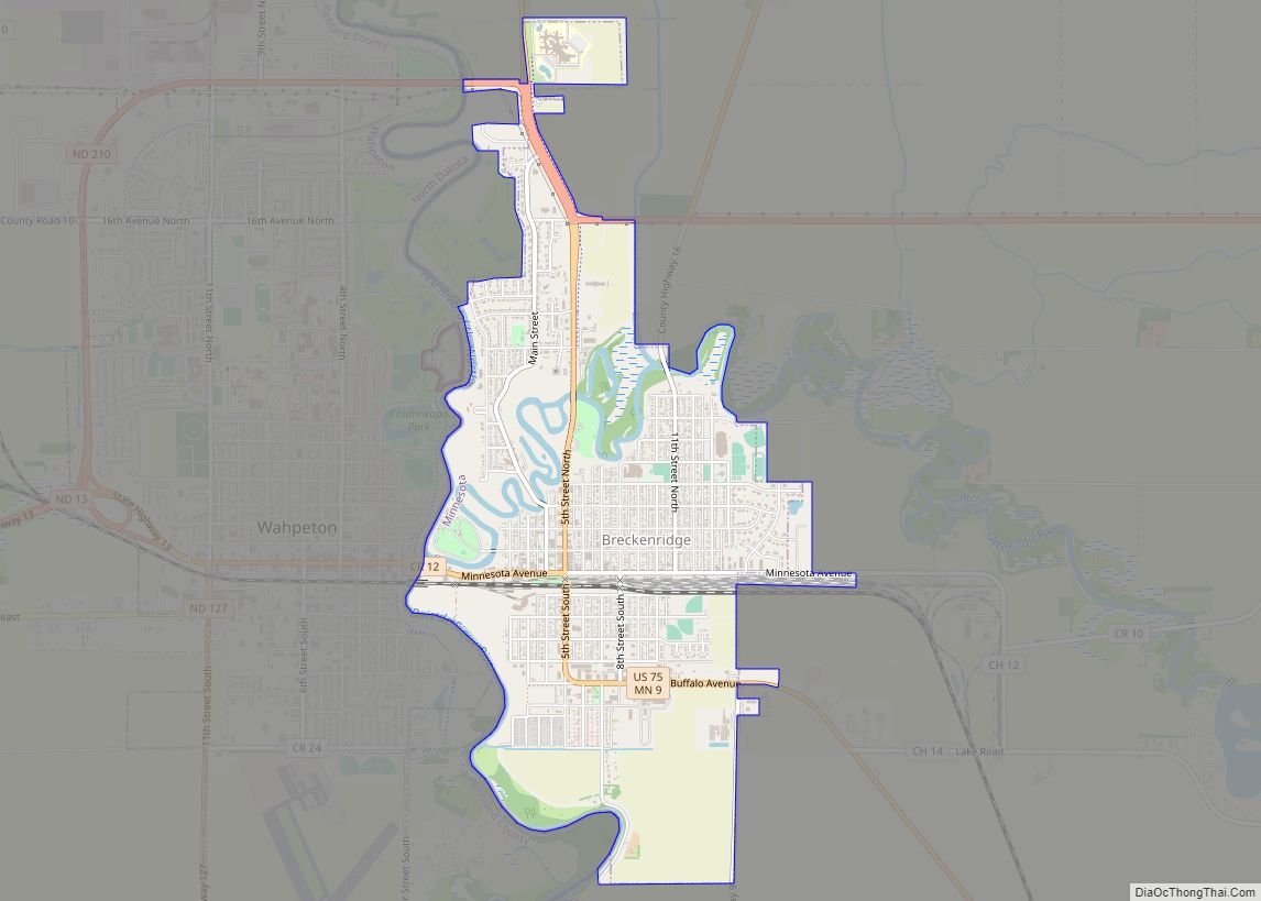
| Largest city: | Breckenridge |
| Total Area: | 751 sq mi (1,950 km²) |
| Land Area: | 751 sq mi (1,950 km²) |
| Total Population: | 6,506 |
| Population Density: | 8.7/sq mi (3.4/km²) |
| Time zone: | UTC−6 (Central) |
| Summer Time Zone (DST): | UTC−5 (CDT) |
| Website: | www.co.wilkin.mn.us |
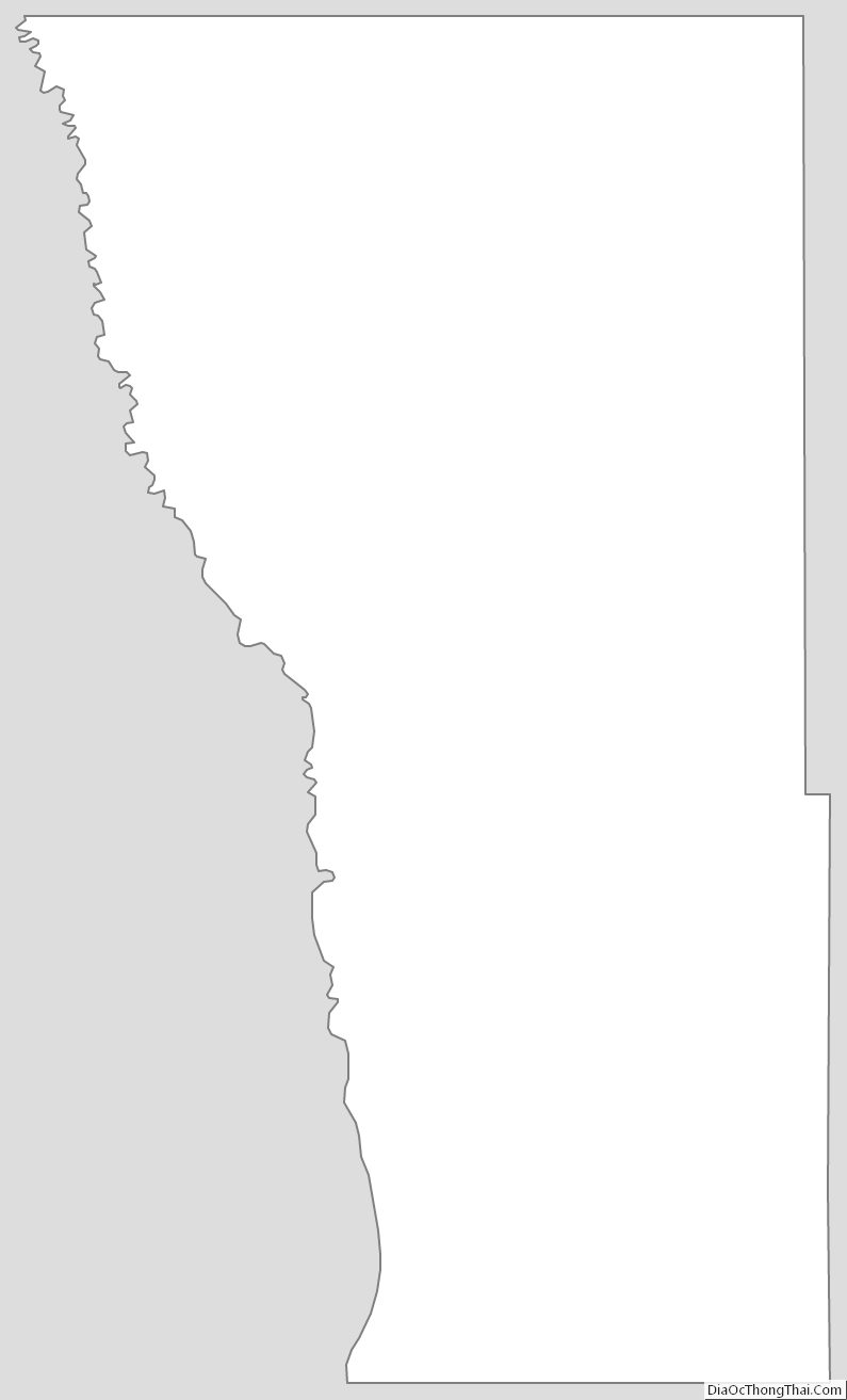
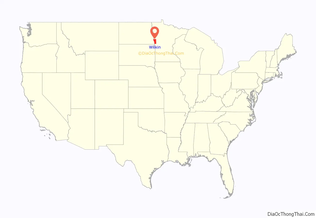
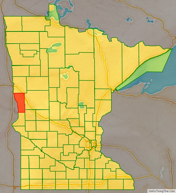
Wilkin County location map. Where is Wilkin County?
History
In 1849, the newly organized Minnesota Territory legislature authorized the creation of nine large counties across the territory. One of those, Pembina (later renamed as Kittson), contained areas that were partitioned off on 8 March 1858 to create Toombs County, named after Robert Toombs (1810–85) of Georgia. Toombs had been a member of the US House of Representatives (1845-1853), and US Senate (1853-1861). He became the Confederate secretary of state in 1861; this disloyalty to the Union displeased county residents, who petitioned for a name change. Accordingly, in 1863, the county was renamed Andy Johnson County for Andrew Johnson, who was serving as the military governor of Tennessee at the time. However, Johnson’s actions and positions as US President (1865-1869) also displeased county residents, so on 6 March 1868 the county name was again changed, to Wilkin County. It was named for Colonel Alexander Wilkin, a Minnesota attorney and secretary to the Minnesota Territory governor.
The future Breckenridge, Minnesota, was settled beginning in the 1850s, and a town was platted there in the spring of 1857. Thus when Toombs County was authorized in 1858, Breckenridge was listed as the county seat. It continued as the county seat through the subsequent county name changes.
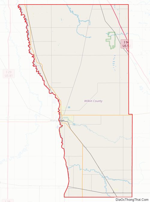
Wilkin County Road Map
Geography
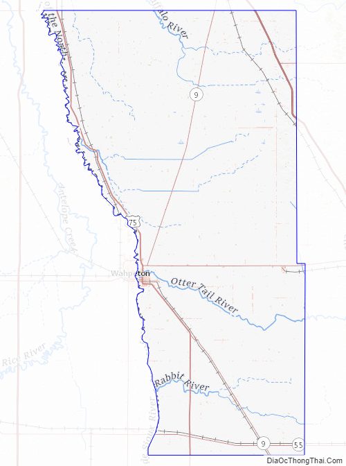
Wilkin County lies on the west side of Minnesota. Its west border abuts the east border of the state of North Dakota (across a river). The Bois de Sioux River flows northward along the county’s west border. The Rabbit River flows westward through the lower part of the county and discharges into the Bois de Sioux on the county’s lower west border. The Otter Tail River flows west-northwestward through the central part of the county and merges with the Bois de Sioux at Breckenridge to form the Red River, which continues to flow along the county’s west line northward toward the Hudson Bay in Canada.
Wilkin County terrain consists of low rolling hills, completely devoted to agriculture. The terrain slopes to the west and north, with its highest point on the upper east border at 1,250′ (381m) ASL. The county has a total area of 751 square miles (1,950 km), of which 751 square miles (1,950 km) is land and 0.2 square miles (0.52 km) (0.03%) is water.
Major highways
- Interstate 94
- U.S. Highway 52
- U.S. Highway 75
- Minnesota State Highway 9
- Minnesota State Highway 55
- Minnesota State Highway 108
- Minnesota State Highway 210
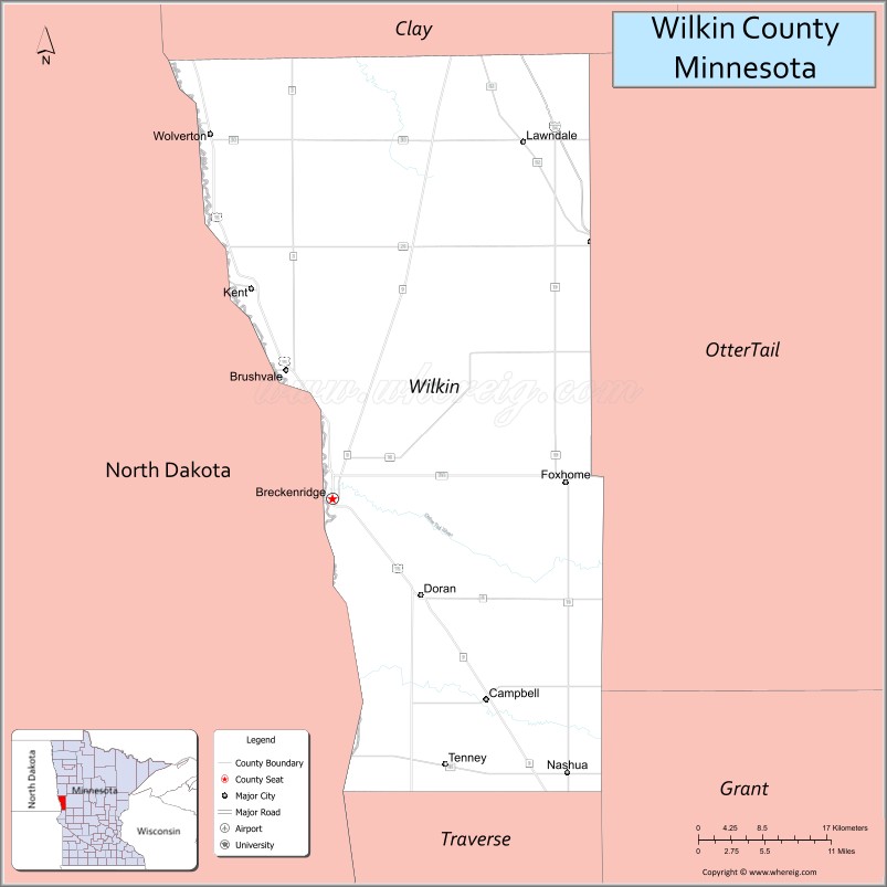
Adjacent counties
- Clay County – north
- Otter Tail County – east
- Grant County – southeast
- Traverse County – south
- Richland County, North Dakota – west
Protected areas
- Akron State Wildlife Management Area
- Atherton State Wildlife Management Area
- Richard M. and Mathilde Rice Elliot Scientific and Natural Area
- Rothsay State Wildlife Management Area
- Sunnyside Township State Game Refuge
- Western Prairie Scientific and Natural Area
Lakes
- Breckenridge Lake – formed by a dam on the Otter Tail River in Breckenridge Township
Wilkin County Topographic Map
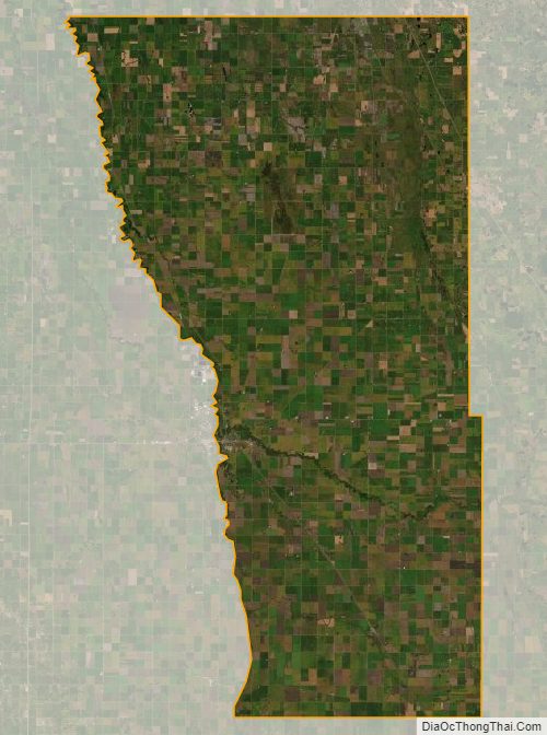
Wilkin County Satellite Map
Wilkin County Outline Map