Greenville County is located in the state of South Carolina, in the United States. As of the 2020 census, the population was 525,534, making it the most populous county in the state. Its county seat is Greenville. The county is also home to the Greenville County School District, the largest school system in South Carolina. County government is headquartered at Greenville County Square.
Greenville County is the most populous county in Upstate South Carolina, as well as the state. It is the central county of the Greenville-Anderson, SC metropolitan statistical area, which in turn is part of the Greenville-Spartanburg-Anderson combined statistical area.
| Name: | Greenville County |
|---|---|
| FIPS code: | 45-045 |
| State: | South Carolina |
| Founded: | 1786 |
| Named for: | Nathanael Greene |
| Seat: | Greenville |
| Largest city: | Greenville |
| Total Area: | 795 sq mi (2,060 km²) |
| Land Area: | 785 sq mi (2,030 km²) |
| Total Population: | 533,834 |
| Population Density: | 680/sq mi (260/km²) |
| Time zone: | UTC−5 (Eastern) |
| Summer Time Zone (DST): | UTC−4 (EDT) |
| Website: | www.greenvillecounty.org |
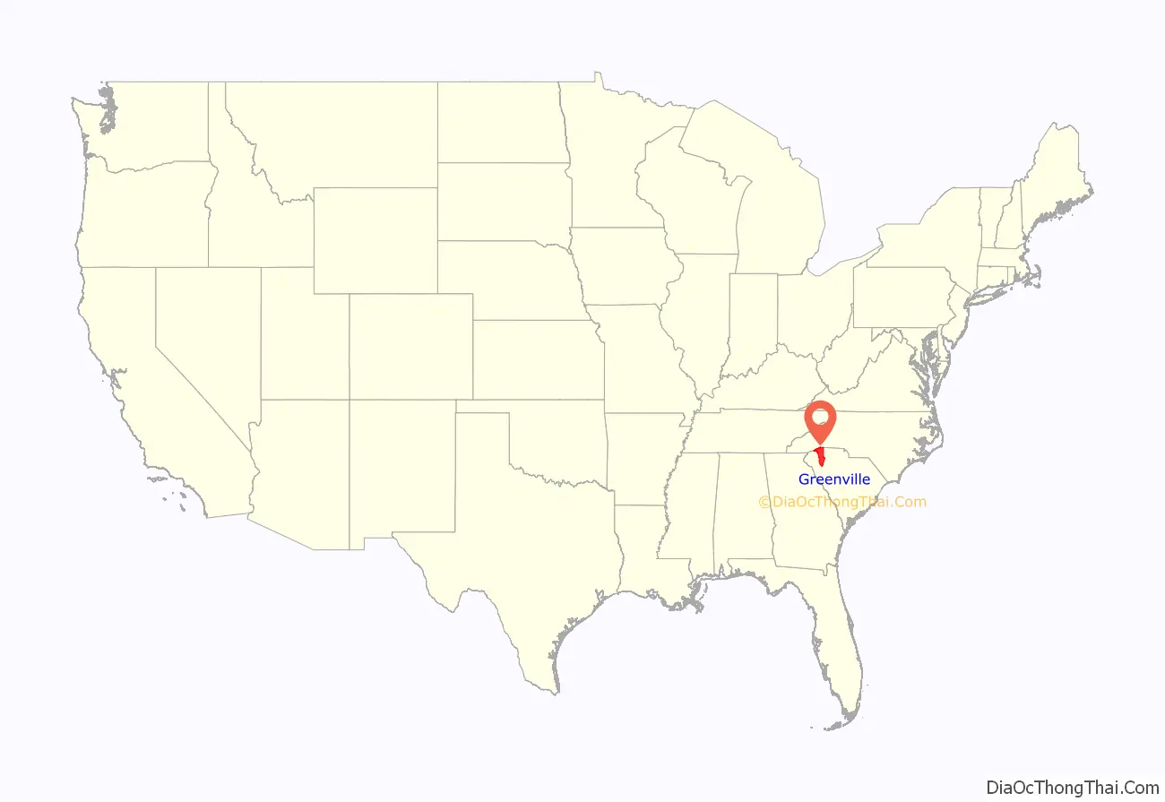
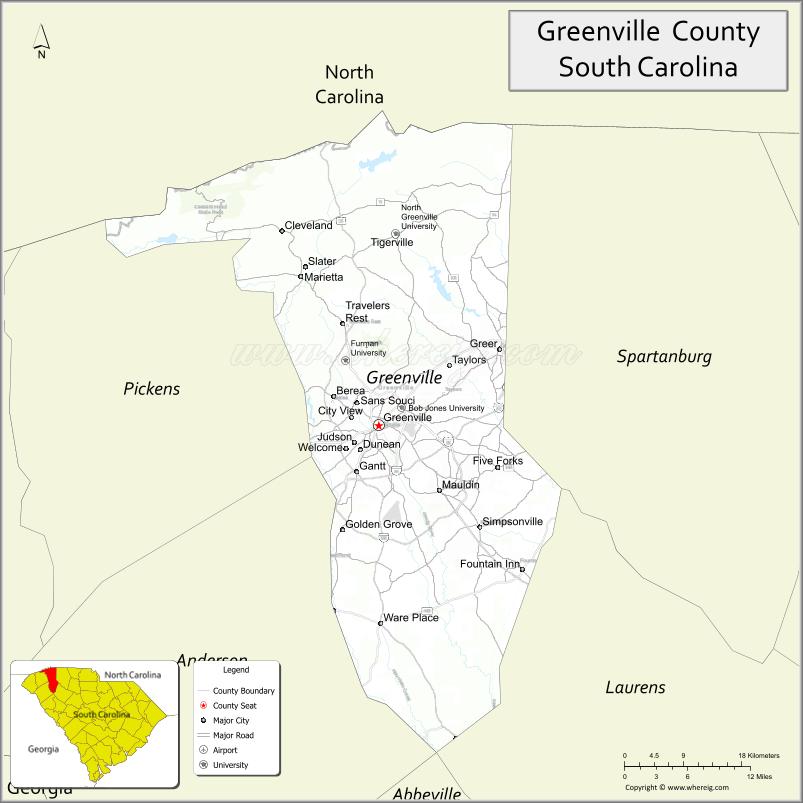
Greenville County location map. Where is Greenville County?
History
18th century
In 1786, due to population growth in Ninety-Six District and the victory of the American Whigs over the British and their colonial Tory and Cherokee allies, the state legislature formed Greenville County (originally spelled Greeneville), named for General Nathanael Greene, the hero of the American southern campaign. Greenville County was the first county created in the overarching Ninety-Six District, but from 1791 to 1798, both neighboring Pendleton County (the other county formed from Cherokee territory in northwestern Ninety-Six District) and it were part of the new overarching Washington District. From 1798 to 1800, it was part of the short-lived overarching Pendleton District. In 1798, all counties were reidentified as “elective districts” to be effective on 1 January 1800; thereafter, the Greenville District was no longer part of Pendleton District. In 1868, the districts were converted back to counties.
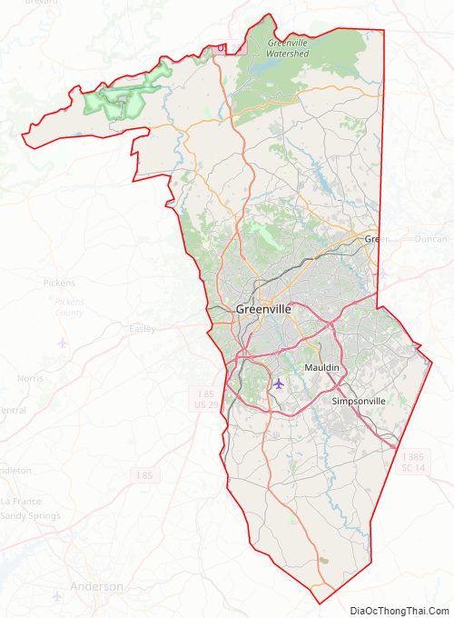
Greenville County Road Map
Geography
According to the U.S. Census Bureau, the county has a total area of 795 square miles (2,060 km), of which 9.7 square miles (25 km) (1.2%) are covered by water.
State and local protected areas
- Blue Wall Preserve
- Caesars Head State Park
- Cedar Falls Park
- Chestnut Ridge Heritage Preserve and Wildlife Management Area
- Conestee Nature Preserve
- J. Verne Smith Park (Lake Robinson)
- Jones Gap State Park
- Mountain Bridge Wilderness Area
- Paris Mountain State Park
- Pleasant Valley Park
Adjacent counties
- Henderson County, North Carolina – north
- Polk County, North Carolina – northeast
- Spartanburg County – east
- Laurens County – southeast
- Abbeville County – south
- Anderson County – southwest
- Pickens County – west
- Transylvania County, North Carolina – northwest
Major water bodies
- Enoree River
- North Saluda River
- Saluda River
- South Saluda River
Major highways
- I-85
- I-185 / I-185 Toll
- I-385
- I-385 BS
- US 25
- US 25 Conn.
- US 29
- US 29 Conn. (Greenville)
- US 29 Conn. (Wade Hampton)
- US 123
- US 276
- US 276 Conn.
- SC 11
- SC 14
- SC 14 Truck
- SC 20
- SC 86
- SC 101
- SC 101 Truck
- SC 124
- SC 146
- SC 183
- SC 253
- SC 288
- SC 290
- SC 290 Truck
- SC 291
- SC 417
- SC 418
Major infrastructure
- Donaldson Center Airport
- Greenville–Spartanburg International Airport (mostly in Spartanburg County)
- Greenville Station (Amtrak)
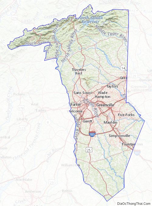
Greenville County Topographic Map
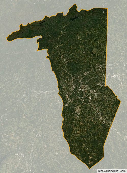
Greenville County Satellite Map
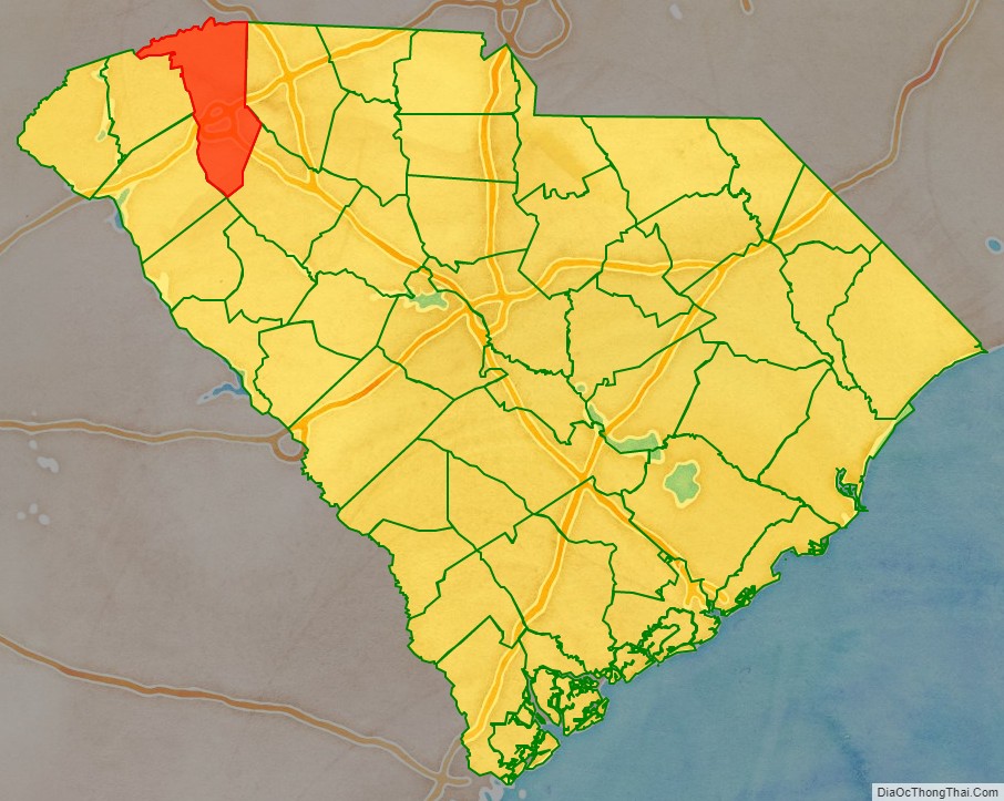
Greenville County Outline Map