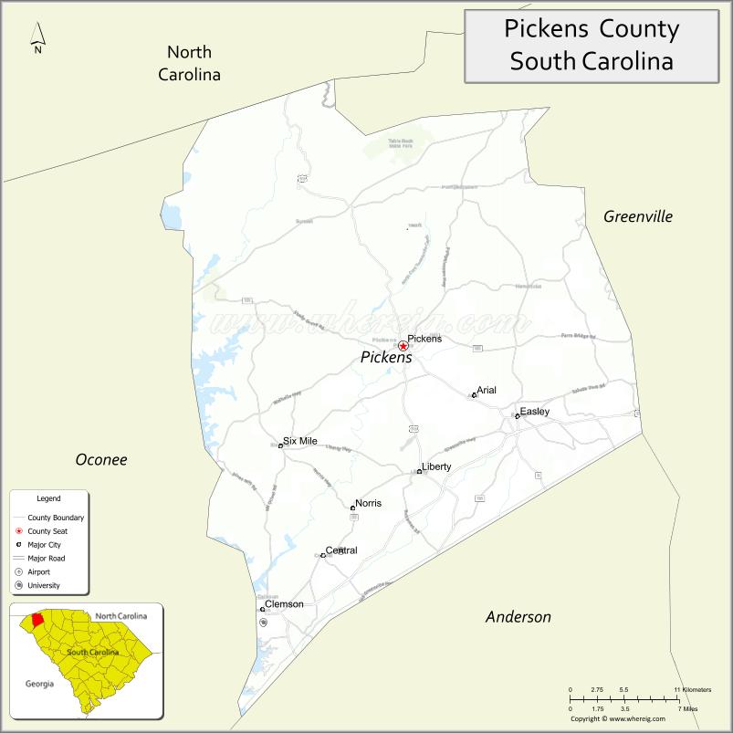
Pickens County is located in the northwest part of the U.S. state of South Carolina. As of the 2020 census, its population was 131,404. Its county seat is Pickens. The county was created in 1826. It is part of the Greenville–Anderson–Mauldin, SC Metropolitan Statistical Area.
| Name: | Pickens County |
|---|---|
| FIPS code: | 45-077 |
| State: | South Carolina |
| Founded: | 1826 |
| Named for: | Andrew Pickens |
| Seat: | Pickens |
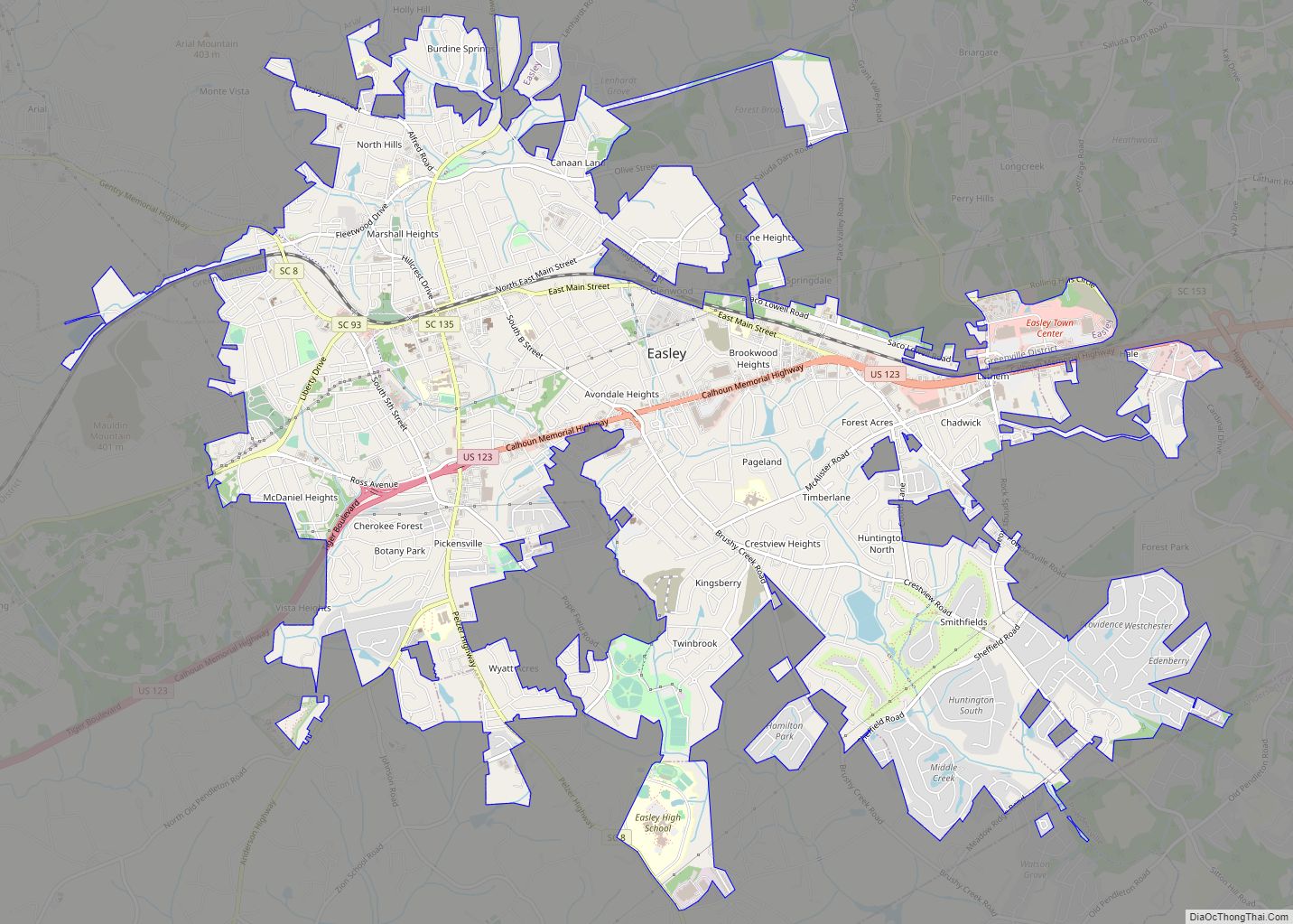
| Largest city: | Easley |
| Total Area: | 512 sq mi (1,330 km²) |
| Land Area: | 496 sq mi (1,280 km²) |
| Total Population: | 132,229 |
| Population Density: | 266.6/sq mi (102.9/km²) |
| Time zone: | UTC−5 (Eastern) |
| Summer Time Zone (DST): | UTC−4 (EDT) |
| Website: | www.co.pickens.sc.us |
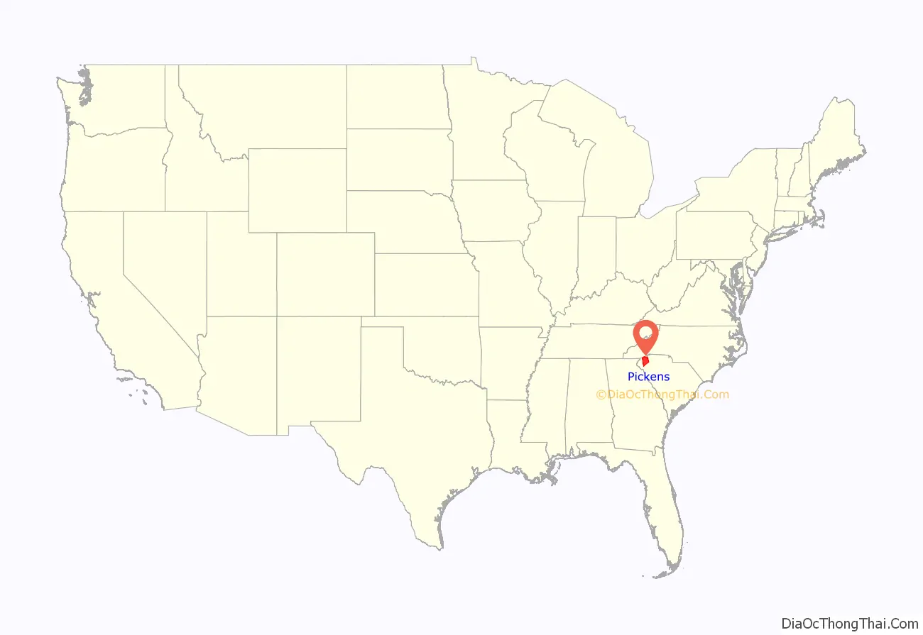
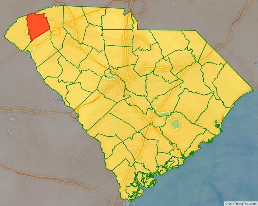
Pickens County location map. Where is Pickens County?
History
Pickens County was part of Cherokee homeland territory until well after the American Revolution. The Cherokee had allied with the British, hoping to gain expulsion of European-American settlers from their lands. But they were defeated in local battles of the Revolution and forced to cede their lands under various treaties.
This former Cherokee territory was included in the new state’s Ninety-Six Judicial District. In 1791 the state legislature established Washington District, a judicial area composed of present-day Greenville, Anderson, Pickens, and Oconee counties (the latter was not organized until 1868); at that time it also included Pendleton County.
Streets for the county seat and courthouse town of Pickensville (near present-day Easley) were laid off. New buildings perhaps included a large wooden hotel, which served as a stagecoach stop. In 1798 Washington District was divided into Greenville and Pendleton districts. The latter included what eventually became Anderson, Oconee, and Pickens counties. After a new courthouse was erected at Pendleton to accommodate the Court of General Sessions and Common Pleas, Pickensville began to decline.
In view of the growing population and poor transportation facilities in Pendleton District, the legislature divided it into counties in 1826. But a year later, it decided to establish judicial districts instead. The legislation went into effect in 1828. The lower part became Anderson and the upper Pickens, named in honor of Brigadier General Andrew Pickens of the American Revolution. His home, Hopewell, was on the southern border of the district. A courthouse was established on the west bank of the Keowee River, and a small town called Pickens Court House soon developed here. Since 1825, John C. Calhoun made his home in what became Pickens County, at Fort Hill, which became the basis around which Clemson University would later grow up.
By 1860 Pickens District had a population of more than 19,000 persons, of whom 22 percent were enslaved African Americans. The district was largely rural and agricultural, with cotton the most important commodity crop. Its small industry consisted mainly of sawmills, gristmills, and a few other shops producing goods for home consumption. The district’s Protestant churches were numerous, but schools were few. The Blue Ridge Railroad reached the district in September 1860. There was little organized troop combat here during the Civil War, but the district was frequently plundered by marauders and deserters who swept down from the mountains.
Post-Civil War to present
After the war, the region was largely destitute. The South Carolina Constitutional Convention of 1868, meeting during the first year of Congressional Reconstruction, changed the name “district” to “county” throughout the state. The Convention also organized Oconee County, from a portion of Pickens District that was west of the Keowee and Seneca rivers, plus a small area around the Fort Hill estate formerly belonging to statesman John C. Calhoun. In the 1960s, this small area around the Calhoun property was transferred to Pickens County.
A new courthouse for Pickens County was erected at its present location. Many of the residents of Old Pickens, on the Keowee River, moved to the newly created town, some relocating their dismantled homes. The loss of the Oconee area greatly reduced the population of Pickens County. It did not again reach 19,000 until 1900.
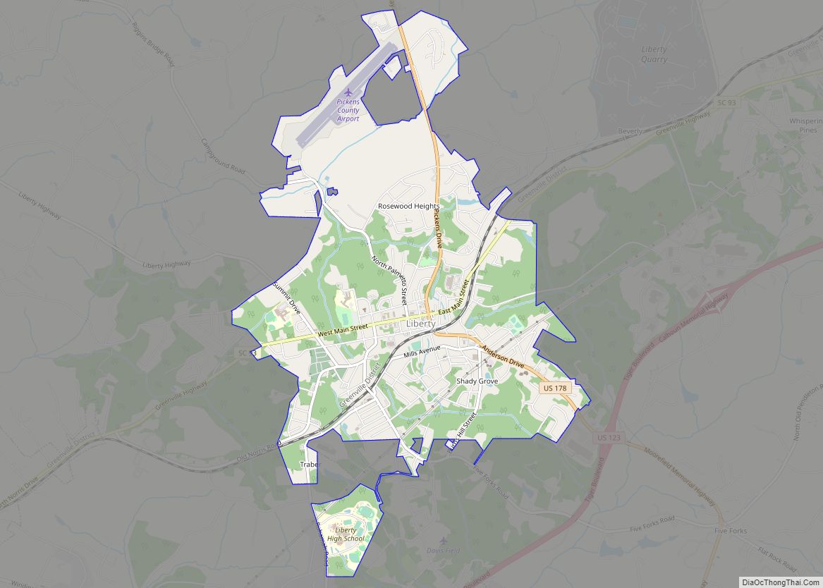
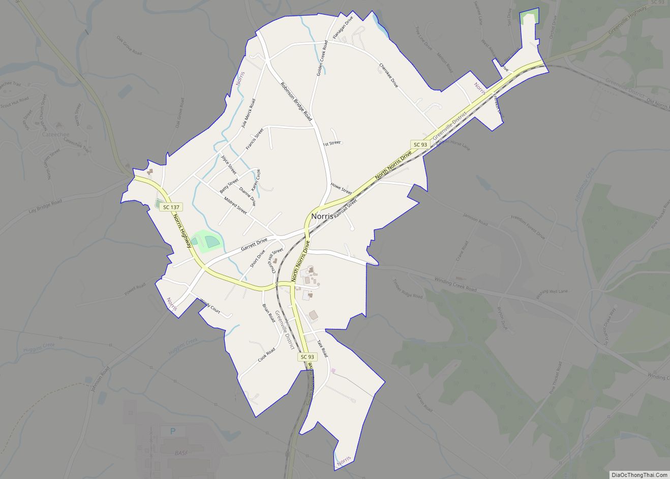
The county’s growth was accelerated by the building of the Atlanta and Charlotte Air Line Railway (later called the Southern Railway) in the 1870s. The town of Easley, named for General W. K. Easley, was chartered in 1874. The towns of Liberty and Central sprang up along the railroad about the same time and were soon incorporated. Calhoun (now part of Clemson) was founded in the 1890s, to be followed in the early 1900s by Six Mile and Norris as incorporated areas.
A major factor in Pickens County’s growth was the development of the regional textile industry, which had earlier been based in New England and New York. The county’s first modern cotton mill, organized by D. K. Norris and others, was established at Cateechee in 1895. By 1900 the county boasted three cotton mills, two railroads, three banks, three roller mills, 37 sawmills, ten shingle mills, and four brickyards.
Yet until 1940, with a population of 37,000 (13.2 percent black), the county remained primarily rural and agricultural. Like many other Piedmont counties, Pickens had a one-crop economy. Its citizens were engaged mainly in growing cotton or manufacturing it into cloth. A notable change in the Pickens landscape was the coming of paved highways; one completed across the county, about 1930, ran from Greenville to Walhalla by way of Easley, Liberty, and Central.
The most significant developments in the county’s history have occurred since World War II. By 1972 there were 99 manufacturing plants in the county, employing almost 15,000 personnel and producing not only textiles but a wide variety of other products. The population today is estimated to be 93,894 residents. New residents continue to be attracted to Pickens County because of its climate, industrial opportunity, proximity to Greenville’s labor market, and scenic beauty.
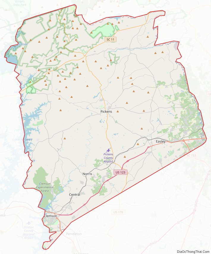
Pickens County Road Map
Geography
According to the U.S. Census Bureau, the county has a total area of 512 square miles (1,330 km), of which 496 square miles (1,280 km) is land and 16 square miles (41 km) (3.1%) is water. The county also contains the highest natural point in South Carolina, Sassafras Mountain, with an elevation of 3560 feet (1085 m). Table Rock State Park is in Pickens County.
Pickens County is in the Savannah River basin, the Saluda River basin, and the French Broad River basin.
State and local protected areas/sites
- Cateechee Point: A Pickens County Park
- Hagood Mill Historic Site
- Jocassee Gorges Wilderness Area
- Keowee-Toxaway State Park
- Long Shoals Roadside Park
- Meadow Falls
- Nine Times Forest
- Nine Times Preserve
- Pinnacle Mountain
- Poe Creek State Forest
- Table Rock State Park
- Twelve Mile Recreation Area
Major water bodies
- Lake Hartwell
- Lake Jocassee
- Lake Keowee
- Keowee River
- South Saluda River
- Table Rock Reservoir
Adjacent counties
- Transylvania County, North Carolina – north
- Greenville County – east
- Anderson County – south
- Oconee County – west
Major highways
- US 76
- US 123
- US 123 Conn.
- US 178
- SC 8
- SC 8 Conn.
- SC 11
- SC 28
- SC 28 Bus.
- SC 88
- SC 93
- SC 124
- SC 133
- SC 135
- SC 137
- SC 153
- SC 183
- SC 186
- SC 288
Major infrastructure
- Clemson Station
- Pickens County Airport
Pickens County Topographic Map
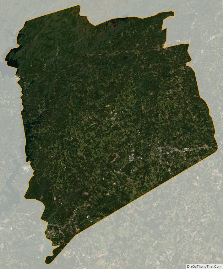
Pickens County Satellite Map
Pickens County Outline Map