Spartanburg County is a county located on the northwestern border of the U.S. state of South Carolina. As of the 2020 census, the population was 327,997, making it the fifth-most populous county in South Carolina. Its county seat is Spartanburg.
Spartanburg County is coterminous with the Spartanburg, SC Metropolitan Statistical Area, which is also included in the Greenville–Spartanburg–Anderson, SC Combined Statistical Area.
USS Spartanburg County is named after the county.
| Name: | Spartanburg County |
|---|---|
| FIPS code: | 45-083 |
| State: | South Carolina |
| Founded: | 1791 |
| Named for: | The Spartan Regiment |
| Seat: | Spartanburg |
| Largest city: | Spartanburg |
| Total Area: | 819 sq mi (2,120 km²) |
| Land Area: | 808 sq mi (2,090 km²) |
| Total Population: | 335,864 |
| Population Density: | 415.7/sq mi (160.5/km²) |
| Time zone: | UTC−5 (Eastern) |
| Summer Time Zone (DST): | UTC−4 (EDT) |
| Website: | www.spartanburgcounty.org |
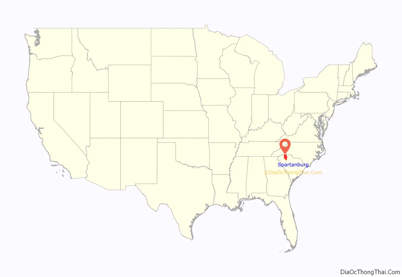
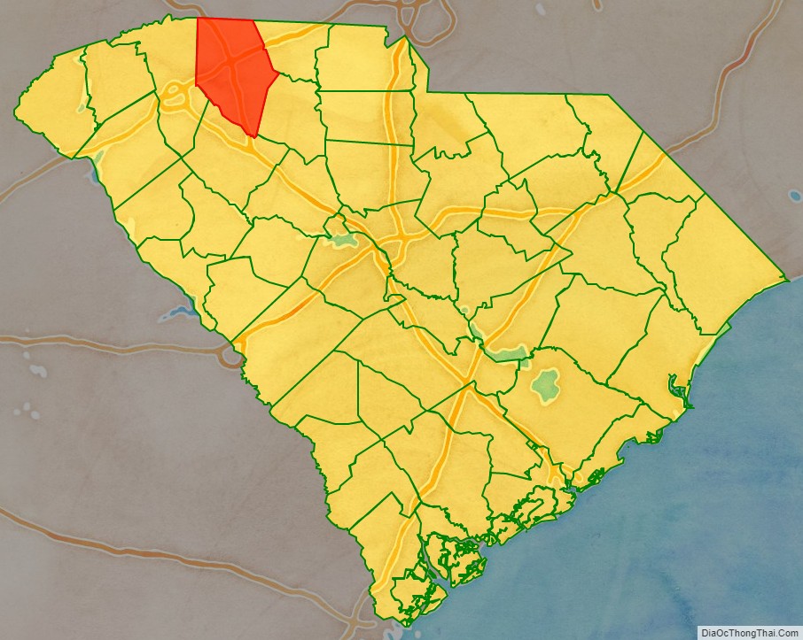
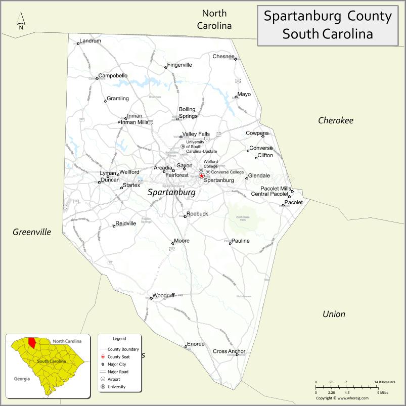
Spartanburg County location map. Where is Spartanburg County?
History
The county was founded in 1785 and was named after the Spartan Rifles which was a local militia during the American Revolutionary War. The largest city and the county seat is Spartanburg which resides in Upstate South Carolina.
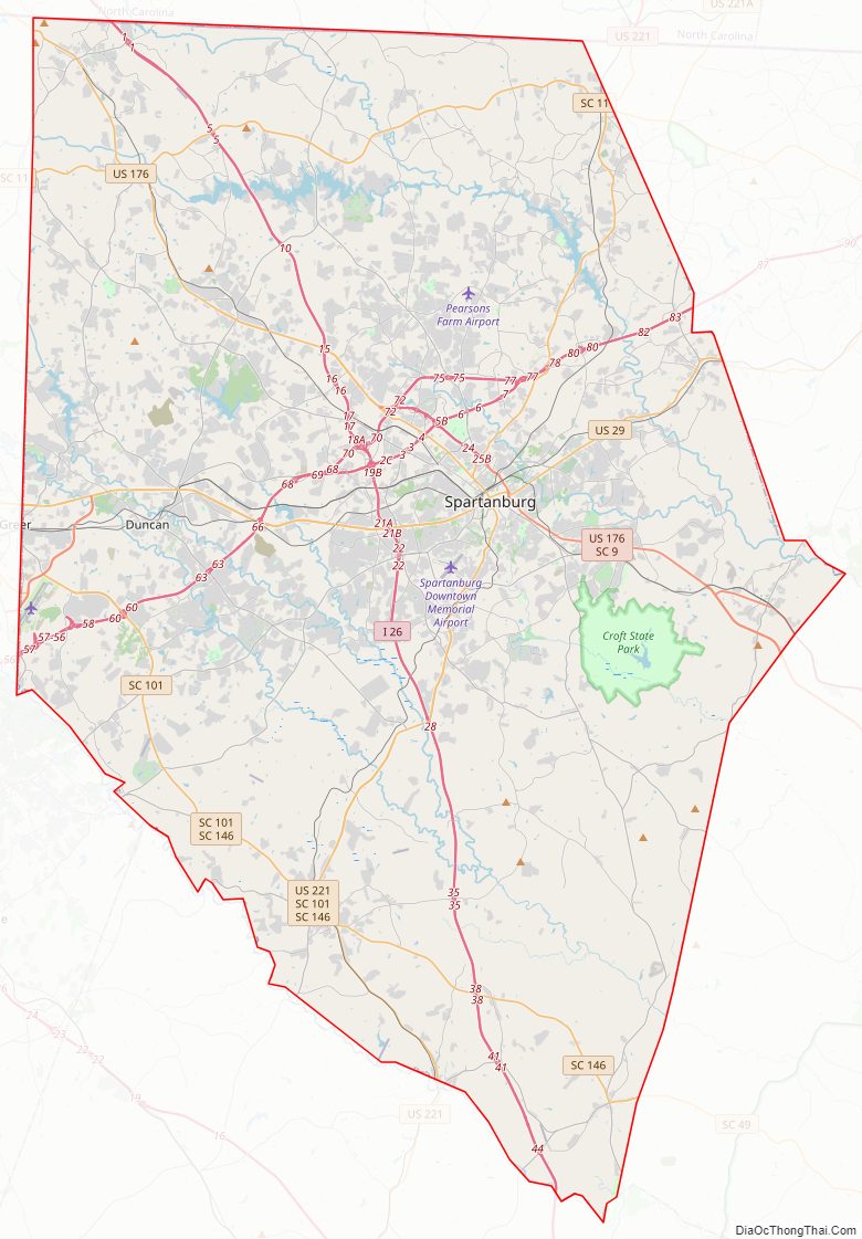
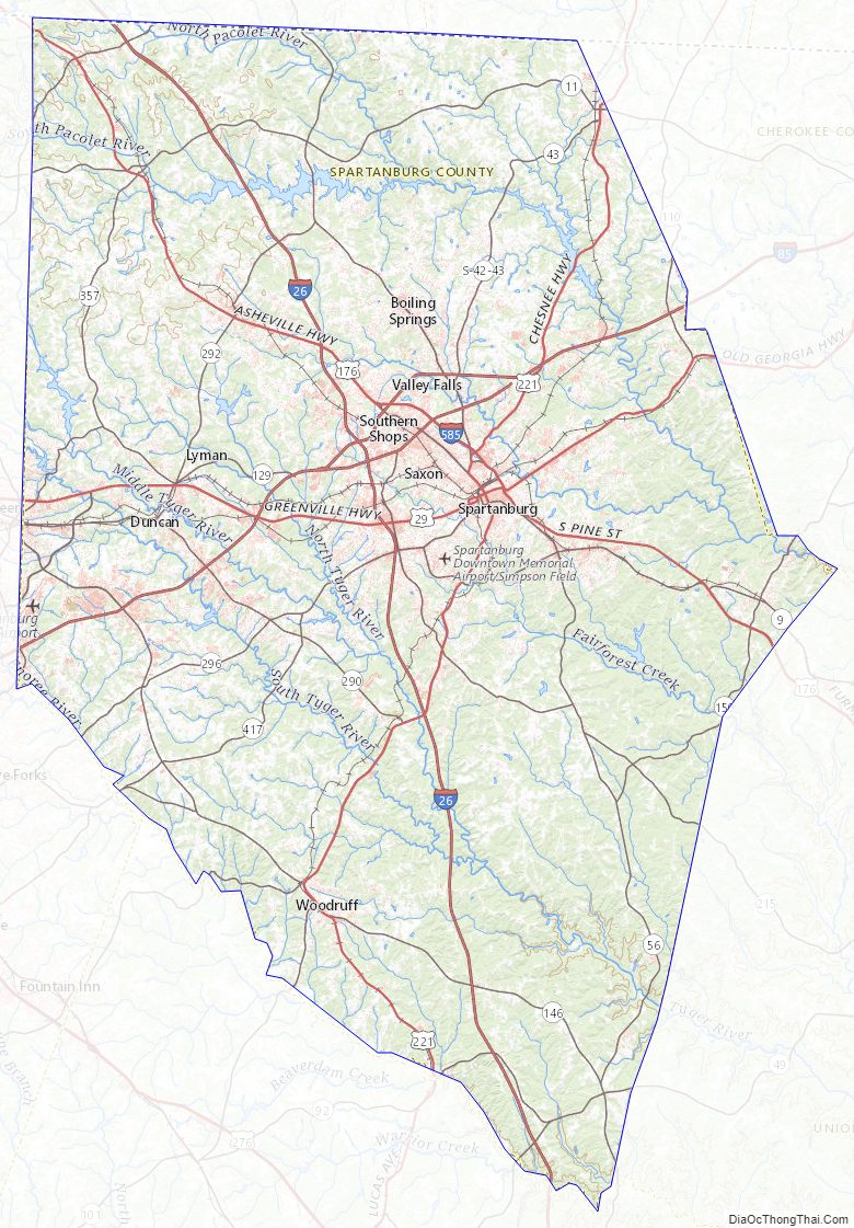
Spartanburg County Road Map
Geography
According to the U.S. Census Bureau, the county has a total area of 819 square miles (2,120 km), of which 808 square miles (2,090 km) is land and 11 square miles (28 km) (1.4%) is water.
State and local protected areas/sites
- Arcadia Mill No. 1
- Arcadia Mill No. 2
- Battle of Musgrove Mill State Historic Site (part)
- Blackstock Plantation (part)
- Converse Heights Historic District
- Croft State Park
- Daniel Morgan Monument
- Emily Dickinson
- Glendale Ridge Archaeological Site
- Hampton Heights Historic District
- Hatcher Garden and Woodland Preserve
- Historic Price House
- Lake Cooley Park
- Nesbitt Shoals Nature Park
- Peter’s Creek Heritage Preserve
- Seay House
- Tyger River Park
Major water bodies
- Enoree River
- Lake Craig
- Lake William C. Bowan
- Pacolet River
- South Tyger River
- Tyger Lake
- Tyger River
Adjacent counties
- Rutherford County, North Carolina – north
- Cherokee County – east
- Union County – southeast
- Laurens County – south
- Greenville County – west
- Polk County, North Carolina – northwest
Major highways
- I-26
- I-85
- I-85 BL
- I-585
- US 29
- US 176
- US 176 Conn. (Spartanburg 1)
- US 176 Conn. (Spartanburg 2)
- US 221
- US 221 Alt.
- SC 9
- SC 11
- SC 43
- SC 49
- SC 56
- SC 56 Conn.
- SC 80
- SC 92
- SC 92 Conn.
- SC 101
- SC 101 Truck
- SC 110
- SC 129
- SC 146
- SC 150
- SC 150 Truck
- SC 215
- SC 290
- SC 290 Truck
- SC 292
- SC 292 Conn.
- SC 296
- SC 357
- SC 358
Major infrastructure
- Greenville–Spartanburg International Airport
- Inland Port Greer, major rail depot in the county.
- Spartanburg Downtown Airport
- Spartanburg Station
Spartanburg County Topographic Map
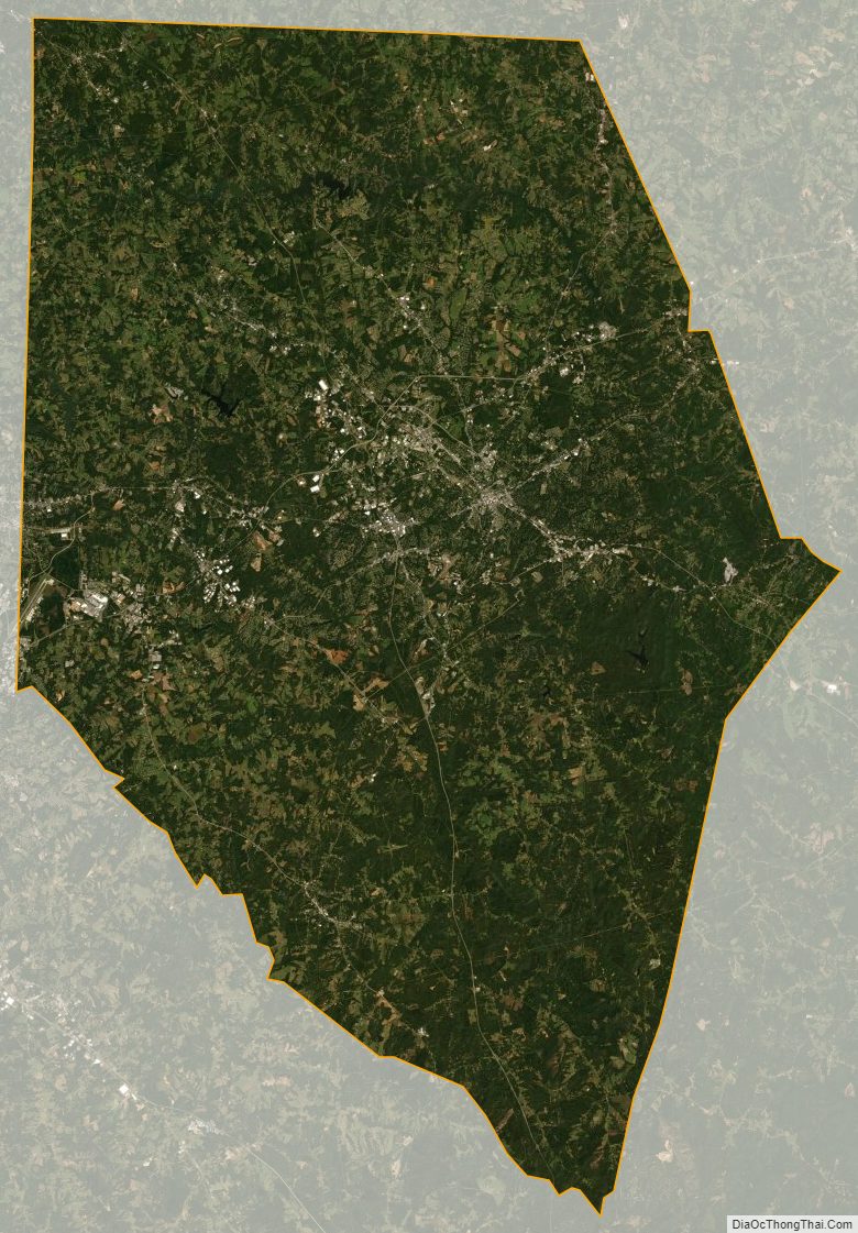
Spartanburg County Satellite Map
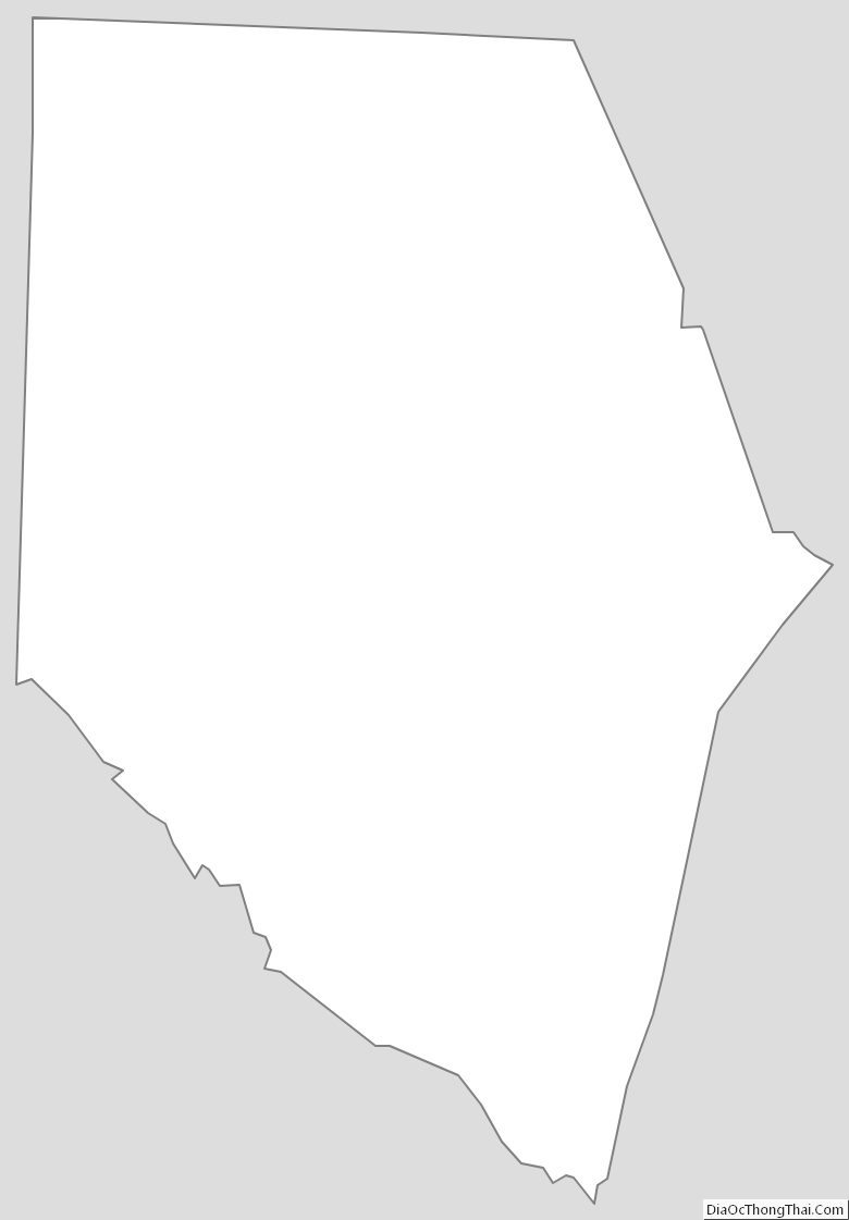
Spartanburg County Outline Map