Anderson is a city in and the county seat of Anderson County, South Carolina, United States. The population was 28,106 at the 2020 census, and the city was the center of an urbanized area of 75,702. It is one of the principal cities in the Greenville-Anderson-Mauldin Metropolitan Statistical Area, which had a population of 824,112 at the 2010 census. It is included in the larger Greenville–Spartanburg-Anderson, South Carolina combined statistical area, with a total population of 1,266,995, at the 2010 census. It is just off Interstate 85 and is 120 miles (190 km) from Atlanta and 140 miles (230 km) from Charlotte. Anderson is the smallest of the three primary cities that make up the Upstate region, and is nicknamed the “Electric City” and the “Friendliest City in South Carolina.”
| Name: | Anderson city |
|---|---|
| LSAD Code: | 25 |
| LSAD Description: | city (suffix) |
| State: | South Carolina |
| County: | Anderson County |
| Founded: | December 1826 |
| Incorporated: | December 19, 1833 |
| Elevation: | 807 ft (246 m) |
| Land Area: | 15.83 sq mi (41.00 km²) |
| Water Area: | 0.04 sq mi (0.10 km²) |
| Population Density: | 1,775.60/sq mi (685.56/km²) |
| FIPS code: | 4501360 |
| GNISfeature ID: | 2403098 |
| Website: | www.cityofandersonsc.com |
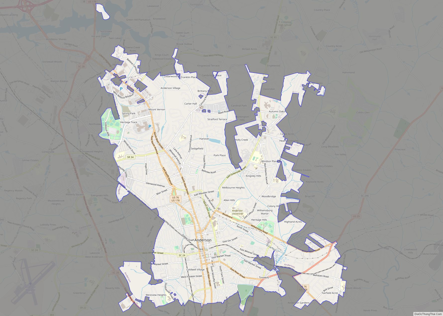
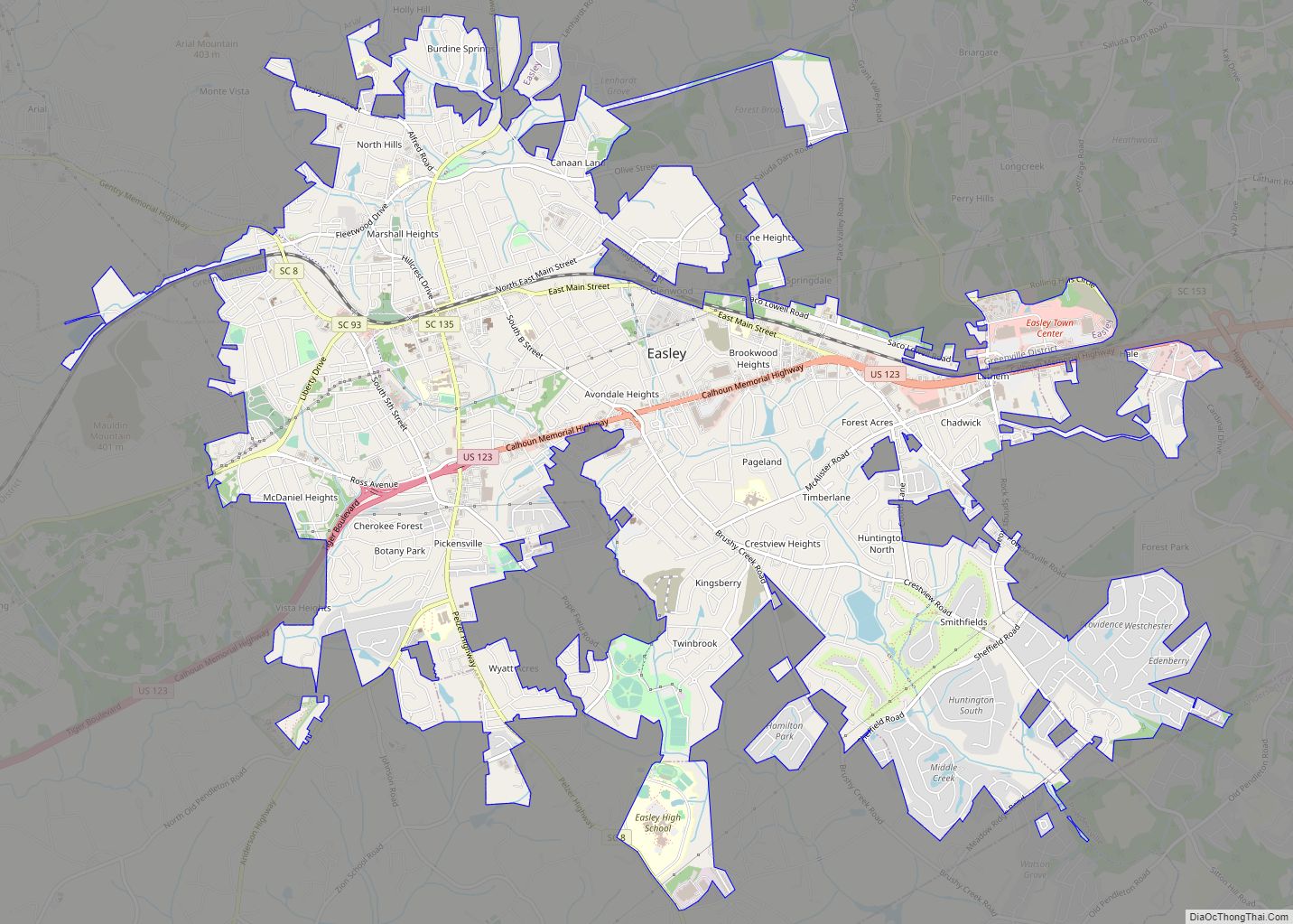
Online Interactive Map
Click on ![]() to view map in "full screen" mode.
to view map in "full screen" mode.
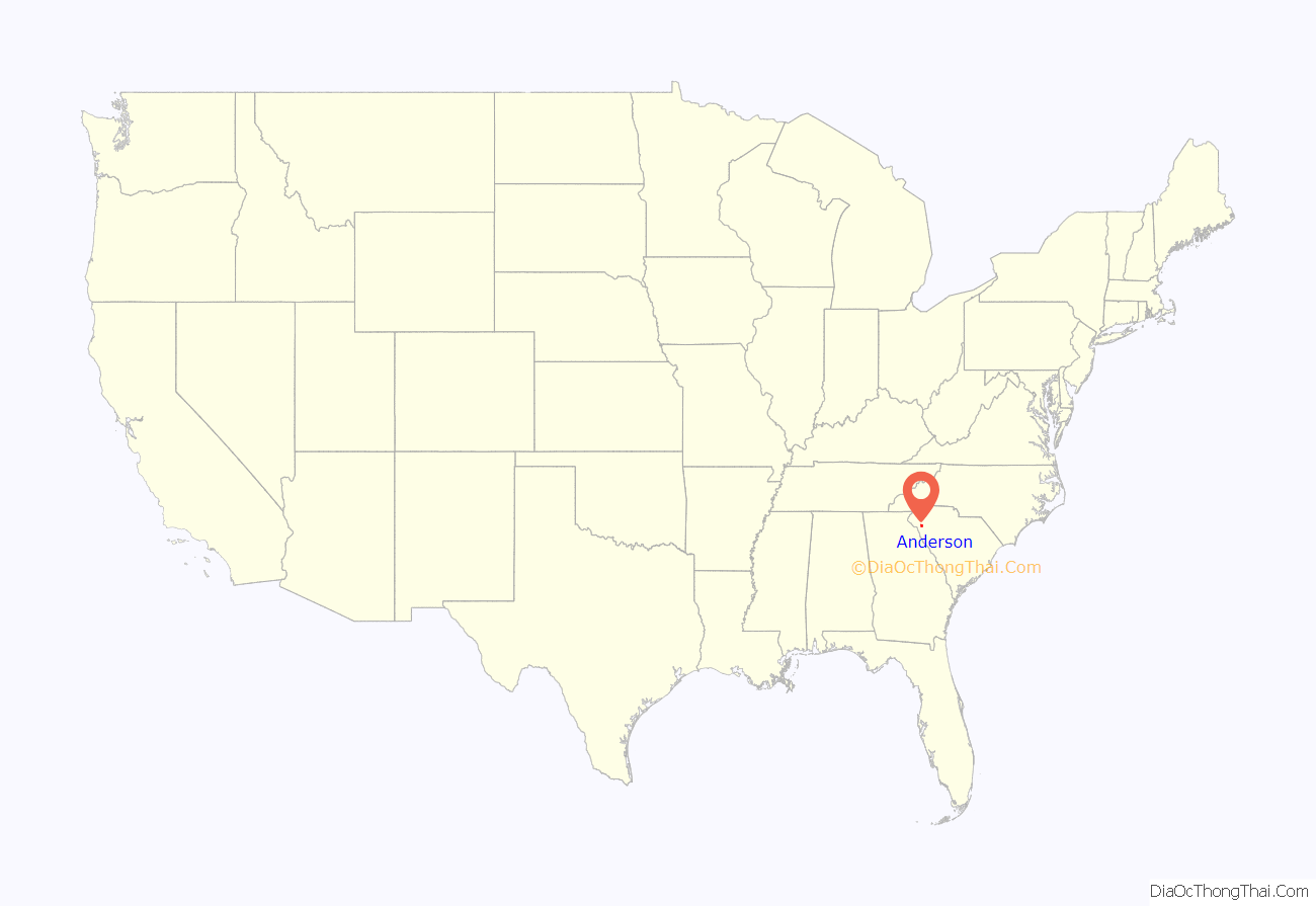
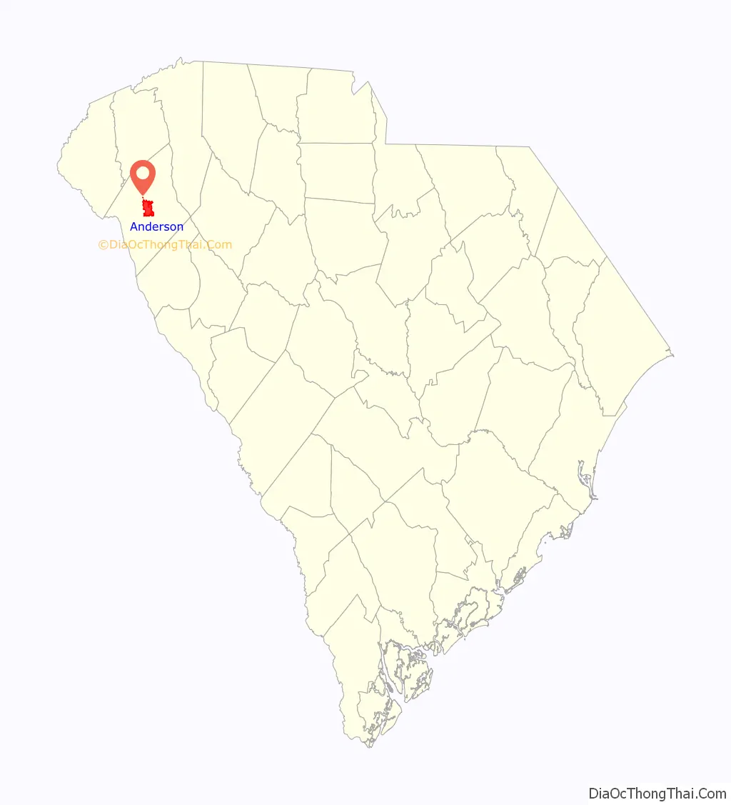
Anderson location map. Where is Anderson city?
History
Anderson Court House
Cherokee first settled the area of what is today the city of Anderson. During the American Revolution, the Cherokee sided with the British. After the American Revolutionary War, the Cherokee’s land was acquired as war reparations and colonized. In 1791, the South Carolina Legislature created the Washington District, which comprised Greenville, Anderson, Oconee, and Pickens Counties. The Washington District was then divided into Greenville and Pendleton districts. Anderson, Pickens, and Oconee comprised the newly created Pendleton district. Anderson was settled in 1826 and incorporated in 1828 as Anderson Court House, separate from the Pendleton district. The name Anderson is in honor of Robert Anderson, who fought in the American Revolutionary War and also explored the Anderson region in the mid-18th century. Anderson District (later Anderson County after 1867) was also established in 1826 out of the Pendleton district.
In 1851, the Johnson Female Seminary was established in Anderson as the first college of the town, and was named after William Bullein Johnson. One year later, the seminary was renamed Johnson University. During the American Civil War, Johnson University was closed and converted into a Confederate treasury. On May 1, 1865, Union forces invaded Anderson looking for the Confederate treasury. The treasury office of Anderson was ransacked by Union forces, and the main building of Johnson University was used as a Union headquarters. A minor skirmish erupted at the Battle of Anderson, leading to two Union casualties. After the war, a Union garrison was stationed in Anderson.
The Electric City
Anderson became one of the first cities in the Southeastern United States to have electricity. Electricity to Anderson was established by William C. Whitner in 1895 at a hydroelectric plant on the Rocky River, giving the city the name the Electric City. Anderson also became the first city in the world to supply a cotton gin by electricity. In 1895, Anderson Court House was renamed to Anderson. In 1897, Whitner’s plant was upgraded with a 10,000-volt generating station at Portman Shoals. Whitner’s power plant at Portman Shoals became the first hydroelectric plant in the United States to generate high voltage without step-up transformers . The Portman Dam was swept away in 1901, forcing Anderson into darkness until it was rebuilt in 1902.
Anderson University
In 1911, Anderson College was established by the Anderson Chamber of Commerce. Anderson College was a successor to the Johnson Female Seminary and is affiliated with the South Carolina Baptist Convention, in particular the First Baptist Church of Anderson. Anderson College became a co-educational, two-year junior college in 1930, and in 2006, it became Anderson University.
Anderson Road Map
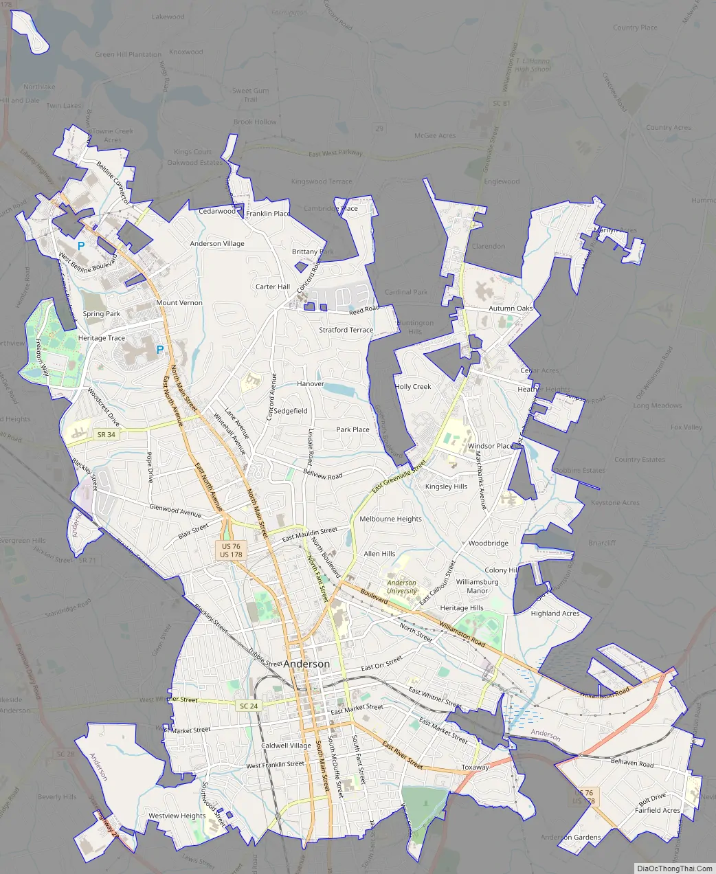
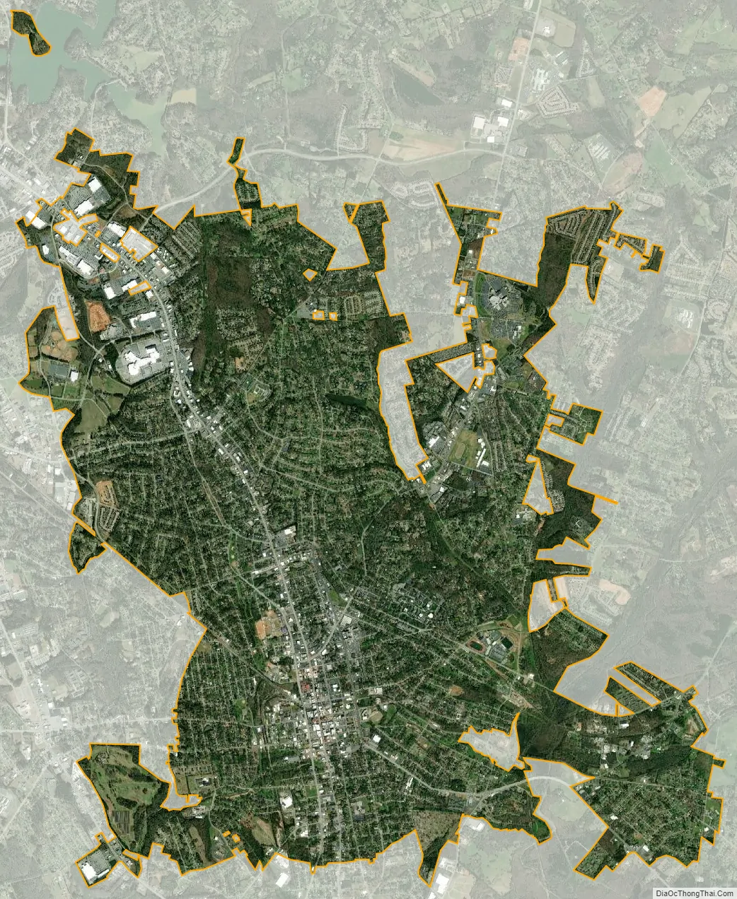
Anderson city Satellite Map
Geography
Anderson is located in the northwest corner of South Carolina on the Piedmont plateau. Anderson is a 1-hour drive from the Blue Ridge Mountains and a 4-hour drive from the South Carolina coast. Anderson lies roughly at the midpoint of the busy I-85 corridor between Atlanta and Charlotte.
According to the United States Census Bureau, the city has a total area of 14.6 square miles (37.9 km), of which 0.039 square miles (0.1 km), or 0.30%, is covered by water.
See also
Map of South Carolina State and its subdivision:- Abbeville
- Aiken
- Allendale
- Anderson
- Bamberg
- Barnwell
- Beaufort
- Berkeley
- Calhoun
- Charleston
- Cherokee
- Chester
- Chesterfield
- Clarendon
- Colleton
- Darlington
- Dillon
- Dorchester
- Edgefield
- Fairfield
- Florence
- Georgetown
- Greenville
- Greenwood
- Hampton
- Horry
- Jasper
- Kershaw
- Lancaster
- Laurens
- Lee
- Lexington
- Marion
- Marlboro
- McCormick
- Newberry
- Oconee
- Orangeburg
- Pickens
- Richland
- Saluda
- Spartanburg
- Sumter
- Union
- Williamsburg
- York
- Alabama
- Alaska
- Arizona
- Arkansas
- California
- Colorado
- Connecticut
- Delaware
- District of Columbia
- Florida
- Georgia
- Hawaii
- Idaho
- Illinois
- Indiana
- Iowa
- Kansas
- Kentucky
- Louisiana
- Maine
- Maryland
- Massachusetts
- Michigan
- Minnesota
- Mississippi
- Missouri
- Montana
- Nebraska
- Nevada
- New Hampshire
- New Jersey
- New Mexico
- New York
- North Carolina
- North Dakota
- Ohio
- Oklahoma
- Oregon
- Pennsylvania
- Rhode Island
- South Carolina
- South Dakota
- Tennessee
- Texas
- Utah
- Vermont
- Virginia
- Washington
- West Virginia
- Wisconsin
- Wyoming