Bloomington is a city in Hennepin County, Minnesota, United States, on the north bank of the Minnesota River, above its confluence with the Mississippi River, 10 miles (16 km) south of downtown Minneapolis. At the 2020 census, the city’s population was 89,987, making it Minnesota’s fourth-largest city.
Bloomington was established as a post–World War II housing boom suburb connected to Minneapolis’s urban street grid, and is serviced by two major freeways: Interstate 35W and Interstate 494. Large-scale commercial development is concentrated along the I-494 corridor. Besides an extensive city park system, with over 1,000 square feet (93 m) of parkland per capita, Bloomington is also home to Hyland Lake Park Reserve in the west and Minnesota Valley National Wildlife Refuge in the southeast.
Bloomington has more jobs per capita than either Minneapolis or Saint Paul, due in part to the United States’ largest enclosed shopping center, the Mall of America. The headquarters of Ceridian, Donaldson Company, HealthPartners, and Toro, and major operations of Pearson, General Dynamics, Seagate Technologies, Express Scripts and Dairy Queen are also based in the city.
The city was named after Bloomington, Illinois.
| Name: | Bloomington city |
|---|---|
| LSAD Code: | 25 |
| LSAD Description: | city (suffix) |
| State: | Minnesota |
| County: | Hennepin County |
| Founded: | 1843 |
| Elevation: | 827 ft (252 m) |
| Land Area: | 34.70 sq mi (89.87 km²) |
| Water Area: | 3.70 sq mi (9.57 km²) 9.73% |
| Population Density: | 2,593.36/sq mi (1,001.31/km²) |
| ZIP code: | 55420, 55425, 55431, 55435, 55437, 55438 |
| Area code: | 952 |
| FIPS code: | 2706616 |
| GNISfeature ID: | 0640278 |
| Website: | bloomingtonmn.gov |
Online Interactive Map
Click on ![]() to view map in "full screen" mode.
to view map in "full screen" mode.
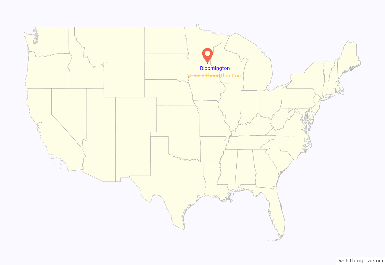
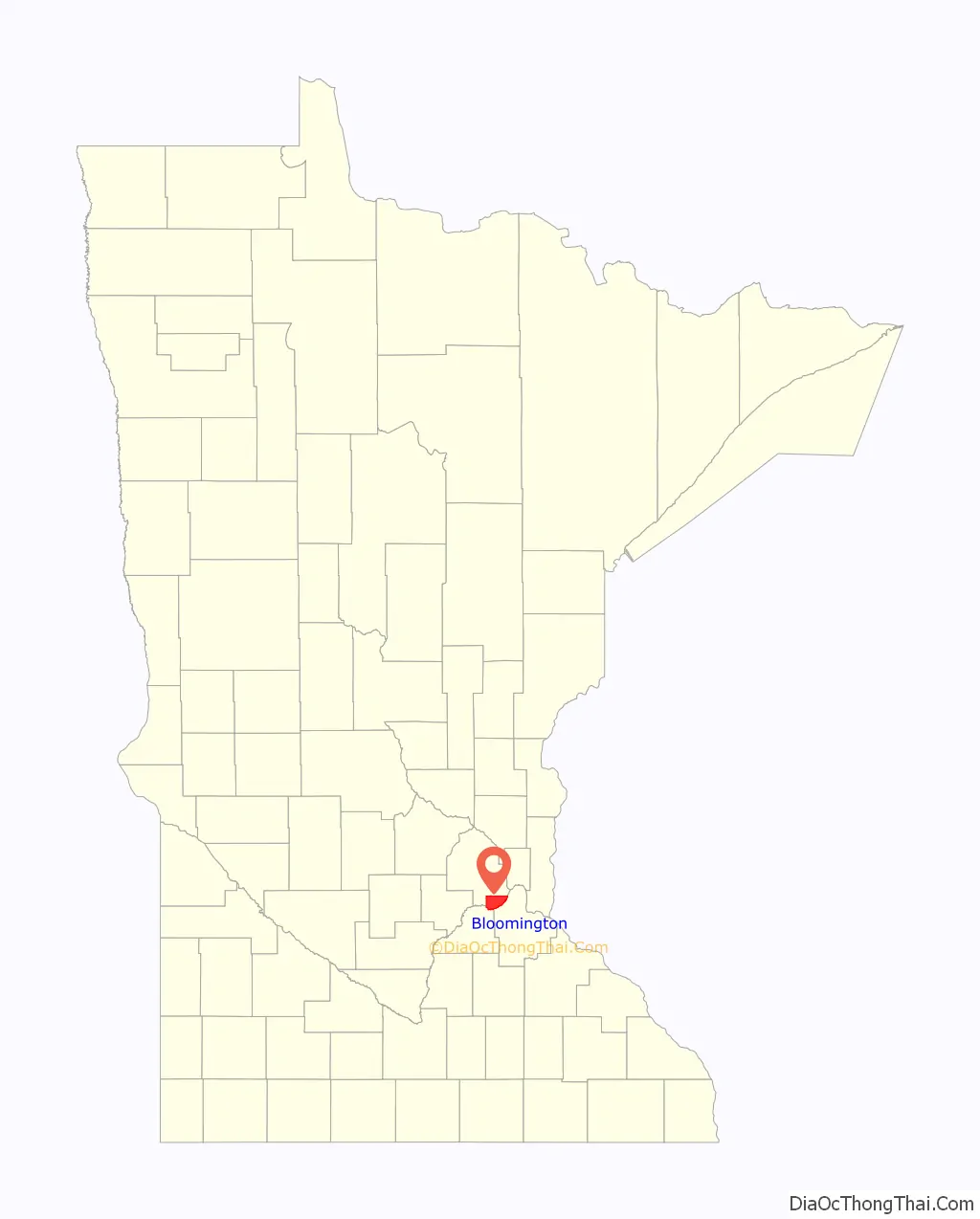
Bloomington location map. Where is Bloomington city?
History
In 1839, with renewed conflict with the Ojibwa nation, Chief Cloud Man relocated his band of the Mdewakanton Sioux from Bde Maka Ska in Minneapolis to an area named Oak Grove in southern Bloomington, close to present-day Portland Avenue. In 1843, Peter and Louisa Quinn, the first European settlers to live in Bloomington, built a cabin along the Minnesota River in the area. The government had sent them to teach the Native Americans farming methods. Gideon Hollister Pond, a missionary who had been following and recording the Dakota language from Cloud Man’s band, relocated later that year, establishing Oak Grove Mission, his log cabin. Pond and his family held church services and taught the Dakota school subjects and farming. Passage across the Minnesota River in Bloomington came in 1849 when William Chambers and Joseph Dean opened the Bloomington Ferry. It remained operational until 1889, when the Bloomington Ferry Bridge was built.
After the Treaty of Traverse des Sioux in 1851, the territory west of the Mississippi River, including Bloomington, was opened to settlers. A group of pioneers settled Bloomington, including the Goodrich, Whalon, and Ames families. They named the area Bloomington after the city they were from, Bloomington, Illinois. Most early jobs were in farming, blacksmithing, and flour milling. The Oxborough family, who came from Canada, built a trading center on Lyndale Avenue and named it Oxboro Heath. Today, the Clover Shopping Center rests near the old trading center site and the nearby Oxboro Clinic is named after them. The Baliff family opened a grocery and general store at what is today Penn Avenue and Old Shakopee Road, and Hector Chadwick, after moving to the settlement, opened a blacksmith shop near the Bloomington Ferry. In 1855, the first public school for all children was opened in Miss Harrison’s house, with the first school, Gibson House, built in 1859. On May 11, 1858, the day Minnesota was admitted into the union and officially became a state, 25 residents incorporated the Town of Bloomington. By 1880, the population had grown to 820. In 1892, the first town hall was built at Penn and Old Shakopee Road. By then, the closest Dakota to Minneapolis lived at the residence of Gideon Pond.
1900s to 1930s
After 1900, the population surpassed 1,000 and Bloomington began to transform into a city. With rising population came conflict among citizens over social issues. Among the major issues during this period were parents’ unwillingness to consolidate the individual schools into a single, larger school, and fear of mounting taxes. By 1900, there were six rural schools spread throughout the territory with over 200 students enrolled in grades first through eighth. In 1917, the school consolidation issue was settled when voters approved the consolidation. A year later, secondary education and school bus transportation began throughout the city. Telephone service and automobiles appeared.
1940s to 1950s
From 1940 to 1960, the city’s population increased to nine times that of the population at the turn of the century. During the 1940s, the city’s development vision was low-cost, low-density housing, each with its own well and septic system. The rapid population growth was due in part to the post-World War II boom and subsequent birth of the baby boomer generation. In 1947, the first fire station was constructed and equipped at a cost of $24,000 and the Bloomington Volunteer Fire Department was established with 25 members.
The 1950s saw a considerable expansion of the city and its infrastructure, with the city shifting away from its small-town atmosphere and feel. In 1950, because of the increasing population, the first elementary school, Cedarcrest, was built. It was evident that one consolidated school could no longer serve the growing population, and ten new schools were built in this decade to meet the need. In 1952, the first large business, Toro Manufacturing Company, moved to Bloomington. The significance of this can be seen in Bloomington today, which is home to hundreds of businesses of all types.
In 1953, Bloomington changed from a township to a village form of government. This more professional approach to government was accompanied by open council meetings, land use plans, and published budgets. The effects of this new form of government began immediately, first with the formation of the city police department (at a cost of $2 per taxpayer) and then with the first parkland acquisition. Both Bush Lake Beach and Moir Park were established at a cost of one dollar to each residence. Today, about 1/3 of the city’s land area is devoted to city and regional parks, playgrounds, and open space. In 1956, the first city land-use plan was initiated with the construction of Interstate 35W and Metropolitan Stadium.
In 1957, Bloomington High School opened at West 88th Street and Sheridan Avenue South.
In 1958, the city changed from a village government to a council-manager form. One of the first policies the council adopted was encouragement of commercial and industrial development, low-cost housing, and shopping centers. Due to the rapid population increase during this time, police and fire departments changed to a 24-hour dispatching system, and the fire department (now with 46 members) converted a garage into the second fire station.
1960s to 1970s
The 1960s saw accelerated school and business growth throughout the city. On November 8, 1960, Bloomington officially became a city as voters approved the city’s organizing document, the city charter. The charter provides for a council-manager form of government in which the city council exercises the city’s legislative power and determines all city policies (see City of Bloomington Government). In 1965, a second high school, John F. Kennedy High School, was built, and Bloomington High School was renamed Abraham Lincoln High School. In 1967, a second and third official fire station were approved and built to more effectively combat fires in the increasingly large city. In 1968, Normandale State Junior College opened with an initial enrollment of 1,358 students. In 1974, it was renamed Normandale Community College to reflect expanded courses of study.
From 1961 to 1981, Bloomington was home to most of Minnesota’s major sports teams. In 1961, after the completion of Metropolitan Stadium in 1956, both the Minnesota Twins and Minnesota Vikings began regular-season play. Though originally built for the American Association Minneapolis Millers, a minor league baseball team, Metropolitan Stadium was renovated and expanded for Major League Baseball and the National Football League. The first Twins game was held on April 21 (Washington 5, Twins 3) and the first Vikings game was held on September 17 (Vikings 37, Chicago Bears 13). On August 21, 1965, The Beatles played Metropolitan Stadium, their only stop ever in the Minneapolis-St. Paul metropolitan area. In 1967, with the expansion of the National Hockey League, the Metropolitan Sports Center was built near Metropolitan Stadium and the Minnesota North Stars began play later that year.
A number of new city buildings were constructed in the 1970s. In 1970, Thomas Jefferson High School, Bloomington Ice Garden rink one, and a fourth fire station were built. In 1971, school enrollment peaked with 26,000 students, and the fire department had grown to a force of 105 men. (In 1974, after a six-hour city council meeting, women were allowed to join the Bloomington Fire Department, but the city’s first female firefighter, Ann Majerus Meyer, did not join the department until 1984; she retired in 2013). In 1975, a second rink was added to the Bloomington Ice Garden and a fifth fire station built, with a sixth added in 1979.
1980s to present
The 1980s brought radical change to Bloomington with the departure of the Twins and Vikings. On September 30, 1981, the last baseball game was played at Metropolitan Stadium (Kansas City Royals 5, Twins 2) as the Twins and Vikings moved to the newly constructed Hubert H. Humphrey Metrodome in downtown Minneapolis for the 1982 season. In 1985, the Bloomington Port Authority purchased the 86-acre (350,000 m) Met Stadium site and in less than two years approved first site plans for Mall of America. Two years later, groundbreaking took place for the new megamall, and in 1992, it opened to the public. Today, tenants of Mall of America, when combined, constitute the largest private-sector employer in Bloomington, employing about 13,000 people.
In 1993, the Minnesota North Stars moved to Dallas, and a year later the Metropolitan Sports Center was demolished. In 2004, an IKEA store opened on the west end of the former Met Center site. The remainder of the property is planned to be the site for Mall of America Phase II. In May 2006, the Water Park of America opened. It is the country’s ninth-largest indoor waterpark.
In 2019, Bloomington passed an ordinance that forbade filming students of Dar Al-Farooq Islamic Center in a public park, which led to a successful lawsuit in the United States Court of Appeals for the Eighth Circuit against the city to reinstate the First Amendment rights of the parties involved. Keith Ellison had previously asked the court to drop the case.
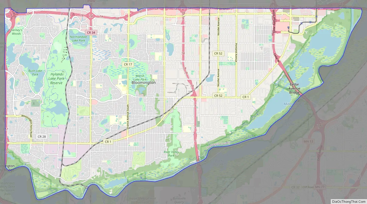
Bloomington Road Map
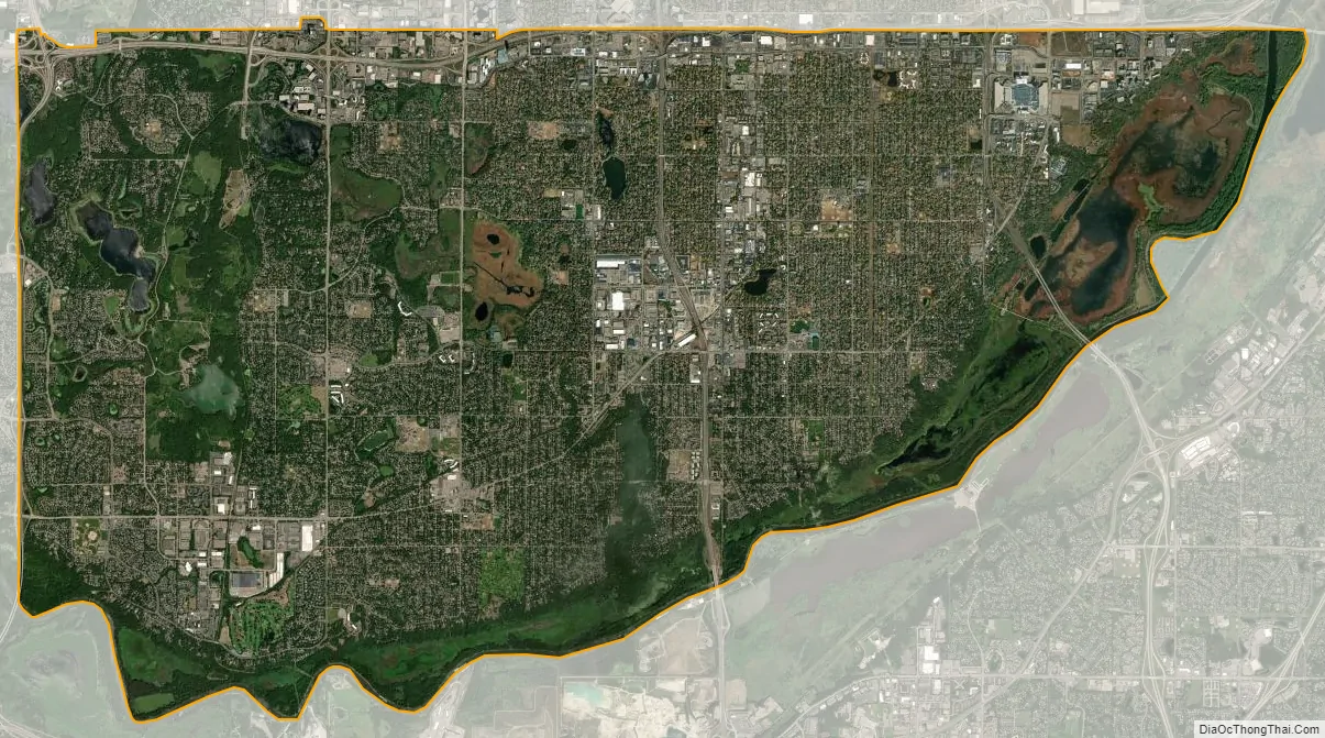
Bloomington city Satellite Map
Geography
According to the United States Census Bureau, the city has an area of 38.42 square miles (99.51 km), of which 34.68 square miles (89.82 km) is land and 3.74 square miles (9.69 km) is water.
There are three primary land types in the city. The northeastern part of the city is a sand plain, low hills dominate the western part, and the far south lies within the valley of the Minnesota River.
About a third of the city is permanently reserved for park purposes, including two large natural areas—the Minnesota Valley’s wetlands (controlled by the City and the United States Fish and Wildlife Service) and the Hyland Lake Park Reserve (controlled by the Three Rivers Park District).
Water bodies in the city include Bush Lake, Long Meadow Lake, Lake Normandale, Marsh Lake (Hennepin), Nine Mile Creek, Penn Lake and about 100 small lakes and ponds with their wetland habitats.
The city is informally divided by Interstate 35W into “West Bloomington” and “East Bloomington.” West Bloomington is mostly residential with newer housing stock, along with multi-story office high-rises along Interstate Highway 494 in the north, whereas East Bloomington contains more industry, destination retail centers, and the majority of Bloomington’s less expensive housing. The dividing line may be placed as far west as France Avenue, where the high school attendance boundaries meet.
See also
Map of Minnesota State and its subdivision:- Aitkin
- Anoka
- Becker
- Beltrami
- Benton
- Big Stone
- Blue Earth
- Brown
- Carlton
- Carver
- Cass
- Chippewa
- Chisago
- Clay
- Clearwater
- Cook
- Cottonwood
- Crow Wing
- Dakota
- Dodge
- Douglas
- Faribault
- Fillmore
- Freeborn
- Goodhue
- Grant
- Hennepin
- Houston
- Hubbard
- Isanti
- Itasca
- Jackson
- Kanabec
- Kandiyohi
- Kittson
- Koochiching
- Lac qui Parle
- Lake
- Lake of the Woods
- Lake Superior
- Le Sueur
- Lincoln
- Lyon
- Mahnomen
- Marshall
- Martin
- McLeod
- Meeker
- Mille Lacs
- Morrison
- Mower
- Murray
- Nicollet
- Nobles
- Norman
- Olmsted
- Otter Tail
- Pennington
- Pine
- Pipestone
- Polk
- Pope
- Ramsey
- Red Lake
- Redwood
- Renville
- Rice
- Rock
- Roseau
- Saint Louis
- Scott
- Sherburne
- Sibley
- Stearns
- Steele
- Stevens
- Swift
- Todd
- Traverse
- Wabasha
- Wadena
- Waseca
- Washington
- Watonwan
- Wilkin
- Winona
- Wright
- Yellow Medicine
- Alabama
- Alaska
- Arizona
- Arkansas
- California
- Colorado
- Connecticut
- Delaware
- District of Columbia
- Florida
- Georgia
- Hawaii
- Idaho
- Illinois
- Indiana
- Iowa
- Kansas
- Kentucky
- Louisiana
- Maine
- Maryland
- Massachusetts
- Michigan
- Minnesota
- Mississippi
- Missouri
- Montana
- Nebraska
- Nevada
- New Hampshire
- New Jersey
- New Mexico
- New York
- North Carolina
- North Dakota
- Ohio
- Oklahoma
- Oregon
- Pennsylvania
- Rhode Island
- South Carolina
- South Dakota
- Tennessee
- Texas
- Utah
- Vermont
- Virginia
- Washington
- West Virginia
- Wisconsin
- Wyoming


