Jackson County is a county located in the U.S. state of Ohio. As of the 2020 census, the population was 32,653. Its county seat is Jackson. The county is named for Andrew Jackson, a hero of the War of 1812 who was subsequently elected President of the United States. It is known as “The Little Wales of Ohio.” Jackson County comprises the Jackson, OH Micropolitan Statistical Area.
| Name: | Jackson County |
|---|---|
| FIPS code: | 39-079 |
| State: | Ohio |
| Founded: | March 1, 1816 |
| Named for: | Andrew Jackson |
| Seat: | Jackson |
| Largest city: | Jackson |
| Total Area: | 422 sq mi (1,090 km²) |
| Land Area: | 420 sq mi (1,100 km²) |
| Total Population: | 32,653 |
| Population Density: | 77/sq mi (30/km²) |
| Time zone: | UTC−5 (Eastern) |
| Summer Time Zone (DST): | UTC−4 (EDT) |
| Website: | www.jacksoncountyohio.us |
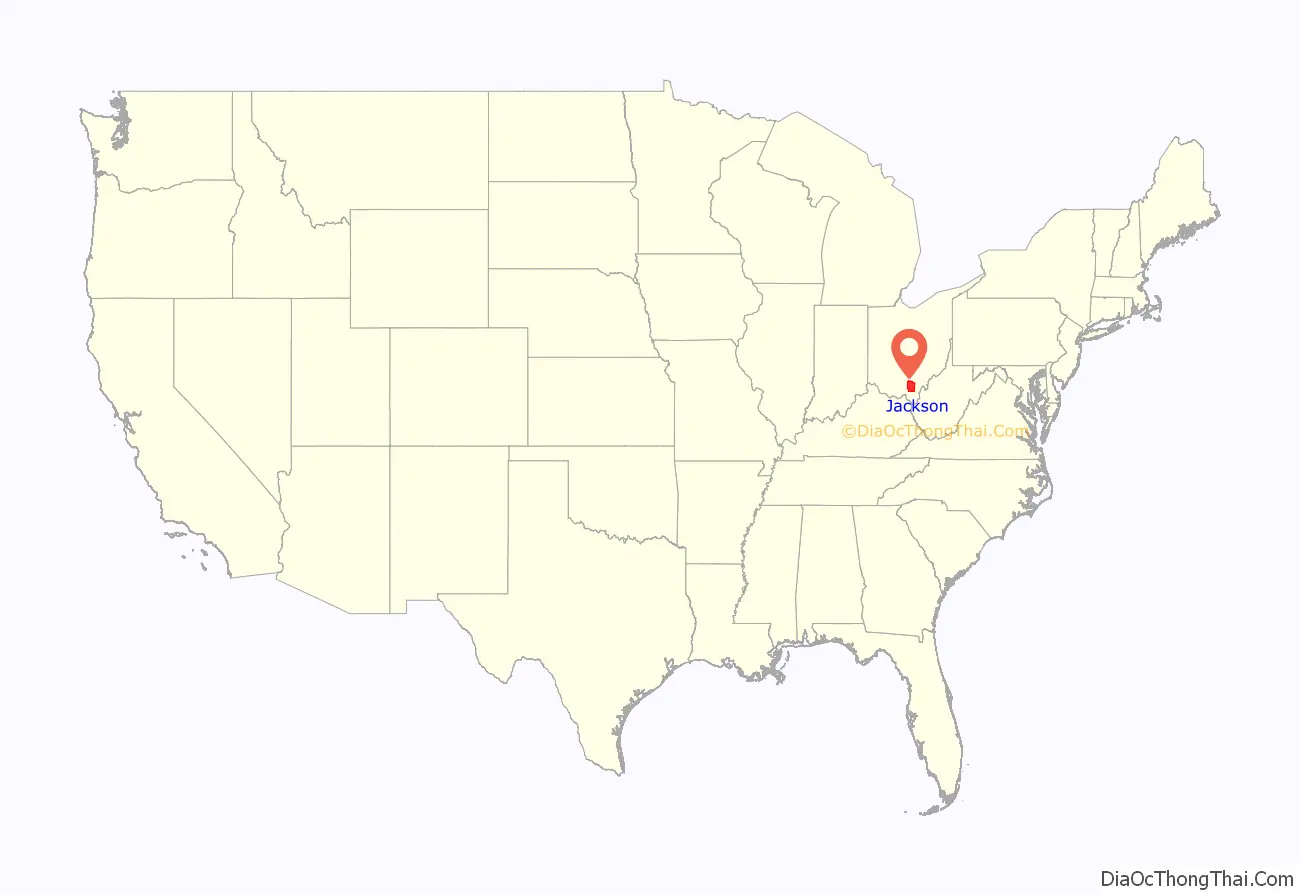
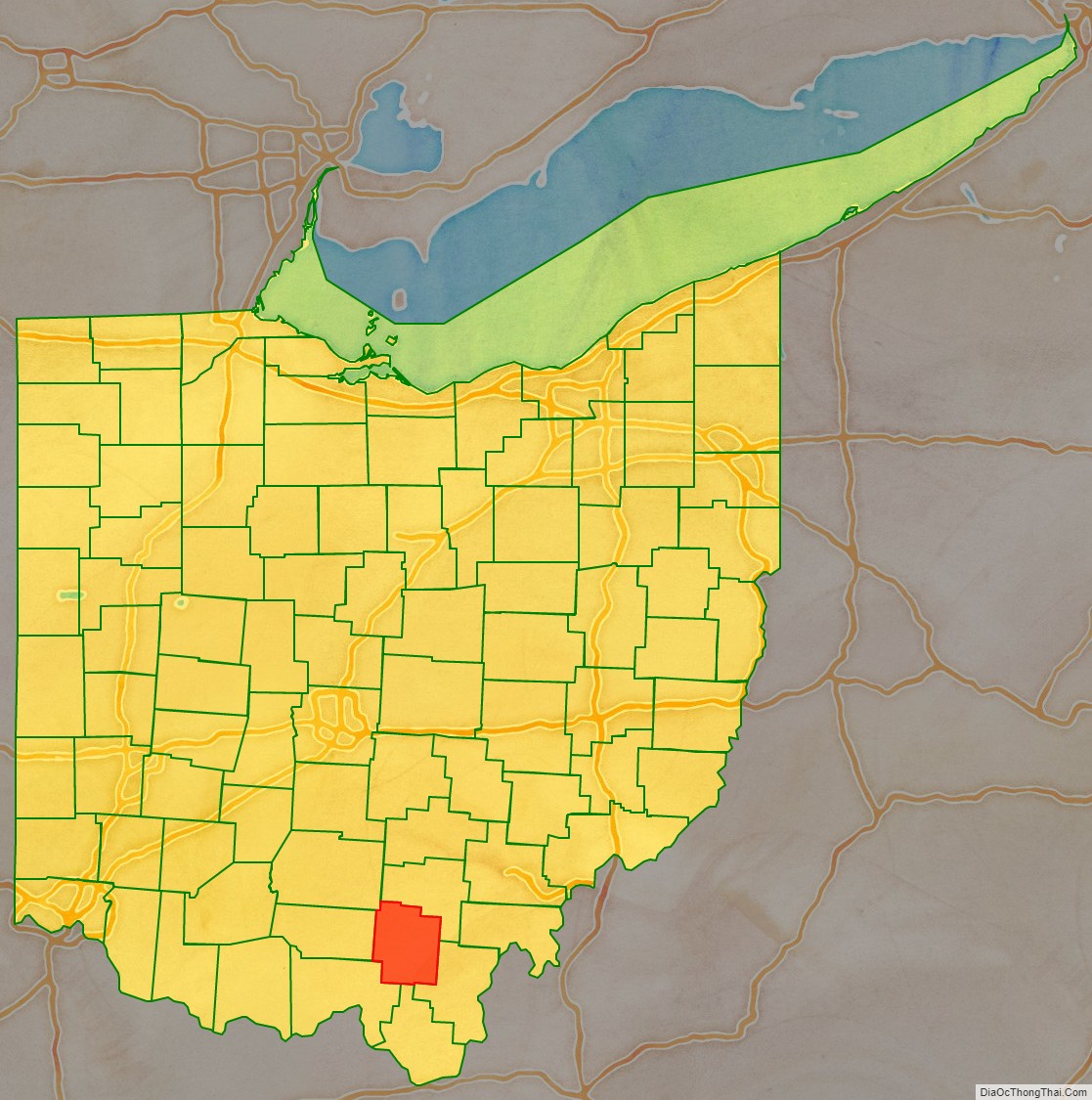
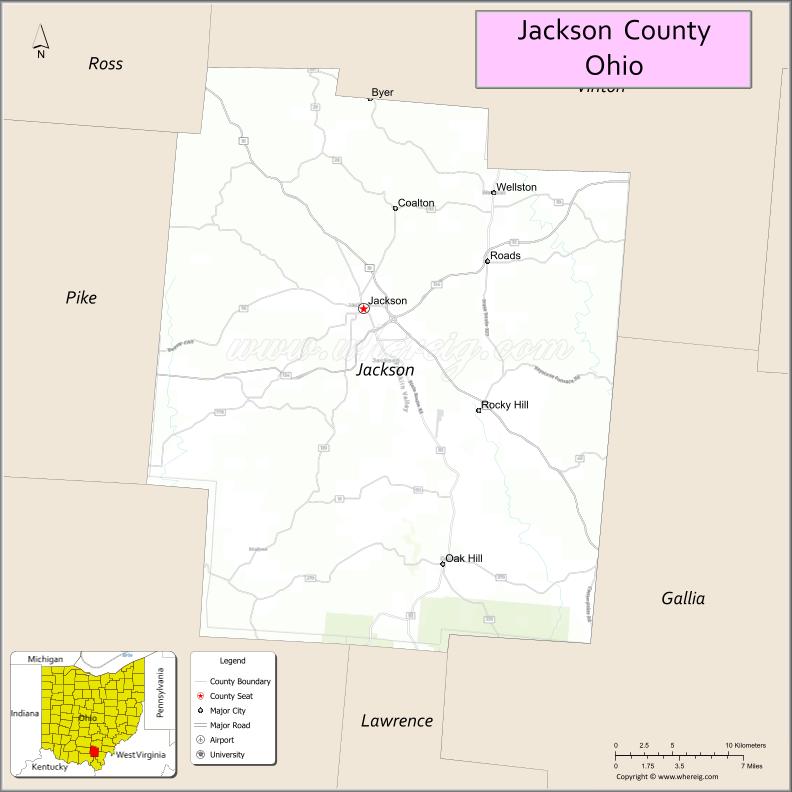
Jackson County location map. Where is Jackson County?
History
Jackson County is north of the Ohio River in eastern Ohio, an area that was long occupied by various tribes of Native Americans. Evidence of this era in the Ohio Valley is found in the area’s large burial and ceremonial mounds and petroglyphs including the Leo Petroglyph.
Tribes that inhabited the area in the Colonial period included with Mingo, Lenape, and Shawnee. Westward expansion by American pioneers displaced the Indigenous People who were killed in wars or relocated to the Great Plains and placed on reservations following the passage of the Indian Removal Act. The pioneer settlers cleared the land for farming and developed industries around which towns and cities grew.
Iron ore was discovered in southern Ohio in the mid-19th century. The combination of deposits of ore and vast stands of old-growth forests made the Hanging Rock Iron Region ideally suited for the iron industry. The Jefferson Iron Furnace was constructed in 1854. It met the growing demand for iron in the developing United States of America. The importance of the furnaces in the Hanging Rock region grew tremendously during the American Civil War. Iron produced in Jackson County was sold to manufacturers under the trademark, “Anchor”. This iron was used to build the USS Monitor, an ironclad warship made famous by its contest against the CSS Virginia, a Confederate ironclad sometimes known as the Merrimack, at the Battle of Hampton Roads.
The era of iron production in Jackson County began to wane in the years following the Civil War. Demand for iron outstripped the resources in the Hanging Rock Iron Region. Ore deposits had been cleared and what remained was minimal and difficult to extract. Also much of the forested land had been cleared to provide charcoal to fire the furnaces. A combination of a lack of ore and charcoal helped bring about the end of the iron era. Remnants of the Jefferson Iron Furnaces are found in Jackson Lake State Park.
Other industries that were in the area included coal mining and salt mining. Over a million tons of coal were mined in 1888. Jackson County was the second leading coal producing county in the state during the coal mining era. Salt mines along Salt Creek were set aside “by Congress for the use of the state to secure the salt.” Indian tribes also used the area and came from great distances to gather salt.
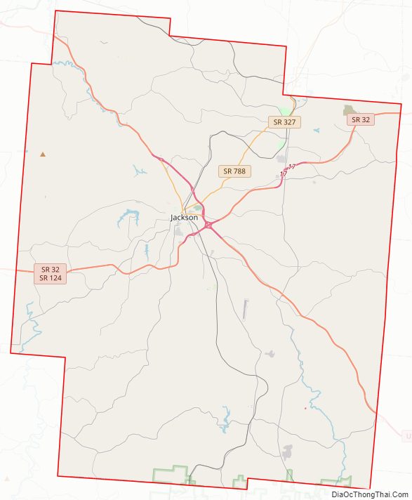
Jackson County Road Map
Geography
According to the U.S. Census Bureau, the county has a total area of 422 square miles (1,090 km), of which 420 square miles (1,100 km) is land and 1.2 square miles (3.1 km) (0.3%) is water.
Adjacent counties
- Vinton County (north)
- Gallia County (east)
- Lawrence County (south)
- Scioto County (southwest)
- Pike County (west)
- Ross County (northwest)
National protected areas
- Wayne National Forest (part)
- Liberty Wildlife Area
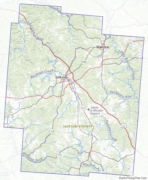
Jackson County Topographic Map
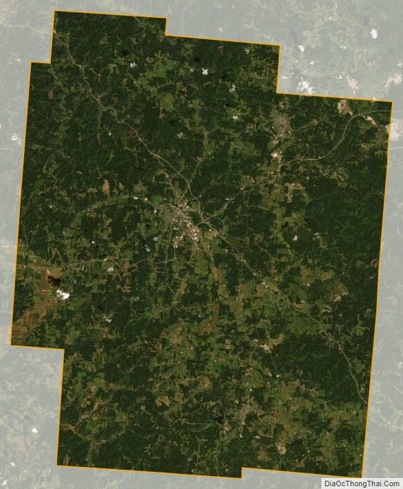
Jackson County Satellite Map
Jackson County Outline Map