Carthage is a city in Jasper County, Missouri, United States. The population was 15,522 as of the 2020 census. It is the county seat of Jasper County and is nicknamed “America’s Maple Leaf City.”
| Name: | Carthage city |
|---|---|
| LSAD Code: | 25 |
| LSAD Description: | city (suffix) |
| State: | Missouri |
| County: | Jasper County |
| Elevation: | 1,040 ft (320 m) |
| Total Area: | 11.95 sq mi (30.96 km²) |
| Land Area: | 11.91 sq mi (30.84 km²) |
| Water Area: | 0.05 sq mi (0.12 km²) |
| Total Population: | 15,522 |
| Population Density: | 1,303.71/sq mi (503.38/km²) |
| ZIP code: | 64836 |
| Area code: | 417 |
| FIPS code: | 2911656 |
| GNISfeature ID: | 2393760 |
| Website: | http://carthagemo.gov/ |
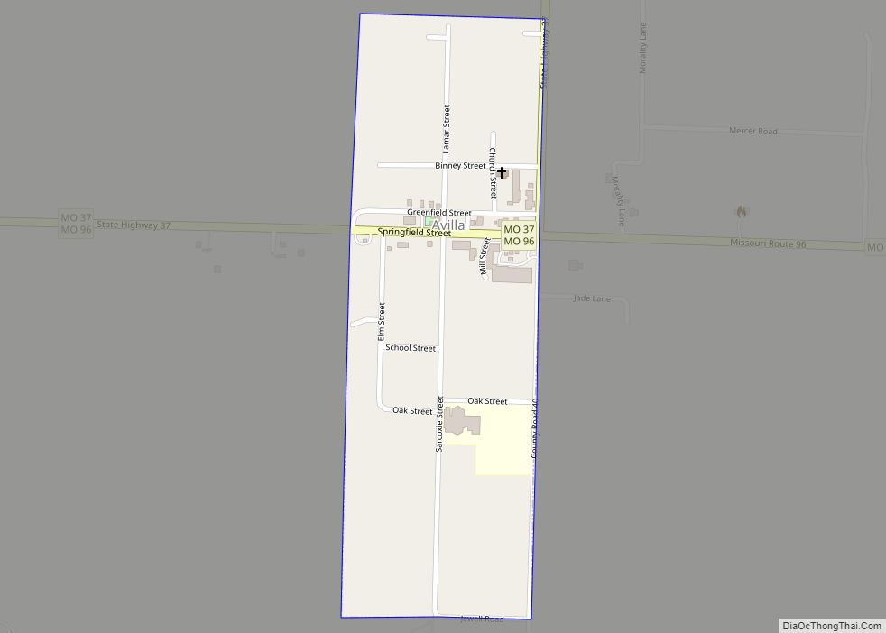
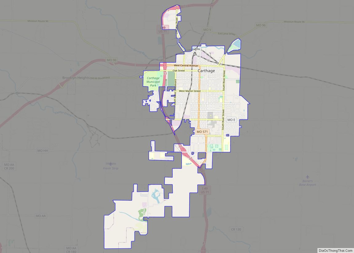
Online Interactive Map
Click on ![]() to view map in "full screen" mode.
to view map in "full screen" mode.
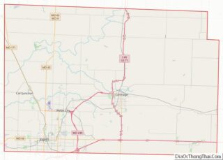
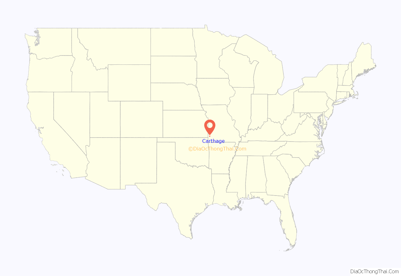
Carthage location map. Where is Carthage city?
History
Jasper County was formed in 1841. Carthage was chosen as the county seat, the area cleared and the town platted in 1842. The city was named after ancient Carthage. By the time of the American Civil War, there were over 500 residents, a brick and stone courthouse, and several businesses.
The area was divided over slavery, and almost all of the African-Americans in the county at the time were slaves. The Battle of Carthage, fought on July 5, 1861, was a clash between Union troops from St. Louis and Confederate troops led by the pro-Southern Missouri Governor Claiborne Fox Jackson. The “Second Battle of Carthage” occurred in October 1863 when Union troops confronted Confederate troops north of town and forced them to return to Arkansas. The town experienced minor skirmishes and attacks throughout the war; pro-Confederate guerrillas burned most of the city (including the courthouse) in September 1864. Historical accounts, such as Jasper County, Missouri in the Civil War (1923) by Col. Ward L. Schrantz, document the regional warfare.
The area grew rapidly following the Civil War. The Missouri Western Railroad arrived in 1872. Town residents started a foundry, furniture factory, woolen and grain mills, a plow works and numerous liveries and other businesses. Leggett & Platt, now a Fortune 500 company still based in Carthage, was founded in 1883. Nearby lead mines and limestone quarries also contributed significant wealth and Carthage became one of the most prosperous towns in the area. Residents poured their money into ornate Victorian-style homes, many of which are now part of the Carthage South District, which was named to the National Register of Historic Places in 1982. The Jasper County Courthouse, also on the National Register of Historic Places, was built of Carthage stone in 1894–95. There is a mural inside the courthouse depicting the history of Jasper County. Growth in Carthage can be documented through Sanborn maps, many of which are available online.
Numerous local buildings, in addition to the courthouse, were built in the late 19th and early 20th century out of stone from local quarries. The limestone is hard enough to be polished into “Carthage marble” and was used in both the interior and exterior of the state capitol building in Jefferson City, Missouri. The quarries known today as the Carthage Underground, a commercial space that utilizes but a small portion of the extensive uncharted quarries nearby.
In 1925, Ozark Wesleyan College merged three Methodist colleges into one institution and built a campus in the center of town. The college operated only a few years before closing. The campus was home to Our Lady of the Ozarks College from 1944 to 1971 and now houses the Vietnamese-American Catholic religious Congregation of the Mother Co-Redemptrix. This Vietnamese order of priests and brothers came from Vietnam and settled in Carthage in 1975, immediately following the Vietnam War. In the monastery of this Vietnamese congregation, Archbishop Pierre Martin Ngô Đình Thục died in 1984.
U.S. Highways 66 and 71 came through town in the 1920s, and for a time the town saw a stream of cross-country traffic. Route 66 intersected with U.S. Route 71 at the present intersection of Central and Garrison Avenue. The original owners of a Boots Court motel at this crossroads promoted a drive-in restaurant with a KDMO AM radio broadcast, “Breakfast at the Crossroads of America”, named as a reference to the two major highways of the era. Route 66 was eventually re-routed, and then replaced in the 1960s with Interstate 44 running south of town.
In the late 20th century, the town began actively courting tourism, emphasizing its history (the Battle of Carthage, Victorian architecture, and Route 66), as well as its proximity to the Precious Moments hotel and store, along with the popular country music destination Branson, Missouri.
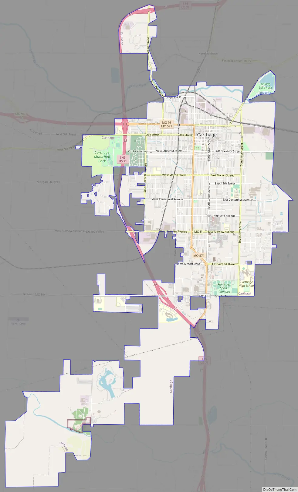
Carthage Road Map
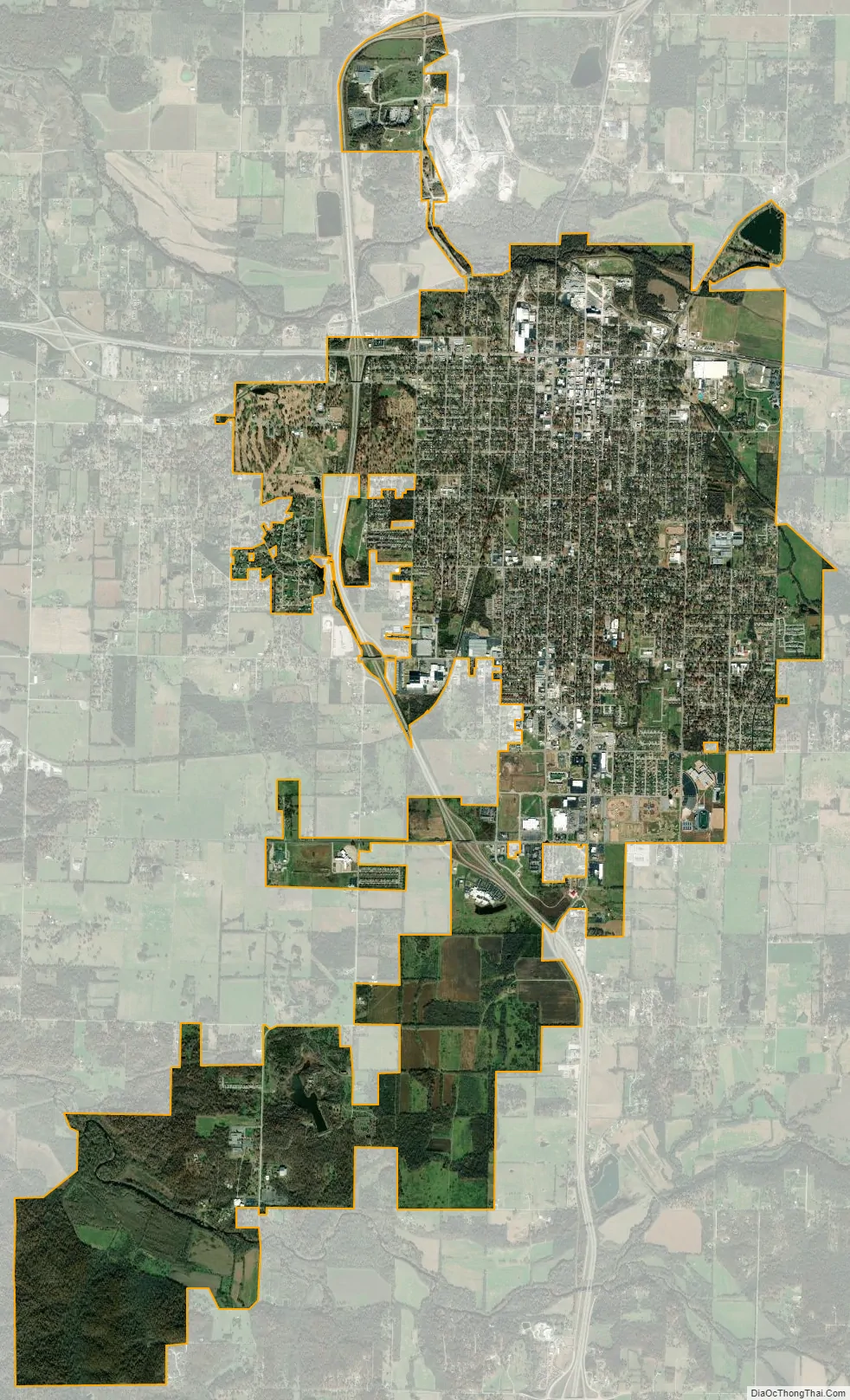
Carthage city Satellite Map
Geography
Carthage is located south of the Spring River along US Route 71. Joplin is approximately twelve miles to the southwest and Neosho is about 17 miles to the south.
According to the United States Census Bureau, the city has a total area of 11.69 square miles (30.28 km), of which 11.65 square miles (30.17 km) is land and 0.04 square miles (0.10 km) is water.
See also
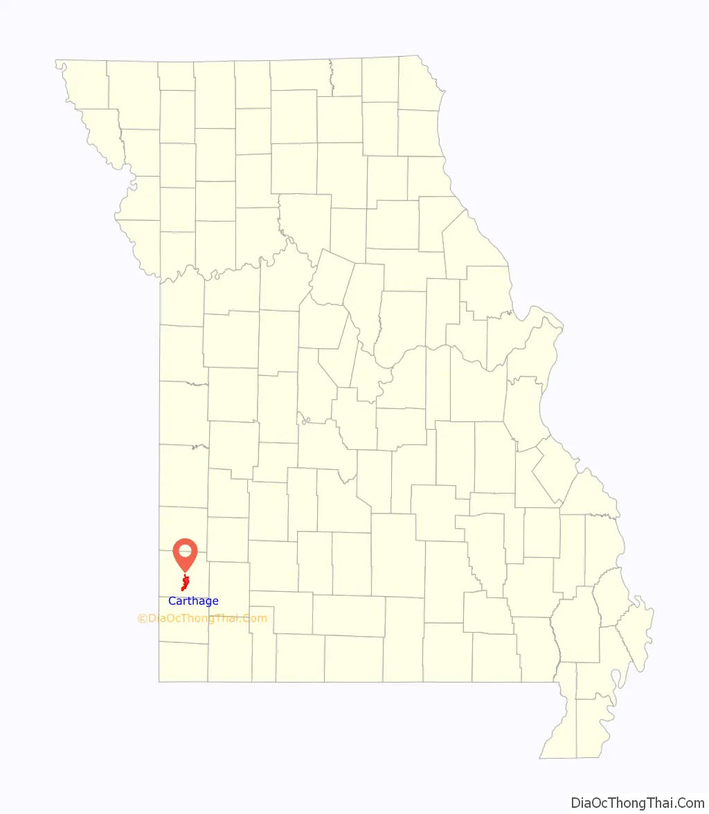
Map of Missouri State and its subdivision:- Adair
- Andrew
- Atchison
- Audrain
- Barry
- Barton
- Bates
- Benton
- Bollinger
- Boone
- Buchanan
- Butler
- Caldwell
- Callaway
- Camden
- Cape Girardeau
- Carroll
- Carter
- Cass
- Cedar
- Chariton
- Christian
- Clark
- Clay
- Clinton
- Cole
- Cooper
- Crawford
- Dade
- Dallas
- Daviess
- De Kalb
- Dent
- Douglas
- Dunklin
- Franklin
- Gasconade
- Gentry
- Greene
- Grundy
- Harrison
- Henry
- Hickory
- Holt
- Howard
- Howell
- Iron
- Jackson
- Jasper
- Jefferson
- Johnson
- Knox
- Laclede
- Lafayette
- Lawrence
- Lewis
- Lincoln
- Linn
- Livingston
- Macon
- Madison
- Maries
- Marion
- McDonald
- Mercer
- Miller
- Mississippi
- Moniteau
- Monroe
- Montgomery
- Morgan
- New Madrid
- Newton
- Nodaway
- Oregon
- Osage
- Ozark
- Pemiscot
- Perry
- Pettis
- Phelps
- Pike
- Platte
- Polk
- Pulaski
- Putnam
- Ralls
- Randolph
- Ray
- Reynolds
- Ripley
- Saint Charles
- Saint Clair
- Saint Francois
- Saint Louis
- Sainte Genevieve
- Saline
- Schuyler
- Scotland
- Scott
- Shannon
- Shelby
- Stoddard
- Stone
- Sullivan
- Taney
- Texas
- Vernon
- Warren
- Washington
- Wayne
- Webster
- Worth
- Wright
- Alabama
- Alaska
- Arizona
- Arkansas
- California
- Colorado
- Connecticut
- Delaware
- District of Columbia
- Florida
- Georgia
- Hawaii
- Idaho
- Illinois
- Indiana
- Iowa
- Kansas
- Kentucky
- Louisiana
- Maine
- Maryland
- Massachusetts
- Michigan
- Minnesota
- Mississippi
- Missouri
- Montana
- Nebraska
- Nevada
- New Hampshire
- New Jersey
- New Mexico
- New York
- North Carolina
- North Dakota
- Ohio
- Oklahoma
- Oregon
- Pennsylvania
- Rhode Island
- South Carolina
- South Dakota
- Tennessee
- Texas
- Utah
- Vermont
- Virginia
- Washington
- West Virginia
- Wisconsin
- Wyoming