Jefferson County (county code JF) is a county located in the U.S. state of Kansas. At the 2020 census, the county population was 18,368. Its county seat and most populous city is Oskaloosa.
| Name: | Jefferson County |
|---|---|
| FIPS code: | 20-087 |
| State: | Kansas |
| Founded: | August 25, 1855 |
| Named for: | Thomas Jefferson |
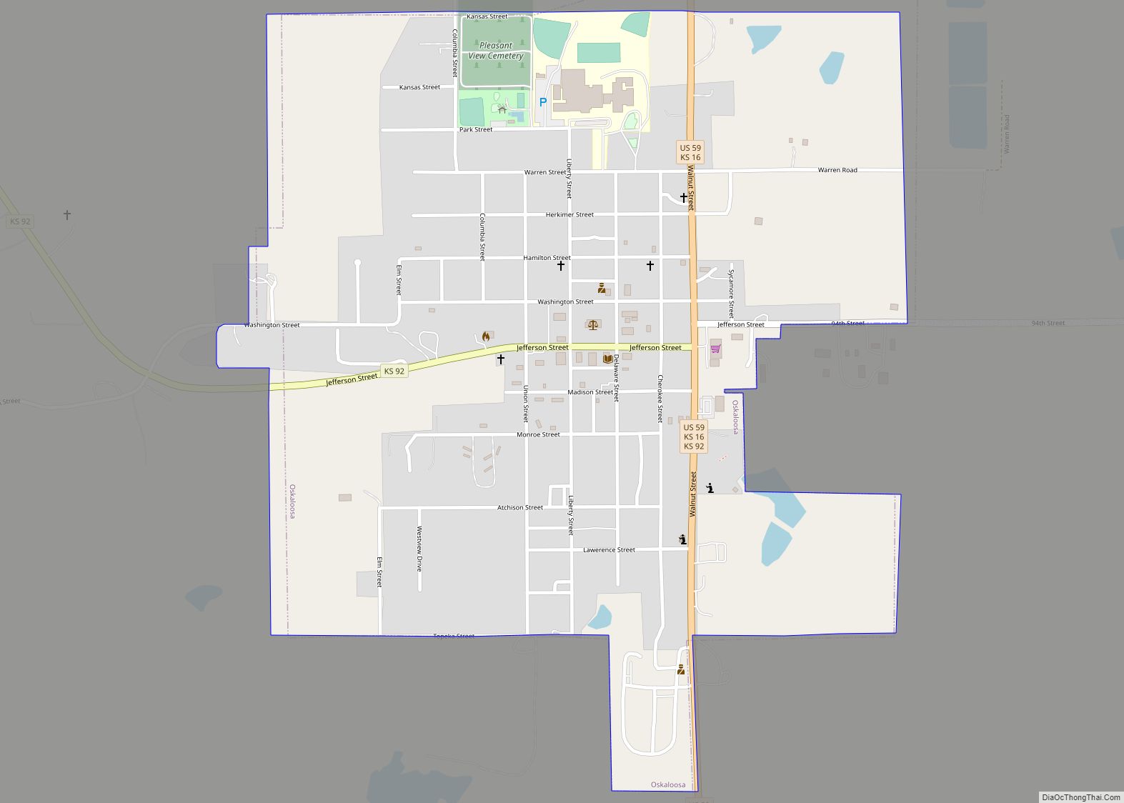
| Seat: | Oskaloosa |
| Largest city: | Valley Falls |
| Total Area: | 557 sq mi (1,440 km²) |
| Land Area: | 533 sq mi (1,380 km²) |
| Total Population: | 18,368 |
| Population Density: | 34.5/sq mi (13.3/km²) |
| Time zone: | UTC−6 (Central) |
| Summer Time Zone (DST): | UTC−5 (CDT) |
| Website: | jfcountyks.com |
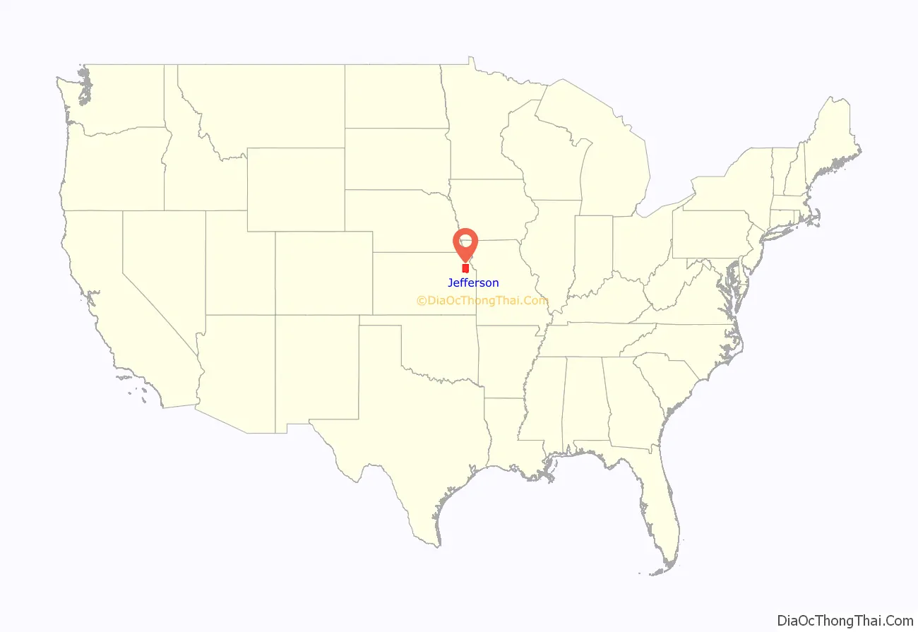
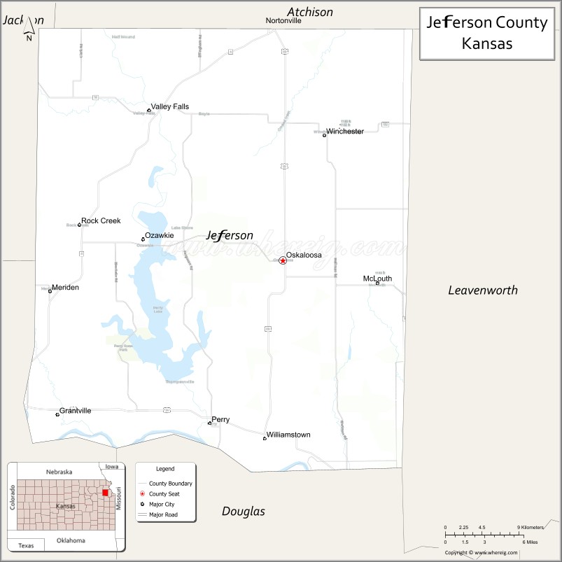
Jefferson County location map. Where is Jefferson County?
History
Early history
For many millennia, the Great Plains of North America was inhabited by nomadic Native Americans. From the 16th century to 18th century, the Kingdom of France claimed ownership of large parts of North America. In 1762, after the French and Indian War, France secretly ceded New France to Spain, per the Treaty of Fontainebleau.
19th century
In 1802, Spain returned most of the land to France, but keeping title to about 7,500 square miles. In 1803, most of the land for modern day Kansas was acquired by the United States from France as part of the 828,000 square mile Louisiana Purchase for 2.83 cents per acre.
In 1854, the Kansas Territory was organized, then in 1861 Kansas became the 34th U.S. state. In 1855, Jefferson County was established, and was named for President Thomas Jefferson. Settlement of the county was slowed by events prior to and during the Civil War, but the present day unincorporated community of Thompsonville (3 miles northwest of Perry on the Delaware River) was the first established in 1851 by Mormon settlers who initially refused to accompany the main group led by Brigham Young to the Salt Lake Valley. The settlement was first abandoned due to the violence resulting from the border wars, but was re-established when the Civil War ended.
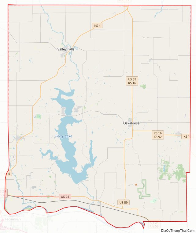
Jefferson County Road Map
Geography
According to the U.S. Census Bureau, the county has a total area of 557 square miles (1,440 km), of which 533 square miles (1,380 km) is land and 2.4 square miles (6.2 km) (4.3%) is water.
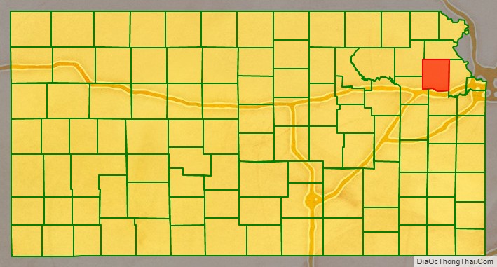
Adjacent counties
- Atchison County (north)
- Leavenworth County (east)
- Douglas County (south)
- Shawnee County (southwest)
- Jackson County (northwest)
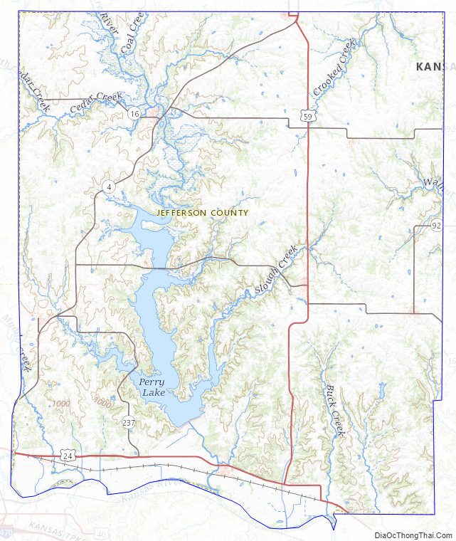
Jefferson County Topographic Map
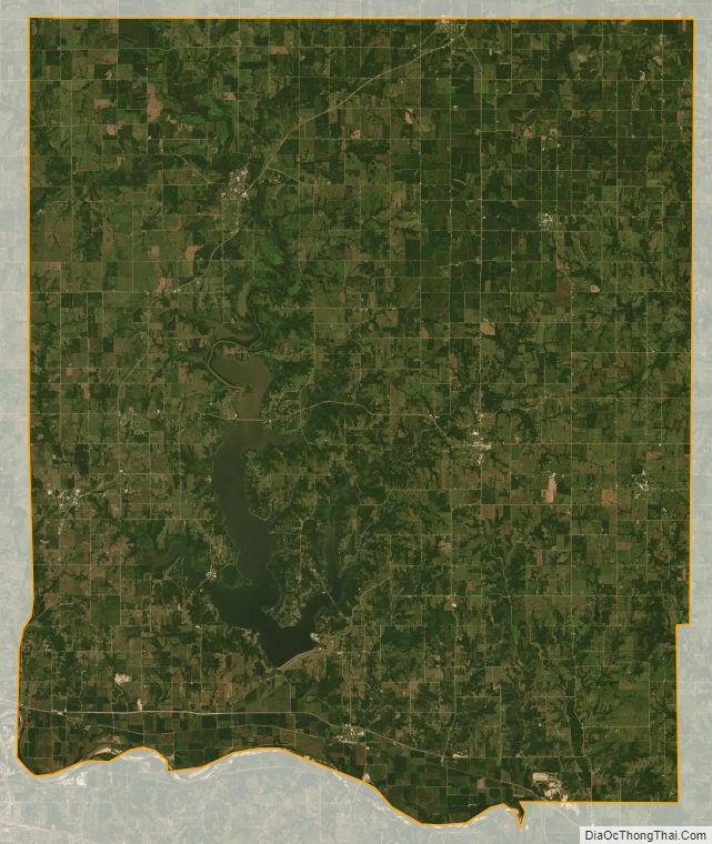
Jefferson County Satellite Map
Jefferson County Outline Map