Isanti County (/aɪˈsæntiː/ eye-SAN-tee) is a county in the east-central part of the U.S. state of Minnesota. As of the 2020 census, the population was 41,135. Its county seat is Cambridge.
| Name: | Isanti County |
|---|---|
| FIPS code: | 27-059 |
| State: | Minnesota |
| Founded: | February 13, 1857 |
| Named for: | Izaty Indians |
| Seat: | Cambridge |
| Largest city: | Cambridge |
| Total Area: | 452 sq mi (1,170 km²) |
| Land Area: | 436 sq mi (1,130 km²) |
| Total Population: | 41,135 |
| Population Density: | 88.8/sq mi (34.3/km²) |
| Time zone: | UTC−6 (Central) |
| Summer Time Zone (DST): | UTC−5 (CDT) |
| Website: | www.co.isanti.mn.us |
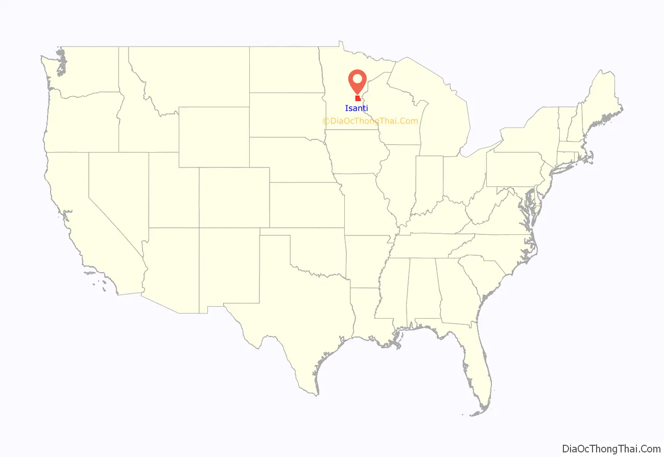
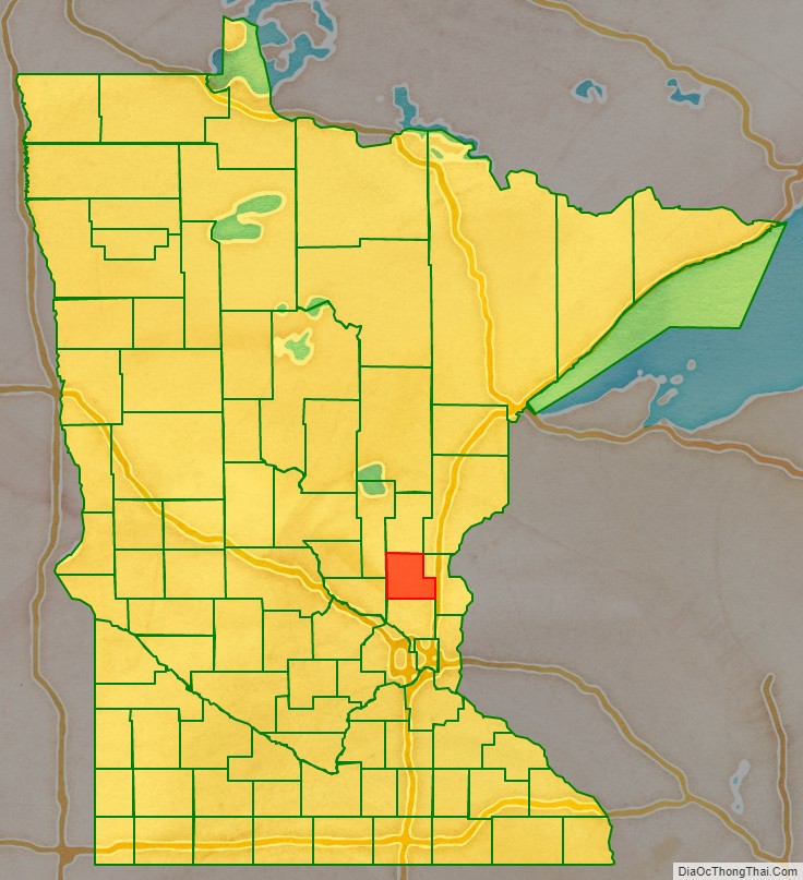
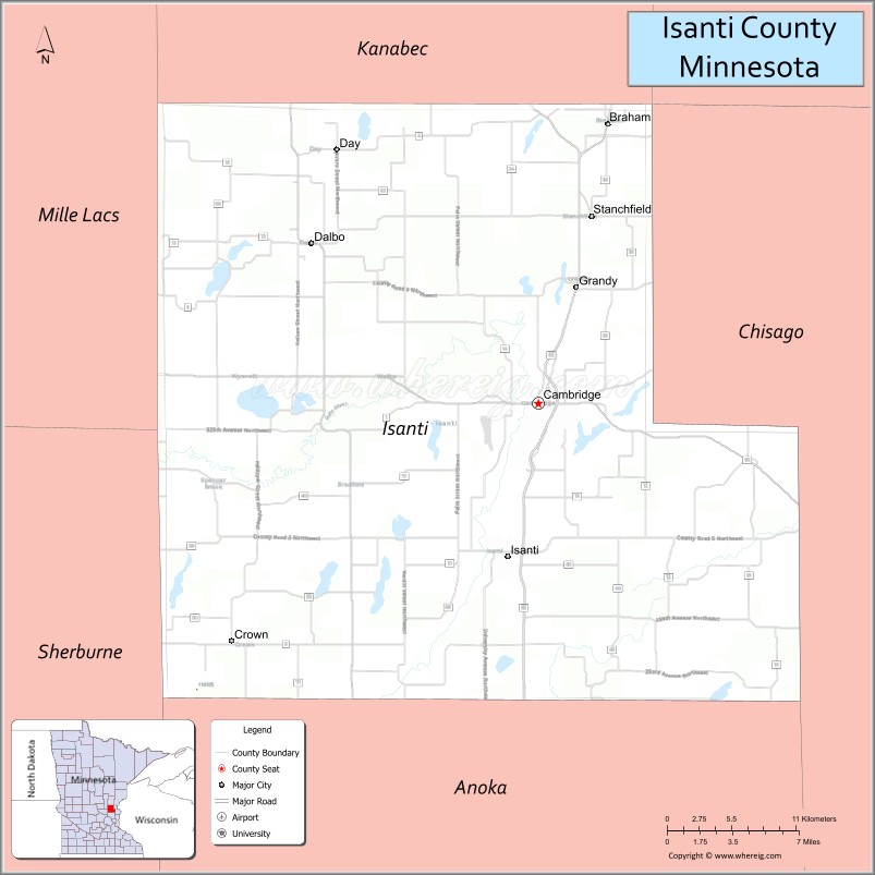
Isanti County location map. Where is Isanti County?
History
The county was formed on February 13, 1857. Its name came from the Izaty Indians, the ancient name for the Santee Indians, members of the Dakota alliance. Isanti is derived from the Dakota word for “knife” and refers to the Santee tribe.
Isanti County is included in the Minneapolis–St. Paul–Bloomington Metropolitan Statistical Area.
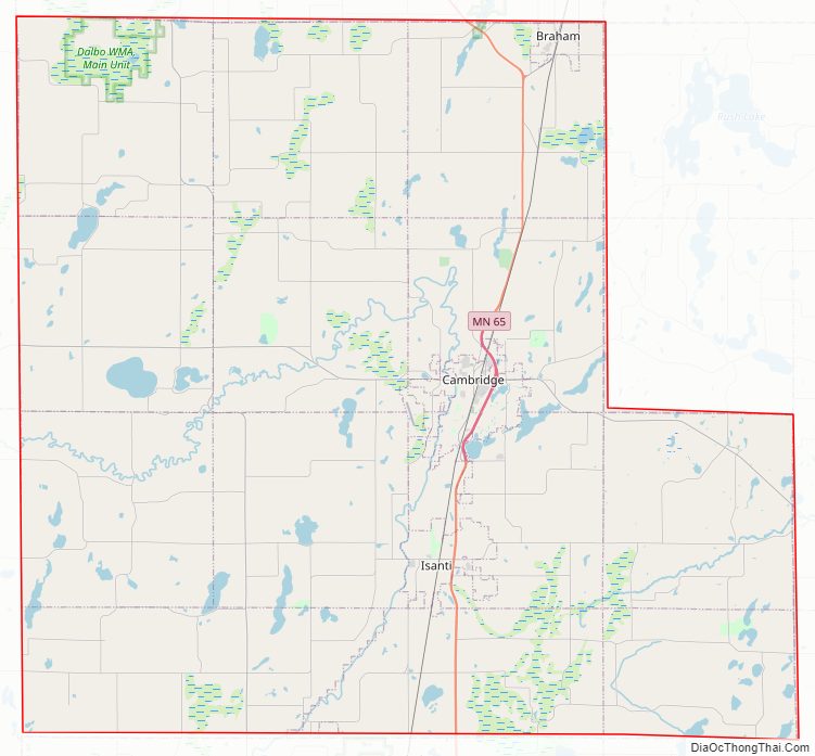
Isanti County Road Map
Geography
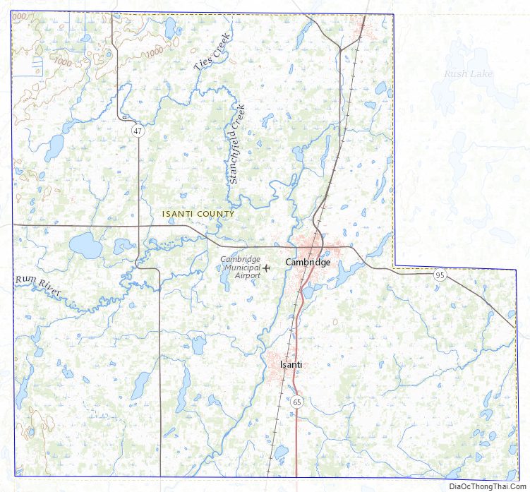
The Rum River flows south through the county’s central part. The county’s terrain is hilly and etched with drainages and gullies, and dotted with lakes and ponds. The terrain generally slopes to the south and east; its highest point is near its northwest corner, at 1,020′ (311m) ASL. The county has an area of 452 square miles (1,170 km), of which 436 square miles (1,130 km) is land and 16 square miles (41 km) (3.5%) is water.
Major highways
- Minnesota State Highway 47
- Minnesota State Highway 65
- Minnesota State Highway 95
- Minnesota State Highway 107
- List of county roads
Adjacent counties
- Kanabec County – north
- Pine County – northeast
- Chisago County – east
- Anoka County – south
- Sherburne County – southwest
- Mille Lacs County – northwest
Protected areas
- Cranberry Wildlife Management Area
- Crooked Road State Wildlife Management Area
- Marget Lake State Wildlife Management Area
- Marvin W. Schubring Memorial Wildlife Management Area
- Maywood County Park
- Spectacle Lake Wildlife Management Area
- Springvale County Park
- Twin Lake Scientific and Natural Area
Isanti County Topographic Map
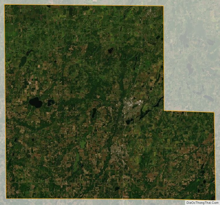
Isanti County Satellite Map
Isanti County Outline Map