Keokuk County is a county located in the U.S. state of Iowa. As of the 2020 United States Census, the population was 10,033. The county seat is Sigourney.
| Name: | Keokuk County |
|---|---|
| FIPS code: | 19-107 |
| State: | Iowa |
| Founded: | 17 February 1843 |
| Named for: | Keokuk (Sauk leader) |
| Seat: | Sigourney |
| Largest city: | Sigourney |
| Total Area: | 580 sq mi (1,500 km²) |
| Land Area: | 579 sq mi (1,500 km²) |
| Total Population: | 10,033 |
| Population Density: | 17/sq mi (6.7/km²) |
| Time zone: | UTC−6 (Central) |
| Summer Time Zone (DST): | UTC−5 (CDT) |
| Website: | www.keokukcountyia.com |
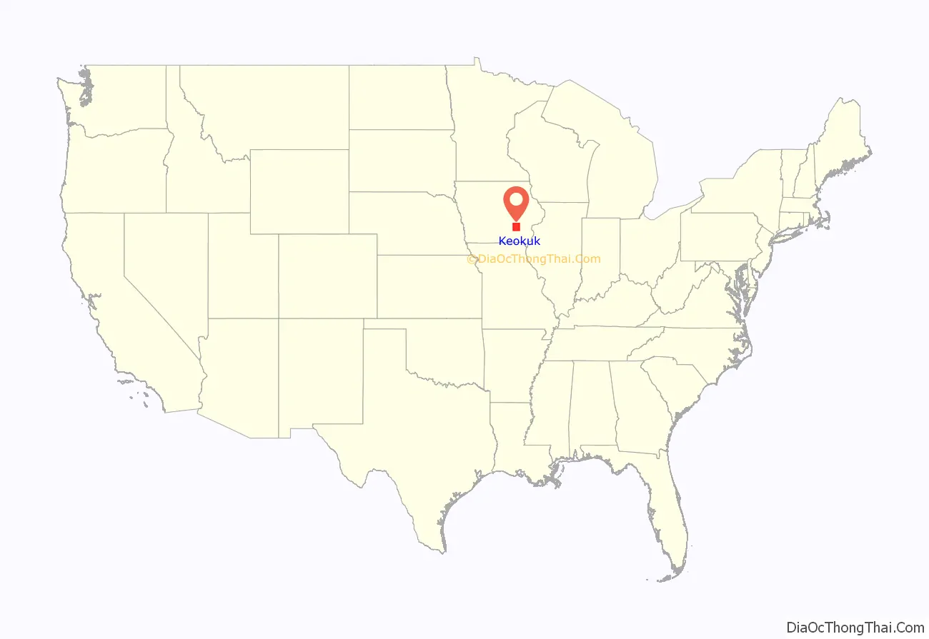
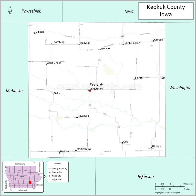
Keokuk County location map. Where is Keokuk County?
History
Keokuk County was formed in 1837. It was named for the eponymous chief of the Sac Indians, who advocated peace with the white settlers. In May 1843, the county opened for public settlement, with its judicial and regulatory duties assigned to the existing Washington County. Its governing structure was created in 1844, although the seat was not decided (for Sigourney) until 1856.
Keokuk County is unusual in that it has two county fairs. The Keokuk County Fair is held in What Cheer and immediately followed by the Keokuk County Expo which is held in Sigourney.
The Keokuk County Courthouse was built in 1911, in Sigourney’s Public Square Historic District. It has been listed on the National Register of Historic Places since 1981.
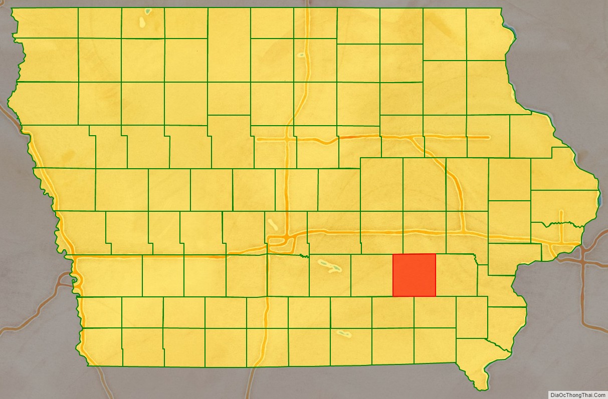
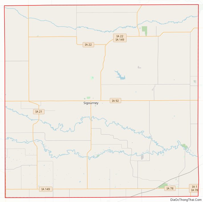
Keokuk County Road Map
Geography
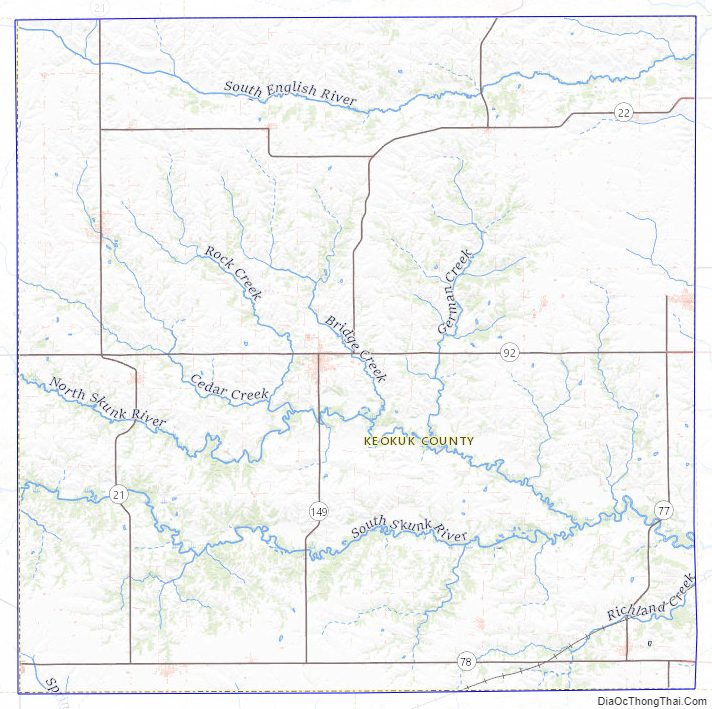
According to the United States Census Bureau, the county has a total area of 580 square miles (1,500 km), of which 579 square miles (1,500 km) is land and 0.7 square miles (1.8 km) (0.1%) is water. The South Branch of the Skunk River drains the topography, flowing eastward through the lower portion of the county.
Major highways
- Iowa Highway 1
- Iowa Highway 21
- Iowa Highway 22
- Iowa Highway 78
- Iowa Highway 92
- Iowa Highway 149
Adjacent counties
- Poweshiek County − northwest
- Iowa County − north
- Washington County − east
- Jefferson County − southeast
- Wapello County − southwest
- Mahaska County − west
Keokuk County Topographic Map
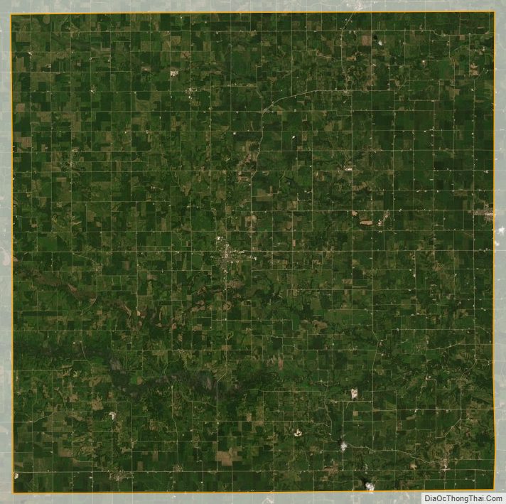
Keokuk County Satellite Map
Keokuk County Outline Map