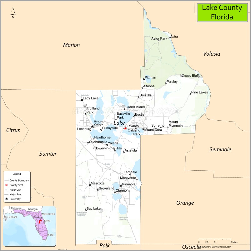
Lake County is a county in the central portion of the U.S. state of Florida. As of the 2020 census, the population was 383,956. Its county seat is Tavares, and its largest city is Clermont. Lake County is included in the Orlando–Kissimmee–Sanford, FL Metropolitan Statistical Area.
| Name: | Lake County |
|---|---|
| FIPS code: | 12-069 |
| State: | Florida |
| Founded: | May 27, 1887 |
| Seat: | Tavares |
| Largest city: | Clermont |
| Total Area: | 1,157 sq mi (3,000 km²) |
| Land Area: | 938 sq mi (2,430 km²) |
| Total Population: | 383,956 |
| Population Density: | 409/sq mi (158/km²) |
| Time zone: | UTC−5 (Eastern) |
| Summer Time Zone (DST): | UTC−4 (EDT) |
| Website: | www.lakecountyfl.gov |
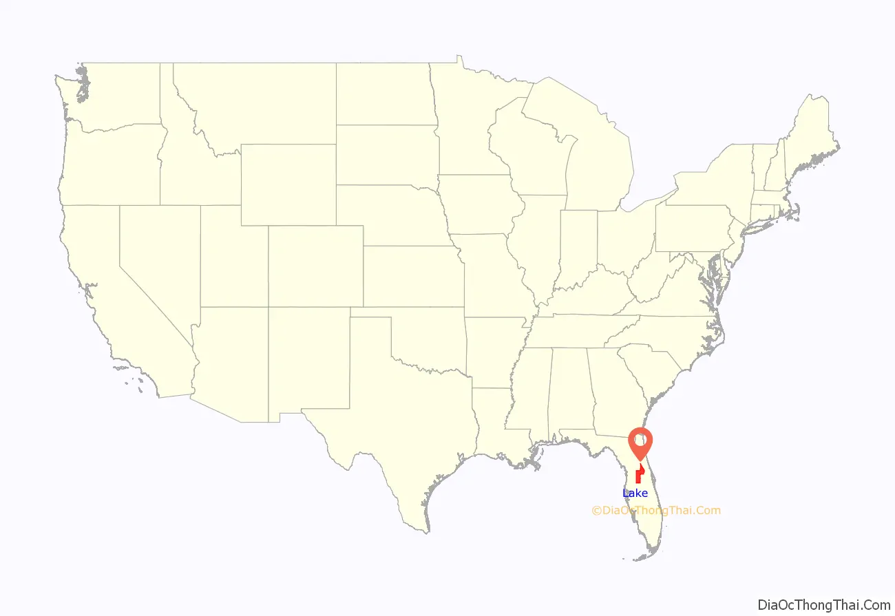
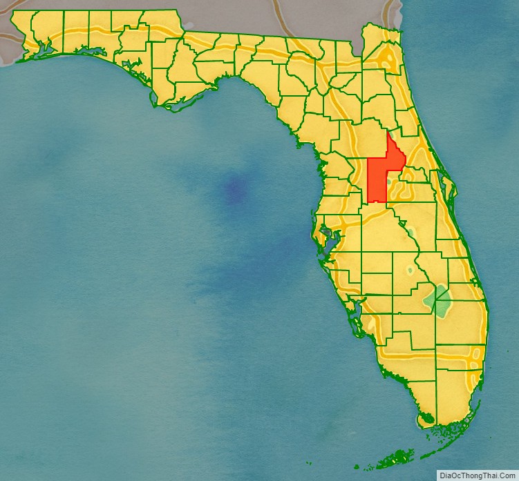
Lake County location map. Where is Lake County?
History
Lake County was created in 1887 from portions of Sumter and Orange counties. It was named for the many lakes contained within its borders (250 named lakes and 1,735 other bodies of water).
In the 1800s, the two main industries in the area were growing cotton and breeding cattle. In the latter part of the 19th century, people started to grow citrus trees. Citrus was introduced by Melton Haynes. Throughout the 1940s and 50s, citrus production increased and grew into the area’s leading industry. The December 1989 United States cold wave destroyed most of the citrus groves, dealing an economic blow from which many growers could not recover. Grove owners sold massive amounts of land to developers, resulting in increasing urban sprawl.
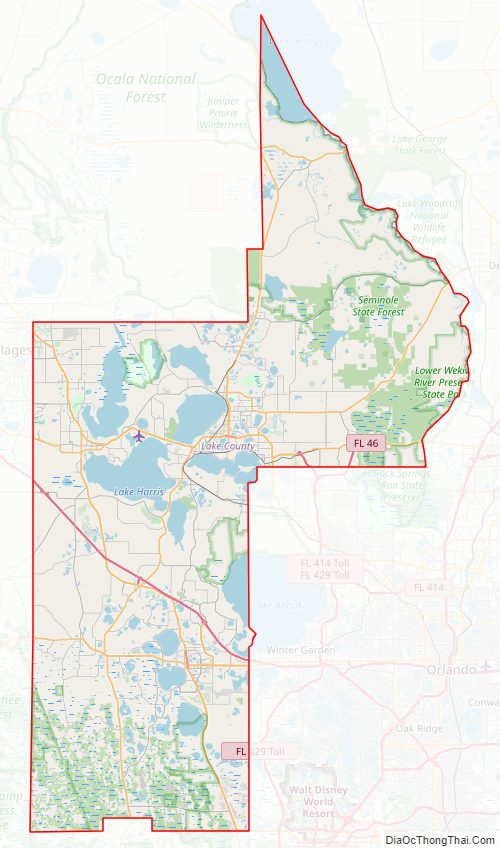
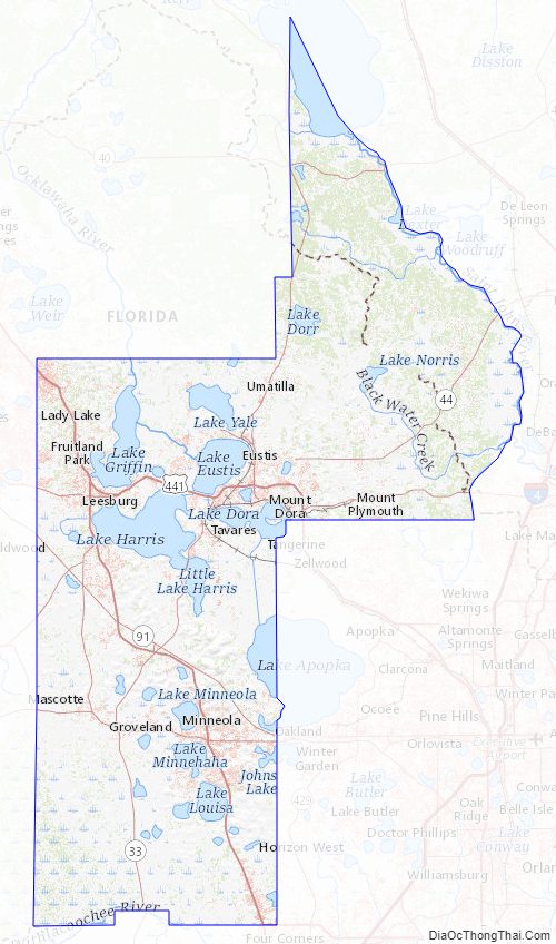
Lake County Road Map
Geography
According to the U.S. Census Bureau, the county has a total area of 1,157 square miles (3,000 km), of which 938 square miles (2,430 km) is land and 219 square miles (570 km) (18.9%) is water.
Sugarloaf Mountain is the highest point in peninsular Florida, at 312 feet (95 m) above sea level.
Adjacent counties
- Volusia County – northeast
- Orange County – east
- Seminole County – east
- Osceola County – southeast
- Polk County – south
- Sumter County – west
- Marion County – northwest
National protected areas
- Lake Woodruff National Wildlife Refuge (part)
- Ocala National Forest (part)
Lake County Topographic Map
Lake County Satellite Map

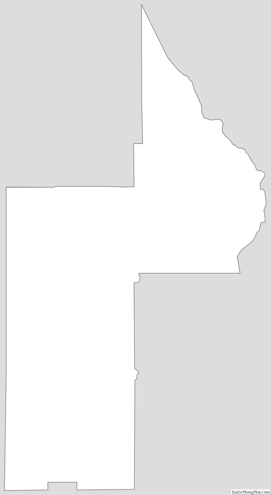
Lake County Outline Map