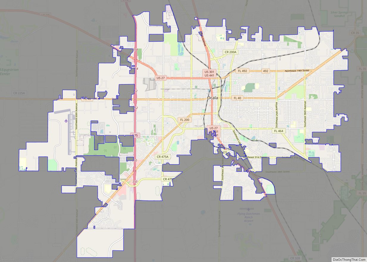
Marion County is located in the northern portion of the U.S. state of Florida. As of the 2020 census, the population was 375,908. Its county seat is Ocala.
Marion County comprises the Ocala, FL Metropolitan Statistical Area. it includes part of Ocala National Forest, which also extends into three other counties.
| Name: | Marion County |
|---|---|
| FIPS code: | 12-083 |
| State: | Florida |
| Founded: | March 14, 1844 |
| Named for: | Francis Marion |
| Seat: | Ocala |
| Largest city: | Ocala |
| Total Area: | 1,663 sq mi (4,310 km²) |
| Land Area: | 1,585 sq mi (4,110 km²) |
| Total Population: | 375,908 |
| Population Density: | 237/sq mi (92/km²) |
| Time zone: | UTC−5 (Eastern) |
| Summer Time Zone (DST): | UTC−4 (EDT) |
| Website: | www.marioncountyfl.org |
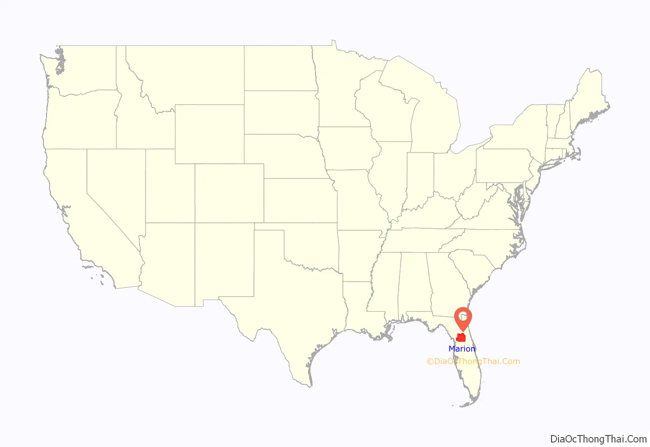
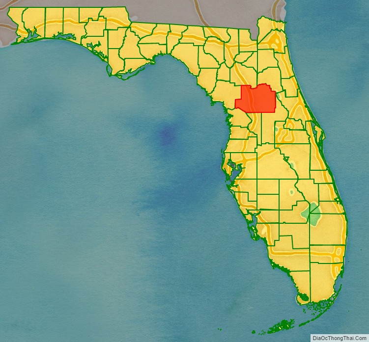
Marion County location map. Where is Marion County?
History
Native Americans
Evidence of ancient indigenous cultures has been found in Marion County, as well as of the earliest encounter between European explorers and historic indigenous peoples. In 1976, an archaeological investigation found ancient artifacts in Marion County that appear to be the oldest in mainland United States. Excavations at an ancient stone quarry (on the Container Corporation of America site (8Mf154) in Marion County) yielded “crude stone implements”. Thousands of pieces of chert were found at the site. These showed signs of extensive wear and were found in deposits below those holding Paleo-Indian artifacts. Thermoluminescence dating and weathering analysis independently gave dates of 26,000 to 28,000 Years Before Present (YBP) for the production of these artifacts, prior to Clovis points. The findings suggested human habitation in this area much earlier than documented by other evidence. Barbara Purdy had bipoint evidence from the CCA site, which also predated Clovis points, which she reported in a 2008 paper.
The county seat of Ocala, Florida, is named for a Timucuan village visited and recorded by the Spanish Hernando de Soto expedition in the sixteenth century. During the colonial period, Spain and Great Britain traded control of this area.
Settlement
After acquisition of the Florida territory by the United States in the 1820s, Marion County was created in 1844 from portions of Alachua, Mosquito (Orange), and Hillsborough counties. Until 1853, Marion County included most of what are now Lake and Sumter counties. In 1849, Putnam County was created and took the northeast portion of Marion. Levy County’s creation took some of the western portion of Marion in 1877, near the end of the Reconstruction era.
Marion County is named after General Francis Marion of South Carolina, a guerrilla fighter and hero of the American Revolutionary War who was known as the “Swamp Fox”. Numerous early settlers of this area were natives of South Carolina and likely picked their local hero as the county’s namesake. The Act creating the county of Marion of the Territory of Florida was signed on March 14, 1844, by the territorial governor, R. K. Call. The county motto is “Kingdom of the Sun.”
Civil War era
Marion County was a hotbed of secessionist activity. Organizers petitioned the state to host the Florida Secession Convention and break away from the United States with other Southern states. The area had many plantations and more than half of the population was enslaved African Americans.
Several Confederate Army units were organized by plantation owners, including the Marion Rifle Guards, organized May 2, 1861, by Captain W.L. Fletcher, county treasurer. It served as part of the Fourth Florida Infantry under Col. Edward Hopkins. Other company’s included the Hammock Guards, commanded by Captain J.S. Hopkins; Marion Dragoons, a cavalry unit organized and financed by William A. Owens, Marion Hornets, commanded by Captain Wade Eichelberger, and the Marion Light Artillery, commanded at one time by John Marshall Martin. The Civil War and its aftermath disrupted local society and strained the economy. The population declined in its wake as many African Americans moved to towns or cities for better opportunities.
Post-Reconstruction era to mid-20th century
During the post-Reconstruction period, there was considerable racial violence in Marion County. Locals lynched between 19 and 26 African Americans in the county from the 1880s to 1935.
Mid-20th century to present
Since the mid-20th century, thoroughbred horse farms have been established in the county. Such thoroughbred farms have become known for such race champions as Needles, bred at Bonnie Heath Farm, and in 1956, becoming the first Florida-bred horse to win the Kentucky Derby. In 1978 Affirmed from Harbor View Farm won the Triple Crown.
Carl G. Rose, who had come to Florida in 1916 from Indiana to oversee construction of the first asphalt road in the state, is credited with developing the first thoroughbred horse farm in 1943. As an engineer, he had become familiar with the area’s limestone, which he realized supported good pasture for raising strong horses. (Limestone also nurtures central Kentucky’s noted Bluegrass Region.) In 1943, Rose bought land along State Highway 200, at $10 per acre, establishing Rosemere Farm. The next year one of his horses, Gornil, won at Miami’s Tropical Park, becoming the first Florida-raised thoroughbred to win a Florida race. This raised the profile of Marion County in the racing world.
Close on Rose’s heels, entrepreneur Bonnie Heath set up his own thoroughbred farm, producing Needles. In 1956 the horse was the state’s first native-bred winner of the Kentucky Derby. (see further below). Bonnie Heath Farm is owned and operated by Bonnie Heath III and his wife Kim.
In 1978, Marion County-bred-and-raised Affirmed won the Triple Crown. Today, Marion County is a major world thoroughbred center with more than 1200 horse farms. There are about 900 thoroughbred farms, totaling some 77,000 acres (310 km). Ocala is well known as a “horse capital of the world.”
Tourism
The nearby community of Silver Springs developed around the Silver Springs, a group of artesian springs on the Silver River. In the 19th century, this site became Florida’s first tourist destination.
Today, well known for glass-bottom boat tours of the area, Silver Springs is owned by the State of Florida; it was incorporated into Silver Springs State Park in 2013. Other nearby natural attractions include the Ocala National Forest and the Florida Trail. Several prominent man-made attractions in the Ocala area existed in the past, such as the Western-themed Six Gun Territory theme park (operated from 1963 to 1984) and the Wild Waters water park (operated from 1978 to 2016).
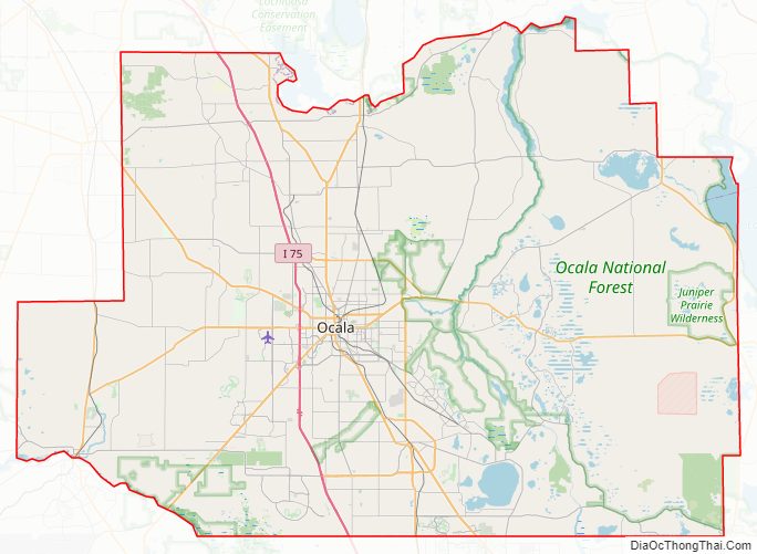
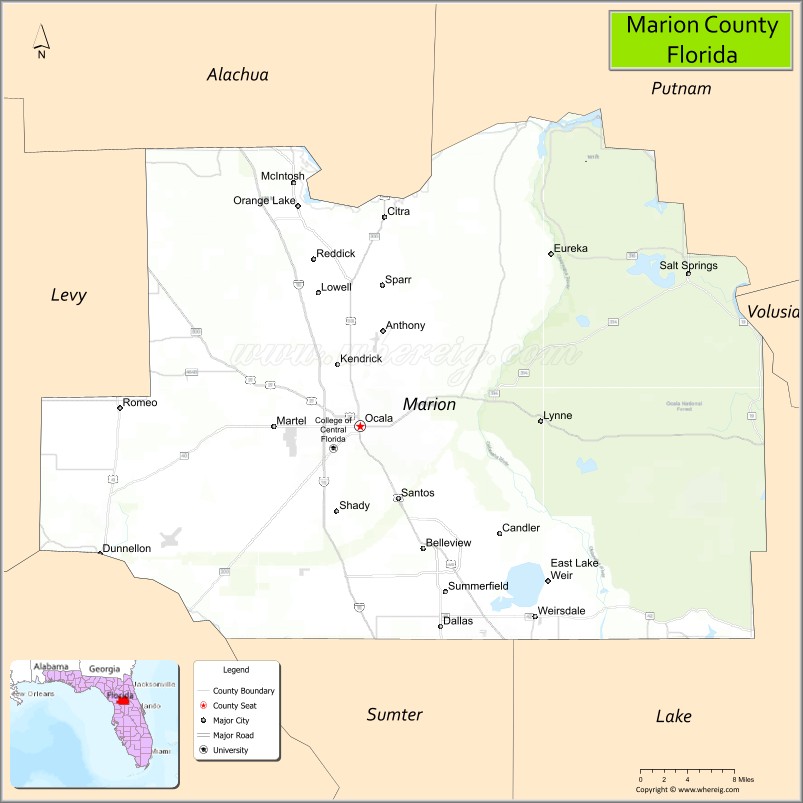
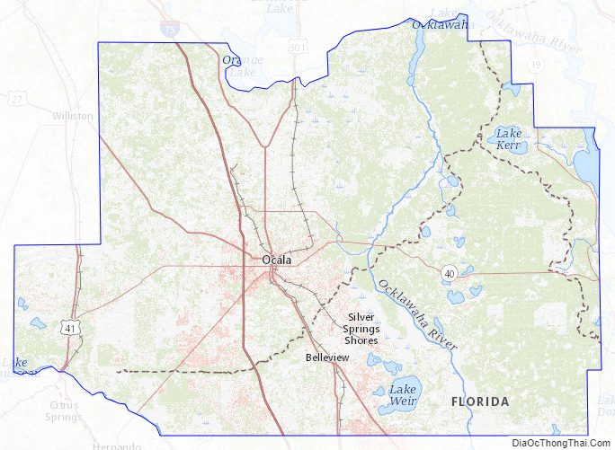
Marion County Road Map
Geography
According to the U.S. Census Bureau, the county has a total area of 4,310 sq km (1663 sq mi), of which 3,962 sq km (1585 sq mi) is land and 195 sq km (78 sq mi) (4.7%) is water.
Marion County is generally composed of rolling hills, much like most of the rest of Florida. The highest elevation is about 60 meters (200 ft). The majority of its trees consist of live oaks, pines, and palm trees.
It is about a two-hour drive from Marion County to many of Florida’s major cities; Orlando is 75 minutes to the southeast, while Daytona Beach is about 90 minutes to the east. Tampa is about 75 minutes to the southwest, Jacksonville is roughly a two-hour drive northeast, and Miami is about six hours to the southeast.
There are several significant lakes within or bordering Marion County. Orange Lake is in the far northern part of Marion County, near the border with Alachua County. Lake Kerr is in the northeastern part of the county, near the town of Salt Springs, which is near the border with Putnam County. Lake Weir, the largest of the three, is in the far southern region, near the border with Lake County. Part of Lake George is also in Marion County.
Marion County is inland, centered between the Atlantic Ocean to the east and the Gulf of Mexico to the west. Because of this, the area is generally not affected as much by hurricanes as the more coastal counties to its east and west. The largest threats from natural disasters are high winds and flooding; tornadoes are also of concern.
Adjacent counties
- Putnam County, Florida – northeast
- Volusia County, Florida – east
- Lake County, Florida – southeast
- Sumter County, Florida – south
- Citrus County, Florida – southwest
- Levy County, Florida – west
- Alachua County, Florida – northwest
National protected area
- Ocala National Forest (part)
Marion County Topographic Map
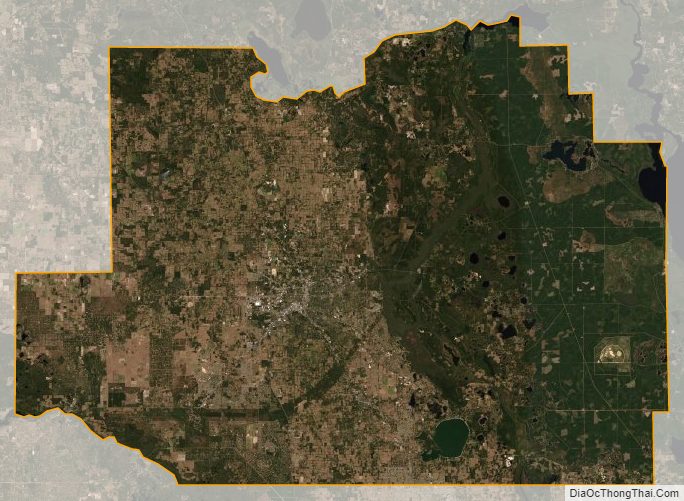
Marion County Satellite Map
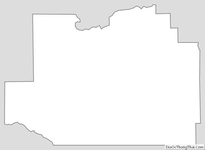
Marion County Outline Map