Orlando (/ɔːrˈlændoʊ/ or-LAN-doh) is a city in, and the county seat of Orange County, Florida, United States. Part of Central Florida, it is the center of the Orlando metropolitan area, which had a population of 2,509,831, according to the U.S. Census Bureau in 2017. It is the sixth-largest metropolitan area in the Southern United States and the third-largest metropolitan area in Florida behind Miami and Tampa Bay. Orlando had a city population of 307,573 in the 2020 census, making it the fourth-largest city in Florida behind Jacksonville, Miami, and Tampa. It is the state’s largest inland city.
Orlando is one of the most-visited cities in the world primarily due to tourism, major events, and convention traffic. In 2018, the city drew more than 75 million visitors. The Orlando International Airport is the 13th-busiest airport in the United States and the 29th-busiest in the world. The two largest and most internationally renowned tourist attractions in the Orlando area are the Walt Disney World Resort, opened by the Walt Disney Company in 1971 and located about 21 miles (34 km) southwest of downtown Orlando in Bay Lake, and the Universal Orlando Resort, opened in 1990 as a major expansion of Universal Studios Florida and the only theme park inside Orlando city limits.
With the exception of the theme parks, most major cultural sites like the Orlando Museum of Art and Dr. Phillips Center for the Performing Arts and world-renowned nightlife, bars and clubs are located in Downtown Orlando. Other attractions like the Wheel at ICON Park are located along International Drive. The city is also one of the busiest American cities for conferences and conventions. The Orange County Convention Center is the second-largest convention facility in the United States.
Like other major cities in the Sun Belt, Orlando grew rapidly from the 1960s into the first decade of the 21st century. Orlando is home to the University of Central Florida, which was the largest university campus in the United States in terms of enrollment in 2015. In 2010, Orlando was listed as a “Gamma+” level global city by the Globalization and World Cities Research Network.
| Name: | Orlando city |
|---|---|
| LSAD Code: | 25 |
| LSAD Description: | city (suffix) |
| State: | Florida |
| County: | Orange County |
| Elevation: | 89 ft (27 m) |
| Total Area: | 119.08 sq mi (308.41 km²) |
| Land Area: | 110.85 sq mi (287.10 km²) |
| Water Area: | 8.23 sq mi (21.31 km²) |
| Total Population: | 307,573 |
| Population Density: | 2,774.65/sq mi (1,071.30/km²) |
| ZIP code: | 32801-32812, 32814-32822, 32824-32837, 32839, 32853-32862, 32867-32869, 32872, 32877-32878, 32885-32887, 32891, 32896-32897, 32899 |
| FIPS code: | 1253000 |
| GNISfeature ID: | 2404443 |
| Website: | www.orlando.gov |
Explore the city of Orlando and its surrounding area with our free Orlando map collection. Get detailed maps of highways, roads, places of interest, and things to do. Print them and take this on your next visit to Orlando for a more enjoyable and productive experience. Discover the endless adventures that Orlando has to offer, from Universal Orlando, Disney World, and other theme parks and water parks, to endless activities for every traveler in your group and every budget.
Online Interactive Map
Click on ![]() to view map in "full screen" mode.
to view map in "full screen" mode.
Get closer to your destination and discover the best of Orlando’s hidden gems. From attractions to restaurants to hotels, this interactive map will help you plan the best way to enjoy your time in Orlando. Travelers of all levels can use this map to explore the best attractions, shopping, farmers’ markets, and even take a look at what Orlando has to offer in terms of recreational activities.
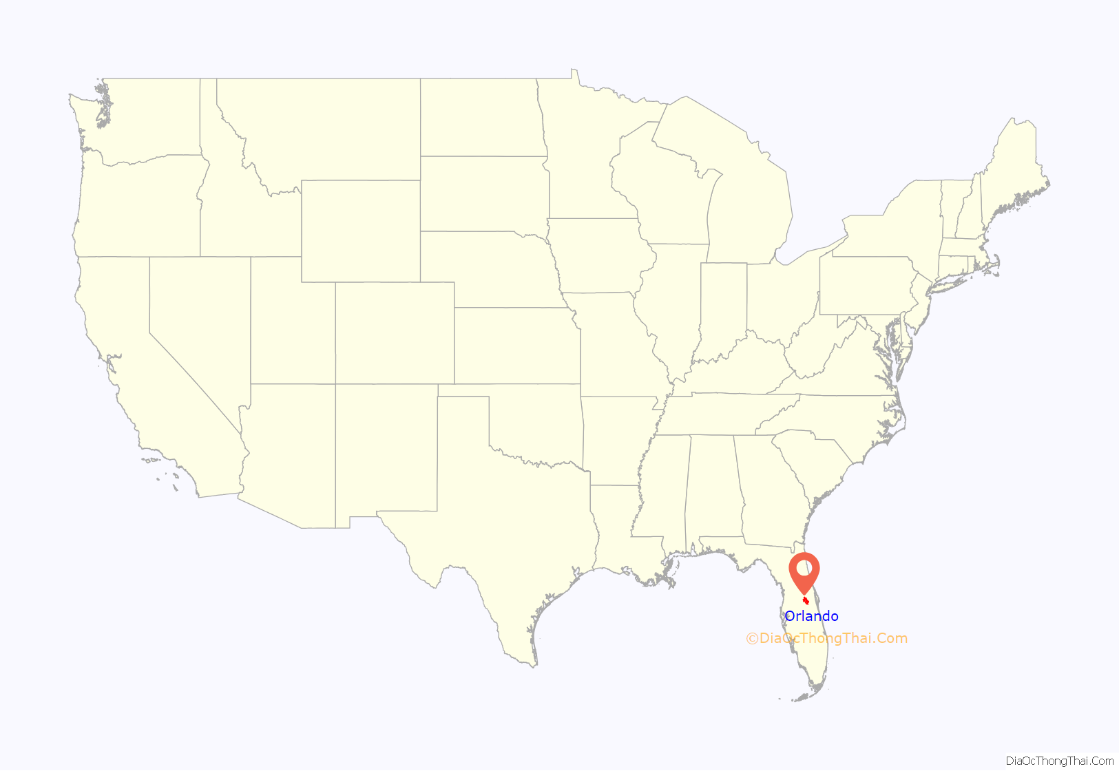
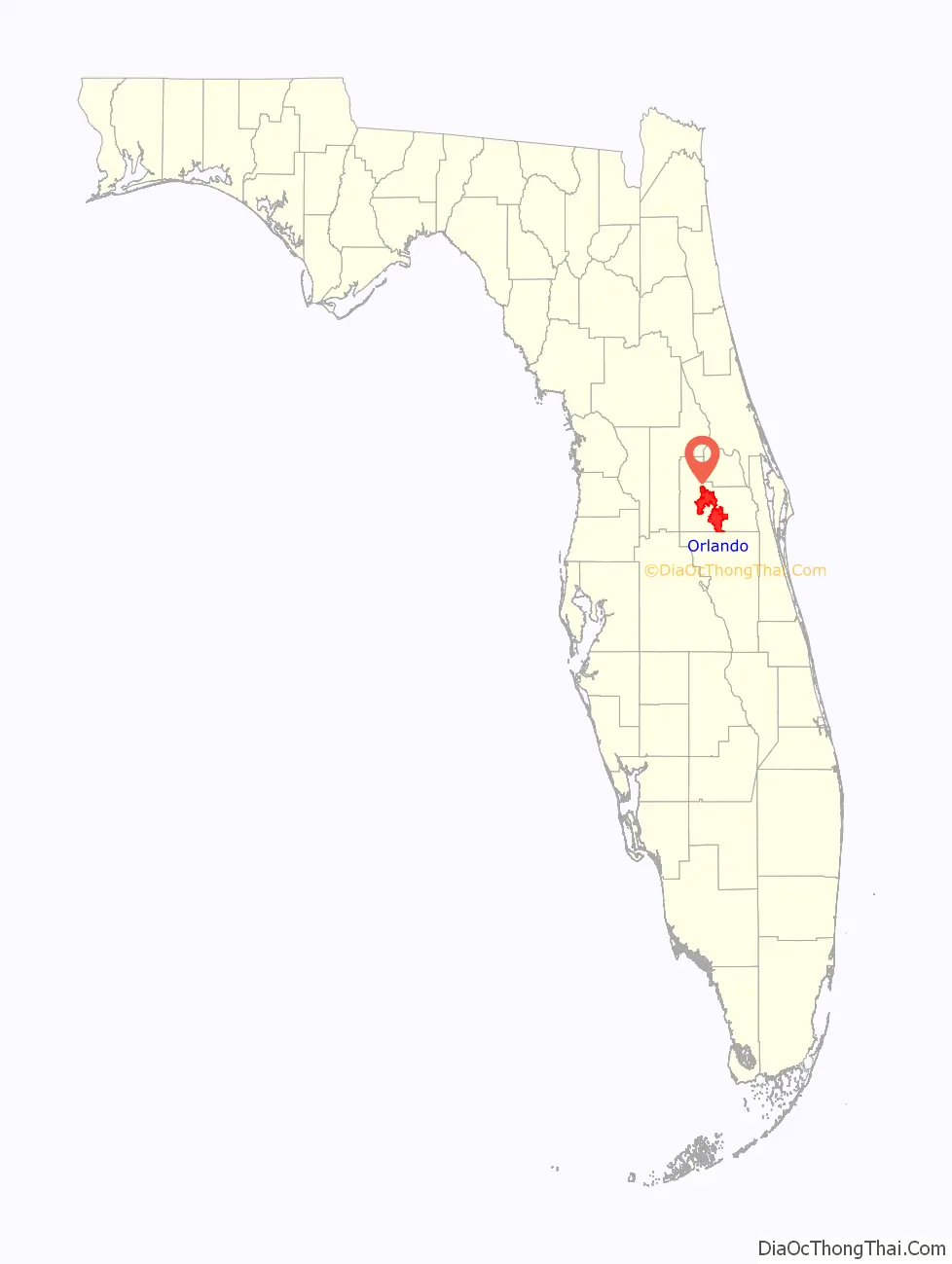
Orlando location map. Where is Orlando city?
History
Settlement
In 1823, the Treaty of Moultrie Creek created a Seminole reservation encompassing much of central Florida, including the area that would become Orlando. The Indian Removal Act of 1830 authorized relocation of the Seminole from Florida to Oklahoma, leading to the Second Seminole War. In 1842, white settlement in the area was encouraged by the Armed Occupation Act. The first settler, Mr. Aaron Jernigan of Camden County, Georgia, arrived the following year and settled near Lake Holden.
Mosquito County was renamed Orange County in 1845, with the county seat shortly thereafter relocated to Mellonville, a few miles west of Sanford. By 1856, settlement had begun in earnest in the interior of the county and a more centrally-located Courthouse was sought. The new town of Orlando, laid out in 1857, consisted of four streets surrounding a courthouse square. The fledgling village suffered greatly during the Union blockade. The Reconstruction Era brought on a population explosion, resulting in the incorporation of the Town of Orlando on July 31, 1875, with 85 residents (22 voters). For a short time in 1879, the town revoked its charter, and was subsequently reincorporated. Orlando was established as a city in 1885.
The period from 1875 to 1895 is remembered as Orlando’s Golden Era, when it became the hub of Florida’s citrus industry. The period ended with the Great Freeze of 1894–95, which forced many owners to give up their independent citrus groves, thus consolidating holdings in the hands of a few “citrus barons”, who shifted operations south, primarily around Lake Wales in Polk County. The freeze caused many in Florida, including many Orlandoans, to move elsewhere, mostly to the North, California, or the Caribbean.
Notable homesteaders in the area included the Curry family. Through their property in east Orlando flowed the Econlockhatchee River, which travelers crossed by fording. This was commemorated by the street’s name, Curry Ford Road. Also, just south of the Orlando International Airport in the Boggy Creek area are 150 acres (0.61 km) of property homesteaded in the late 19th century by the Ward family. This property is still owned by the Ward family, and can be seen from southbound flights out of Orlando International Airport immediately on the south side of SR 417.
Post–Industrial Revolution
Orlando became a popular resort during the years between the Spanish–American War and World War I. In the 1920s, Orlando experienced extensive housing development during the Florida Land Boom, causing land prices to soar. During this period, dozens of neighborhoods in the vicinity of downtown were constructed. The boom ended when several hurricanes hit Florida in the late 1920s, along with the Great Depression.
During World War II, a number of Army personnel were stationed at the Orlando Army Air Base and nearby Pinecastle Army Air Field. Some of these servicemen stayed in Orlando to settle and raise families. In 1956, the aerospace and defense company Martin Marietta (now Lockheed Martin) established a plant in the city. Orlando AAB and Pinecastle AAF were transferred to the United States Air Force in 1947 when it became a separate service and were redesignated as air force bases (AFB). In 1958, Pinecastle AFB was renamed McCoy Air Force Base after Colonel Michael N. W. McCoy, a former commander of the 320th Bombardment Wing at the installation, killed in the crash of a B-47 Stratojet bomber north of Orlando. In the 1960s, the base subsequently became home to the 306th Bombardment Wing of the Strategic Air Command, operating B-52 Stratofortress and KC-135 Stratotanker aircraft, in addition to detachment operations by EC-121 and U-2 aircraft.
In 1968, Orlando AFB was transferred to the United States Navy and became Naval Training Center Orlando. In addition to boot camp facilities, the NTC Orlando was home of one of two Navy Nuclear Power Schools, and home of the Naval Air Warfare Center Training Systems Division. When McCoy AFB closed in 1976, its runways and territory to its south and east were imparted to the city to become Orlando International Airport, while a small portion to the northwest was transferred to the Navy as McCoy NTC Annex. That closed in 1995, and became a housing, though the former McCoy AFB still hosts a Navy Exchange, as well as national guard and reserve units for several branches of service. NTC Orlando was completely closed by the end of 1999 by the Base Realignment and Closure Commission, and converted into the Baldwin Park neighborhood. The Naval Air Warfare Center had moved to Central Florida Research Park near UCF in 1989.
Tourism in history
Perhaps the most critical event for Orlando’s economy occurred in 1965 when Walt Disney announced plans to build Walt Disney World. Although Disney had considered the regions of Miami and Tampa for his park, one of the major reasons behind his decision not to locate there was due to hurricanes – Orlando’s inland location, although not free from hurricane damage, exposed it to less threat than coastal regions. The vacation resort opened in October 1971, ushering in an explosive population and economic growth for the Orlando metropolitan area, which now encompasses Orange, Seminole, Osceola, and Lake Counties. As a result, tourism became the centerpiece of the area’s economy. Orlando now has more theme parks and entertainment attractions than anywhere else in the world.
Another major factor in Orlando’s growth occurred in 1962, when the new Orlando Jetport, the precursor of the present-day Orlando International Airport, was built from a portion of the McCoy Air Force Base. By 1970, four major airlines (Delta Air Lines, National Airlines, Eastern Airlines, and Southern Airways) were providing scheduled flights. McCoy Air Force Base officially closed in 1975, and most of it is now part of the airport. The airport still retains the former Air Force Base airport code (MCO).
21st century
Today, the historic core of “Old Orlando” resides in downtown Orlando along Church Street, between Orange Avenue and Garland Avenue. The urban development and the central business district of downtown have rapidly shaped the downtown skyline during recent history. The present-day historic district is primarily associated with the neighborhoods around Lake Eola but stretches west across the city to Lake Lorna Dune and north into the College Park Neighborhood where you can find century-old oaks line brick streets. These neighborhoods include the “Downtown Business District,” “North Quarter,” “Parramore,” “Callahan,” “South Eola Heights, “Lake Eola Heights,”Thornton Park” and “College Park”, and contain some of the oldest homes in Orlando.
On June 12, 2016, more than 100 people were shot at Pulse, a gay nightclub in Orlando. Fifty (including the gunman) were killed and 60 were wounded. The gunman, whom the police SWAT team shot to death, was identified as 29-year-old Omar Mir Seddique Mateen, an American security guard. The act of terrorism was both the deadliest mass shooting in modern United States history at the time and one of the deadliest mass shootings perpetrated by a single person in recorded world history. Mateen pledged allegiance to the Islamic State during his unsuccessful negotiations with police. After the shooting, the city held numerous vigils. In November 2016, Orlando mayor Buddy Dyer announced the city’s intention to acquire the Pulse Nightclub to build a permanent memorial for the 49 victims of the shooting. The city offered to buy it for $2.25 million, but the club’s owner declined to sell.
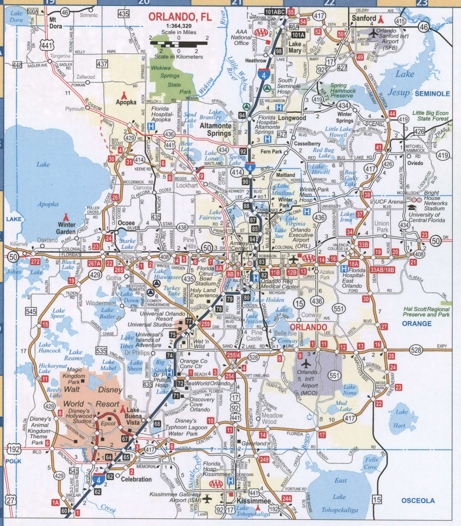
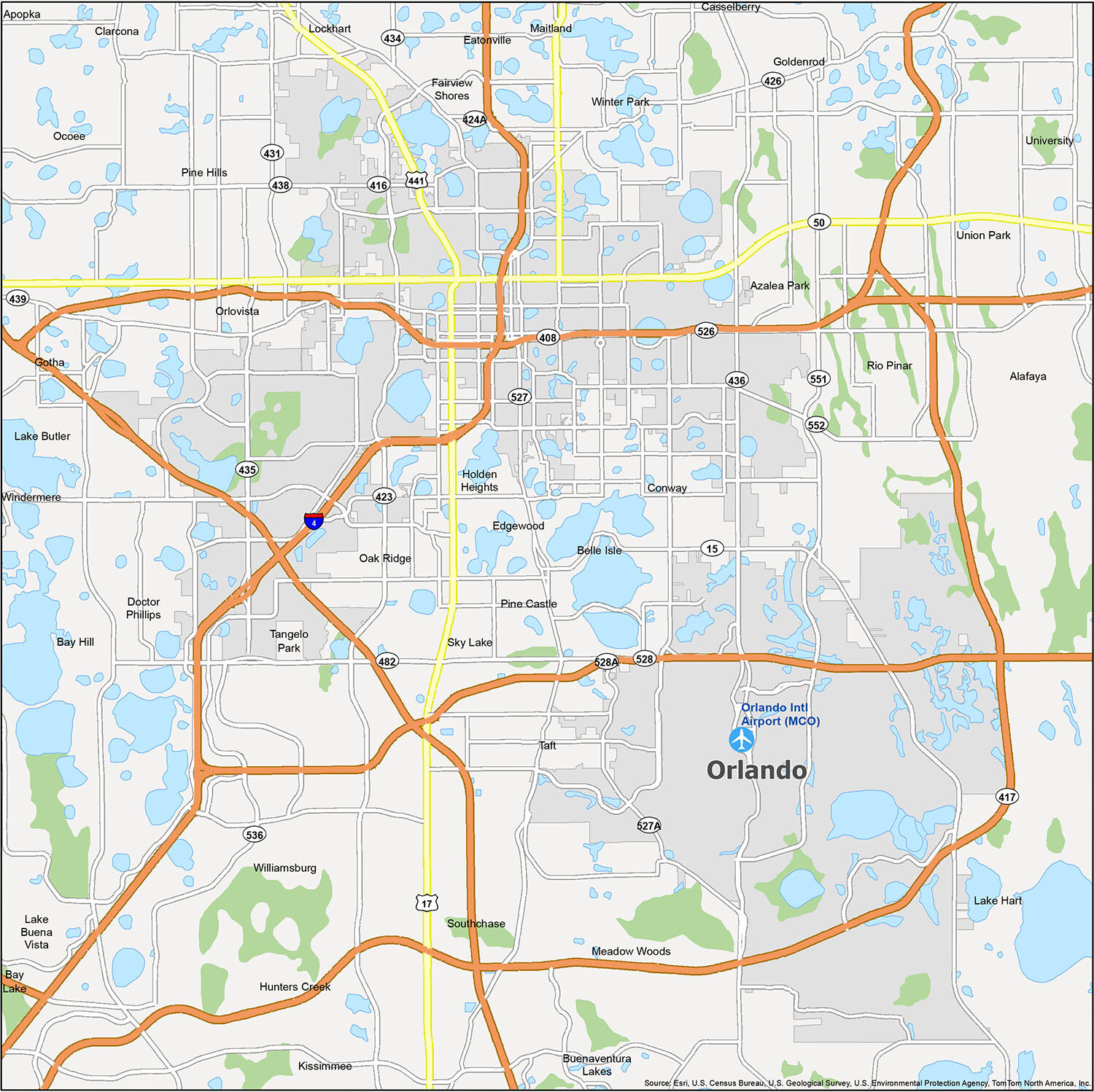
Orlando Road Map
With this road map in hand, you can explore the best that Orlando has to offer. You can print it out to help you guide your way through the city. With information about interstate highways, US highways, parkways, and major roads, you will have a handy guide to help you navigate the city. Plus, you can easily plan your trip and find places to visit in Orlando and the surrounding area. For any travel outside the city, you can find a road map of Florida with highways and major roads.
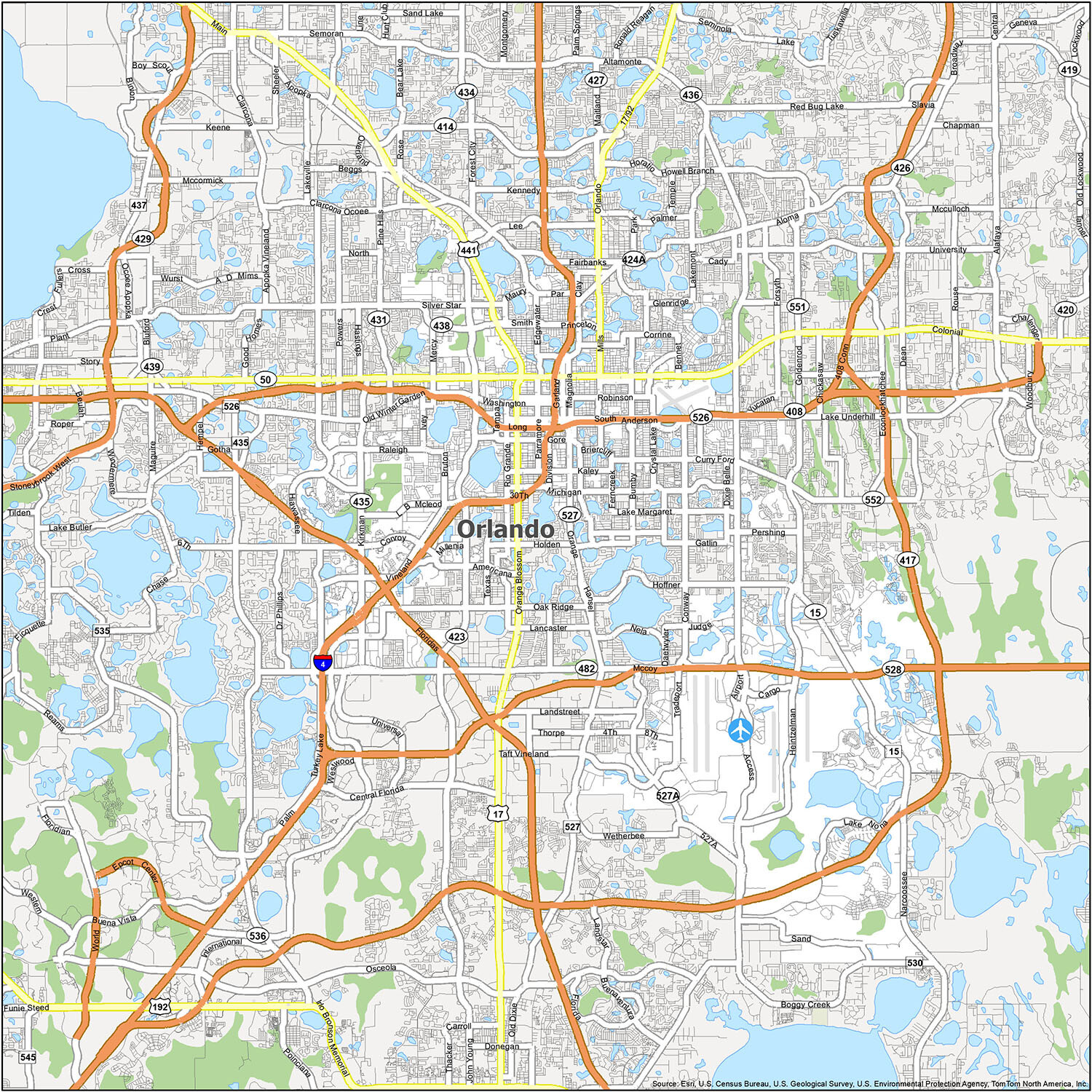
Orlando, the city of endless fun and adventure, is home to one of the most popular attractions in the world: Walt Disney World. However, there’s much more to discover beyond the theme parks. This reference map features the best lakes, populated areas, and other points of interest to help you explore all the wonders of Orlando, Florida.
Airports: Orlando International Airport (MCO)
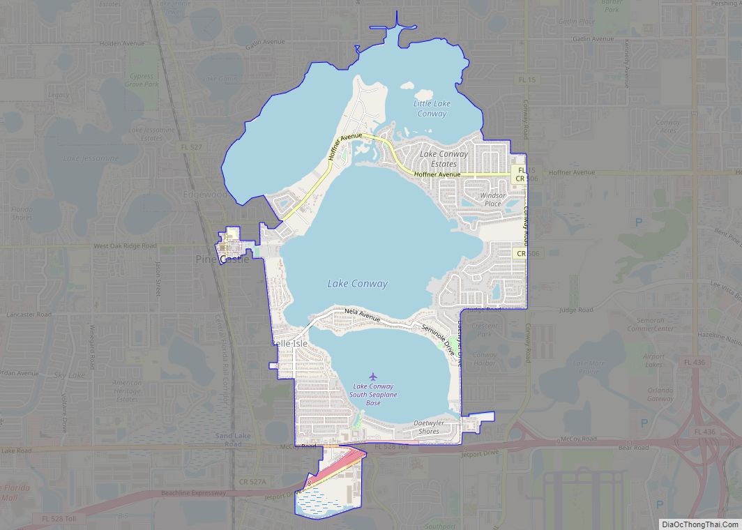
Cities: Altamonte Springs, Apopka, Bay Lake, Belle Isle, Casselberry, Edgewood, Kissimmee, Lake Buena Vista, Longwood, Maitland, Ocoee, Orlando, Oviedo, Winter Garden, Winter Park, Winter Springs
Towns: Eatonville, Windermere
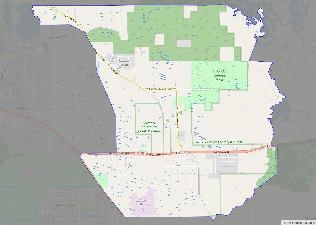
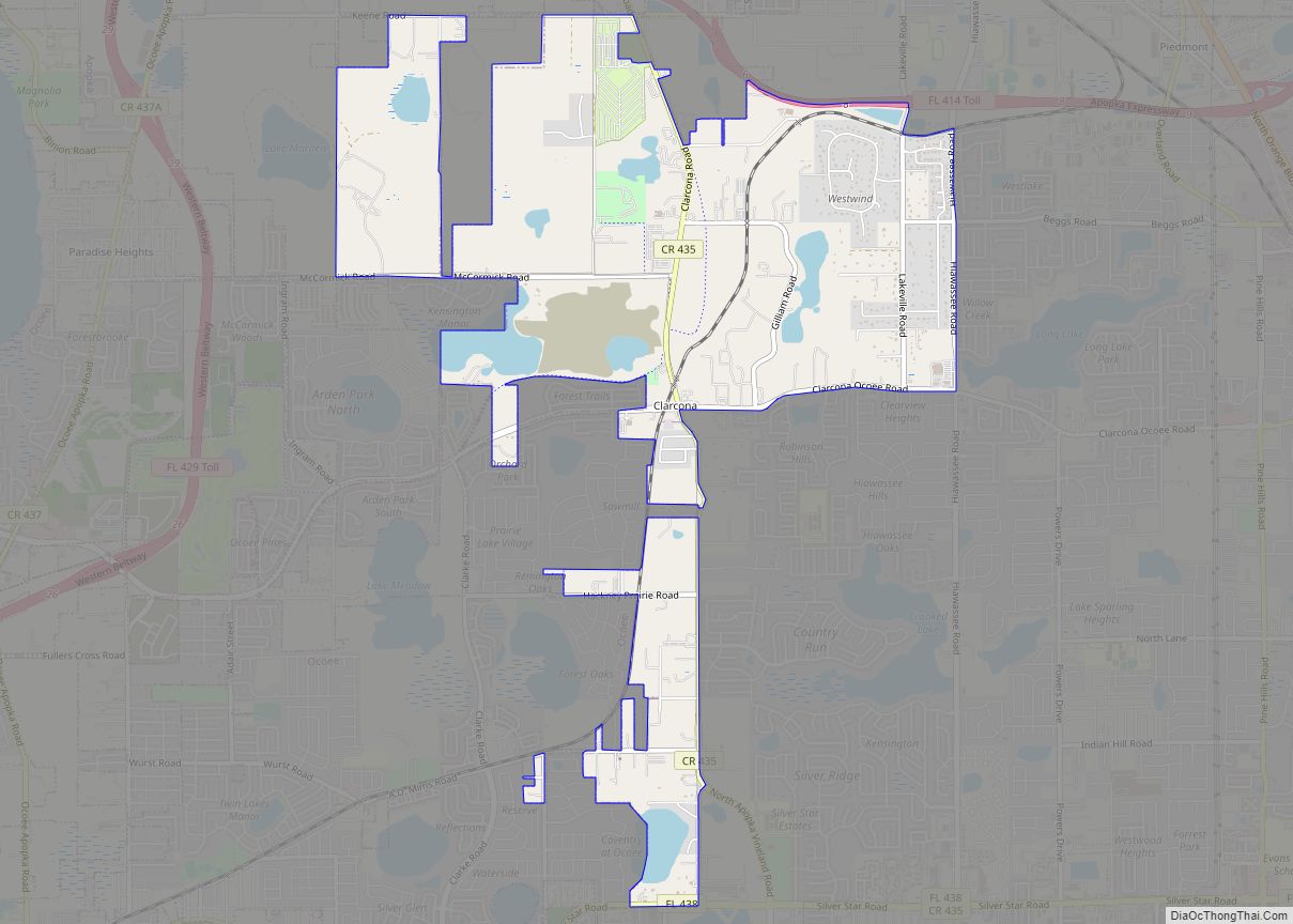
Census-designated place (CDP): Alafaya, Azalea Park, Bay Hill, Black Hammock, Buenaventura Lakes, Celebration, Clarcona, Conway, Doctor Phillips, Fairview Shores, Fern Park, Forest City, Four Corners, Goldenrod, Gotha, Holden Heights, Horizon West, Hunters Creek, Lake Butler, Lake Hart, Lake Mary Jane, Lockhart, Meadow Woods, Oak Ridge, Orlovista, Paradise Heights, Pine Castle, Pine Hills, Rio Pinar, Sky Lake, South Apopka, Southchase, Taft, Tangelo Park, Tildenville, Union Park, University, Wekiwa Springs, Williamsburg
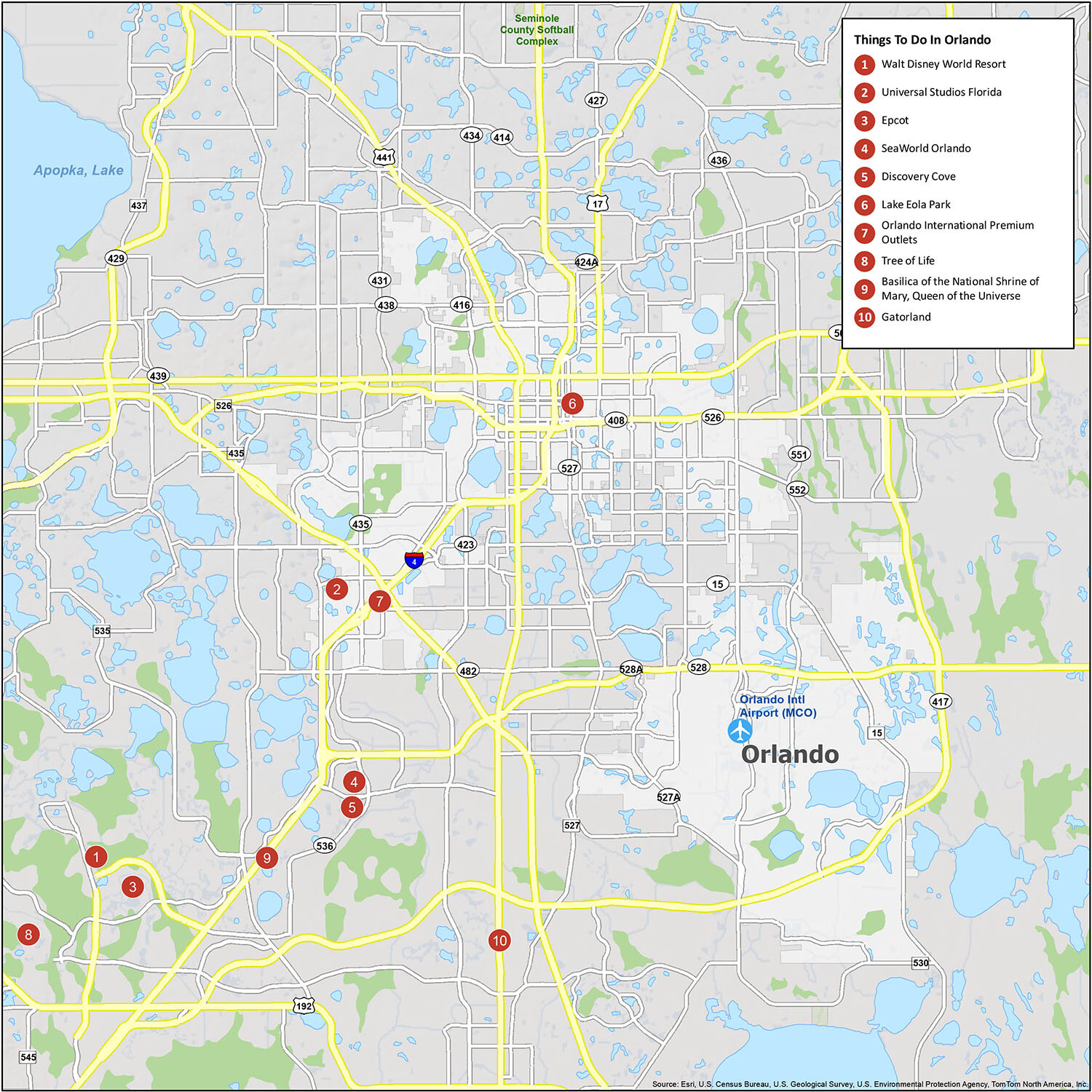
10 things to do in Orlando city
Get closer to your destination and discover the best of Orlando’s hidden gems. From attractions to restaurants to hotels, this interactive map will help you plan the best way to enjoy your time in Orlando. Travelers of all levels can use this map to explore the best attractions, shopping, farmers’ markets, and even take a look at what Orlando has to offer in terms of recreational activities.
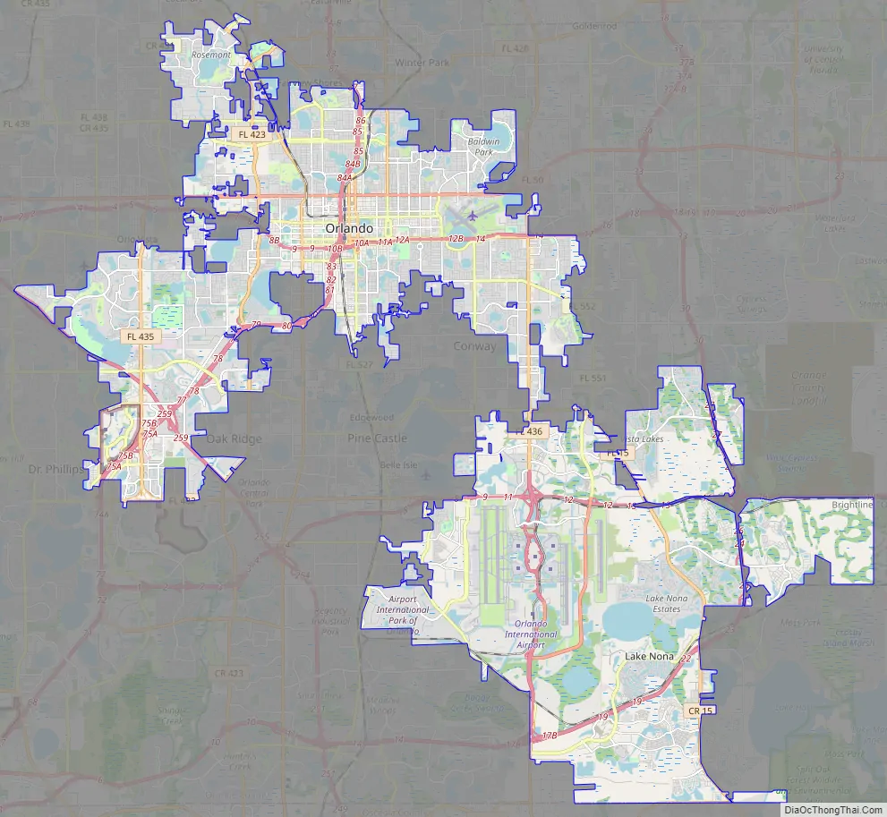
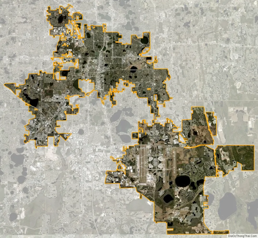
Orlando city Satellite Map
Geography
The geography of Orlando is mostly wetlands, consisting of many lakes and swamps. The terrain is generally flat, making the land fairly low and wet. The area is dotted with hundreds of lakes, the largest of which is Lake Apopka. Central Florida’s bedrock is mostly limestone and very porous; the Orlando area is susceptible to sinkholes. Probably the most famous incident involving a sinkhole happened in 1981 in Winter Park, a city immediately north of downtown Orlando, dubbed “The Winter Park Sinkhole”.
There are 115 neighborhoods within the city limits and many unincorporated communities. Orlando’s city limits resemble a checkerboard, with pockets of unincorporated Orange County surrounded by city limits. Such an arrangement results in some areas being served by both Orange County and the City of Orlando. This also explains Orlando’s relatively low city population when compared to its metropolitan population. The city and county are working together in an effort to “round-out” the city limits with Orlando annexing portions of land already bordering the city limits.
Skyscrapers
Metro Orlando has a total of 19 completed skyscrapers. The majority are located in downtown Orlando and the rest are located in the tourist district southwest of downtown. Skyscrapers built in downtown Orlando have not exceeded 441 ft (134 m), since 1988, when the SunTrust Center was completed. The main reason for this is the Orlando Executive Airport, just under 2 miles (3.2 km) from the city center, which does not allow buildings to exceed a certain height without approval from the FAA.
- 200 South Orange, 1988, 441 ft (134 m), formerly SunTrust Center it’s the tallest skyscraper in Greater Orlando
- The Vue at Lake Eola, 2008, 426 ft (130 m)
- Orange County Courthouse, 1997, 416 ft (127 m)
- Bank of America Center, 1988, 409 ft (125 m)
- 55 West on the Esplanade, 2009, 377 ft (115 m)
- Solaire at the Plaza, 2006, 359 ft (109 m)
- Church Street Plaza Tower 1, 2019, 315 ft (96 m)
- Dynetech Center, 2009, 357 ft (109 m)
- Regions Bank Tower, 1986, 292 ft (89 m)
- Premiere Trade Plaza Office Tower II 2006, 277 ft (84 m)
- Citrus Center, 1971, 281 ft (85 m)
- Citi Tower, 2017, 275 ft (83 m)
- SkyHouse Orlando, 2013, 262 ft (80 m)
- Modera Central, 2018, 260 ft (76 m)
- The Waverly on Lake Eola, 2001, 280 ft (85 m)
- Hyatt Regency Orlando, 2010, 428 ft (130 m)
- SeaWorld SkyTower, 400 ft (122 m)
- The Wheel at ICON Park, 2015, 400 ft (122 m)
- Orlando International Airport’s ATC tower, 2002, 346 ft (105 m)
- StarFlyer Orlando on International Drive, 2018, 450 ft (137 m)
Climate
According to the Köppen climate classification, Orlando has a humid subtropical climate (Cfa) like much of the deep Southern United States. The two basic seasons in Orlando are a hot and rainy season, lasting from May until late October (roughly coinciding with the Atlantic hurricane season), and a warm and dry season from November through April. The area’s warm and humid climate is caused primarily by its low elevation, its position relatively close to the Tropic of Cancer, and its location in the center of a peninsula. Many characteristics of its climate are a result of its proximity to the Gulf Stream, which flows around the peninsula of Florida.
During the height of Orlando’s humid summer season, high temperatures are typically in the low 90s °F (32–34 °C), while low temperatures rarely fall below the low 70s °F (22–24 °C). The average window for 90 °F (32 °C) temperatures is April 9 to October 14. The area’s humidity acts as a buffer, usually preventing actual temperatures from exceeding 100 °F (38 °C), but also pushing the heat index to over 110 °F (43 °C). The city’s highest recorded temperature is 103 °F (39 °C), set on September 8, 1921. During these months, strong afternoon thunderstorms occur almost daily. These storms are caused by air masses from the Gulf of Mexico and the Atlantic Ocean colliding over Central Florida. They are highlighted by spectacular lightning and can also bring heavy rain (sometimes several inches per hour) and powerful winds as well as rare damaging hail.
During the winter, humidity is much lower and temperatures are more moderate, and can fluctuate more readily. The monthly daily average temperature in January is 60.6 °F (15.9 °C). Temperatures dip below the freezing mark on an average of only 1.6 nights per year and the lowest recorded temperature is 18 °F (−8 °C), set on December 28, 1894. The annual mean minimum is just above 30 °F (−1 °C) putting Orlando in hardiness zone 10a. Because the winter season is dry and freezing temperatures usually occur only after cold fronts (and their accompanying precipitation) have passed, snow is exceptionally rare. The only accumulation ever to occur in the city proper since record keeping began was in 1948, although some accumulation occurred in surrounding areas in a snow event in January 1977 that reached Miami. Flurries have also been observed in 1989, 2006, and 2010.
The average annual rainfall in Orlando is 51.45 inches (1,307 mm), a majority of which occurs in the period from June to September. October through May are Orlando’s dry season. During this period (especially in its later months), often a wildfire hazard exists. During some years, fires have been severe. In 1998, a strong El Niño caused an unusually wet January and February, followed by drought throughout the spring and early summer, causing a record wildfire season that created numerous air-quality alerts in Orlando and severely affected normal daily life, including the postponement of that year’s Pepsi 400 NASCAR race in nearby Daytona Beach.
Orlando is a major population center and has a considerable hurricane risk, although it is not as high as in South Florida’s urban corridor or other coastal regions. Since the city is located 42 miles (68 km) inland from the Atlantic and 77 miles (124 km) inland from the Gulf of Mexico, hurricanes usually weaken before arriving. Storm surges are not a concern since the region is 100 feet (30 m) above mean sea level. Despite its location, the city does see strong hurricanes. During the notorious 2004 hurricane season, Orlando was hit by three hurricanes that caused significant damage, with Hurricane Charley the worst of these. The city also experienced widespread damage during Hurricane Donna in 1960.
Tornadoes are not usually connected with the strong thunderstorms of the humid summer. They are more common during the infrequent cold days of winter, as well as in passing hurricanes. The two worst major outbreaks in the area’s history, a 1998 outbreak that killed 42 people and a 2007 outbreak that killed 21, both happened in February.
See also
Map of Florida State and its subdivision:- Alachua
- Baker
- Bay
- Bradford
- Brevard
- Broward
- Calhoun
- Charlotte
- Citrus
- Clay
- Collier
- Columbia
- Desoto
- Dixie
- Duval
- Escambia
- Flagler
- Franklin
- Gadsden
- Gilchrist
- Glades
- Gulf
- Hamilton
- Hardee
- Hendry
- Hernando
- Highlands
- Hillsborough
- Holmes
- Indian River
- Jackson
- Jefferson
- Lafayette
- Lake
- Lee
- Leon
- Levy
- Liberty
- Madison
- Manatee
- Marion
- Martin
- Miami-Dade
- Monroe
- Nassau
- Okaloosa
- Okeechobee
- Orange
- Osceola
- Palm Beach
- Pasco
- Pinellas
- Polk
- Putnam
- Saint Johns
- Saint Lucie
- Santa Rosa
- Sarasota
- Seminole
- Sumter
- Suwannee
- Taylor
- Union
- Volusia
- Wakulla
- Walton
- Washington
- Alabama
- Alaska
- Arizona
- Arkansas
- California
- Colorado
- Connecticut
- Delaware
- District of Columbia
- Florida
- Georgia
- Hawaii
- Idaho
- Illinois
- Indiana
- Iowa
- Kansas
- Kentucky
- Louisiana
- Maine
- Maryland
- Massachusetts
- Michigan
- Minnesota
- Mississippi
- Missouri
- Montana
- Nebraska
- Nevada
- New Hampshire
- New Jersey
- New Mexico
- New York
- North Carolina
- North Dakota
- Ohio
- Oklahoma
- Oregon
- Pennsylvania
- Rhode Island
- South Carolina
- South Dakota
- Tennessee
- Texas
- Utah
- Vermont
- Virginia
- Washington
- West Virginia
- Wisconsin
- Wyoming