| Name: | Logan County |
|---|---|
| FIPS code: | 20-109 |
| State: | Kansas |
| Founded: | February 24, 1887 |
| Named for: | John A. Logan |
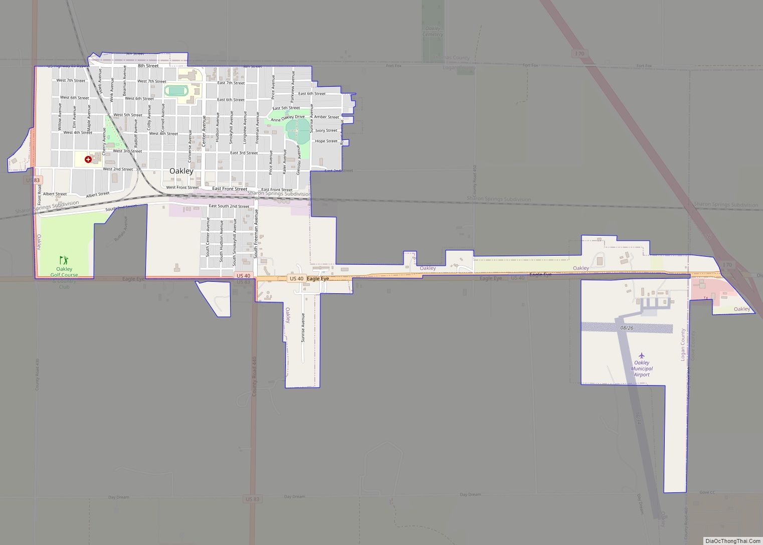
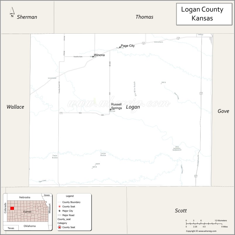
| Seat: | Oakley |
| Largest city: | Oakley |
| Total Area: | 1,073 sq mi (2,780 km²) |
| Land Area: | 1,073 sq mi (2,780 km²) |
| Total Population: | 2,762 |
| Population Density: | 2.6/sq mi (1.0/km²) |
| Time zone: | UTC−6 (Central) |
| Summer Time Zone (DST): | UTC−5 (CDT) |
| Website: | discoveroakley.com |
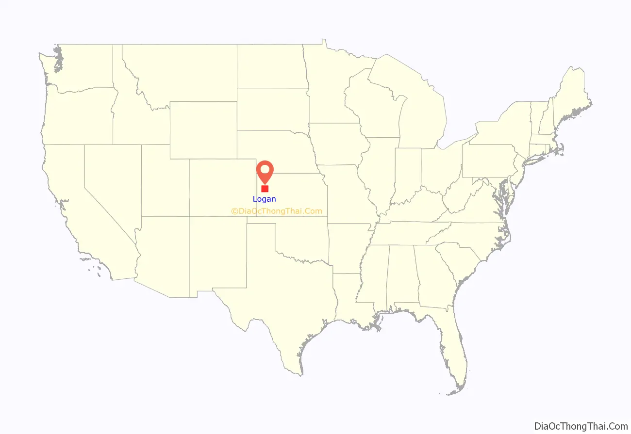
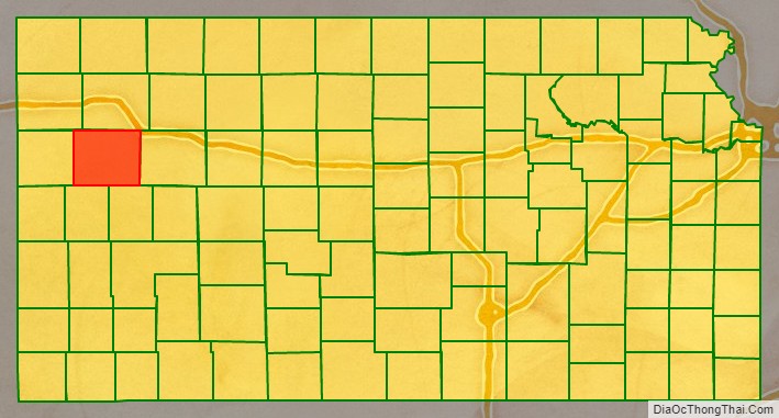
Logan County location map. Where is Logan County?
History
Early history
For many millennia, the Great Plains of North America was inhabited by nomadic Native Americans. From the 16th century to 18th century, the Kingdom of France claimed ownership of large parts of North America. In 1762, after the French and Indian War, France secretly ceded New France to Spain, per the Treaty of Fontainebleau.
19th century
In 1802, Spain returned most of the land to France, but keeping title to about 7,500 square miles. In 1803, most of the land for modern day Kansas was acquired by the United States from France as part of the 828,000 square mile Louisiana Purchase for 2.83 cents per acre.
In 1854, the Kansas Territory was organized, then in 1861 Kansas became the 34th U.S. state. In 1887, Logan County was established.
Logan County was first created in 1871 as St. John County. St. John was formed from the area to the east of range 38 in what was then part of Wallace County. The Kansas State Legislature changed the name from St. John to Logan in 1885.
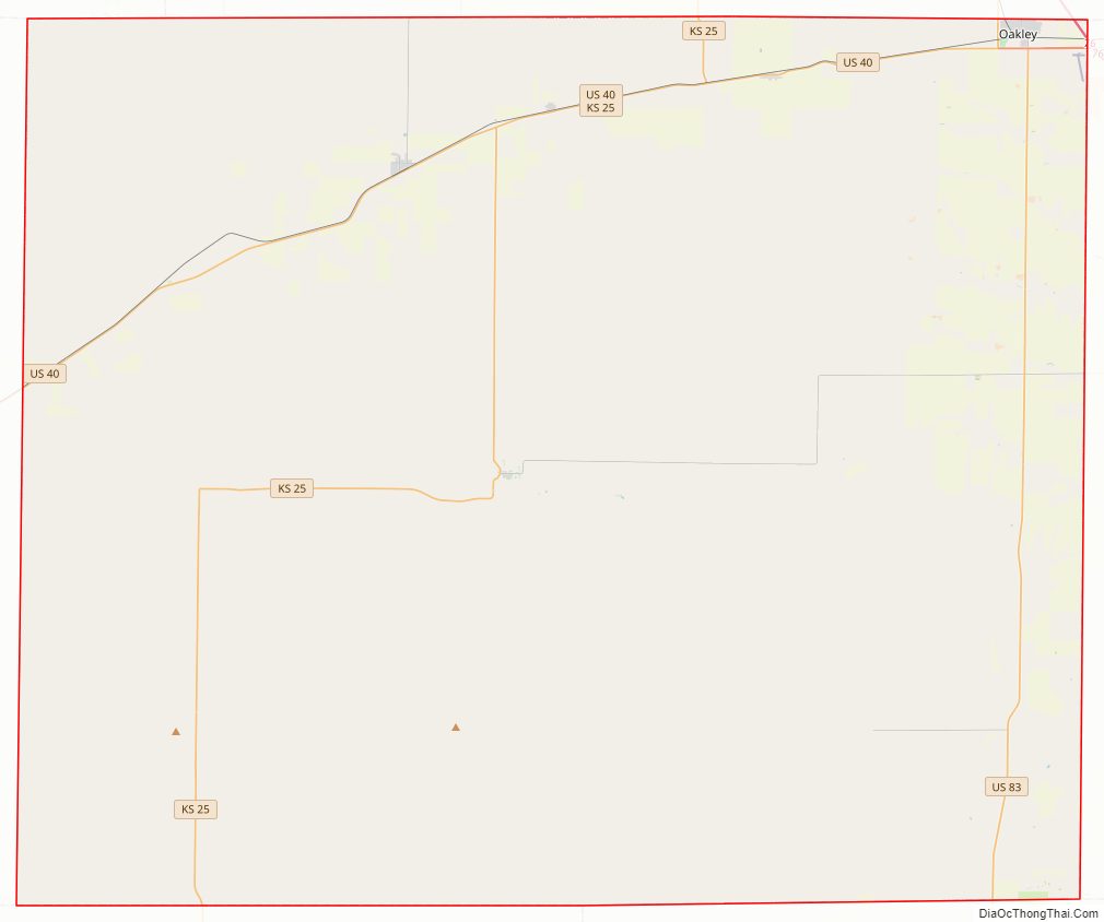
Logan County Road Map
Geography
According to the U.S. Census Bureau, the county has a total area of 1,073 square miles (2,780 km), of which 1,073 square miles (2,780 km) is land and 0.1 square miles (0.26 km) (0.01%) is water.
Major highways
- Kansas Highway 25
- U.S. Highway 40
- U.S. Highway 83
- Interstate 70
Adjacent counties
- Thomas County (north)
- Gove County (east)
- Scott County (southeast)
- Wichita County (south)
- Wallace County (west/Mountain Time border)
- Sherman County (northwest/Mountain Time border)
Logan County Topographic Map
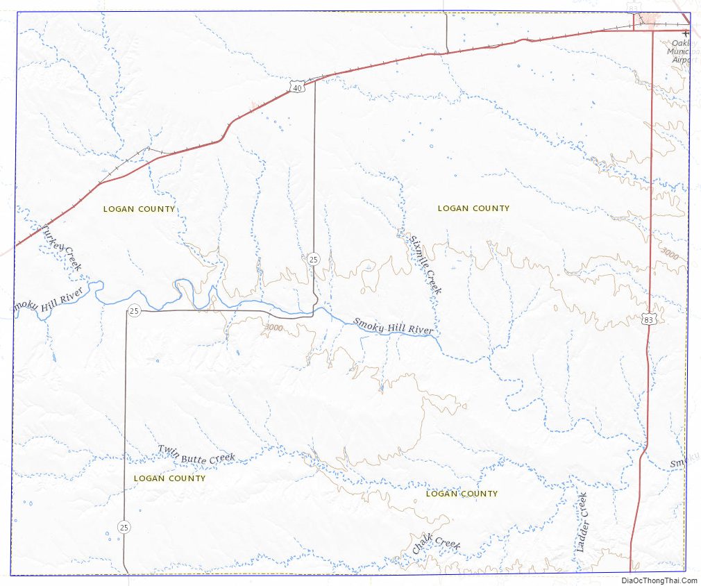
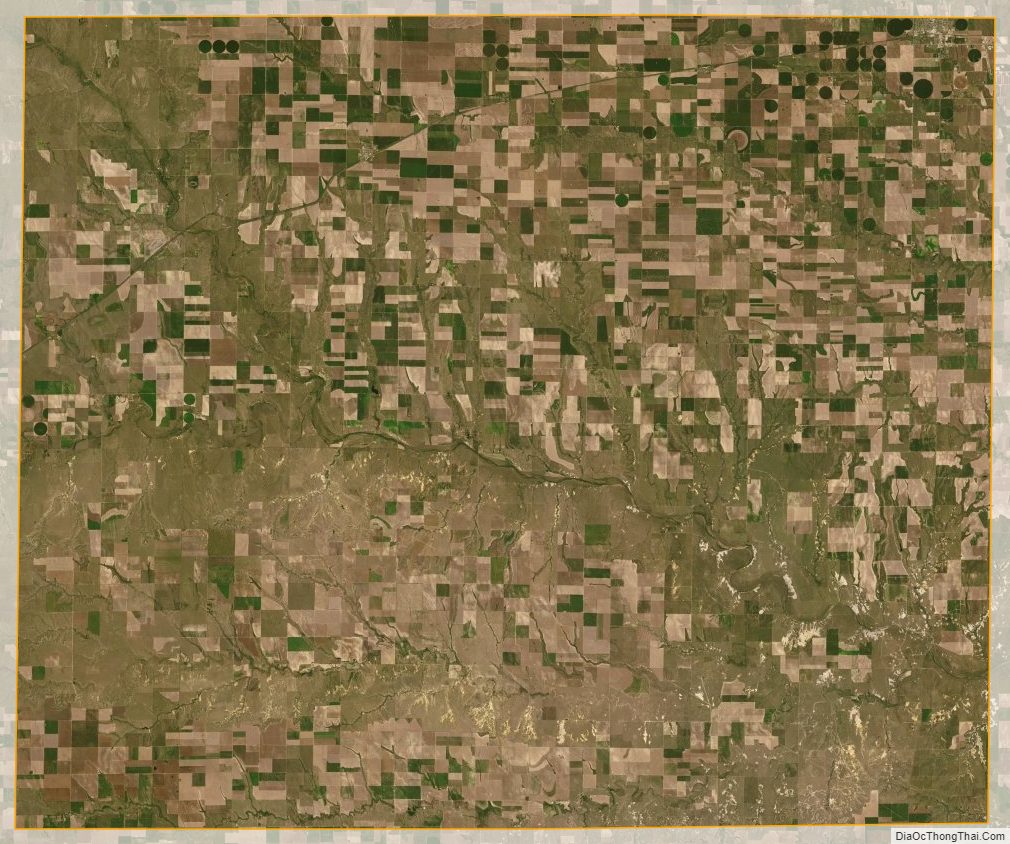
Logan County Satellite Map
Logan County Outline Map