Lynchburg is an independent city in the Commonwealth of Virginia in the United States. First settled in 1757 by ferry owner John Lynch, the city’s population was 79,009 at the 2020 census, making Lynchburg the 11th most populous city in Virginia. Located in the foothills of the Blue Ridge Mountains along the banks of the James River, Lynchburg is known as the “City of Seven Hills” or the “Hill City”. In the 1860s, Lynchburg was the only city in Virginia that was not recaptured by the Union before the end of the American Civil War.
Lynchburg lies at the center of a wider metropolitan area close to the geographic center of Virginia. It is the fifth-largest MSA in Virginia, with a population of 261,593. It is the site of several institutions of higher education, including Virginia University of Lynchburg, Randolph College, University of Lynchburg, Central Virginia Community College and Liberty University. Nearby cities include Roanoke, Charlottesville, and Danville.
| Name: | Lynchburg City |
|---|---|
| FIPS code: | 51-680 |
| State: | Virginia |
| Founded: | 1786 |
| Named for: | John Lynch |
| Land Area: | 48.97 sq mi (126.84 km²) |
| Population Density: | 1,600/sq mi (620/km²) |
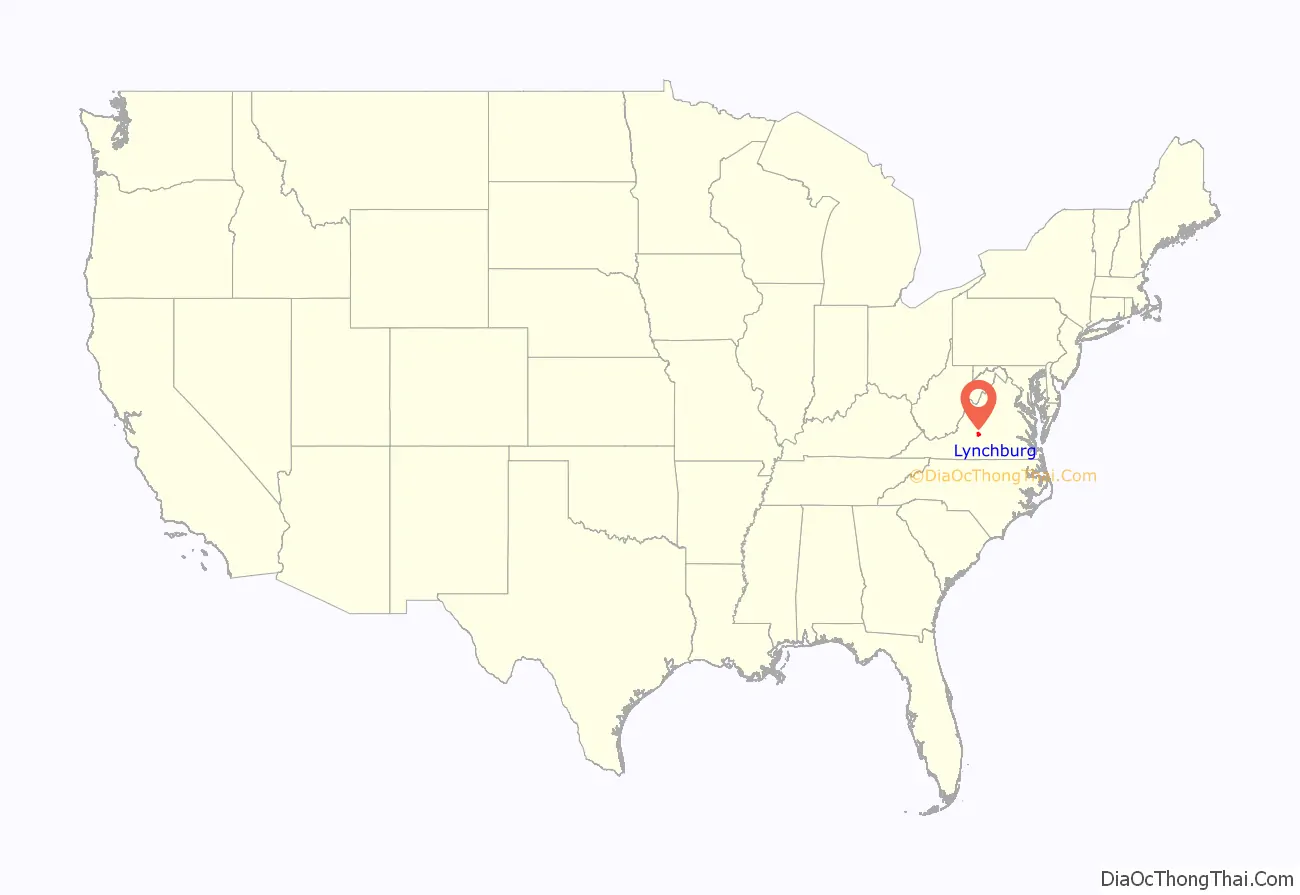
Lynchburg City location map. Where is Lynchburg City?
History
Monacan Indian Nation and other Siouan Tutelo-speaking tribes had lived in the area since at least 1270, driving the Virginia Algonquians eastward to the coastal areas. Explorer John Lederer visited one of the Siouan villages (Saponi) in 1670, on the Staunton River at Otter Creek, southwest of the present-day city, as did the Thomas Batts and Robert Fallam expedition in 1671.
Siouan peoples occupied this area until about 1702; they had become weakened because of high mortality from infectious diseases. The Seneca people, who were part of the Haudenosaunee, or Iroquois Confederacy based in New York, defeated them. The Seneca had ranged south while seeking new hunting grounds through the Shenandoah Valley to the West. At the Treaty of Albany in 1718, the Iroquois Five Nations ceded control of their land east of the Blue Ridge Mountains, including Lynchburg, to the Colony of Virginia; they confirmed this in 1721.
Founding and early growth
First settled by Anglo-Americans in 1757, Lynchburg was named for its founder, John Lynch. When about 17 years old, Lynch started a ferry service at a ford across the James River to carry traffic to and from New London, where his parents had settled. The “City of Seven Hills” quickly developed along the hills surrounding Lynch’s Ferry.
In 1786, Virginia’s General Assembly recognized Lynchburg, the settlement by Lynch’s Ferry on the James River. The James River Company had been incorporated the previous year (and President George Washington was given stock, which he donated to charity) in order to “improve” the river down to Richmond, which was growing and was named as the new Commonwealth’s capital. Shallow-draft James River bateau provided a relatively easy means of transportation through Lynchburg down to Richmond and eventually to the Atlantic Ocean. Rocks, downed trees, and flood debris were constant hazards, so their removal became expensive ongoing maintenance. Lynchburg became a tobacco trading, then commercial, and much later an industrial center.
Eventually the state built a canal and towpath along the river to make transportation by the waterway easier, and especially to provide a water route around the falls at Richmond, which prevented through navigation by boat. By 1812, U.S. Chief Justice John Marshall, who lived in Richmond, reported on the navigation difficulties and construction problems on the canal and towpath.
The General Assembly recognized the settlement’s growth by incorporating Lynchburg as a town in 1805; it was not incorporated as a city until 1852. In between, Lynch built Lynchburg’s first bridge across the James River, a toll structure that replaced his ferry in 1812. A toll turnpike to Salem, Virginia was begun in 1817. Lynch died in 1820 and was buried beside his mother in the graveyard of the South River Friends Meetinghouse. Quakers later abandoned the town because of their opposition to slaveholding. Presbyterians took over the meetinghouse and adapted it as a church. It is now preserved as a historic site.
To avoid the many visitors at Monticello, Thomas Jefferson in 1806 developed a plantation and house near Lynchburg, called Poplar Forest. He often visited the town, noting, “Nothing would give me greater pleasure than to be useful to the town of Lynchburg. I consider it as the most interesting spot in the state.” In 1810, Jefferson wrote, “Lynchburg is perhaps the most rising place in the U.S…. It ranks now next to Richmond in importance….”
Early Lynchburg residents were not known for their religious enthusiasm. The established Church of England supposedly built a log church in 1765. In 1804, evangelist Lorenzo Dow wrote: “…where I spoke in the open air in what I conceived to be the seat of Satan’s Kingdom. Lynchburg was a deadly place for the worship of God’.” That referred to the lack of churches, which was corrected the following year. Itinerant Methodist Francis Asbury visited the town; Methodists built its first church in 1805. Lynchburg hosted the last Virginia Methodist Conference that bishop Asbury attended (February 20, 1815). As Lynchburg grew, prostitution and other “rowdy” activities became part of the urban mix of the river town. They were often ignored, if not accepted, particularly in a downtown area referred to as the “Buzzard’s Roost.” Methodist preacher and later bishop John Early became one of Lynchburg’s civic leaders; unlike early Methodist preachers who had urged abolition of slavery during the Great Awakening; Early was of a later generation that had accommodated to this institution in the slave societies of the South.
On December 3, 1840, the James River and Kanawha Canal from Richmond reached Lynchburg. It was extended as far as Buchanan, Virginia in 1851, but never reached a tributary of the Ohio River as originally planned. Lynchburg’s population exceeded 6,000 by 1840, and a water works system was built. Floods in 1842 and 1847 wreaked havoc with the canal and towpath. Both were repaired. Town businessmen began to lobby for a railroad, but Virginia’s General Assembly refused to fund such construction. In 1848 civic boosters began selling subscriptions for the Lynchburg and Tennessee Railroad.
By the 1850s, Lynchburg (along with New Bedford, Massachusetts) was among the richest towns per capita in the US. Tobacco (including the manufacture of plug tobacco in factories using rented slave labor), slave-trading, general commerce, and iron and steel manufacturing powered the economy.
Railroads had become the wave of the future. Construction on the new Lynchburg and Tennessee railroad had begun in 1850 and a locomotive tested the track in 1852. A locomotive called the “Lynchburg” blew up in Forest, Virginia (near Poplar Forest) later that year, showing the new technology’s dangers. By the Civil War, two more railroads had been built, including the South Side Railroad from Petersburg. It became known as the Atlantic, Mississippi and Ohio Railroad in 1870, then a line in the Norfolk and Western Railway, and last as part of the Norfolk Southern Railway. The Orange and Alexandria Railroad stopped in Lynchburg.
American Civil War
During the American Civil War, Lynchburg served as a Confederate transportation hub and supply depot. It had 30 hospitals, often placed in churches, hotels, and private homes.
In June 1864, Union forces of General David Hunter approached within 1-mile (1.6 km) as they drove south from the Shenandoah Valley. Confederate troops under General John McCausland harassed them. Meanwhile, the city’s defenders hastily erected breastworks on Amherst Heights. Defenders were led by General John C. Breckinridge, who was an invalid from wounds received at the Battle of Cold Harbor. Union General Philip Sheridan appeared headed for Lynchburg on June 10, as he crossed the Chickahominy River and cut the Virginia Central Railroad. However, Confederate cavalry under General Wade Hampton, including the 2nd Virginia Cavalry from Lynchburg under General Thomas T. Munford, defeated his forces at the two-day Battle of Trevillian Station in Louisa County, and they withdrew. This permitted fast-marching troops under Confederate General Jubal Early to reach within four miles of Lynchburg on June 16 and tear up the tracks of the Orange and Alexandria Railroad to inhibit travel by Union reinforcements, while Confederate reinforcements straggled in from Charlottesville.
On June 18, 1864, in the Battle of Lynchburg, Early’s combined forces, though outnumbered, repelled Union General Hunter’s troops. Lynchburg’s defenders had taken pains to create an impression that the Confederate forces within the city were much larger than they were in fact. For example, a train was continuously run up and down the tracks while drummers played and Lynchburg citizens cheered as if reinforcements were disembarking. Local prostitutes took part in the deception, misleading their Union clients about the large number of Confederate reinforcements. Narcissa Owen (Cherokee), wife of the president of the Lynchburg and Tennessee Railroad, later wrote about her similar deception of Union spies.
From April 6 to 10, 1865, Lynchburg served as the capital of Virginia after the Confederate government fled from Richmond. Governor William Smith and the Commonwealth’s executive and legislative branches escaped to Lynchburg as Richmond surrendered on April 3. Gen. Robert E. Lee surrendered to Gen. Ulysses S. Grant at Appomattox Courthouse, roughly 20-mile (32 km) east of Lynchburg, ending the Civil War. Lynchburg surrendered on April 12, to Union General Ranald S. Mackenzie.
Ten days later, Confederate Brigadier General James Dearing died. He was a native of nearby Campbell County and descendant of John Lynch; he had been wounded on April 6 at High Bridge during that Appomattox campaign. Mackenzie had visited his wounded friend and former West Point classmate, easing the transition of power.
Post-Civil War recovery
The railroads that had driven Lynchburg’s economy were destroyed by the war’s end. The residents of the city deeply resented occupying forces under General J. L. Gregg, and worked more readily with his affable successor General N.M. Curtis. Thomas J. Kirkpatrick became superintendent for the public education established under Virginia’s Reconstruction-era legislature and Constitution of 1869, and built four new public schools. Previously, the only education for students from poor families was provided through St. Paul’s Episcopal Church.
Floods in 1870 and 1877 destroyed the city’s bridges (which were rebuilt) and the James River and Kanahwa Canal (which was not rebuilt). The towpath was used as the bed for laying the rails of the Richmond and Allegheny Railroad, a project conceived five decades earlier.
The city limits expanded in 1874. In 1881 that railroad was completed to Lynchburg, and another railroad reached it through the Shenandoah Valley. Lynchburg had a telegraph, about 15,000 residents, and the beginnings of a streetcar system. Many citizens, believing their city crowded enough, did not join the boosters who wanted Lynchburg to become the junction of that valley line and what became the Norfolk and Western Railroad, so the junction was moved to Big Lick. This later developed as the City of Roanoke.
In the latter 19th century, Lynchburg embraced manufacturing (the city being sometimes referred to as the “Pittsburgh of the South”). On a per capita basis, it became one of the wealthiest cities in the United States. In 1880, Lynchburg resident James Albert Bonsack invented the first cigarette-rolling machine. Shortly thereafter Dr. Charles Browne Fleet, a physician and pharmacological tinkerer, introduced the first micro-enema to be mass marketed over-the-counter. By the city’s centennial in 1886, banking activity had increased sixfold over the 1860 level, which some attributed to slavery’s demise. The Lynchburg Cotton Mill and Craddock-Terry Shoe Co. (which would become the largest shoe manufacturer in the South) were founded in 1888. The Reusens hydroelectric dam began operating in 1903 and soon delivered more power.
In 1886, Virginia Baptists founded a training school, the Lynchburg Baptist Seminary. It began to offer a college-level program to African-American students in 1900. Now named the Virginia University of Lynchburg, it is the city’s oldest institution of higher learning. Not far outside town, Randolph-Macon Woman’s College and Sweet Briar College were founded as women’s colleges in 1893 and 1901, respectively. In 1903, the Christian Church (Disciples of Christ) founded Lynchburg Christian College (later Lynchburg College) in what had been the Westover Hotel resort, which went bankrupt in the Panic of 1901. During the 2018-19 school year, the college’s name was changed to the University of Lynchburg, reflecting its expansion of graduate-level programs and research. Lynchburg’s first public library, Jones Memorial Library, opened in 1907.
During World War I, the city’s factories supported the war effort, and the area also supplied troops. The city powered through the Roaring Twenties and survived the Great Depression. Its first radio station, WLVA, began in 1930, and its airport opened in 1931. In 1938, the former fairgrounds were redeveloped as side-by-side baseball and football stadiums.
World War II and after
Lynchburg’s factories again worked 24 hours daily during World War II. In 1955, both General Electric and Babcock & Wilcox built high technology factories in the area.
Lynchburg lost its bid to gain access to an interstate highway. In the late 1950s, interested citizens, including Virginia Senator Mosby G. Perrow, Jr., asked the federal government to change its long-planned route for the interstate highway, now known as I-64, between Clifton Forge and Richmond.
Since the 1940s, maps of the federal interstate highway system showed a proposed northern route, bypassing the manufacturing centers at Lynchburg and Roanoke. But federal officials assured Virginia that the state would decide the route. Although initially favoring that northern route, Virginia’s State Highway Commission eventually supported a southern route from Richmond via US-360 and US-460, which connected Lynchburg and Roanoke via US-220 from Roanoke to Clifton Forge, then continued west following US-60 into West Virginia. However, in July 1961, Governor J. Lindsay Almond and US Secretary of Commerce Luther Hodges announced that the route would not be changed. Lynchburg was left as the only city with a population in excess of 50,000 (at the time) that was not served by an interstate.
The Virginia State Colony for Epileptics and Feebleminded (now known as the Central Virginia Training School), was established outside Lynchburg in Madison Heights. For several decades throughout the mid-20th century, the state of Virginia authorized compulsory sterilization of the mentally retarded for the purpose of eugenics. The operations were carried out at the institution. An estimated 8,300 Virginians were relocated to Lynchburg and sterilized there, making the city a “dumping ground” of sorts for the feeble-minded, poor, blind, epileptic, and those otherwise seen as genetically “unfit”. Carrie Buck challenged the state sterilization, but it was finally upheld by the United States Supreme Court in Buck v. Bell. She was classified as “feeble-minded” and sterilized while a patient at the Virginia State Colony.
Sterilizations were carried out for 35 years until 1972, when the operations were halted. Later in the late 1970s, the American Civil Liberties Union filed a class-action lawsuit against the state of Virginia on behalf of the sterilization victims. In the settlement, victims received formal apologies from the state and counseling if they chose, but the judiciary denied requests for the state to pay for reverse sterilization operations. In 1994, Buck’s sterilization and litigation were featured as a television drama, Against Her Will: The Carrie Buck Story. The Manic Street Preachers address the issue in their song “Virginia State Epileptic Colony” on their 2009 album Journal for Plague Lovers.
Modern revitalization
Liberty University, founded in 1971 as Lynchburg Baptist College and renamed in 1985, is one of the country’s largest institutions of higher education and the largest employer in the Lynchburg region. The university states that it generates over $1 billion in economic impact to the Lynchburg area annually.
Lynchburg has ten recognized historic districts, four of them in the downtown residential area. Since 1971, 40 buildings have been individually listed on the National Register of Historic Places.
Downtown Lynchburg has undergone significant revitalization, with hundreds of new loft apartments created through adaptive reuse of historic warehouses and mills. Since 2000, downtown has attracted private investments of more than $110 million, and business activity increased by 205% from 2004 to 2014. In 2014, 75 new apartment units were added to downtown Lynchburg, with 155 further units under construction, increasing the number of housing units downtown by 48% from 2010 to 2014.
In 2015, the $5.8-million Lower Bluffwalk pedestrian street zone opened. Notable projects underway in downtown by the end of 2015 include the $25-million Virginian Hotel restoration project, a $16.6-million restoration of the Academy Center of the Arts, and $4.6-million expansion of Amazement Square Children’s Museum.
Timeline
- 1786 – Lynchburg founded.
- 1791 – Tobacco warehouse built.
- 1798 – South River Friends Meetinghouse built.
- 1805 – Town of Lynchburg incorporated.
- 1806
- City Cemetery established.
- Construction of Thomas Jefferson’s Poplar Forest begins near Lynchburg.
- 1830
- Elijah Fletcher becomes mayor.
- Population: 4,630.
- 1840
- James River and Kanawha Canal to Richmond opens.
- Population: 6,395.
- 1850 – Population: 8,071.
- 1852
- Virginia & Tennessee Railroad begins operating.
- City of Lynchburg incorporated.
- Lynchburg Daily Virginian newspaper begins publication.
- 1855 – Lynchburg Courthouse built.
- 1856 – Methodist Protestant Lynchburg College established.
- 1864 – June 17–18: Battle of Lynchburg fought near city during the American Civil War.
- 1866 – Southern Memorial Association founded.
- 1870 – September: Flood.
- 1879 – George D. Witt Shoe Corporation in business.
- 1880 – James Albert Bonsack invents cigarette rolling machine.
- 1886 – First Baptist Church built.
- 1888 – Virginia Theological Seminary founded.
- 1893 – Randolph-Macon Woman’s College opens.
- 1895 – St. Paul’s Church built.
- 1898 – “Confederate Infantryman” monument erected.
- 1900 – Population: 18,891.
- 1903 – Virginia Christian College founded.
- 1908 – Jones Memorial Library opens.
- 1912 – Equal Suffrage League formed.
- 1913 – Statue of John Warwick Daniel erected.
- 1920 – Little Theater established.
- 1928 – Monument Terrace built.
- 1930
- WLVA radio begins broadcasting.
- Population: 40,661.
- 1932 – Civic Art League founded.
- 1940 – City Stadium opens.
- 1953 – WLVA-TV (television) begins broadcasting.
- 1954 – Carter Glass Memorial Bridge opens.
- 1959 – Pittman Plaza shopping centre in business.
- 1966
- Lynchburg Public Library opens.
- Central Virginia Community College and Lynchburg Baseball Corporation established.
- 1971 – Lynchburg Baptist College (later Liberty University) founded.
- 1978 – Point of Honor house museum opens.
- 1980 – Population: 66,743.
- 1990 – President George H. W. Bush gives commencement speech at Liberty University.
- 1993 – Bob Goodlatte becomes U.S. representative for Virginia’s 6th congressional district.
- 1995 – Lynchburg Hillcats baseball team active.
- 2000 – City website online (approximate date).
- 2010 – Population: 75,568.
- 2016 – Joan Foster becomes mayor.
- 2017 – President Donald Trump gives commencement speech at Liberty University.
- 2023 – Stephanie Reed becomes mayor.
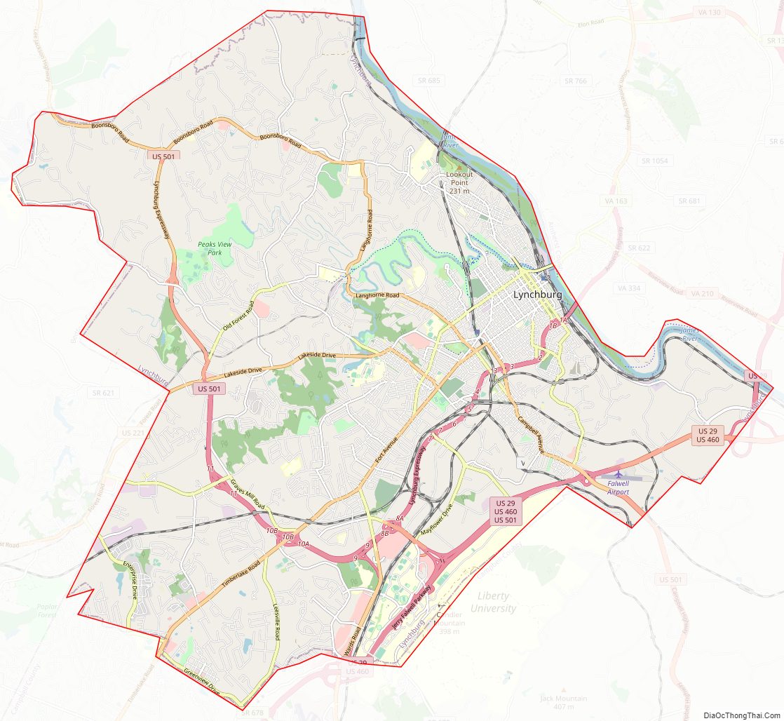
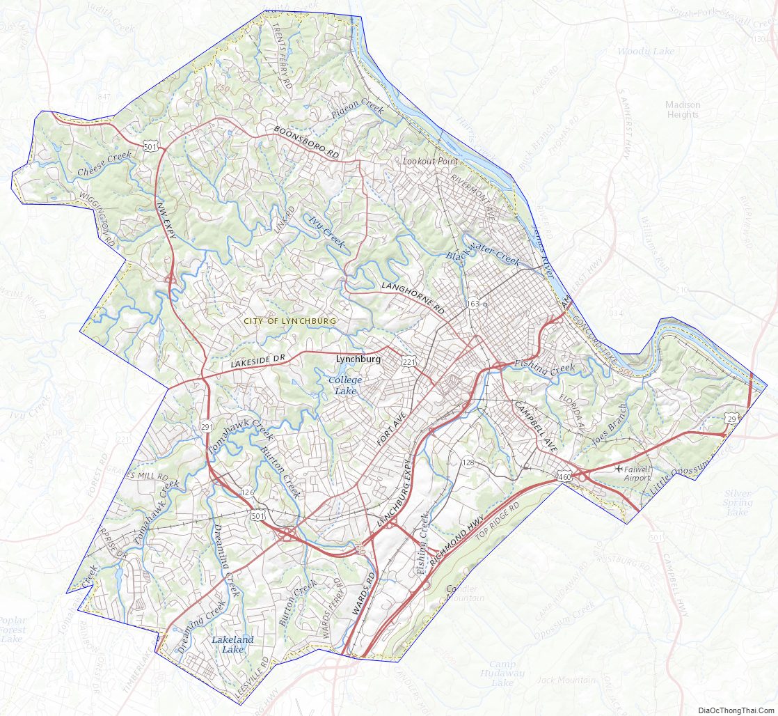
Lynchburg City Road Map
Geography
According to the United States Census Bureau, the city has a total area of 49.6 square miles (128.5 km), of which 49.2 square miles (127.4 km) is land and 0.5 square miles (1.3 km) (1.0%) is water.
Neighborhoods
The first neighborhoods of Lynchburg developed upon seven hills adjacent to the original ferry landing. These neighborhoods include:
- Court House Hill (original hill)
- College Hill
- Daniel’s Hill
- Diamond Hill (Grace Street, Washington Street)
- Federal Hill
- Franklin Hill
- Garland Hill
- White Rock Hill (Florida Avenue)
Other major neighborhoods, with more upside, include Tinbridge Hill, Boonsboro, Trents Ferry, Rivermont, Fairview Heights (Campbell Ave corridor), Jackson Heights, Federal Hill (Federal Street, Jackson Street, Harrison Street) Fort Hill, Forest Hill (Old Forest Rd. Area), Timberlake, Windsor Hills, Sandusky, Sheffield, Linkhorne, Cornerstone and Wyndhurst.
Climate
Lynchburg has a four-season humid subtropical climate (Köppen Cfa), with cool winters and hot, humid summers. The monthly daily average temperature ranges from 35.9 °F (2.2 °C) in January to 76.0 °F (24.4 °C) in July. Nights tend to be significantly cooler than days throughout much of the year due in part to the moderate elevation. In a typical year, there are 27.4 days with a high temperature 90 °F (32 °C) or above, and 6.2 days with a high of 32 °F (0 °C) or below. Snowfall averages 11.6 inches (29 cm) per season but this amount varies highly with each winter; the snowiest winter is 1995–96 with 56.8 in (144 cm) of snow, but the following winter recorded only trace amounts, the least on record.
Temperature extremes range from 106 °F (41 °C), recorded on July 10, 1936, down to −10 °F (−23 °C), recorded on January 21, 1985 and February 5, 1996. However, several decades may pass between 100 °F (38 °C) and 0 °F (−18 °C) readings, with the last such occurrences being July 8, 2012 and February 20, 2015, respectively.
Seven Hills
One of the most prominent nicknames of Lynchburg is the “City of Seven Hills.” This is due to one prominent feature of its geography, the seven hills that are spread throughout the region. They seven hills are: College Hill, Garland Hill, Daniel’s Hill, Federal Hill, Diamond Hill, White Rock Hill, and Franklin Hill.
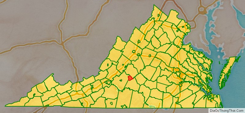
Adjacent counties
- Amherst County, Virginia – northeast
- Bedford County, Virginia – west, northwest
- Campbell County, Virginia – south, southeast
Lynchburg City Topographic Map
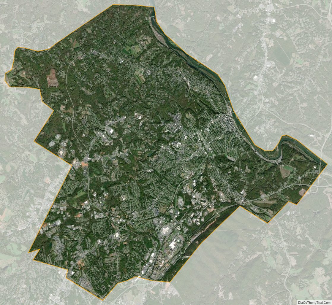
Lynchburg City Satellite Map
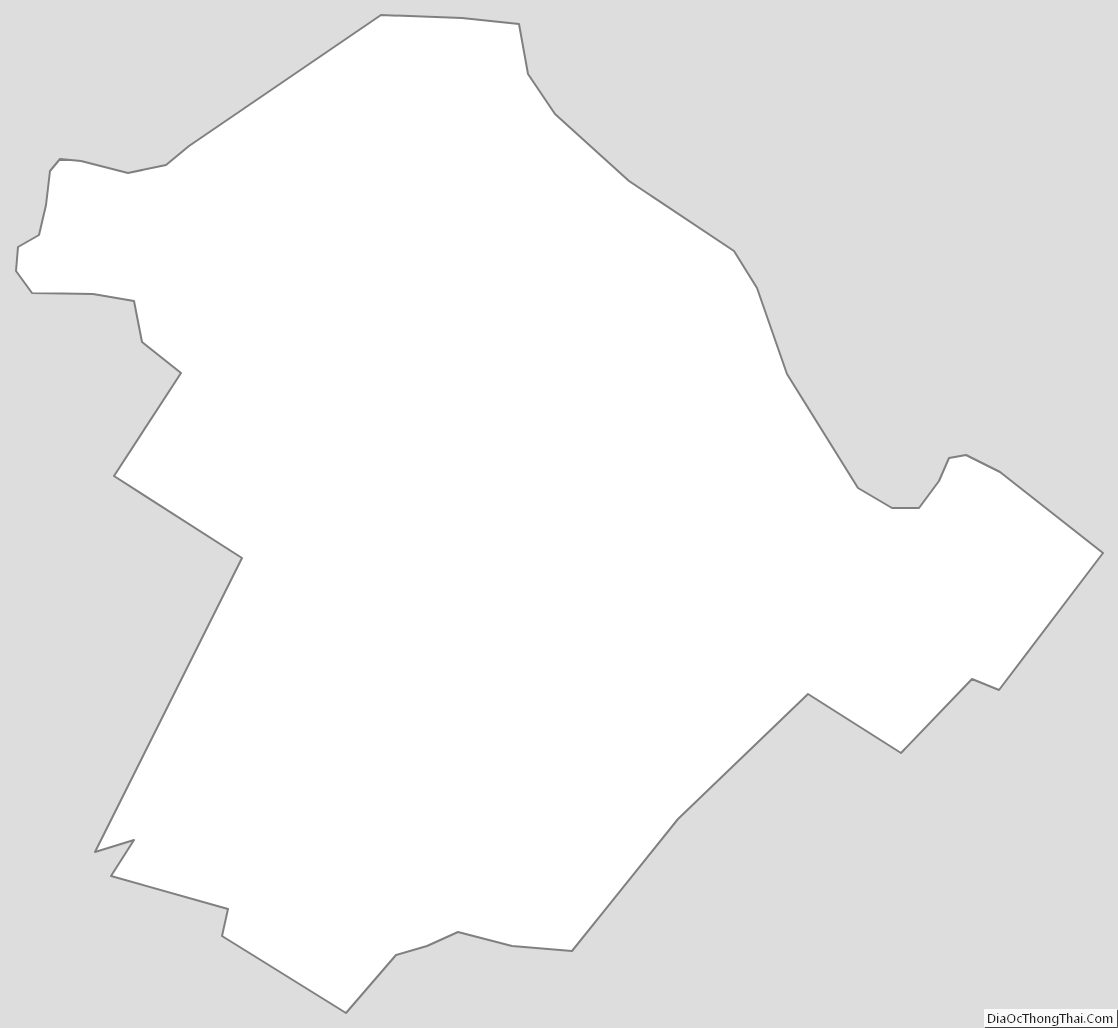
Lynchburg City Outline Map