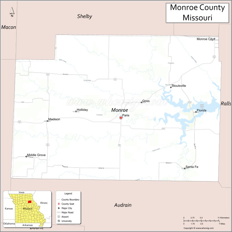
Monroe County is a county in northeast Missouri. As of the 2020 census, the population was 8,666. Its county seat is Paris. It is the birthplace of Mark Twain.
| Name: | Monroe County |
|---|---|
| FIPS code: | 29-137 |
| State: | Missouri |
| Founded: | January 6, 1831 |
| Named for: | James Monroe |
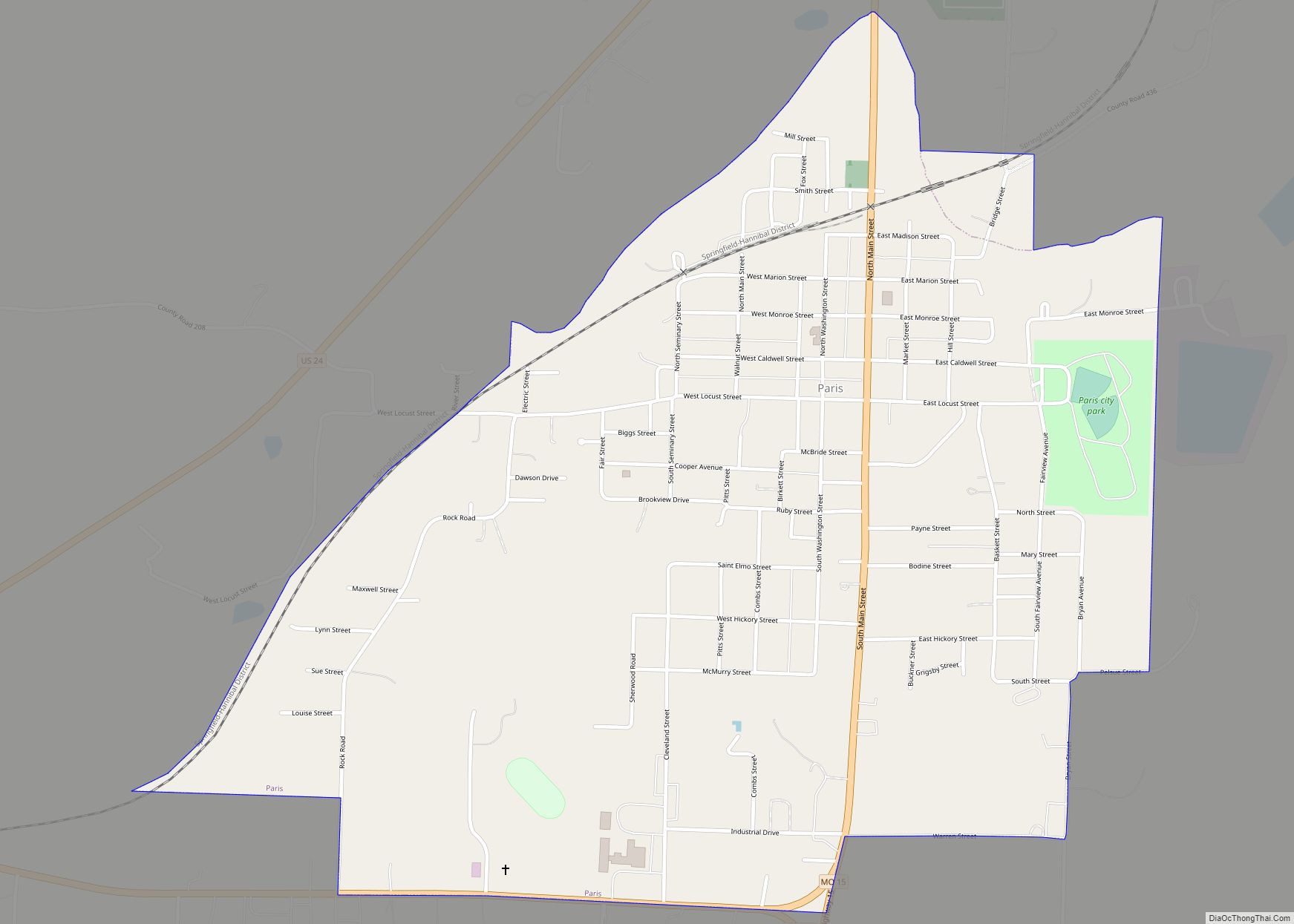
| Seat: | Paris |
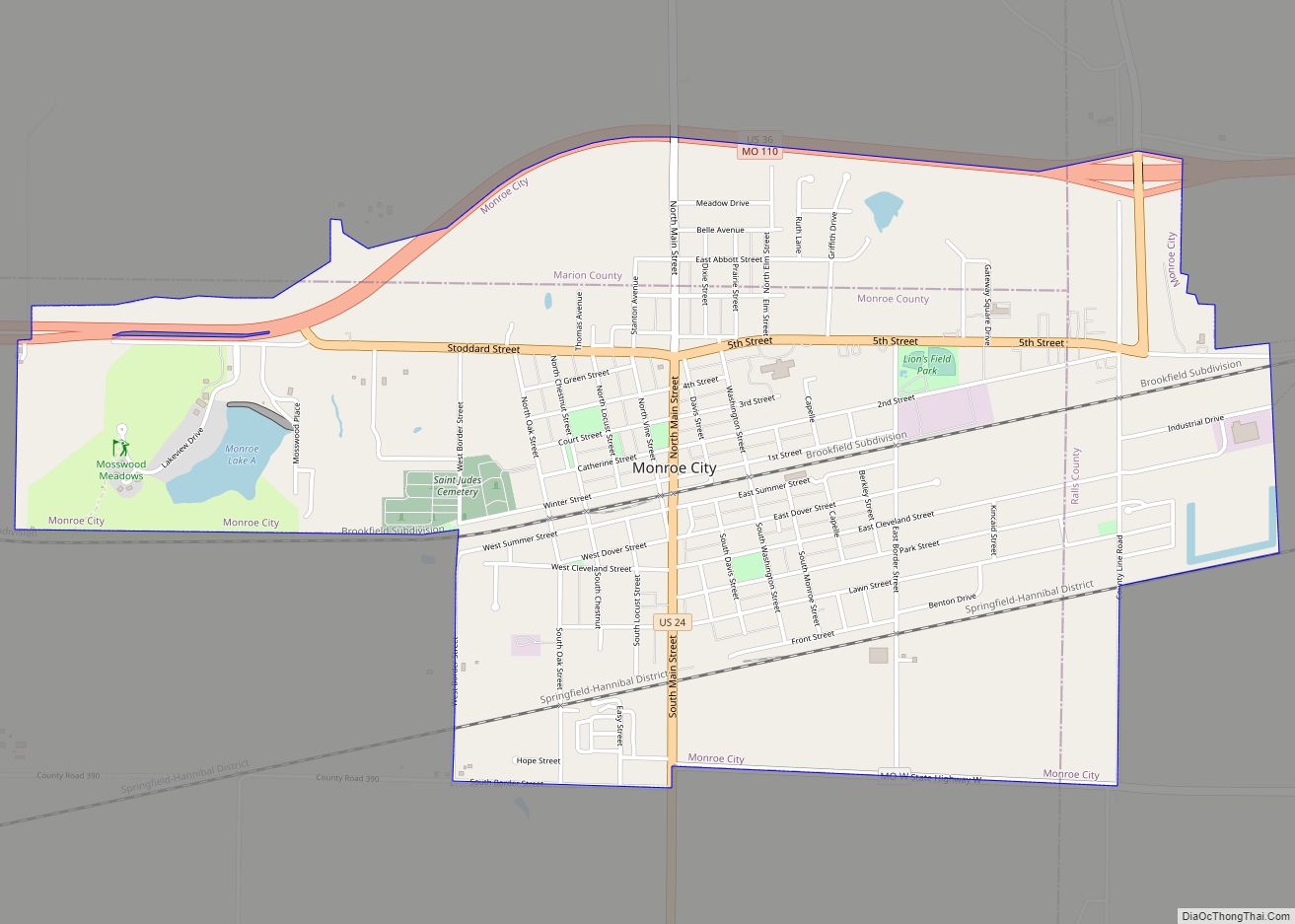
| Largest city: | Monroe City |
| Total Area: | 670 sq mi (1,700 km²) |
| Land Area: | 648 sq mi (1,680 km²) |
| Total Population: | 8,666 |
| Population Density: | 13/sq mi (5.0/km²) |
| Time zone: | UTC−6 (Central) |
| Summer Time Zone (DST): | UTC−5 (CDT) |
| Website: | www.monroecountymo.org |
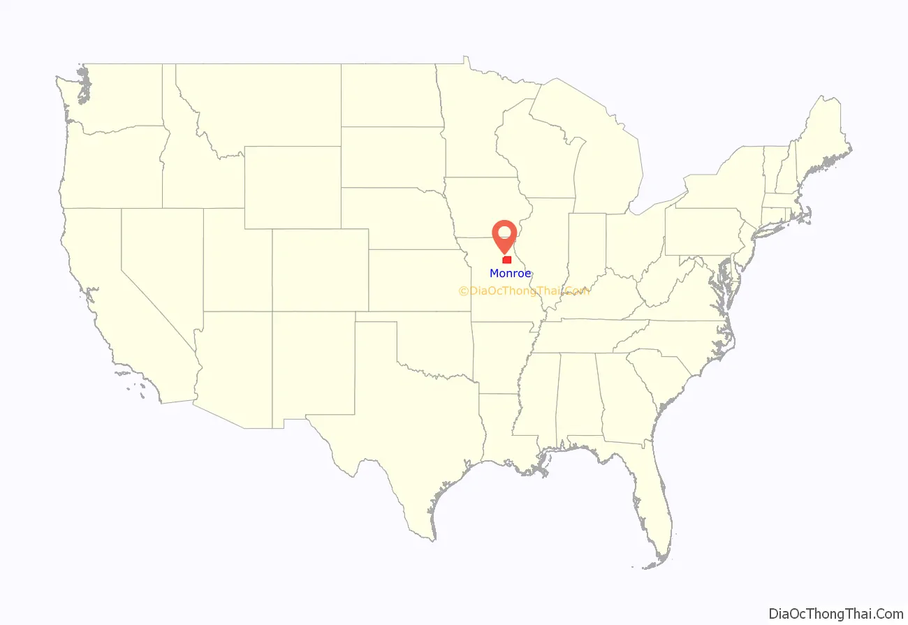
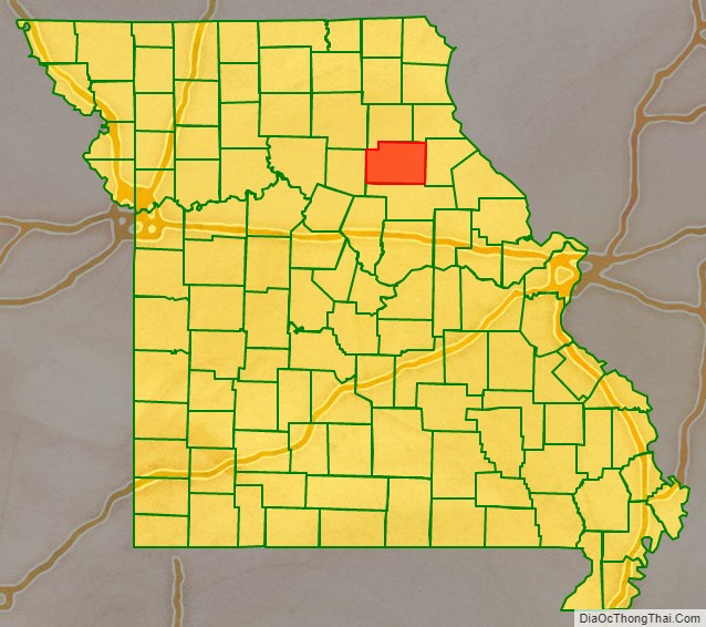
Monroe County location map. Where is Monroe County?
History
The county was organized January 6, 1831 and named for James Monroe, the fifth President of the United States.
Monroe County was one of several along the Missouri River settled by migrants from the Upper South, especially Kentucky and Tennessee. They brought slaves and slaveholding traditions with them and quickly started cultivating crops similar to those in Middle Tennessee and Kentucky: hemp and tobacco. They also brought characteristic antebellum architecture and culture. The county was at the heart of what was called Little Dixie.
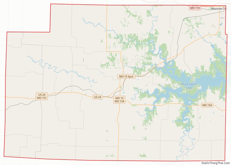
Monroe County Road Map
Geography
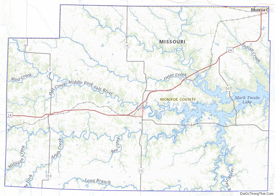
According to the U.S. Census Bureau, the county has a total area of 670 square miles (1,700 km), of which 648 square miles (1,680 km) is land and 23 square miles (60 km) (3.4%) is water.
Adjacent counties
- Shelby County (north)
- Marion County (northeast)
- Ralls County (east)
- Audrain County (south)
- Randolph County (west)
Major highways
- U.S. Route 24
- U.S. Route 36
- Route 15
- Route 107
- Route 151
Monroe County Topographic Map
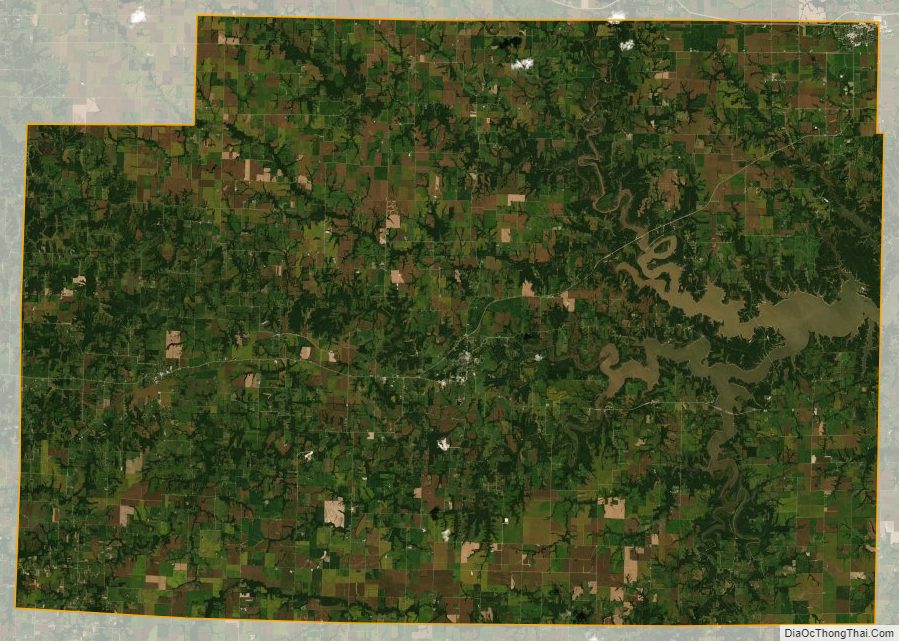
Monroe County Satellite Map
Monroe County Outline Map