Montgomery County is located in the southwestern portion of the U.S. state of Ohio. As of the 2020 census, the population was 537,309, making it the fifth-most populous county in Ohio. The county seat is Dayton. The county was named in honor of Richard Montgomery, an American Revolutionary War general killed in 1775 while attempting to capture Quebec City, Canada. Montgomery County is part of the Dayton, Ohio Metropolitan Statistical Area.
| Name: | Montgomery County |
|---|---|
| FIPS code: | 39-113 |
| State: | Ohio |
| Founded: | May 1, 1803 |
| Named for: | Richard Montgomery |
| Seat: | Dayton |
| Largest city: | Dayton |
| Total Area: | 464 sq mi (1,200 km²) |
| Land Area: | 462 sq mi (1,200 km²) |
| Total Population: | 537,309 |
| Population Density: | 1,200/sq mi (450/km²) |
| Time zone: | UTC−5 (Eastern) |
| Summer Time Zone (DST): | UTC−4 (EDT) |
| Website: | www.mcohio.org |
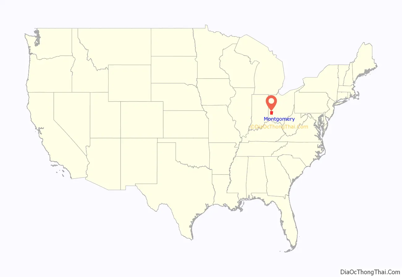
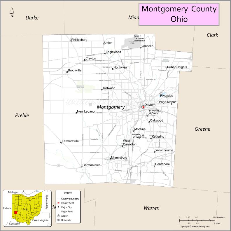
Montgomery County location map. Where is Montgomery County?
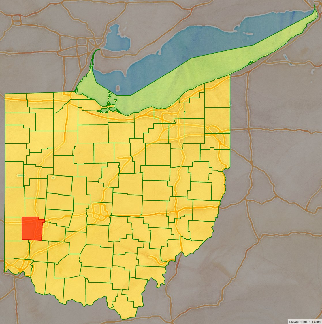
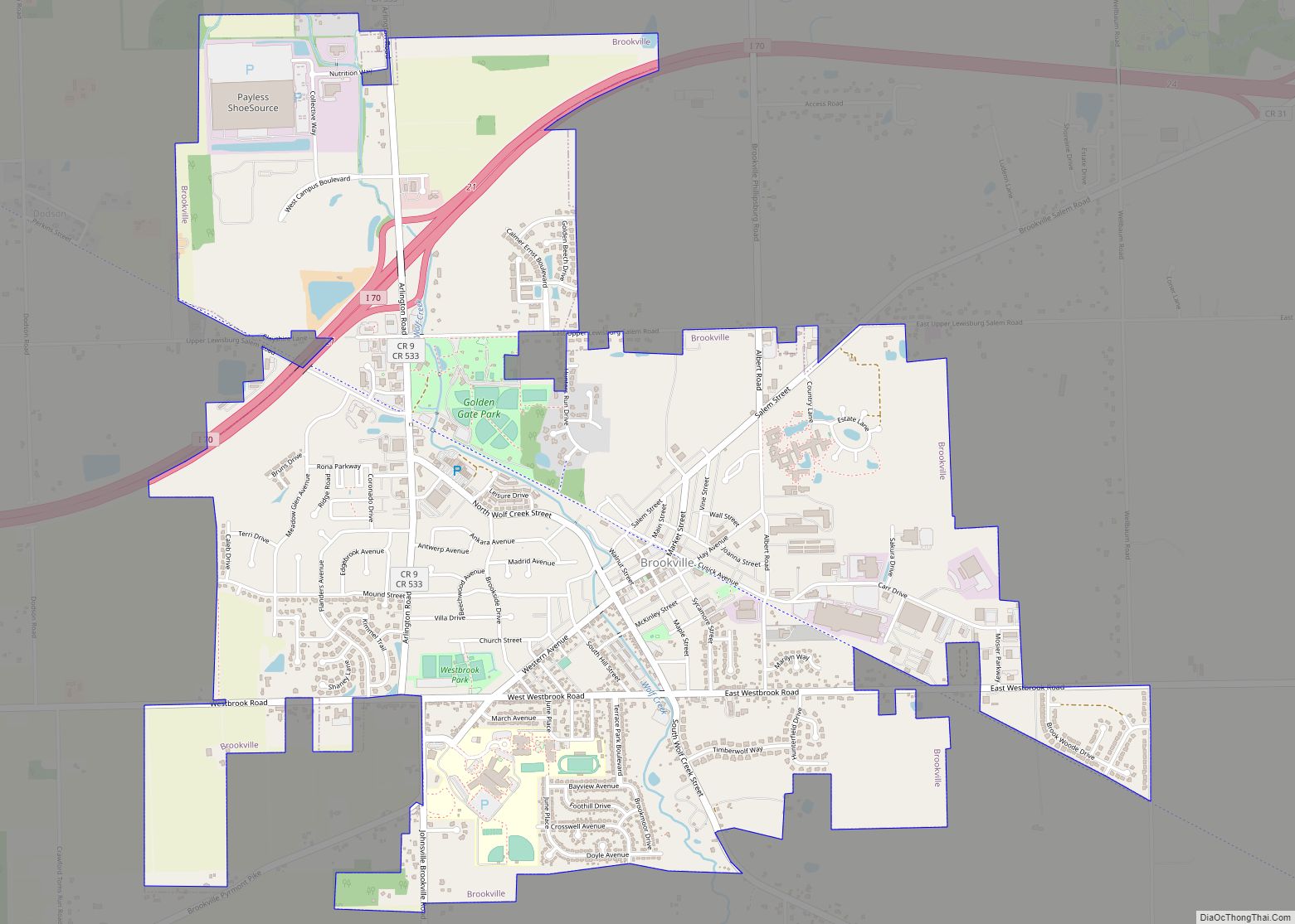
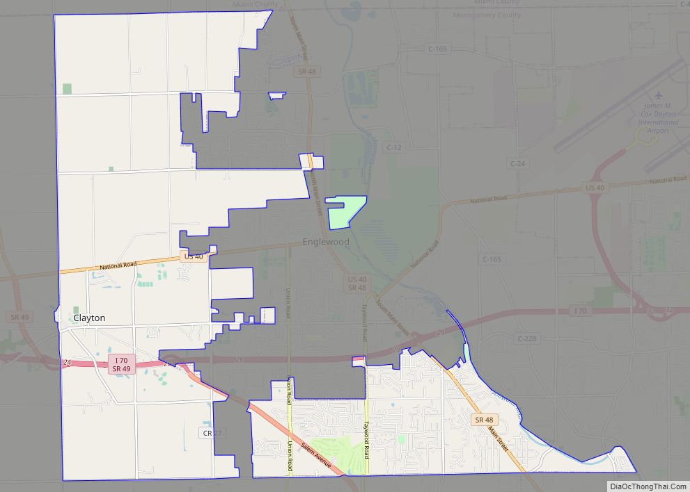
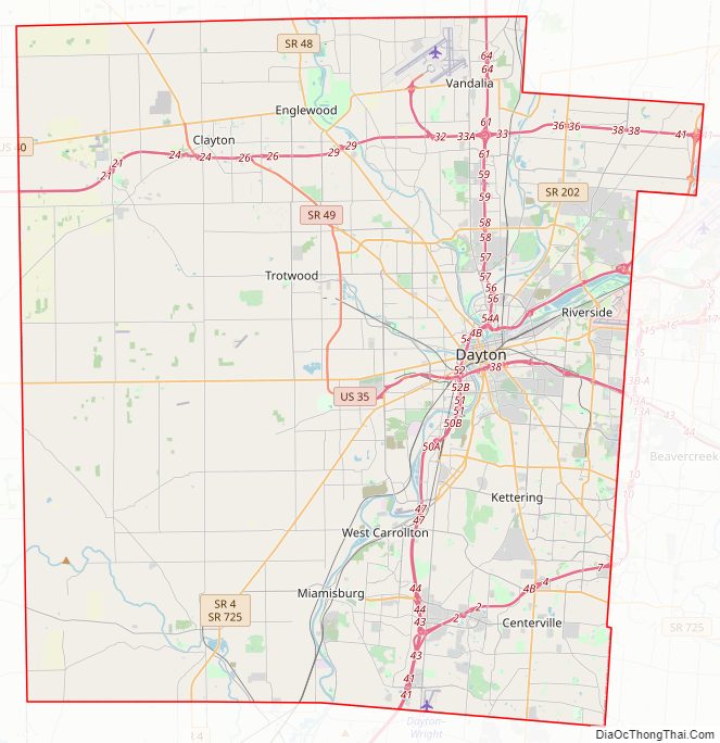
Montgomery County Road Map
Geography
According to the United States Census Bureau, the county has a total area of 464 square miles (1,200 km), of which 462 square miles (1,200 km) is land and 2.8 square miles (7.3 km) (0.6%) is water.
Adjacent counties
- Miami County (north)
- Clark County (northeast)
- Greene County (east)
- Warren County (south)
- Butler County (southwest)
- Preble County (west)
- Darke County (northwest)
Major highways
- Interstate 70
Interstate 70 Alternate- Interstate 75
- Interstate 675
- U.S. Route 25
- U.S. Route 35
- U.S. Route 40
- State Route 4
- State Route 48
- State Route 49
- State Route 123
- State Route 201
- State Route 202
- State Route 235
- State Route 444
- State Route 725
- State Route 741
- State Route 835
National protected area
- Dayton Aviation Heritage National Historical Park (part)
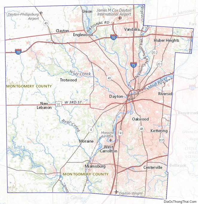
Montgomery County Topographic Map
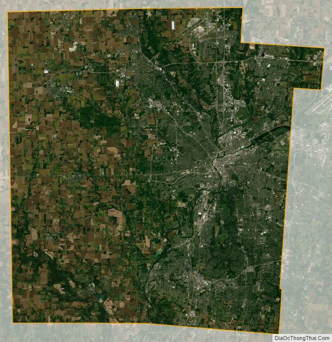
Montgomery County Satellite Map
Montgomery County Outline Map