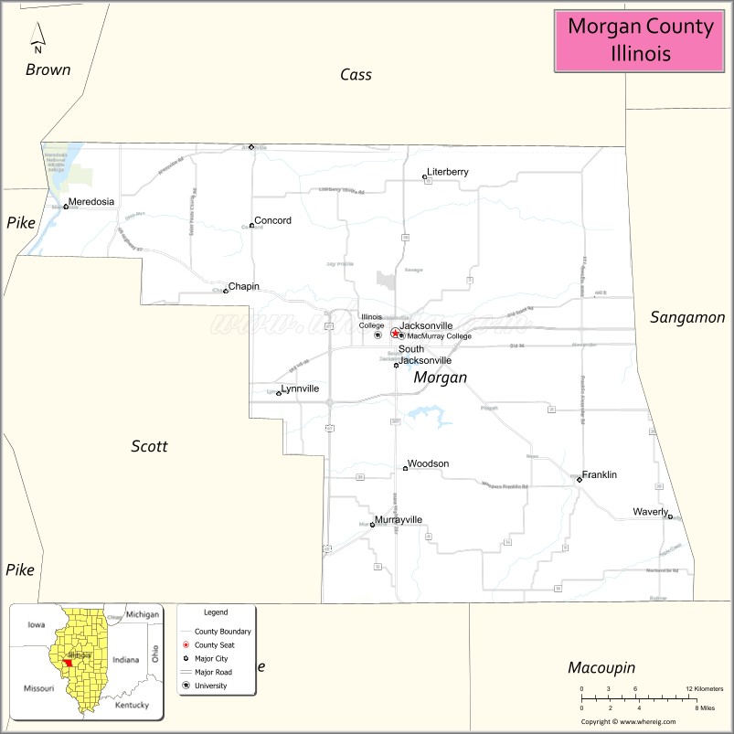
Morgan County is a county located in the U.S. state of Illinois. According to the 2010 census, it had a population of 35,547. Its county seat is Jacksonville.
Morgan County is part of the Jacksonville, IL Micropolitan Statistical Area, which is also included in the Springfield-Jacksonville-Lincoln, IL Combined Statistical Area.
| Name: | Morgan County |
|---|---|
| FIPS code: | 17-137 |
| State: | Illinois |
| Founded: | 1823 |
| Named for: | Daniel Morgan |
| Seat: | Jacksonville |
| Largest city: | Jacksonville |
| Total Area: | 572 sq mi (1,480 km²) |
| Land Area: | 569 sq mi (1,470 km²) |
| Total Population: | 35,547 |
| Population Density: | 62/sq mi (24/km²) |
| Time zone: | UTC−6 (Central) |
| Summer Time Zone (DST): | UTC−5 (CDT) |
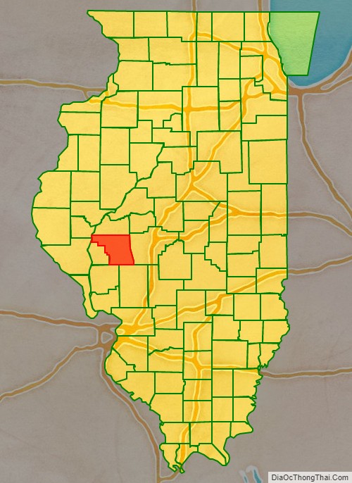
Morgan County location map. Where is Morgan County?

History
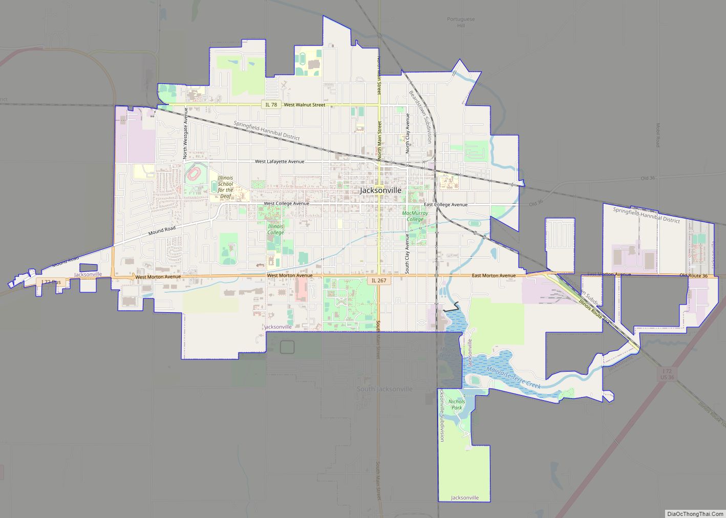
Morgan County was formed in 1823 out of Greene and Sangamon Counties. It was named in honor of General Daniel Morgan, who defeated the British at the Battle of Cowpens in the American Revolutionary War. General Morgan was serving under General Nathanael Greene at Cowpens. Jacksonville was established by European Americans on a 160-acre tract of land in the center of Morgan County in 1825, two years after the county was founded. The founders of Jacksonville, Illinois consisted entirely of settlers from New England. These people were “Yankee” settlers, that is to say they were descended from the English Puritans who settled New England in the 1600s. They were part of a wave of New England farmers who headed west into what was then the wilds of the Northwest Territory during the early 1800s. Most of them arrived as a result of the completion of the Erie Canal and the end of the Black Hawk War. The Yankee migration to Illinois was a result of several factors, one of which was the overpopulation of New England. The old stock Yankee population had large families, often bearing up to ten children in one household. Most people were expected to have their own piece of land to farm, and due to the massive and nonstop population boom, land in New England became scarce as every son claimed his own farmstead. As a result, there was not enough land for every family to have a self-sustaining farm, and Yankee settlers began leaving New England for the Midwestern United States. When they arrived in what is now Jacksonville there was nothing but dense virgin forest and wild prairie, the “Yankee” New Englanders laid out farms, constructed roads, erected government buildings and established post routes. They brought with them many of their Yankee New England values, such as a passion for education, establishing many schools as well as staunch support for abolitionism. They were mostly members of the Congregationalist Church though some were Episcopalian. Due to the second Great Awakening some of them had converted to Methodism and Presbyterianism while some others became Baptist, before moving to what is now Jacksonville. Jacksonville, like some other parts of Illinois, would be culturally very continuous with early New England culture for most of its early history.
Morgan County from the time of its creation to 1837
Morgan County between 1837 and 1839, when Scott County was split off
Morgan County between 1839 and 1845
Morgan County in 1845, when its border with Cass County was moved southward, bringing both to their present borders
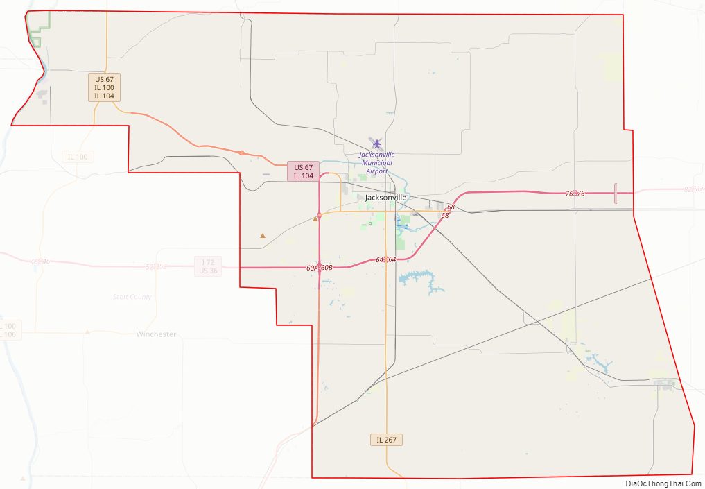
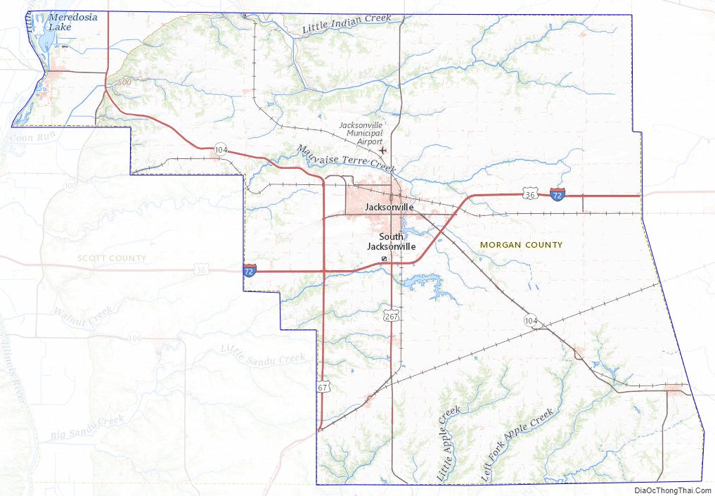
Morgan County Road Map
Geography
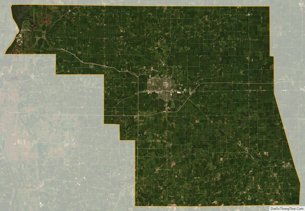
According to the US Census Bureau, the county has a total area of 572 square miles (1,480 km), of which 569 square miles (1,470 km) is land and 3.5 square miles (9.1 km) (0.6%) is water.
The 90th Meridian of Longitude goes through Morgan County, as seen on a road sign at mile 78 of I-72.
Climate and weather
Average temperatures in the county seat of Jacksonville range from a low of 15 °F (−9 °C) in January to a high of 87 °F (31 °C) in July; a record low of −28 °F (−33 °C) was recorded in February 1934 and a record high of 114 °F (46 °C) was recorded in July 1954. Average monthly precipitation ranged from 1.35 inches (34 mm) in January to 4.86 inches (123 mm) in May.
Major highways
- Interstate 72
- U.S. Route 36
- U.S. Route 67
- Illinois Route 123
- Illinois Route 78
- Illinois Route 100
- Illinois Route 104
- Illinois Route 267
Adjacent counties
- Cass County – north
- Sangamon County – east
- Macoupin County – southeast
- Greene County – south
- Pike County – west
- Scott County – southwest
- Brown County – northwest
National protected area
- Meredosia National Wildlife Refuge (part)
Morgan County Topographic Map
Morgan County Satellite Map
Morgan County Outline Map