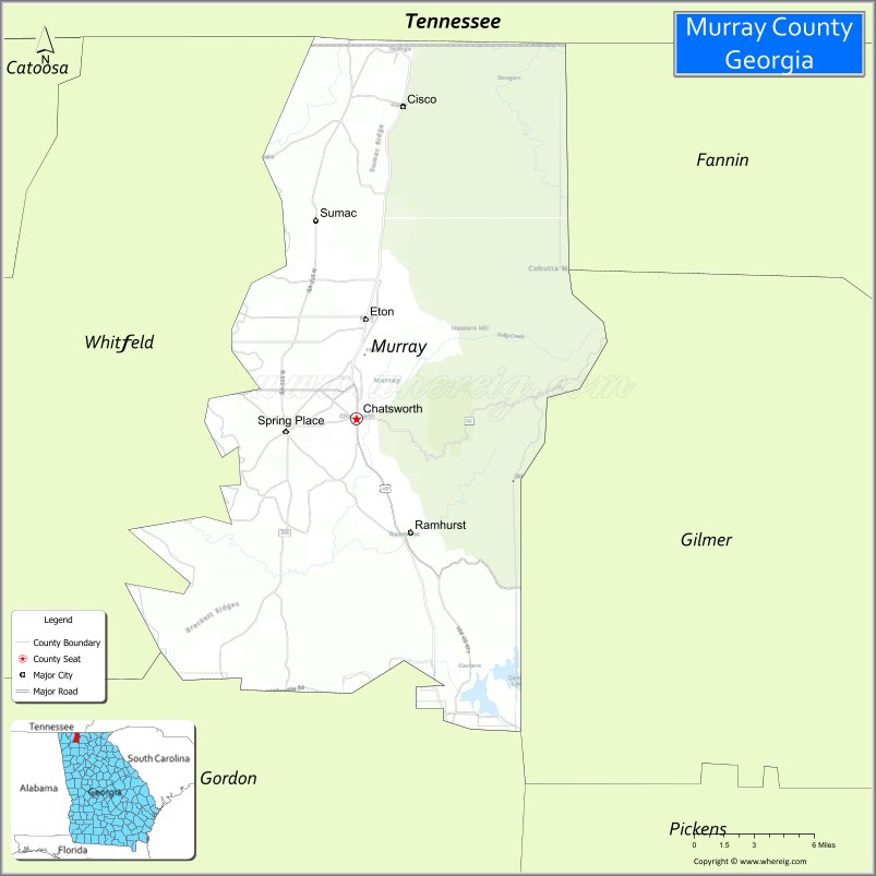
Murray County is a county located in the northwestern part of the U.S. state of Georgia. As of the 2020 census, the population was 39,973. The county seat is Chatsworth.
Murray County is part of the Dalton, GA Metropolitan Statistical Area, which is also included in the Chattanooga–Cleveland-Dalton, TN-GA-AL Combined Statistical Area.
| Name: | Murray County |
|---|---|
| FIPS code: | 13-213 |
| State: | Georgia |
| Founded: | 1832 |
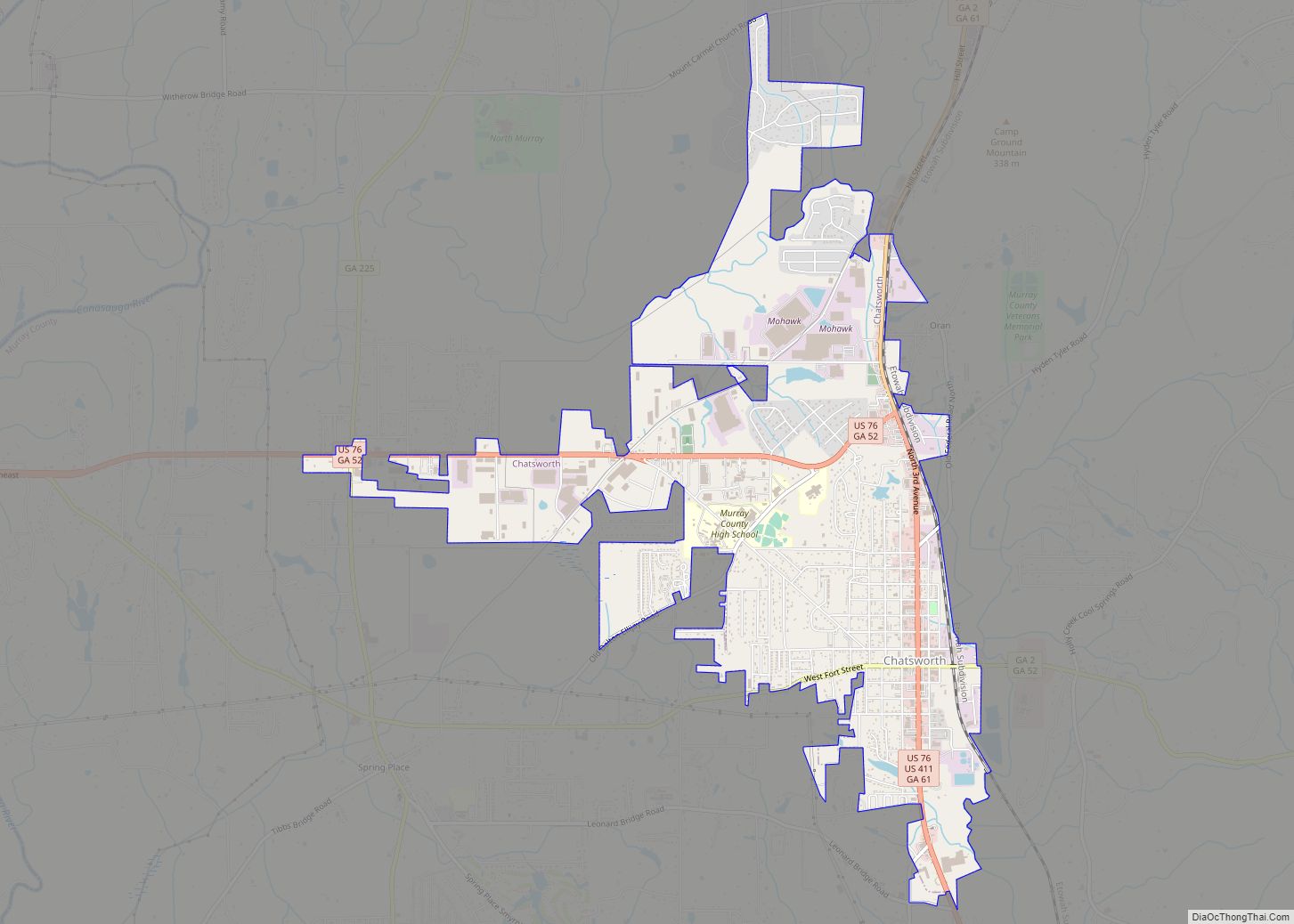
| Seat: | Chatsworth |
| Largest city: | Chatsworth |
| Total Area: | 347 sq mi (900 km²) |
| Land Area: | 344 sq mi (890 km²) |
| Total Population: | 39,973 |
| Population Density: | 116/sq mi (45/km²) |
| Time zone: | UTC−5 (Eastern) |
| Summer Time Zone (DST): | UTC−4 (EDT) |
| Website: | www.murraycountyga.org |
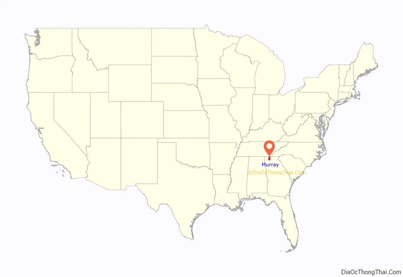
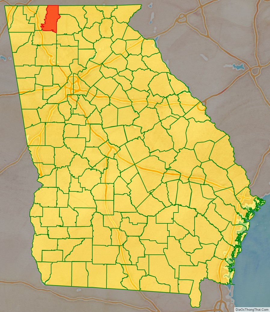
Murray County location map. Where is Murray County?
History
In December, 1832 the Georgia General Assembly designated the extreme northwestern corner of the state as Murray County. Formerly part of Cherokee County, the area was named for a distinguished Georgia statesman from Lincoln County, Mr. Thomas W. Murray, a former speaker of the Georgia House. Within a short time the legislature found the county was too large to administer properly as the population grew, for the county then included what is now Dade, Walker, Catoosa, Whitfield, Murray, Gordon and parts of Bartow and Chatooga Counties, so further division became necessary. Within two decades, Murray County came to be 342 square miles (886 km) of land with Spring Place as its county seat until the railroad was built through Chatsworth. With Chatsworth more accessible, the county seat was moved there.
Cherokees
The area was in the heart of the Cherokee Nation at the time the boundary lines were drawn through the territory. Not until after the Cherokees were removed in 1838–39 did white settlers enter the county in large numbers. Spring Place had been established in 1801 as a Moravian mission to the Cherokee and had been a post office since 1810 – the second oldest in North Georgia. After the Cherokee removal, the Moravians relocated with the tribe in what is now Oklahoma to establish New Springplace near the town of Oaks, Oklahoma. Sometime during the late 19th century, James B. Brackett donated the land upon which the Brackett Indian School was built. The school did not always function as a segregated Indian school. At one point in its previously integrated history it was referred to as the Lone Cherry School.
The Bracketts were a notable Eastern Cherokee family that lived along Brackett’s Ridges, amongst several other American Indian families, several of which were also Eastern Cherokee. Most of the Bracketts were forced to leave Georgia during the Trail of Tears earlier in the 19th century; however, some of them returned to Georgia several years later. James Brackett’s brother Adam Brackett, along with several other siblings show up on the Dawes Rolls as being enrolled members of the Cherokee Nation of Oklahoma.
Civil War
At the outbreak of the American Civil War, Murray County had no industry and very little wealth. When Georgia seceded from the Union, hundreds of men and boys from Murray enlisted in the Confederate Army. The following units were from Murray County:
- 3rd Battalion, Georgia Infantry, Company B, Spring Place Volunteers
- 11th Regiment, Georgia Infantry, Company C, Murray Rifle Company
- 22nd Regiment, Georgia Infantry, Company D
- 37th Regiment, Georgia Infantry, Company A
- 39th Regiment, Georgia Infantry, Company A, Cohutta Rangers
- 39th Regiment, Georgia Infantry, Company B
- 19th State Troops – Capt. John Oats Company
In 1864, two skirmishes between Union and Confederate soldiers took place just to the west of Spring Place, one of which took place on June 25, 1864, with the 8th Michigan Cavalry US. The First Tennessee Cavalry CS also skirmished about 5 miles north of Spring Place on April 19, 1864. Another skirmish took place near Westfield late during the night of August 22, 1864. Captain Woody of the Murray County Home Guard was reported wounded.
On February 27, 1865, and April 20, 1865, there was a skirmish at Spring Place between Confederates and the 145th Indiana Infantry US. This was followed by a skirmish on Holly Creek on March 1, 1865. By 1865 Spring Place was known as an area occupied by Confederate Guerrillas. During March 20–22, 1865 Union soldiers made an attempt to suppress this activity.
Railroad
In 1906, after two earlier attempts at building a railroad in Murray County had failed, the Louisville and Nashville line was built to run north to south through the entire length of the county. Murray grew, with new towns developing along the railroad. One of these new towns was named Chatsworth. With the new railroad line in place, timber could be shipped out of the mountains, and talc deposits, discovered in the 1870s, was able to be mined and the ore shipped throughout the country.
The old county seat of Spring Place was bypassed by the railroad. Some Murray Countians began an effort to move the county seat to the more central and accessible railroad town of Chatsworth. Much dissention was caused by this effort. A county-wide referendum was held on the matter in 1912, which resulted in Chatsworth being named as the seat of local government, where it remains to present day.
Into the twentieth century, Murray remained predominantly agricultural. Shortly after World War II the textile industry, prevalent in neighboring Whitfield County, began to move into Murray. Today, the carpet industry is the predominant employer in Murray County.
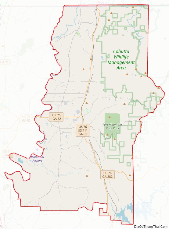
Murray County Road Map
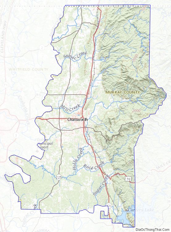
Geography
According to the U.S. Census Bureau, the county has a total area of 347 square miles (900 km), of which 344 square miles (890 km) is land and 2.2 square miles (5.7 km) (0.6%) is water.
The majority of Murray County is located in the Conasauga River sub-basin in the ACT River Basin (Coosa-Tallapoosa River Basin), and the southeastern corner of the county is located in the Coosawattee River sub-basin of the same larger ACT River Basin.
Major highways
- U.S. Route 76
- U.S. Route 411
- State Route 2
- State Route 52
- State Route 52 Alternate
- State Route 61
- State Route 136
- State Route 225
- State Route 282
- State Route 286
Adjacent counties
- Polk County, Tennessee (northeast)
- Fannin County (east-northeast)
- Gilmer County (east)
- Gordon County (south)
- Whitfield County (west)
- Bradley County, Tennessee (northwest)
National protected area
- Chattahoochee National Forest (part)
Murray County Topographic Map
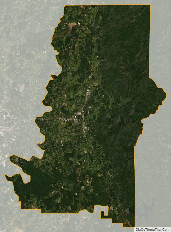
Murray County Satellite Map
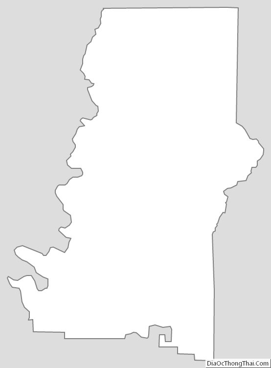
Murray County Outline Map