Dalton is a city and the county seat of Whitfield County, Georgia, United States. It is also the principal city of the Dalton Metropolitan Statistical Area, which encompasses all of Murray and Whitfield counties.
As of the 2010 census, the city had a population of 33,128 people, with the total metropolitan area having a population of 142,227. Dalton is located just off Interstate 75 in the foothills of the Blue Ridge Mountains in northwest Georgia and is the second-largest city in northwest Georgia, after Rome.
Dalton is home to many of the nation’s floor-covering manufacturers, primarily those producing carpet, rugs, and vinyl flooring. It is home to the Dalton Convention Center, which showcases the Georgia Athletic Coaches’ Hall of Fame and hosts a variety of events.
| Name: | Dalton city |
|---|---|
| LSAD Code: | 25 |
| LSAD Description: | city (suffix) |
| State: | Georgia |
| County: | Whitfield County |
| Elevation: | 761 ft (232 m) |
| Land Area: | 21.14 sq mi (54.76 km²) |
| Water Area: | 0.02 sq mi (0.04 km²) |
| Population Density: | 1,627.90/sq mi (628.52/km²) |
| ZIP code: | 30719-30722 |
| Area code: | 706/762 |
| FIPS code: | 1321380 |
| GNISfeature ID: | 0355424 |
| Website: | http://www.cityofdalton-ga.gov/ |
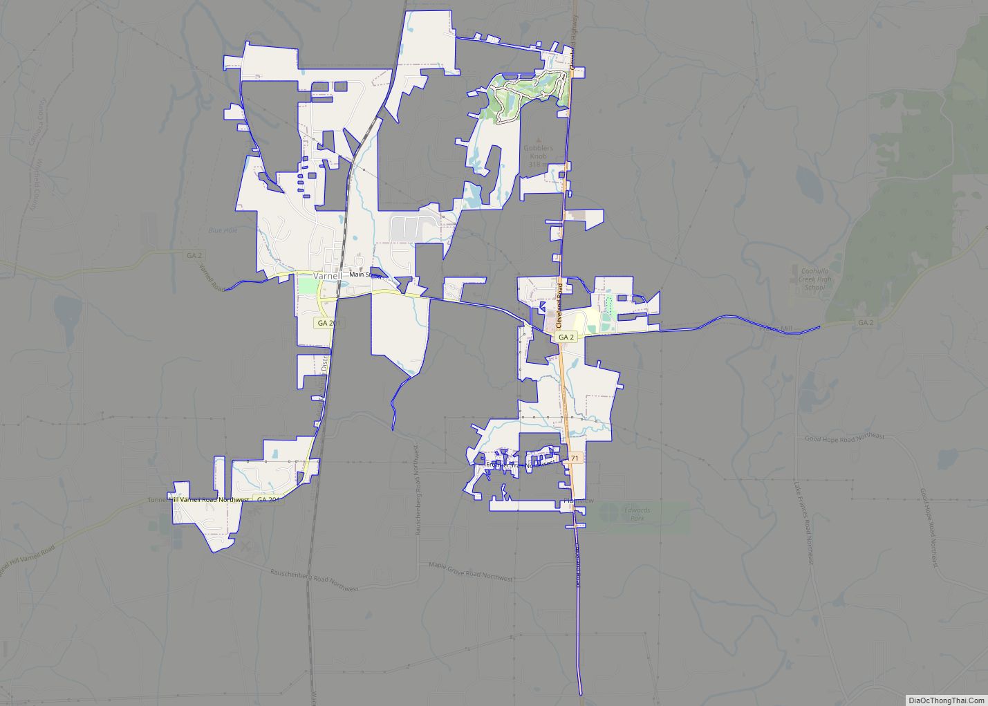
Online Interactive Map
Click on ![]() to view map in "full screen" mode.
to view map in "full screen" mode.
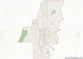
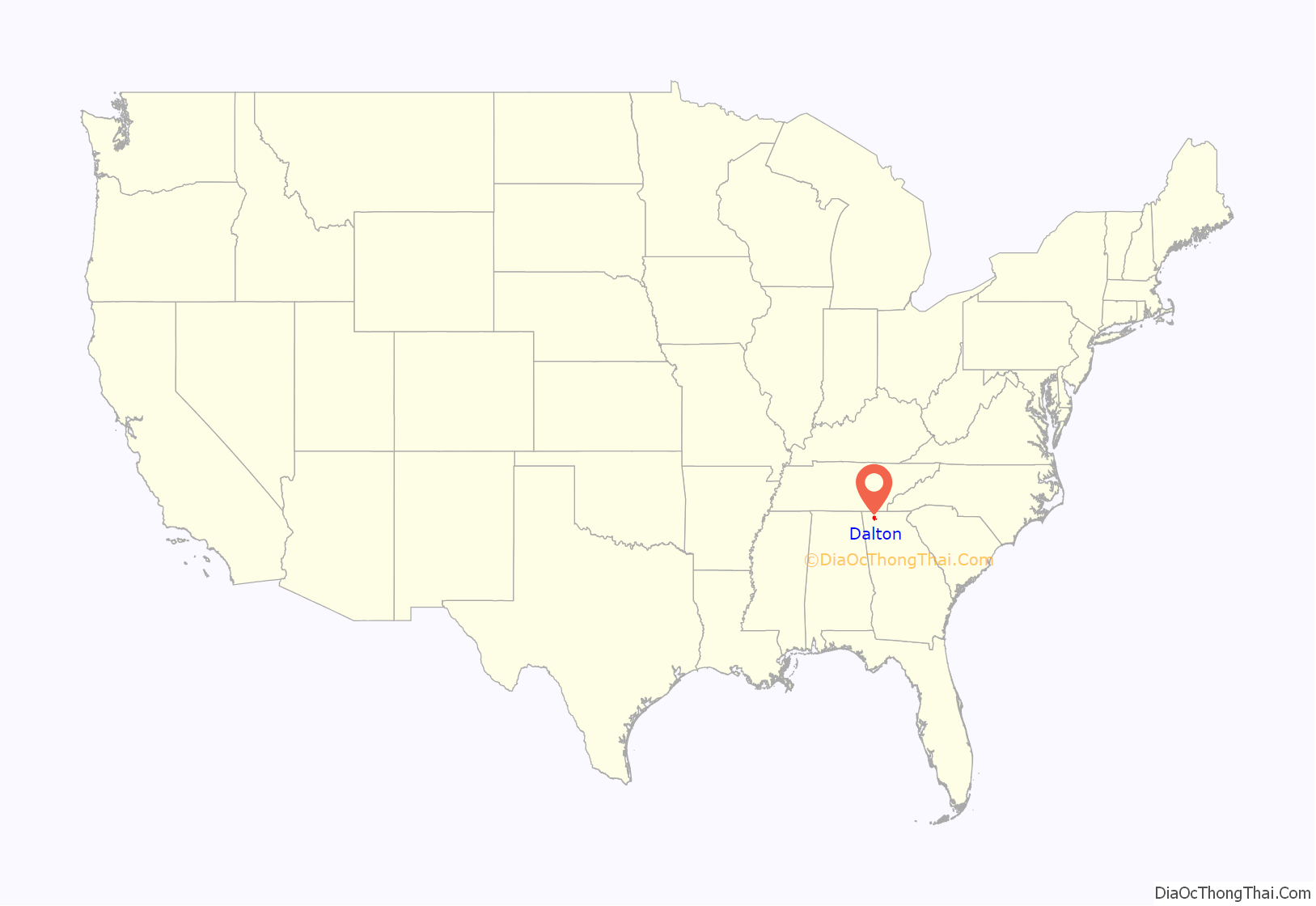
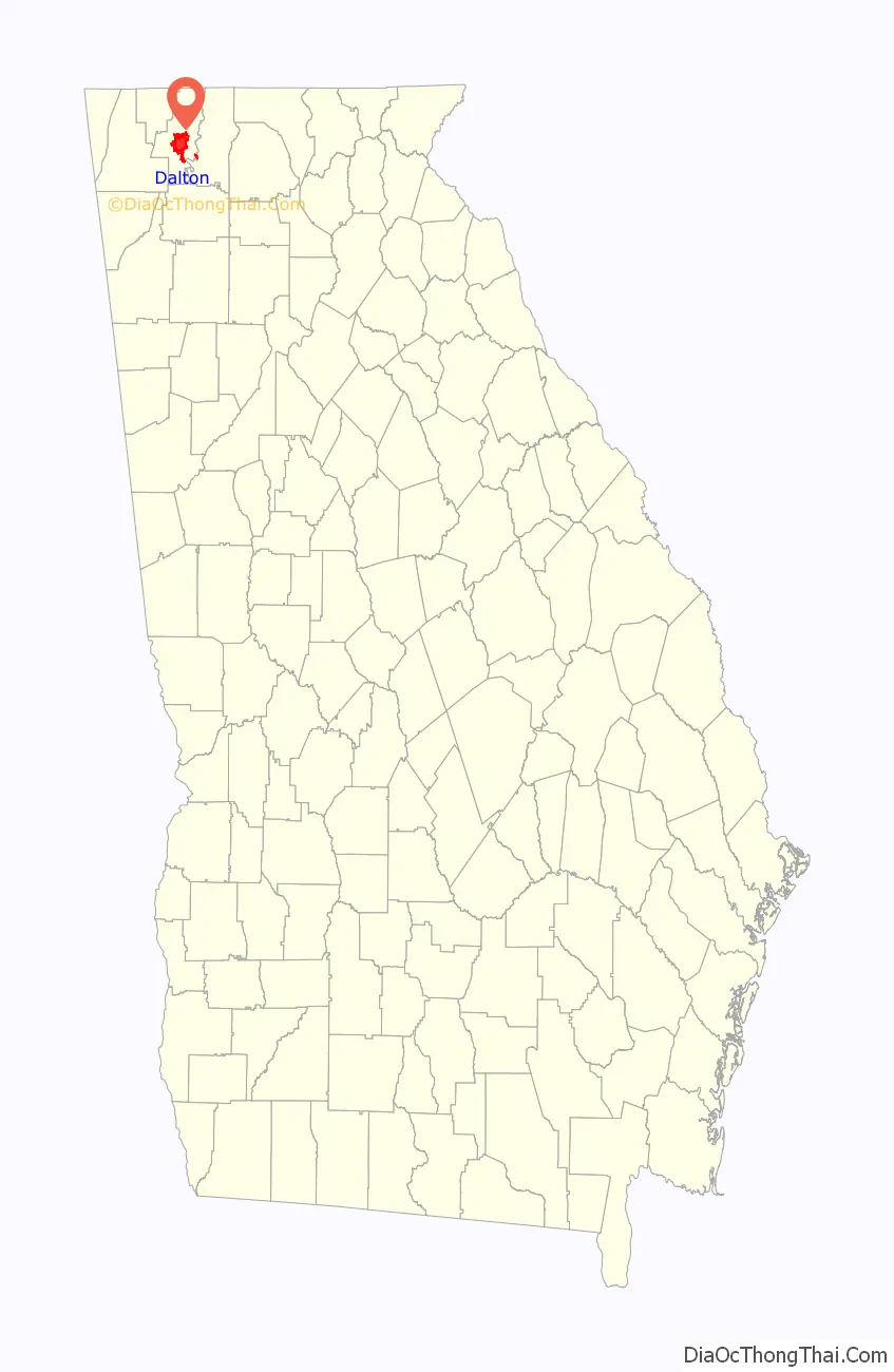
Dalton location map. Where is Dalton city?
History
Pre- history
Woodland Indians and Creek Nation initially held the area of present-day Dalton, Georgia. The first recorded white man in the area, was Spanish explorer Hernando de Soto (1540). By the mid-18th century, when the Cherokee forced the Creek Nation out of their homelands, to the west and south. The Cherokee Indians called the mountains of north Georgia their “Enchanted Land” until their own forced removal in 1838.
Industrialization
By the time the last Cherokees were removed from the land, work was underway for a railroad, the Western and Atlantic Railroad (W&A), to join the Tennessee River with the Georgia Railroad then under construction. In 1847, Dalton was defined as a mile radius from the city center, the Western and Atlantic Depot. The final segment of this pivotal railway was completed in Tunnel Hill, Whitfield County in 1850. A second railroad, East Tennessee and Georgia, was completed in 1852.
Catherine Evans Whitener’s revitalization of the pre-Civil War-era craft of candlewicking gave rise to a cottage chenille bedspread industry. Homes along U.S. Highway 41 displayed brightly patterned homemade bedspreads on front yard clotheslines in hopes of luring tourists into a purchase. The stretch of highway passing through Whitfield County became known colloquially as “Peacock Alley” in reference to one of the most common patterns depicted on the bedspreads. The bedspread business boomed to a multimillion-dollar industry by the 1950s, and from this early origin, the carpet tufting industry grew in Dalton after Glenn Looper developed an adaptation that allowed the mechanism used to tuft yarn into muslin or cotton for bedspreads to tuft into jute, shifting the nation’s carpet manufacturers from woven wool products in the northeast to tufted synthetic carpets in northwest Georgia. Today, carpet mills remain the region’s major employers and economic drivers.
Dalton was named for Tristram Dalton of Massachusetts.
Civil War
During the Civil War, the city of Dalton saw its first action during the Great Locomotive Chase, on April 12, 1862. More than a year later, on September 18–20, 1863, massive Union and Confederate forces battled a few miles west of Dalton at the Battle of Chickamauga, and later during the Chattanooga campaign. The war came to Whitfield County in the spring of 1864. The First Battle of Dalton included the battle of Rocky Face Ridge and Dug Gap began on May 7, 1864, and ended when General Johnston completed his withdrawal from Dalton on May 12. The Second Battle of Dalton occurred August 14–15, 1864.
In John Bell Hood’s Tennessee campaign, Joseph Wheeler’s cavalry attacked a Union blockhouse in Tilton before passing through Dalton and heading west.
The U.S. government recently declared Dalton and Whitfield County to have more intact Civil War artifacts than any other place in the country. Also of interest is the site of the historic Western & Atlantic Railroad Station; one of the few still standing and restored to its original architectural state, this site used to be the location of the Dalton Depot Restaurant (closed since 2015). The steel center marker for the original surveying of the city of Dalton is still inside the depot.
Modern history
The A. D. Strickland Store was once a rural county store, built c. 1878, and is now part of the National Register of Historic Places.
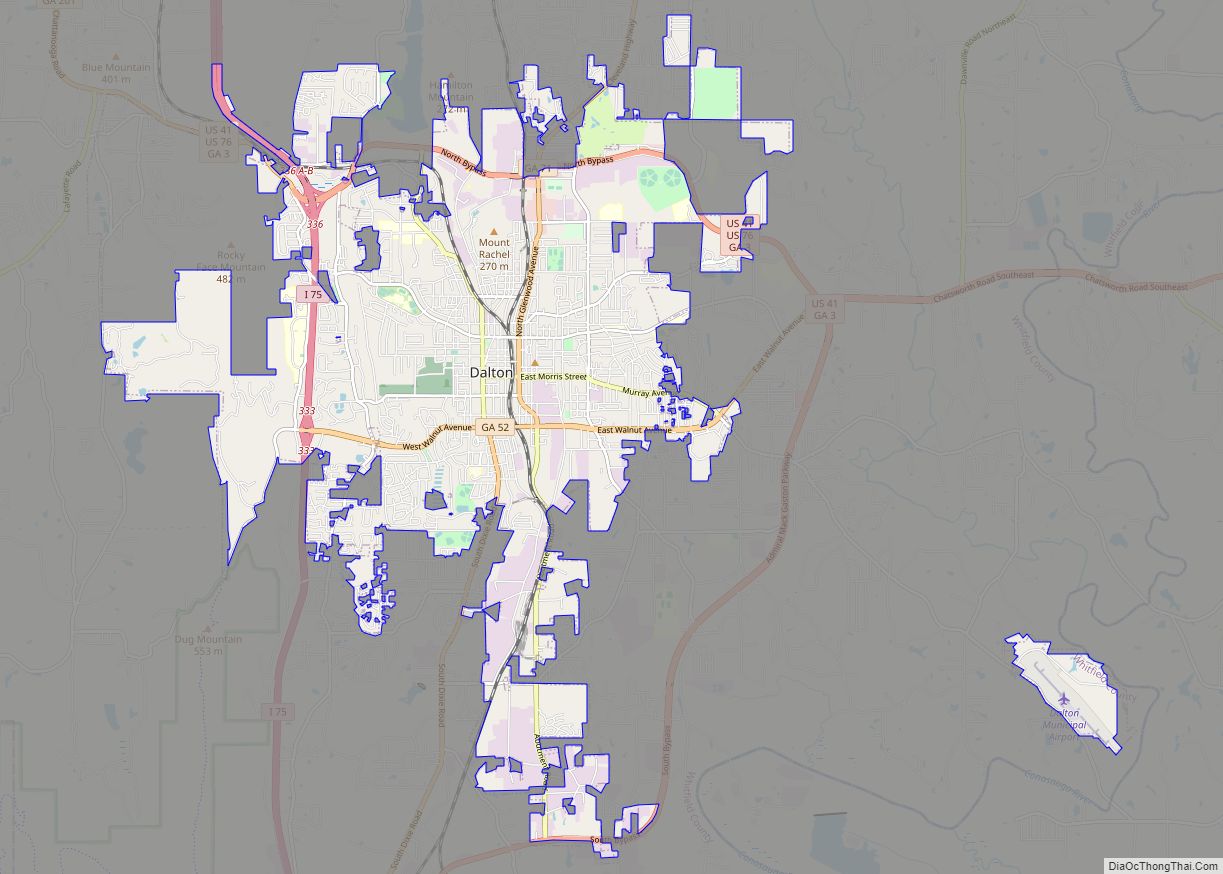
Dalton Road Map
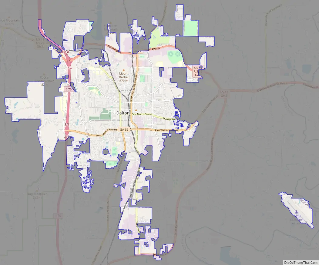
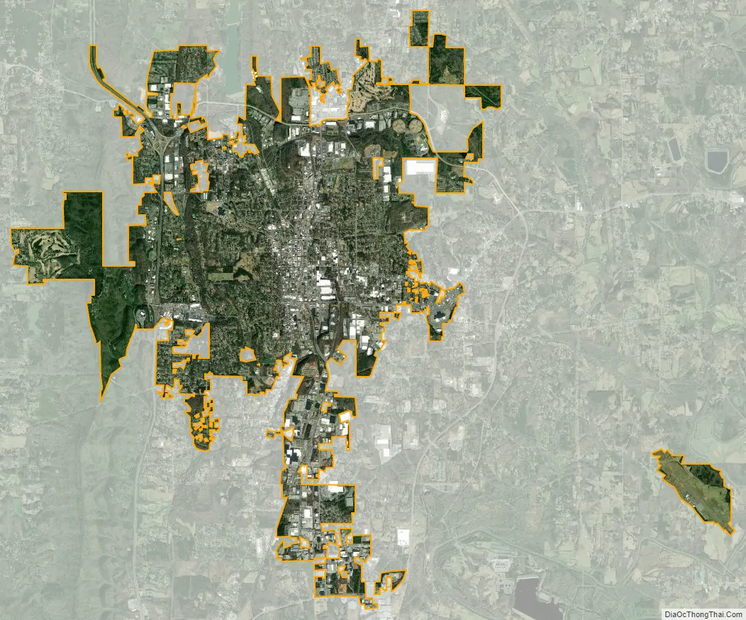
Dalton city Satellite Map
Geography
Dalton is located at (34.771088, -84.971553). According to the United States Census Bureau, the city has a total area of 19.8 square miles (51 km), of which 19.8 square miles (51 km) is land and 0.04 square miles (0.10 km) (0.10%) is water.
See also
Map of Georgia State and its subdivision:- Appling
- Atkinson
- Bacon
- Baker
- Baldwin
- Banks
- Barrow
- Bartow
- Ben Hill
- Berrien
- Bibb
- Bleckley
- Brantley
- Brooks
- Bryan
- Bulloch
- Burke
- Butts
- Calhoun
- Camden
- Candler
- Carroll
- Catoosa
- Charlton
- Chatham
- Chattahoochee
- Chattooga
- Cherokee
- Clarke
- Clay
- Clayton
- Clinch
- Cobb
- Coffee
- Colquitt
- Columbia
- Cook
- Coweta
- Crawford
- Crisp
- Dade
- Dawson
- Decatur
- DeKalb
- Dodge
- Dooly
- Dougherty
- Douglas
- Early
- Echols
- Effingham
- Elbert
- Emanuel
- Evans
- Fannin
- Fayette
- Floyd
- Forsyth
- Franklin
- Fulton
- Gilmer
- Glascock
- Glynn
- Gordon
- Grady
- Greene
- Gwinnett
- Habersham
- Hall
- Hancock
- Haralson
- Harris
- Hart
- Heard
- Henry
- Houston
- Irwin
- Jackson
- Jasper
- Jeff Davis
- Jefferson
- Jenkins
- Johnson
- Jones
- Lamar
- Lanier
- Laurens
- Lee
- Liberty
- Lincoln
- Long
- Lowndes
- Lumpkin
- Macon
- Madison
- Marion
- McDuffie
- McIntosh
- Meriwether
- Miller
- Mitchell
- Monroe
- Montgomery
- Morgan
- Murray
- Muscogee
- Newton
- Oconee
- Oglethorpe
- Paulding
- Peach
- Pickens
- Pierce
- Pike
- Polk
- Pulaski
- Putnam
- Quitman
- Rabun
- Randolph
- Richmond
- Rockdale
- Schley
- Screven
- Seminole
- Spalding
- Stephens
- Stewart
- Sumter
- Talbot
- Taliaferro
- Tattnall
- Taylor
- Telfair
- Terrell
- Thomas
- Tift
- Toombs
- Towns
- Treutlen
- Troup
- Turner
- Twiggs
- Union
- Upson
- Walker
- Walton
- Ware
- Warren
- Washington
- Wayne
- Webster
- Wheeler
- White
- Whitfield
- Wilcox
- Wilkes
- Wilkinson
- Worth
- Alabama
- Alaska
- Arizona
- Arkansas
- California
- Colorado
- Connecticut
- Delaware
- District of Columbia
- Florida
- Georgia
- Hawaii
- Idaho
- Illinois
- Indiana
- Iowa
- Kansas
- Kentucky
- Louisiana
- Maine
- Maryland
- Massachusetts
- Michigan
- Minnesota
- Mississippi
- Missouri
- Montana
- Nebraska
- Nevada
- New Hampshire
- New Jersey
- New Mexico
- New York
- North Carolina
- North Dakota
- Ohio
- Oklahoma
- Oregon
- Pennsylvania
- Rhode Island
- South Carolina
- South Dakota
- Tennessee
- Texas
- Utah
- Vermont
- Virginia
- Washington
- West Virginia
- Wisconsin
- Wyoming