| Name: | Sussex County |
|---|---|
| FIPS code: | 34-037 |
| State: | New Jersey |
| Founded: | June 8, 1753 |
| Named for: | Sussex, England |
| Seat: | Newton |
| Largest city: | Vernon Township (population and area) |
| Total Area: | 535.74 sq mi (1,387.6 km²) |
| Land Area: | 519.01 sq mi (1,344.2 km²) |
| Total Population: | 144,221 |
| Population Density: | 278.1/sq mi (107.4/km²) |
| Website: | www.sussex.nj.us |
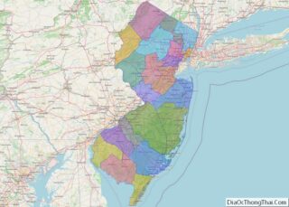
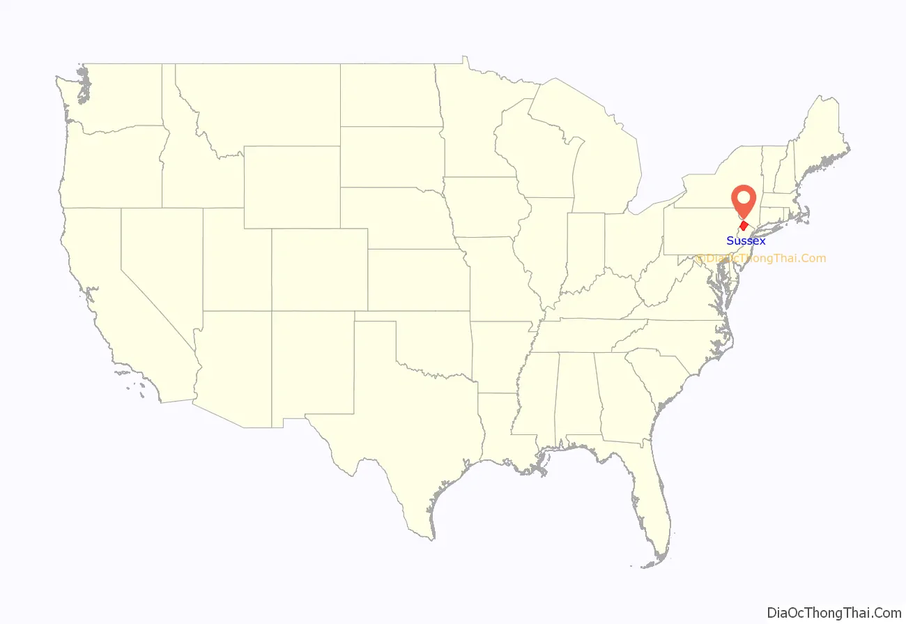
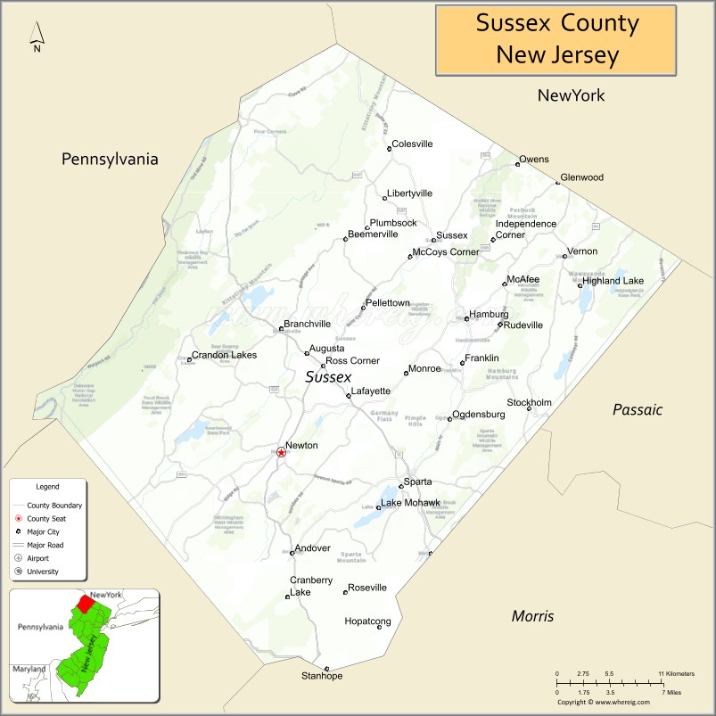
Sussex County location map. Where is Sussex County?
History
Etymology
The county was established in 1753 from portions of Morris County and named after the county of Sussex in England.
History
The area of Sussex County and its surrounding region was occupied for approximately 8,000-13,000 years by succeeding cultures of indigenous peoples. The Munsee Indians inhabited the region at the time of European encounter. The Munsee were a loosely organized division of the Lenape (or Lenni Lenape), a Native American people also called “Delaware Indians” after their historic territory along the Delaware River. The Lenape inhabited the mid-Atlantic coastal areas and inland along the Hudson and Delaware rivers. The Munsee spoke a very distinct dialect of the Lenape and inhabited a region bounded by the Hudson River, the head waters of the Delaware River and the Susquehanna River, and south to the Lehigh River and Conewago Creek. As a result of disruption following the French and Indian War (1756–1763), the American Revolutionary War (1775–1783), and later Indian removals from the eastern United States, the main Lenape groups now live in Ontario in Canada, and in Wisconsin and Oklahoma in the United States.
As early as 1690, Dutch and French Huguenot colonists from towns along the Hudson River Valley in New York began permanently settling in the Upper Delaware Valley (known as the “Minisink”). The route these Dutch settlers had taken was the path of an old Indian trail and became the route of the Old Mine Road and stretches of present-date U.S. Route 209. These Dutch settlers penetrated the Minisink Valley and settled as far south as the Delaware Water Gap, by 1731 this valley had been incorporated as Walpack Precinct. Throughout the 18th century, immigrants from the Rheinland Palatinate in Germany and Switzerland fled religious wars and poverty to arrive in Philadelphia and New York City. Several German families began leaving Philadelphia to settle along river valleys in Northwestern New Jersey and Pennsylvania’s Lehigh Valley in the 1720s, spreading north into Sussex County in the 1740s and 1750s as additional German emigrants arrived. Also during this time, Scottish settlers from Elizabethtown and Perth Amboy, and English settlers from these cities, Long Island, Connecticut and Massachusetts, came to New Jersey and moved up the tributaries of the Passaic and Raritan rivers, settling in the eastern sections of present-day Sussex and Warren counties.
By the 1750s, residents of this area began to petition colonial authorities for a new county to be formed; they complained of the inconvenience of long travel to conduct business with the government and the courts. By this time, four large townships had been created in this sparsely populated Northwestern region: Walpack Township (before 1731), Greenwich Township (before 1738), Hardwick Township (1750) and Newtown Township (1751). On June 8, 1753, Sussex County was created from these four municipalities, which had been part of Morris County when Morris stretched over all of northwestern New Jersey. Sussex County at this time encompassed present-day Sussex and Warren Counties and its boundaries were drawn by the New York-New Jersey border to the north, the Delaware River to the west, and the Musconetcong River to the south and east. After several decades of debate over where to hold the sessions of the county’s courts, the state legislature eventually voted to divide Sussex County in two, using a line drawn from the juncture of the Flat Brook and Delaware River in a southeasterly direction to the Musconetcong River running through the Yellow Frame Presbyterian Church in present-day Fredon Township (then part of Hardwick). On November 20, 1824, Warren County was created from the southern territory of the Sussex County.
Throughout the 18th, 19th, and 20th centuries, Sussex County’s economy was largely centered around agriculture and the mining of iron and zinc ores. Early settlers established farms whose operations were chiefly focused towards subsistence agriculture. Because of geological constraints, Sussex County’s agricultural production was centered around dairy farming. Several farms had orchards—typically apples and peaches—and surplus fruit and grains were often distilled or brewed into alcoholic beverages (hard ciders, applejack and fruit brandies). This was the economic model until the mid-19th century when advances in food preservation and the introduction of railroads (e.g. the Sussex Railroad) into the area allowed Sussex County to transport farm products throughout the region. Railroads also promoted the building of factories as companies relocated to the area at the end of the 19th century—including that of the H.W. Merriam Shoe Company (1873) in Newton.
The Highlands Region of Northwestern New Jersey has proven to possess rich deposits of iron ore. In the mid 18th century, several entrepreneurial colonists began mining iron in area around Andover, Hamburg, and Franklin present-day Sussex County and establishing forges and furnaces to create pig iron and bar iron. During the American Revolution, the Quartermaster Department of the Continental Army complained to Congress of difficulties in acquiring iron to support the war effort and the Congress ordered two colonels, Benjamin Flower and Thomas Maybury to take possession of the iron works at Andover in order to equip General Washington’s army. During the middle of the 19th century, under the management of Cooper and Hewitt, the Andover mine produced 50,000 tons of iron ore each year. The firm manufactured railroad rails and the country’s first structural steel, which and led to the building of railroads and commercial development in the county. Iron from the Andover mines was fashioned into cable wire for the bridge built at Niagara Falls and for the beams used to rebuild Princeton University’s Nassau Hall in Princeton, New Jersey after a fire undermined the structure in 1855. During the American Civil War, Andover iron found its way into rifle barrels and cannonballs just as it had during the Revolution years before.
As deposits were depleted, the iron mining industry began to diminish by the mid-19th century. During the late 19th century, prolific American inventor Thomas Edison began to explore the commercial opportunities of processing poor-quality low-grade iron ore to combat the growing scarcity of iron deposits in the United States. He began to purchase mining companies in Sussex County in the 1880s and consolidating their assets. He developed a process of crushing and milling iron-bearing minerals and separating iron ore from the material through large electromagnets, and built one of the world’s largest ore-crushing mills near Ogdensburg. Completed in 1889, the factory contained three giant electromagnets and was intended to process up to 1200 tons of iron ore every day. However, technical difficulties repeatedly thwarted production. However, in the 1890s, richer soft-grade iron ore deposits located in Minnesota‘s Iron Range rendered Edison’s Ogdensburg operation unprofitable and he closed the works in 1900. Edison adapted the process and machinery for the cement industry and invested in producing Portland Cement in other locations.
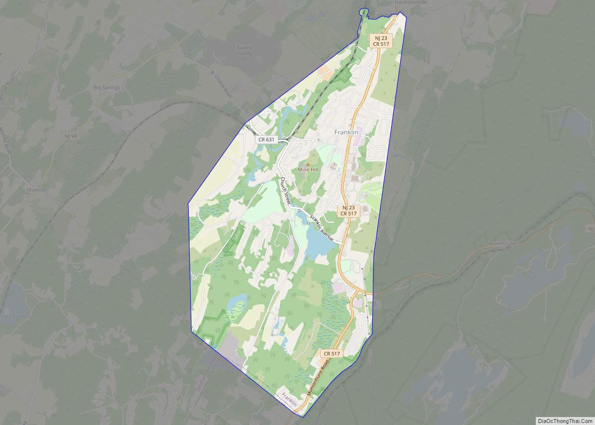
In the early 19th century, Samuel Fowler (1779–1844) settled in Franklin Furnace (now Franklin) to open up a medical practice, but is largely known for his interest in mineralogy which led to his developing commercial uses for zinc and for discovery of several rare minerals (chiefly various ores of zinc). Many of these zinc minerals are known for fluorescing in vivid colors when exposed to ultraviolet light. Because of both the rich deposits and many of these minerals are not found anywhere else on earth, Franklin is known as the “Fluorescent Mineral Capitol of the World.” Fowler, who later briefly served in elected political office, operated the local iron works and bought several abandoned zinc and iron mines in the area. Shortly after his death, two companies were created to exploit the iron and zinc deposits in this region; they acquired the rights to Fowler’s holdings in Franklin and nearby Sterling Hill. These companies later merged to form the New Jersey Zinc Corporation (today known as Horsehead Industries). At this time, Russian, Chilean, British, Irish, Hungarian and Polish immigrants came to Franklin to work in the mines, and the population of Franklin swelled from 500 (in 1897) to over 3,000 (in 1913). Declining deposits in the Franklin area, the expense of pumping groundwater from mine shafts, tax disputes and misdirected investments by the company led to the abandonment of the mines. Today, both the Franklin and Sterling Hill mines are operated as museums.
Beginning in the 1950s and 1960s, construction or improvements of Interstate 80, Route 181 and Route 23 triggered rapid growth to Sussex County. Since 1950, the population nearly quadrupled from 34,423 people to 130,943 people in 1990. This has caused Sussex County to begin developing into a light suburban atmosphere, instead of the sparsely populated rural region it once was, especially in the eastern half of the county.
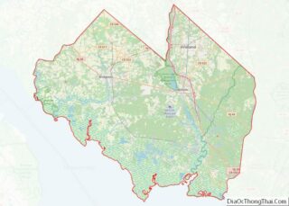
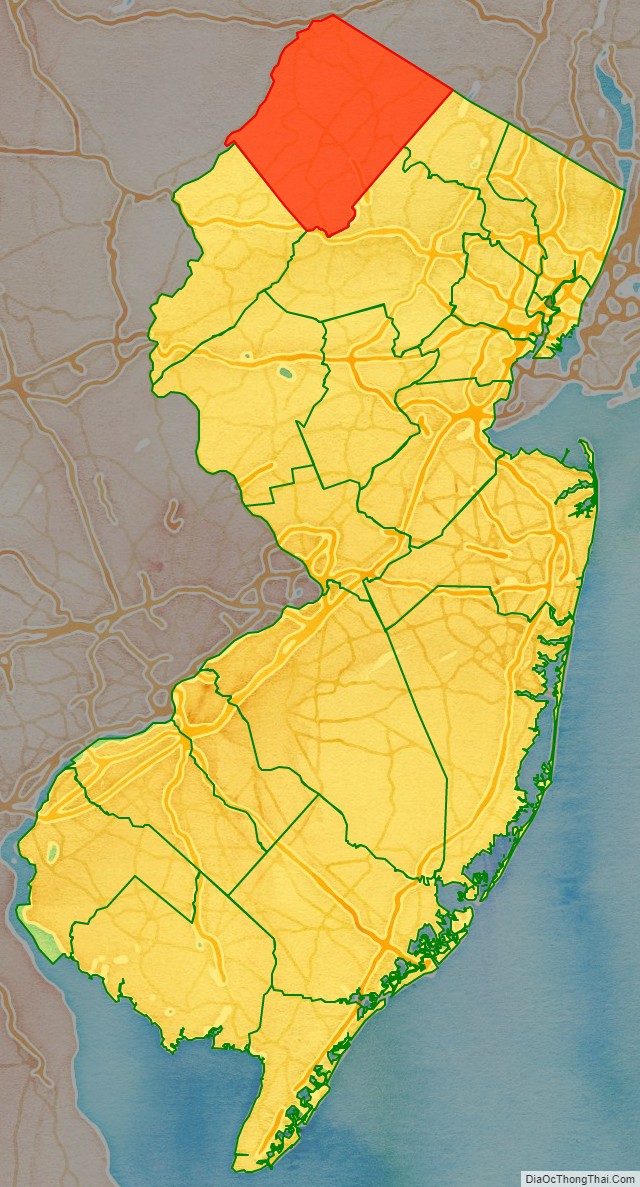
Sussex County Road Map
Geography
According to the 2010 Census, the county had a total area of 535.74 square miles (1,387.6 km), including 519.01 square miles (1,344.2 km) of land (96.9%) and 16.73 square miles (43.3 km) of water (3.1%). It is the fourth-largest of the state’s 21 counties in terms of area.
Sussex County lies within the Kittatinny Mountains of Northwestern New Jersey and the overall Appalachian Mountains range. High Point, located at the northernmost tip of New Jersey in Montague Township, is the highest natural elevation in the state at 1,803 feet (549.5 m) above sea level. Nearby, Sunrise Mountain in Stokes State Forest has an elevation of 1,653 feet (504 m). Many mountains in the Highlands region range between 1000 and 1500 feet (375–450 m). Officially, the county’s lowest elevation is approximately 300 feet (90 m) above sea level along the Delaware River near Flatbrookville. However, local authorities claim that the mine adit descending 2,675 feet (815 m) at the Sterling Hill Mine in Ogdensburg is unofficially the lowest elevation in New Jersey.
Because of its topography, Sussex County has remained a relatively rural and forested area. In the western half of the county, several state and federal parks have kept the large tracts of land undeveloped and in their natural states. The eastern half of the county has had more suburban development because of its proximity to more populated areas and commercial development zones.
With its location at the top of New Jersey, Sussex County is the only county to neighbor both New York and Pennsylvania. Because it is shaped roughly like a diamond or rhombus with its point matching the cardinal points of the compass, its boundary lines are roughly oriented along the ordinal or intercardinal directions.
Climate
Because of its location in the higher elevations of northwestern New Jersey’s Appalachian mountains, Sussex County has a cooler humid continental climate or microthermal climate (Köppen Dfb) which indicates patterns of significant precipitation in all seasons and at least four months where the average temperature rises above 10 °C (50 °F) This differs from the rest of the state which is generally a humid mesothermal climate, in which temperatures range between -3 °C (27 °F) and 18 °C (64 °F) during the year’s coldest month. Sussex County is part of USDA Plant Hardiness Zone 6.
During winter and early spring, New Jersey in some years is subject to “nor’easters”—significant storm systems that have proven capable of causing blizzards or flooding throughout the northeastern United States. Hurricanes and tropical storms, tornadoes, and earthquakes are relatively rare. The Kittatinny Valley to the north of Newton, part of the Great Appalachian Valley, experiences a snowbelt phenomenon and has been categorized as a microclimate region known as the “Sussex County Snow Belt.” This region receives approximately forty to fifty inches of snow per year and generally more snowfall that the rest of Northern New Jersey and the Northern Climate Zone. This phenomenon is attributed to the orographic lift of the Kittatinny Ridge which impacts local weather patterns by increasing humidity and precipitation, providing the ski resorts of Vernon Valley in the northeastern part of this region with increased snowfall.
In recent years, average temperatures in the county seat of Newton have ranged from a low of 17 °F (−8 °C) in January to a high of 84 °F (29 °C) in July. Average monthly precipitation ranged from 2.86 inches (73 mm) in February to 4.76 inches (121 mm) in June.
According to the USDA Natural Resource Conservation Service soil survey, the area receives sunshine approximately 62% of the time in summer and 48% in winter. Prevailing winds are typically from the southwest for most of year; but in late winter and early spring come from the northwest. The lowest recorded temperature was −26 °F on January 21, 1994. The highest recorded temperature was 104 °F (40 °C) on September 3, 1953. The heaviest one-day snowfall was 24 inches (610 mm) recorded on January 8, 1996; combined with the next day, total snowfall was 40 inches (1,000 mm). The heaviest one-day rainfall–6.70 inches (170 mm) was recorded on August 19, 1955.
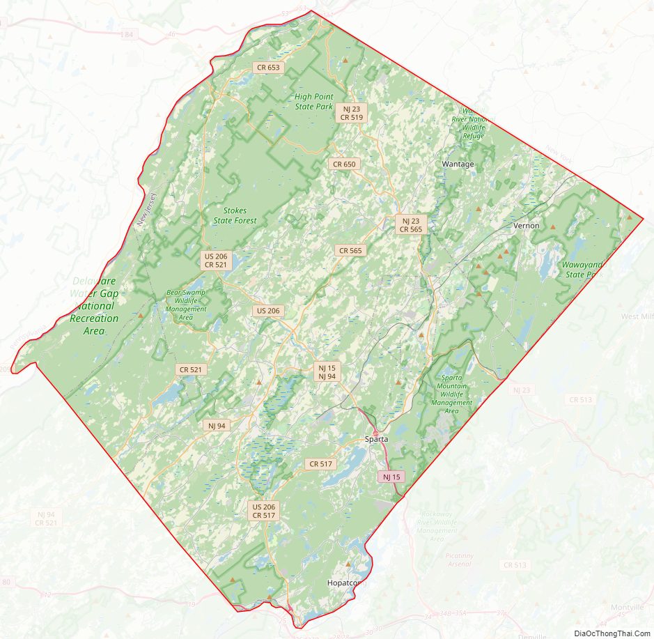
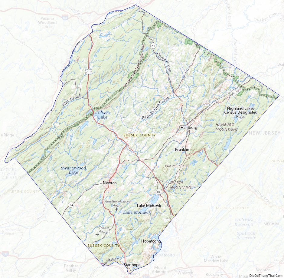
Sussex County Topographic Map
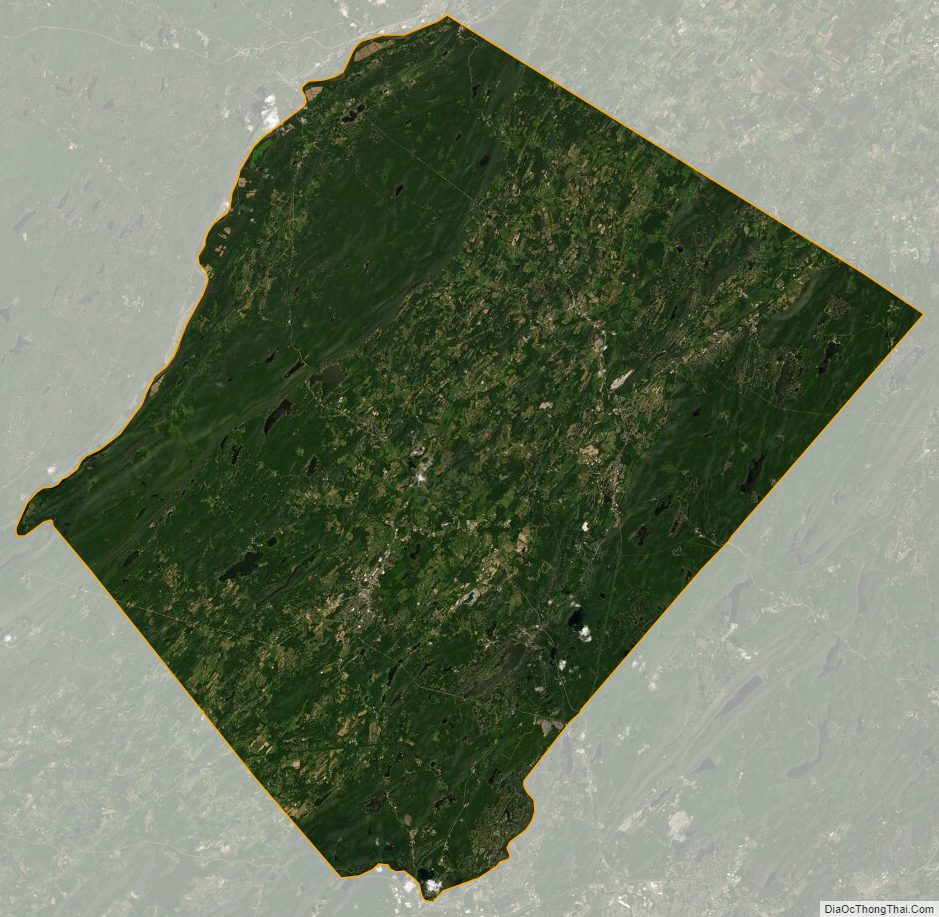
Sussex County Satellite Map
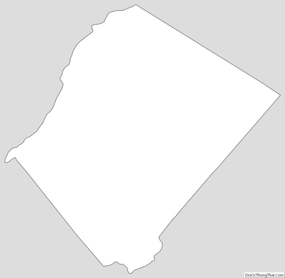
Sussex County Outline Map