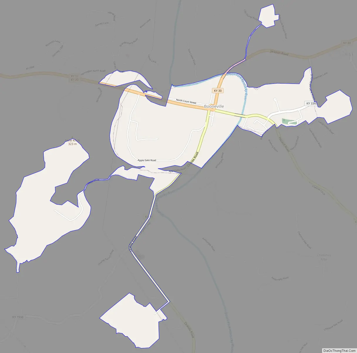
Booneville is a home rule-class city in Owsley County, Kentucky, in the United States. The population was 81 at the 2010 census. It is the county seat of Owsley County. It is located at the junction of Kentucky Route 11 and Kentucky Route 30 on the South Fork of the Kentucky River.
| Name: | Booneville city |
|---|---|
| LSAD Code: | 25 |
| LSAD Description: | city (suffix) |
| State: | Kentucky |
| County: | Owsley County |
| Incorporated: | March 1, 1847 |
| Elevation: | 709 ft (216 m) |
| Total Area: | 1.48 sq mi (3.82 km²) |
| Land Area: | 1.45 sq mi (3.75 km²) |
| Water Area: | 0.03 sq mi (0.08 km²) |
| Total Population: | 168 |
| Population Density: | 116.10/sq mi (44.82/km²) |
| ZIP code: | 41314 |
| Area code: | 606 |
| FIPS code: | 2108614 |
| GNISfeature ID: | 0510852 |
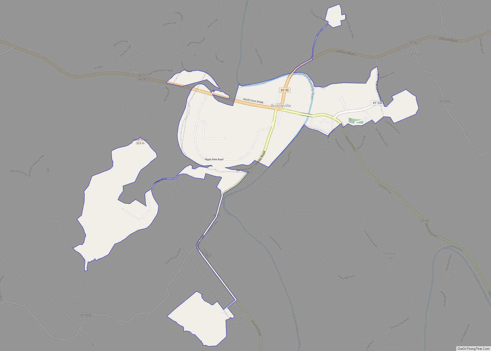
Online Interactive Map
Click on ![]() to view map in "full screen" mode.
to view map in "full screen" mode.
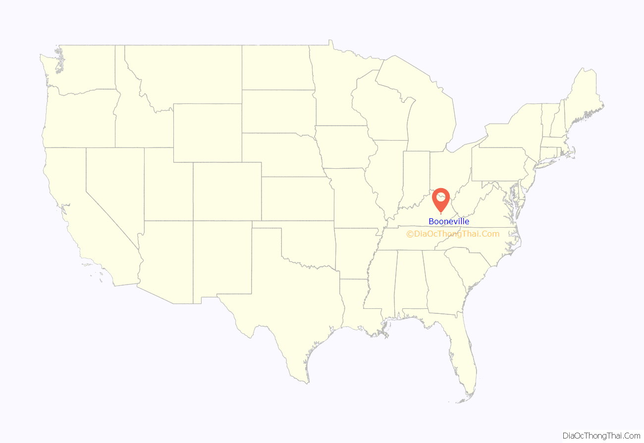
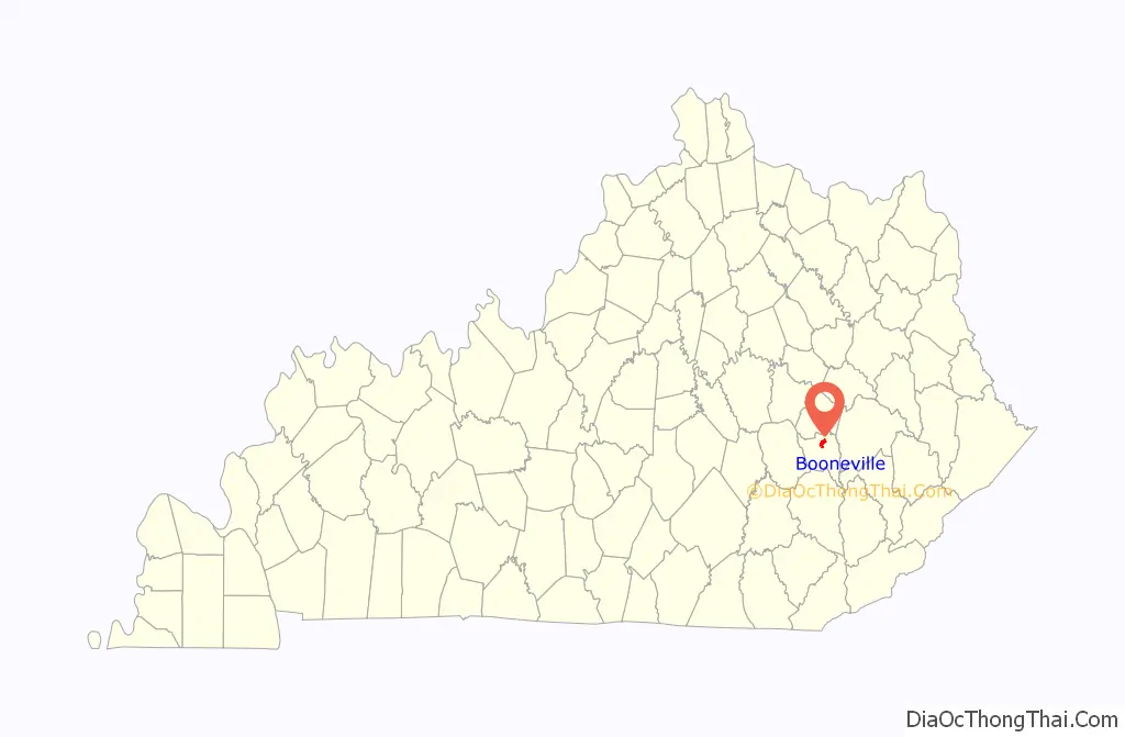
Booneville location map. Where is Booneville city?
History
The town was originally named Moore’s Station after its chief landowner. It was renamed Boone’s Station and then Booneville in honor of the American frontiersman, Daniel Boone. The town, consisting at the time of little more than a temporary log courthouse, became the county seat when Owsley County was formed on May 20, 1844. From this, the settlement was also sometimes known as Owsley Court House around this time. It was formally incorporated as a city by the state assembly on March 1, 1847. During the Civil War, Booneville was a crossroads for various Union and Confederate regiments, and was threatened by Confederate guerrillas, but avoided the destruction that befell some other county seats of Kentucky during the war.
The Moyers Building in Boonesville was added to the National Register of Historic Places in 1982.
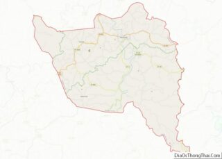
Booneville Road Map
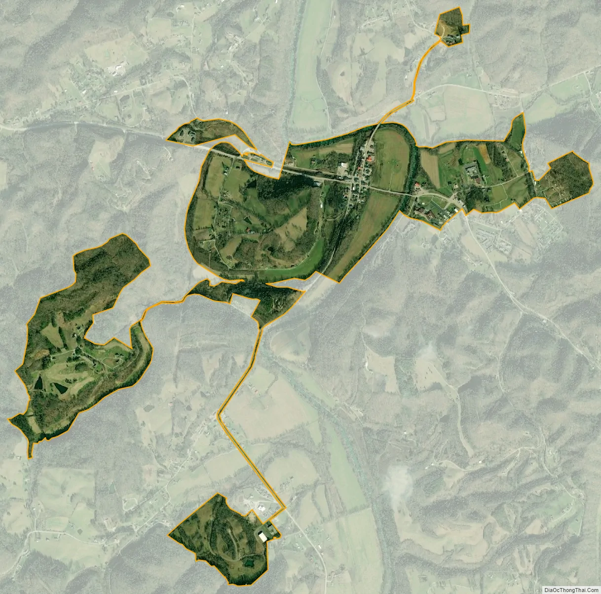
Booneville city Satellite Map
Geography
According to the United States Census Bureau, the city has a total area of 0.6 square miles (1.6 km), all land.
See also
Map of Kentucky State and its subdivision:- Adair
- Allen
- Anderson
- Ballard
- Barren
- Bath
- Bell
- Boone
- Bourbon
- Boyd
- Boyle
- Bracken
- Breathitt
- Breckinridge
- Bullitt
- Butler
- Caldwell
- Calloway
- Campbell
- Carlisle
- Carroll
- Carter
- Casey
- Christian
- Clark
- Clay
- Clinton
- Crittenden
- Cumberland
- Daviess
- Edmonson
- Elliott
- Estill
- Fayette
- Fleming
- Floyd
- Franklin
- Fulton
- Gallatin
- Garrard
- Grant
- Graves
- Grayson
- Green
- Greenup
- Hancock
- Hardin
- Harlan
- Harrison
- Hart
- Henderson
- Henry
- Hickman
- Hopkins
- Jackson
- Jefferson
- Jessamine
- Johnson
- Kenton
- Knott
- Knox
- Larue
- Laurel
- Lawrence
- Lee
- Leslie
- Letcher
- Lewis
- Lincoln
- Livingston
- Logan
- Lyon
- Madison
- Magoffin
- Marion
- Marshall
- Martin
- Mason
- McCracken
- McCreary
- McLean
- Meade
- Menifee
- Mercer
- Metcalfe
- Monroe
- Montgomery
- Morgan
- Muhlenberg
- Nelson
- Nicholas
- Ohio
- Oldham
- Owen
- Owsley
- Pendleton
- Perry
- Pike
- Powell
- Pulaski
- Robertson
- Rockcastle
- Rowan
- Russell
- Scott
- Shelby
- Simpson
- Spencer
- Taylor
- Todd
- Trigg
- Trimble
- Union
- Warren
- Washington
- Wayne
- Webster
- Whitley
- Wolfe
- Woodford
- Alabama
- Alaska
- Arizona
- Arkansas
- California
- Colorado
- Connecticut
- Delaware
- District of Columbia
- Florida
- Georgia
- Hawaii
- Idaho
- Illinois
- Indiana
- Iowa
- Kansas
- Kentucky
- Louisiana
- Maine
- Maryland
- Massachusetts
- Michigan
- Minnesota
- Mississippi
- Missouri
- Montana
- Nebraska
- Nevada
- New Hampshire
- New Jersey
- New Mexico
- New York
- North Carolina
- North Dakota
- Ohio
- Oklahoma
- Oregon
- Pennsylvania
- Rhode Island
- South Carolina
- South Dakota
- Tennessee
- Texas
- Utah
- Vermont
- Virginia
- Washington
- West Virginia
- Wisconsin
- Wyoming