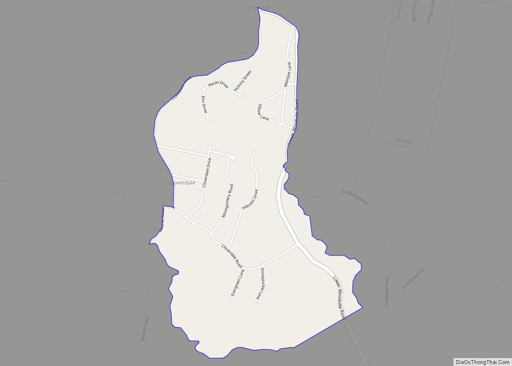
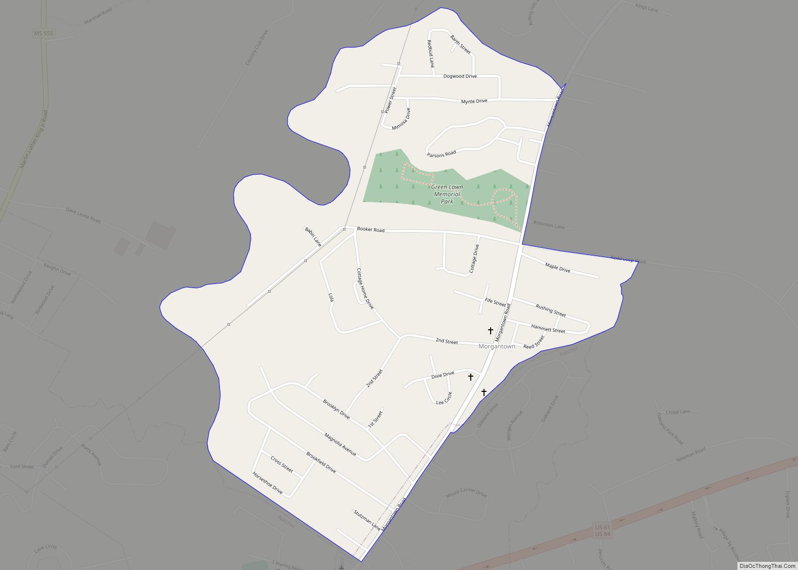
Natchez (/ˈnætʃɪz/ NATCH-iz) is the only city in and the county seat of Adams County, Mississippi, United States. It has a total population of 14,520 (as of the 2020 census). Located on the Mississippi River across from Vidalia in Concordia Parish, Louisiana, Natchez was a prominent city in the antebellum years, a center of cotton planters and Mississippi River trade.
Natchez is approximately 90 miles (140 km) southwest of Jackson, the capital of Mississippi, which is located in the central part of the state. It is approximately 85 miles (137 km) north of Baton Rouge, Louisiana, located on the lower Mississippi River. Natchez is the 25th-largest city in the state. The city was named for the Natchez tribe of Native Americans, who with their ancestors, inhabited much of the area from the 8th century AD through the French colonial period.
| Name: | Natchez city |
|---|---|
| LSAD Code: | 25 |
| LSAD Description: | city (suffix) |
| State: | Mississippi |
| County: | Adams County |
| Founded: | 1716 as Fort Rosalie, renamed by 1730 Louisiana (New France) |
| Incorporated: | 1800s |
| Elevation: | 217 ft (66 m) |
| Total Area: | 16.41 sq mi (42.49 km²) |
| Land Area: | 15.81 sq mi (40.96 km²) |
| Water Area: | 0.59 sq mi (1.53 km²) |
| Total Population: | 14,520 |
| Population Density: | 918.12/sq mi (354.48/km²) |
| ZIP code: | 39120-39122 |
| Area code: | 601 |
| FIPS code: | 2850440 |
| GNISfeature ID: | 0691586 |
| Website: | www.natchez.ms.us/1 |
Online Interactive Map
Click on ![]() to view map in "full screen" mode.
to view map in "full screen" mode.
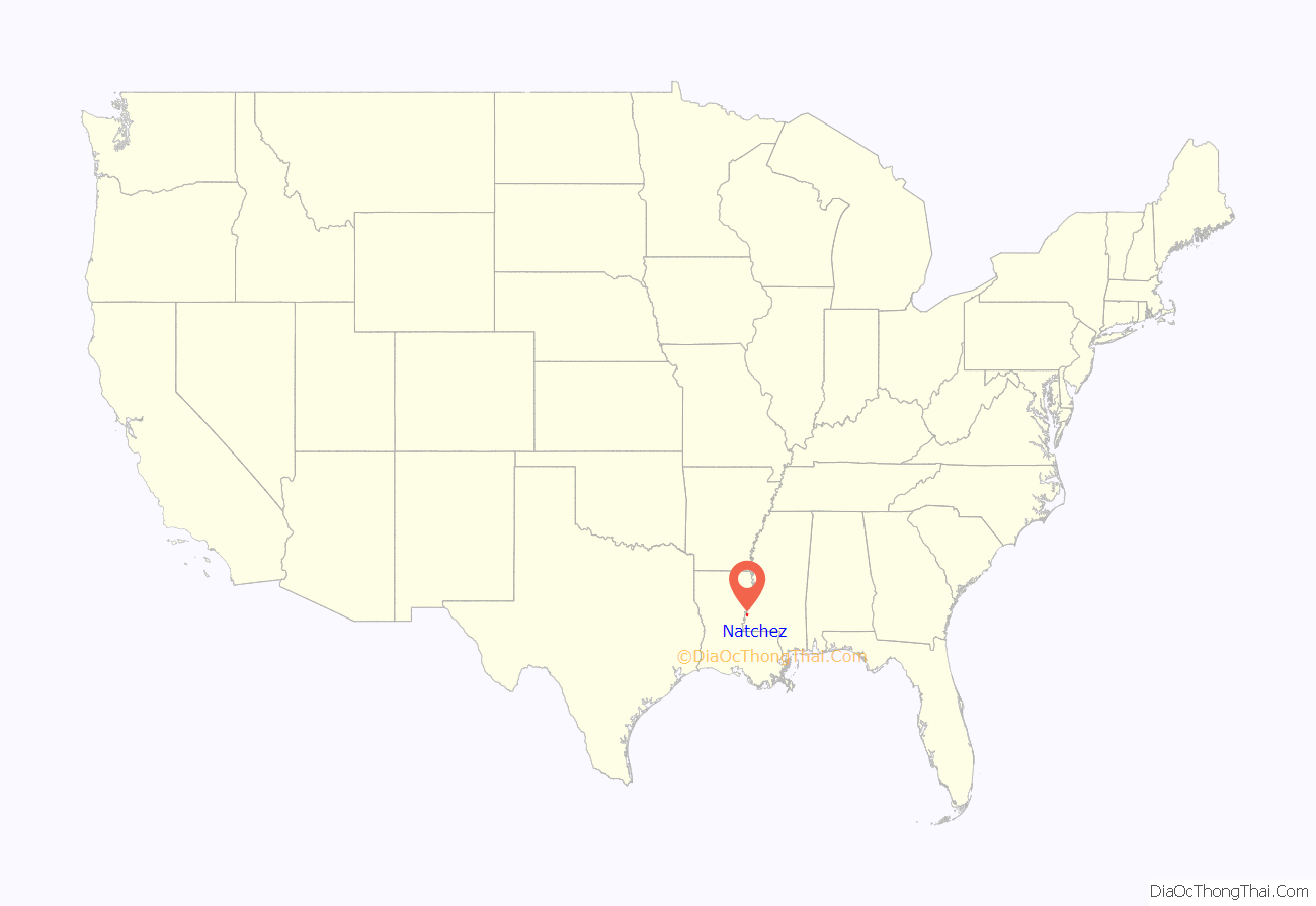
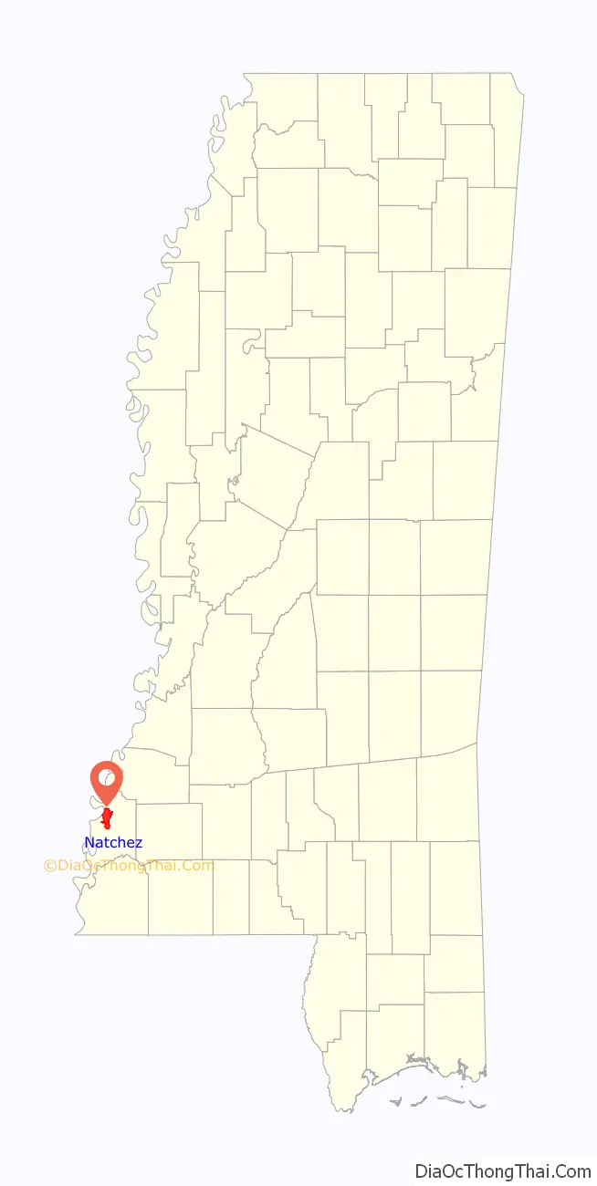
Natchez location map. Where is Natchez city?
History
Established by French colonists in 1716, Natchez is one of the oldest and most important European settlements in the lower Mississippi River Valley. After the French lost the French and Indian War (Seven Years’ War), they ceded Natchez and near territory to Great Britain in the Treaty of Paris of 1763. (It later traded other territory east of the Mississippi River with Great Britain, which expanded what it called West Florida). The British Crown bestowed land grants in this territory to officers who had served with distinction in the war. These officers came mostly from the colonies of New York, New Jersey, and Pennsylvania. They established plantations and brought their upper-class style of living to the area.
Beginning 1779, the area was under Spanish colonial rule. After defeat in the American Revolutionary War, Great Britain ceded the territory to the United States under the terms of the Treaty of Paris (1783). Spain was not a party to the treaty, and it was their forces who had taken Natchez from British troops. Although Spain had been allied with the American colonists, they were more interested in advancing their power at the expense of Britain. Once the war was over, they were not inclined to give up that which they had acquired by force.
In 1797 Major Andrew Ellicott of the United States marched to the highest ridge in the young town of Natchez, set up camp, and raised the first American Flag claiming Natchez and all former Spanish lands east of the Mississippi above the 31st parallel for the United States.
After the United States acquired this area from the Spanish, the city served as the capital of the Mississippi Territory and then of the state of Mississippi. It predates Jackson by more than a century; the latter replaced Natchez as the capital in 1822, as it was more centrally located in the developing state. The strategic location of Natchez, on a bluff overlooking the Mississippi River, ensured that it would be a pivotal center of trade, commerce, and the interchange of ethnic Native American, European, and African cultures in the region; it held this position for two centuries after its founding.
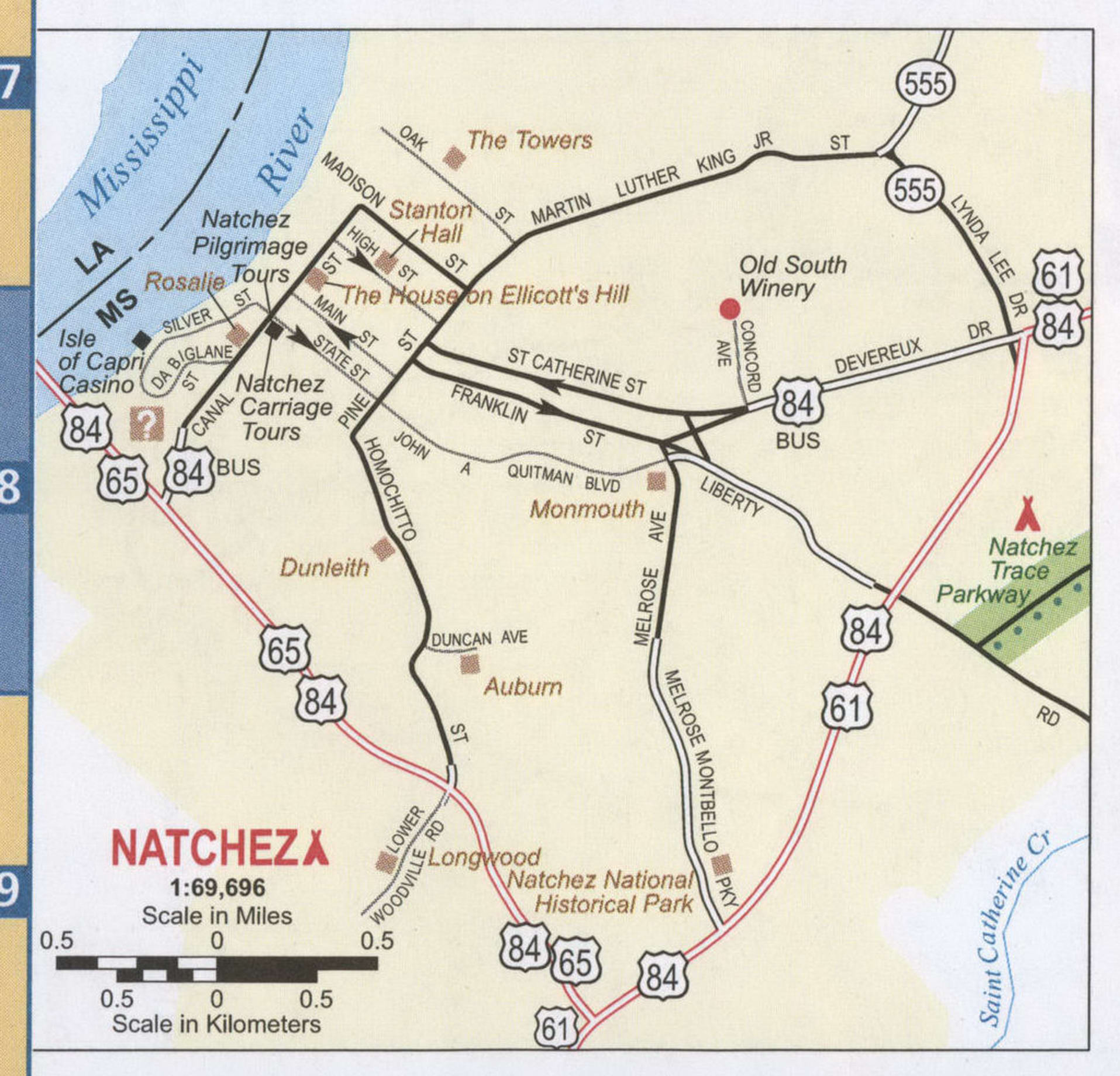
In U.S. history, Natchez is recognized particularly for its role in the development of the Old Southwest during the first half of the 19th century. It was the southern terminus of the historic Natchez Trace, with the northern terminus being Nashville, Tennessee. After unloading their cargoes in Natchez or New Orleans, many pilots and crew of flatboats and keelboats traveled by the Trace overland to their homes in the Ohio River Valley. (Given the strong current of the Mississippi River, it was not until steam-powered vessels were developed in the 1820s that travel northward on the river could be accomplished by large boats.) The Natchez Trace also played an important role during the War of 1812. Today the modern Natchez Trace Parkway, which commemorates this route, still has its southern terminus in Natchez.
In the decades preceding the Civil War, Natchez was by far the most prevalent slave trading city in Mississippi, and second in the United States only to New Orleans. The leading markets were located at the Forks of the Road, at the intersection of Liberty Road and Washington Road (now D’Evereux Drive and St. Catherine Street). In 1833, the most active slavers in the United States, John Armfield and Isaac Franklin began a program of arbitraging low slave prices in the Middle Atlantic area by sending thousands of slaves to Deep South markets in Natchez and New Orleans. Their company, Franklin and Armfield sent an annual caravan of slaves, called a coffle, from Virginia to the Forks of the Road in Natchez, as well as sending others by ship through New Orleans. Unlike other slave sellers of the day, Franklin and Armfield sold slaves individually, with the buyers allowed to survey the people much like items in a modern retail store.
In 1840, the city was struck by a devastating tornado that killed 317 people and injured 109. It ranks today as the second-deadliest tornado in U.S. history, although the death toll may be higher due to slave deaths not traditionally being counted in the South at that time.
In the middle of the nineteenth century, the city attracted wealthy Southern planters as residents, who built mansions to fit their ambitions. Their plantations were vast tracts of land in the surrounding lowlands along the river fronts of Mississippi and Louisiana, where they grew large commodity crops of cotton and sugarcane using slave labor. Natchez became the principal port from which these crops were exported, both upriver to Northern cities and downriver to New Orleans, where much of the cargo was exported to Europe. Many of the mansions built by planters before 1860 survive and form a major part of the city’s architecture and identity. Agriculture remained the primary economic base for the region until well into the twentieth century.
During the American Civil War Natchez was surrendered by Confederate forces without a fight in September 1862. Following the Union victory at the Battle of Vicksburg in July 1863, many refugees, including former slaves, freed by the Emancipation Proclamation, began moving into Natchez and the surrounding countryside. The Union Army officers claimed to be short on resources and unable to provide for the refugees. The Army planned to address the situation with a mixture of paid labor for freed slaves on government leased plantations, the enlistment of able bodied males who were willing to fight in the Union Army and the establishment of refugee camps where former slaves could be provided with education. However, as the war continued, the plan was never effectively implemented and the leased plantations were crowded, poorly managed and frequently raided by Confederate troops who controlled the surrounding territory. Hundreds of people living in Natchez, including many former slaves and refugees, died of hunger, disease, overwork or were killed in the fighting during this period. In order to manage the tens of thousands of freed Black slaves, the Union Army created a concentration camp in Natchez in a natural pit known as the Devil’s Punchbowl, where thousands died of starvation, smallpox, and other diseases.
After the American Civil War, the city’s economy rapidly revived, mostly due to Natchez having been spared the destruction visited upon many other parts of the South. From 1870 to 1871, Robert H. Wood served as Mayor of Natchez, he was the one of only five African Americans to serve as mayor during the Reconstruction-era, and he may be the first black mayor in the entire country. Natchez was also home to politians Hiram Rhodes Revels and John R. Lynch, both African Americans.
The vitality of the city and region was captured most significantly in the 80 years or so following the war by the photographers Henry C. Norman and his son Earl. The output of the Norman Studio between roughly 1870 and 1950 documents this period in Natchez’s development vividly; the photographs are now preserved as the Thomas and Joan Gandy Collection in special collections of the library of Louisiana State University in Baton Rouge.
During the twentieth century, the city’s economy experienced a downturn, first due to the replacement of steamboat traffic on the Mississippi River by railroads in the early 1900s, some of which bypassed the river cities and drew away their commerce. Later in the 20th century, many local industries closed in a restructuring that sharply reduced the number of jobs in the area. Despite its status as a popular destination for heritage tourism because of well-preserved antebellum architecture, Natchez has had a general decline in population since 1960. It remains the principal city of the Natchez micropolitan area.
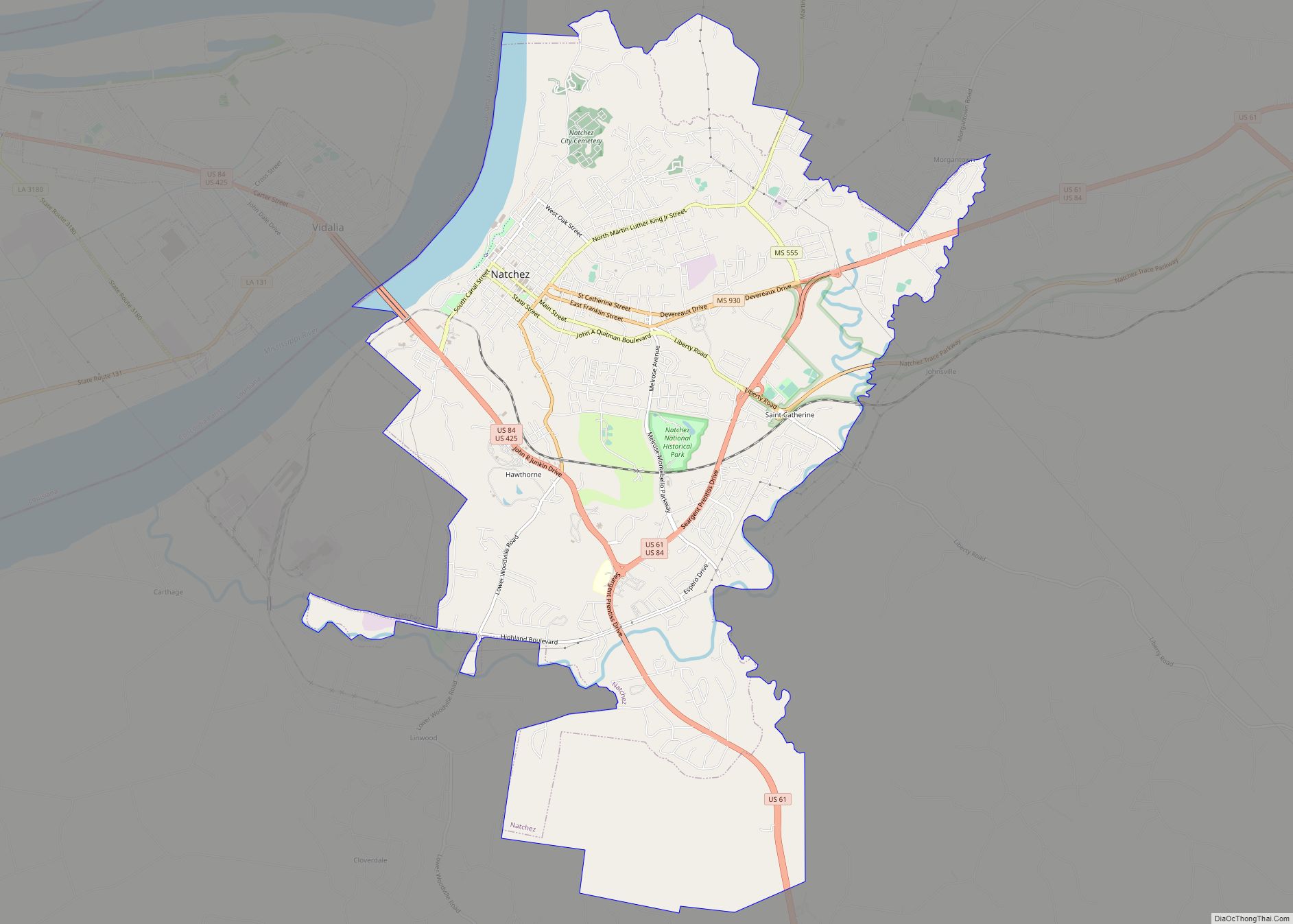
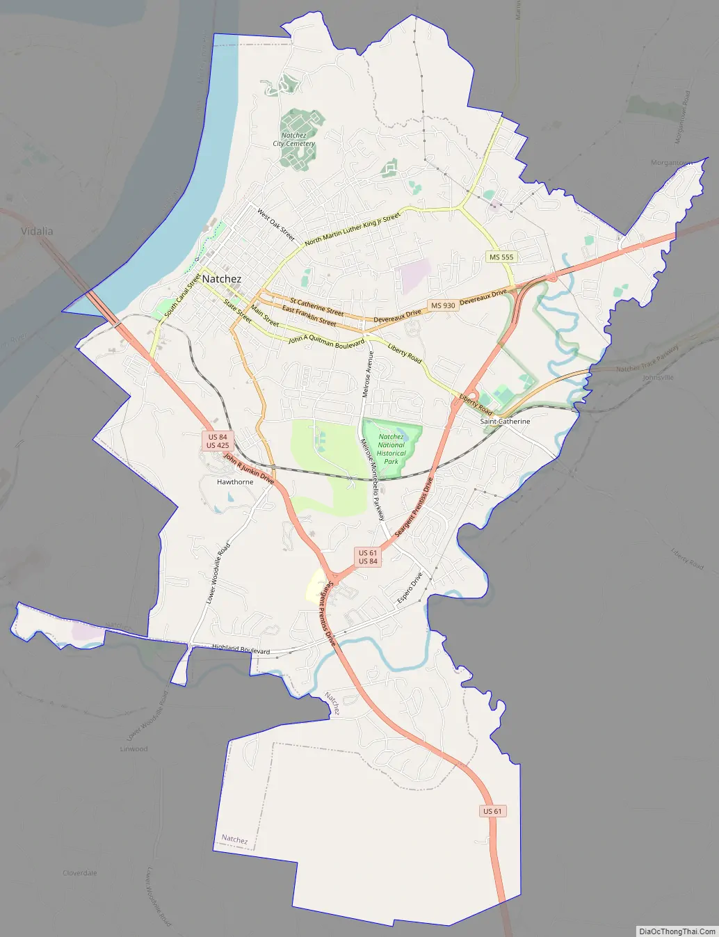
Natchez Road Map
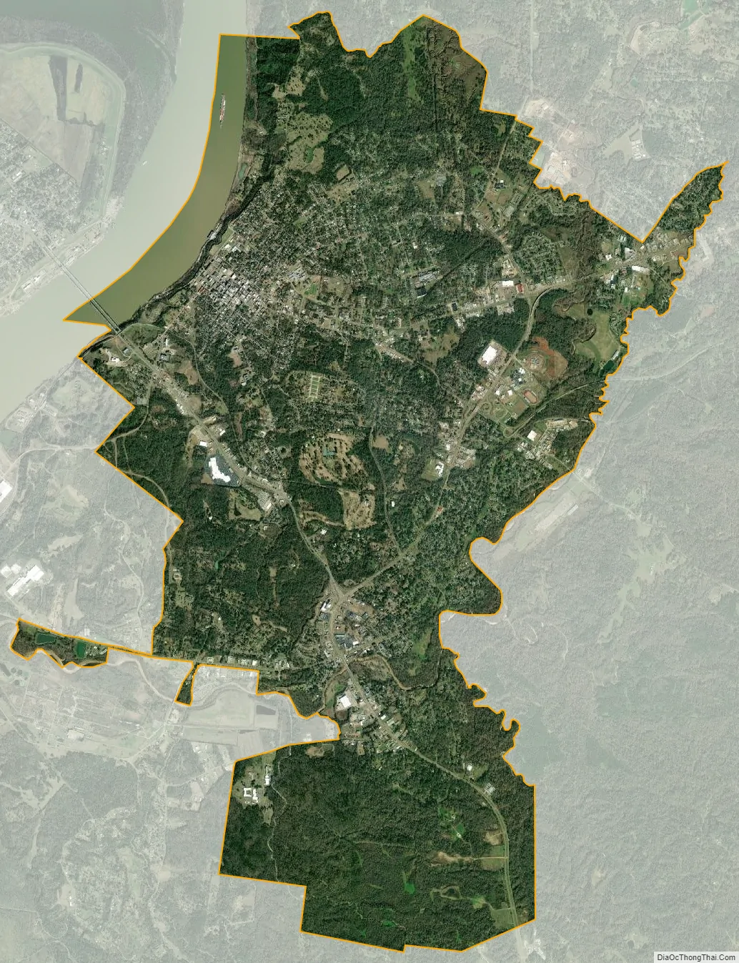
Natchez city Satellite Map
Geography
According to the United States Census Bureau, the city has a total area of 13.9 square miles (36 km), of which 13.2 square miles (34 km) are land and 0.6 square miles (1.6 km) (4.62%) is water.
Climate
Natchez has a humid subtropical climate (Cfa) under the Köppen climate classification system.
See also
Map of Mississippi State and its subdivision:- Adams
- Alcorn
- Amite
- Attala
- Benton
- Bolivar
- Calhoun
- Carroll
- Chickasaw
- Choctaw
- Claiborne
- Clarke
- Clay
- Coahoma
- Copiah
- Covington
- Desoto
- Forrest
- Franklin
- George
- Greene
- Grenada
- Hancock
- Harrison
- Hinds
- Holmes
- Humphreys
- Issaquena
- Itawamba
- Jackson
- Jasper
- Jefferson
- Jefferson Davis
- Jones
- Kemper
- Lafayette
- Lamar
- Lauderdale
- Lawrence
- Leake
- Lee
- Leflore
- Lincoln
- Lowndes
- Madison
- Marion
- Marshall
- Monroe
- Montgomery
- Neshoba
- Newton
- Noxubee
- Oktibbeha
- Panola
- Pearl River
- Perry
- Pike
- Pontotoc
- Prentiss
- Quitman
- Rankin
- Scott
- Sharkey
- Simpson
- Smith
- Stone
- Sunflower
- Tallahatchie
- Tate
- Tippah
- Tishomingo
- Tunica
- Union
- Walthall
- Warren
- Washington
- Wayne
- Webster
- Wilkinson
- Winston
- Yalobusha
- Yazoo
- Alabama
- Alaska
- Arizona
- Arkansas
- California
- Colorado
- Connecticut
- Delaware
- District of Columbia
- Florida
- Georgia
- Hawaii
- Idaho
- Illinois
- Indiana
- Iowa
- Kansas
- Kentucky
- Louisiana
- Maine
- Maryland
- Massachusetts
- Michigan
- Minnesota
- Mississippi
- Missouri
- Montana
- Nebraska
- Nevada
- New Hampshire
- New Jersey
- New Mexico
- New York
- North Carolina
- North Dakota
- Ohio
- Oklahoma
- Oregon
- Pennsylvania
- Rhode Island
- South Carolina
- South Dakota
- Tennessee
- Texas
- Utah
- Vermont
- Virginia
- Washington
- West Virginia
- Wisconsin
- Wyoming