Person County is a county located in the U.S. state of North Carolina. The population was 39,097 as of the 2020 census. The county seat is Roxboro.
Person County is included in the Durham–Chapel Hill Metropolitan Statistical Area, which is also included in the Raleigh-Durham-Chapel Hill Combined Statistical Area, which had an estimated population of 2,106,463 in the 2020 census.
| Name: | Person County |
|---|---|
| FIPS code: | 37-145 |
| State: | North Carolina |
| Founded: | 1792 |
| Named for: | Thomas Person |
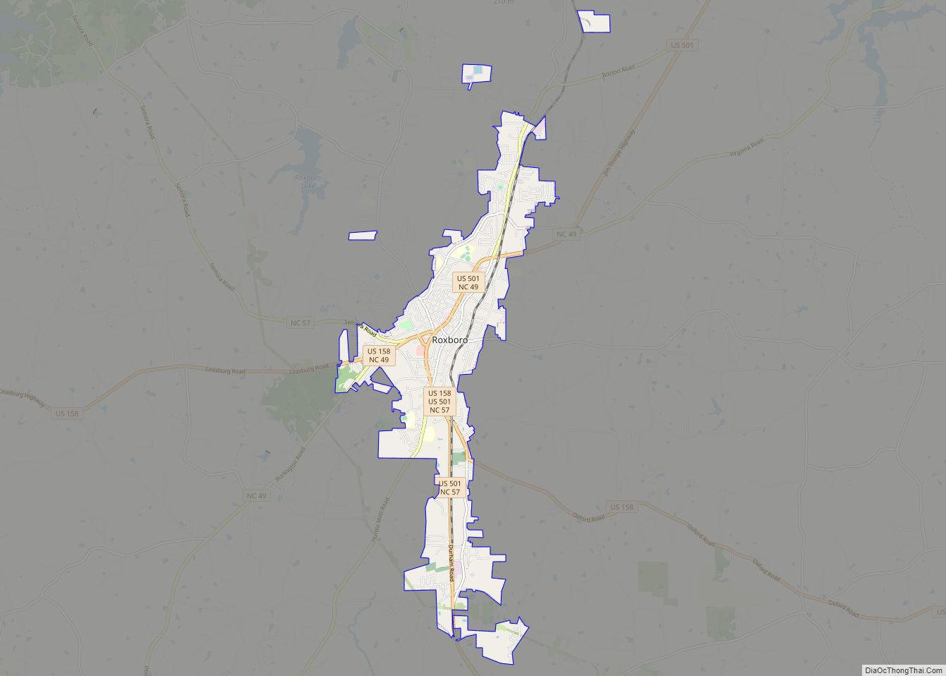
| Seat: | Roxboro |
| Largest city: | Roxboro |
| Total Area: | 404 sq mi (1,050 km²) |
| Land Area: | 392 sq mi (1,020 km²) |
| Total Population: | 39,127 |
| Population Density: | 99.8/sq mi (38.5/km²) |
| Time zone: | UTC−5 (Eastern) |
| Summer Time Zone (DST): | UTC−4 (EDT) |
| Website: | www.personcountync.gov |
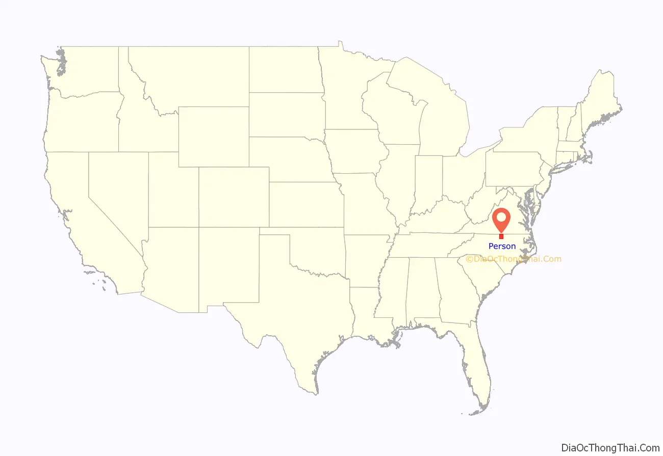
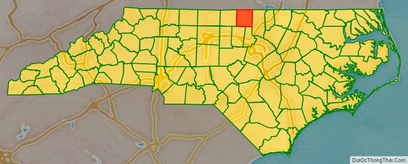
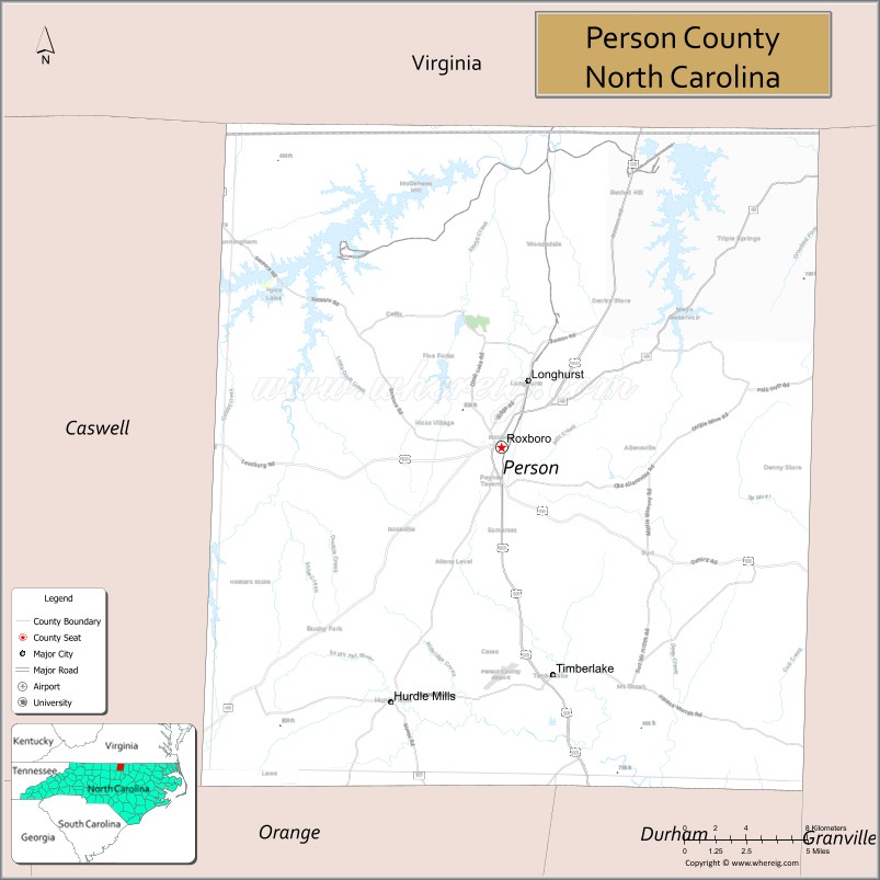
Person County location map. Where is Person County?
History
The colonial government established Person County as part of Edgecombe County in 1746. County designations kept changing, and it was part of Granville County from 1746 to 1752; included in Orange County until 1778; and part of Caswell County until 1791/1792. By dividing Caswell County into two squares–each side measuring approximately twenty (20) miles in length, the state formed two counties of 400 square miles (1,000 km) each. The county was named after Brigadier General Thomas Person, a Revolutionary War patriot, who made significant contributions to Person County and surrounding areas.
The area was first inhabited by Native Americans over 10,000 years ago. The historical tribes encountered here by early Spanish explorers were generally Siouan-speaking, including the Saponi, Occaneechee, and other groups.
Settlement by immigrants of Scots, Scots-Irish, English, French Huguenot, and German ancestry began in the mid-17th and continued into the 19th centuries. The settlers tended to be yeoman farmers, and few owned any slaves.
Religious affiliation in the county reflects the early settlers and is predominantly Protestant. Due to Person County’s nearness to Virginia, the Carolina coast, and the Appalachian foothills, a wide variety of Southern American English dialects can be heard here, including Virginia Piedmont, Coastal Southern, South Midland, and African-American English.
Revolutionary and Civil Wars
The county was named for Brigadier General Thomas Person, a Revolutionary War patriot, who made significant contributions to Person County and surrounding areas. He was a trustee of the University of North Carolina at Chapel Hill. His generous donations were recognized by the construction and naming of Person Hall.
Lieutenant Colonel Stephen Moore, Deputy Quartermaster General of the Hillsborough district, was another Revolutionary War hero, commanding the Person County militia at the disastrous Battle of Camden. He was captured and held on the prison ship Torbay. In 1775-1776 he had purchased property in the south of Person County and named his plantation Mt. Tirzah. His home, constructed in 1778, has been renovated recently. Stephen Moore was buried in the family cemetery.
During the Civil War, Person County supplied between 800 and 1000 soldiers to the Confederate Army. A granite monument at the Courthouse honors E. Fletcher Satterfield, who carried the Confederate flag at Gettysburg.
Late 19th century
J.A. Long, W.W. Kitchin, A.R. Foushee, J.S. Bradsher, J.C. Pass, W.F. Reade, and R.E. Long were key leaders who helped make a transition to a more diversified economic base after the Civil War. The arrival of the newly constructed Norfolk and Western Railroad was a major influence around 1890, as it enabled the addition of tobacco processing plants and warehouses to the rural economy. Although the processing plants disappeared many years ago, a few of the warehouses still stand.
J.A. Long established Peoples Bank in 1891 and the Roxboro Cotton Mill in 1899, later known as Tultex Yarns. His home at Roxboro, the James A. and Laura Thompson Long House, was added to the National Register of Historic Places in 2005. Long died in 1915 but was succeeded by his son, J.A. Long, Jr., who began attracting new business to Roxboro. Baker Company opened here in 1923, making textile manufacturing a major contributor to the local economy for decades. Baker was merged with Collins and Aikman Corporation (C&A), becoming a major industry in Person County for several decades before closing in August 2006. Textile manufacturers have moved to other locations in the US and overseas.
20th and 21st centuries
Residential and commercial development have grown steadily over the past few years in part due to the county’s location near the Research Triangle region. The Hyco Lake area and southern portion of the county have had an influx of new home and commercial development in the late 20th and early 21st century. The county’s largest employers are Duke Energy, Eaton Corporation, Georgia-Pacific Corporation and GKN Driveline.
The Holloway-Walker Dollarhite House, Henry-Vernon House, Burleigh, and Waverly Plantation are listed on the National Register of Historic Places outside Roxboro.
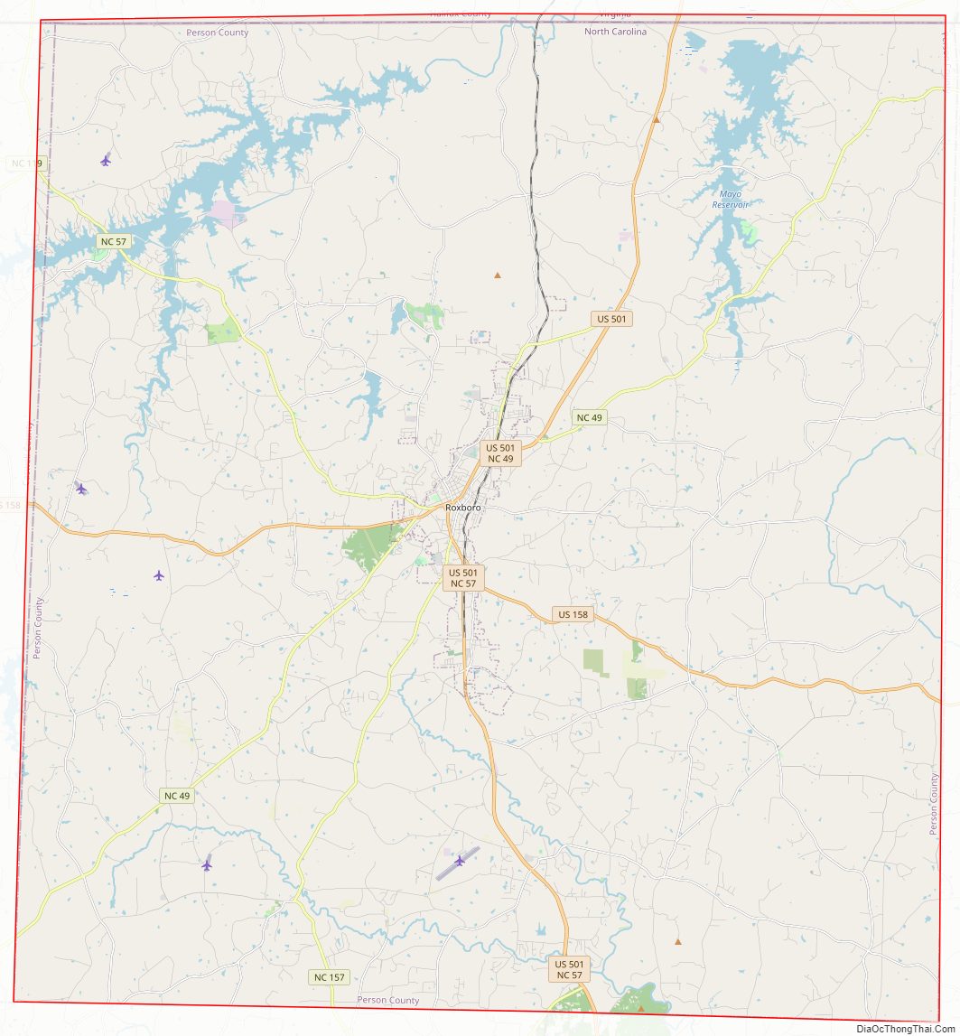
Person County Road Map
Geography
According to the U.S. Census Bureau, the county has a total area of 404 square miles (1,050 km), of which 392 square miles (1,020 km) is land and 12 square miles (31 km) (2.9%) is water.
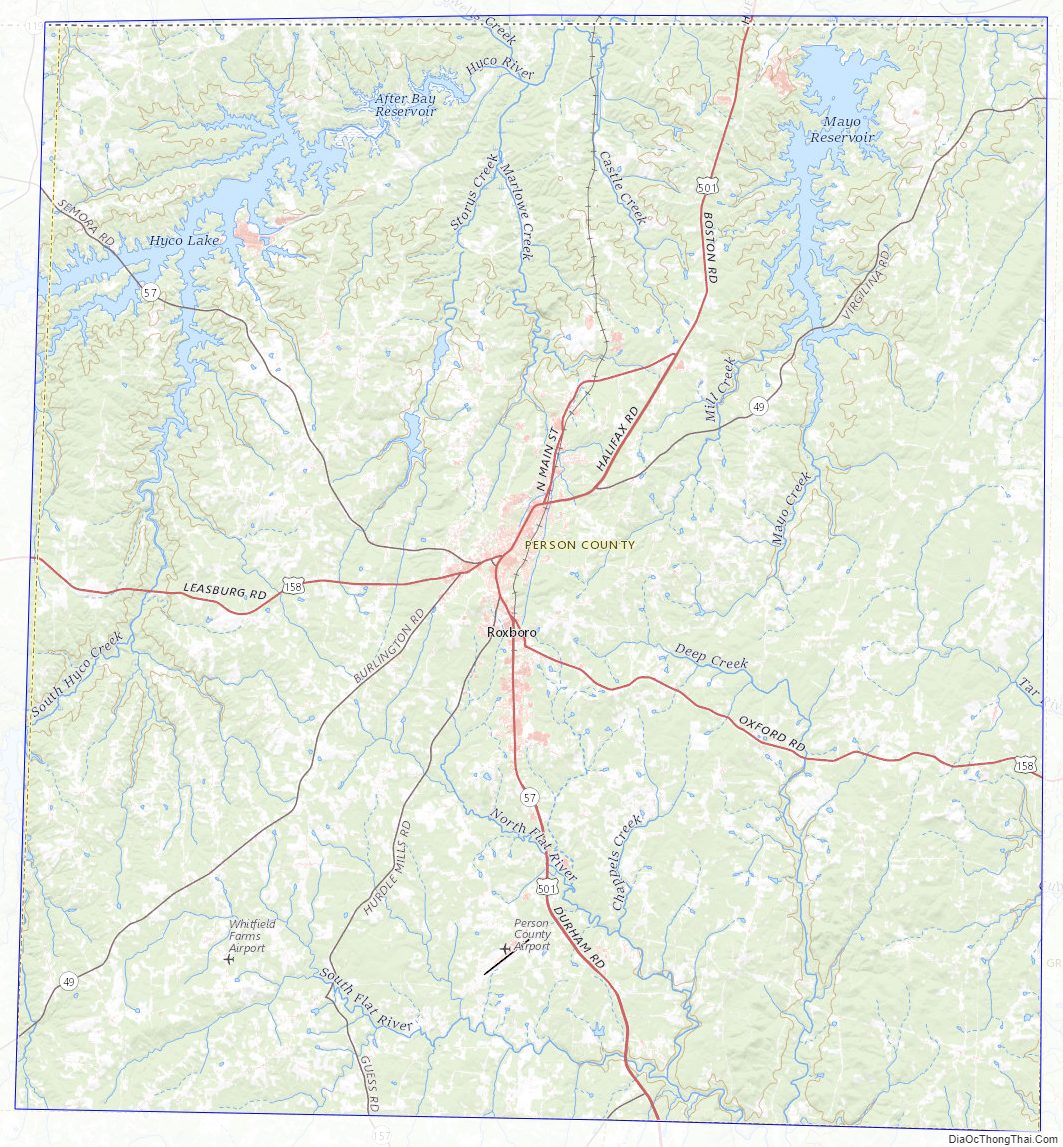
Person County contains parts of three major river basins: the Neuse, the Roanoke and the Tar, providing essential clean drinking water to the south and east of the state. The origin of the Tar River is in southeast Person County. In the northwest section of the county is Hyco Lake, with Mayo Reservoir in the northeast section. Both lakes are used for electrical power generation and recreation. Near the western border with Caswell County is Lake Roxboro. Part of the Neuse River begins here with the Flat River, where it combines with the Little and Eno rivers to go into Falls Lake and create the Neuse.
The Uwharrie Mountains, part of North Carolina’s easternmost mountain range, are the oldest mountain range in North America. They are the lowest mountain range in the state. The Uwharries begin in Montgomery County and terminate at Hager’s Mountain in the hills of northern Person County.
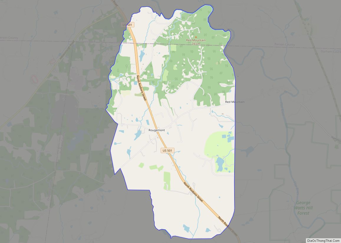
The county is largely covered by rolling hills divided by farmlands and forest. The area’s ridges are not narrow and sharp like those in some parts of the Piedmont, and the gullies and ditches are not as abrupt. The northern part of the county between the lakes is skirted by a plateau. The highest point of the county is a prominent hill in Roxboro, where the county seat has located its water reservoir tank. Person County claims three small mountains. Hager’s Mountain is north of Roxboro. Red Mountain and Mt. Tirzah are in the southeastern part of the county. The geology of the county is dominated by igneous formation, overlaid by a variety of soils. Granite boulders are strewn across the county.
State and local protected areas
- Hagers Mountain
- Mayo Lake Park
Major water bodies
- After Bay Reservoir
- Byrds Creek
- Castle Creek (Hyco River tributary)
- Flat River
- Ghent Creek
- Hyco Lake
- Mayo Lake
- Mill Creek
- Richland Creek (South Hyco Creek tributary)
- Roxboro Lake
- South Hyco Creek
- Storys Creek (Hyco River tributary)
- Tar River
Adjacent counties
- Halifax County, Virginia – north
- Granville County – east
- Durham County – south
- Orange County – south
- Caswell County – west
Major highways
- US 501
- US 158
- NC 49
- NC 57
- NC 157
Interstate 85 is the closest interstate highway to the county, located 29 miles south in Durham.
Major infrastructure
- Norfolk Southern, freight rail service
- Raleigh Regional Airport at Person County, located 6 miles (10 km) south of Roxboro on U.S. Route 501
Raleigh-Durham International Airport, located 42 miles (68 km) south of Roxboro Piedmont Triad International Airport, located 82 miles (132 km) southwest of Roxboro
Person County Topographic Map
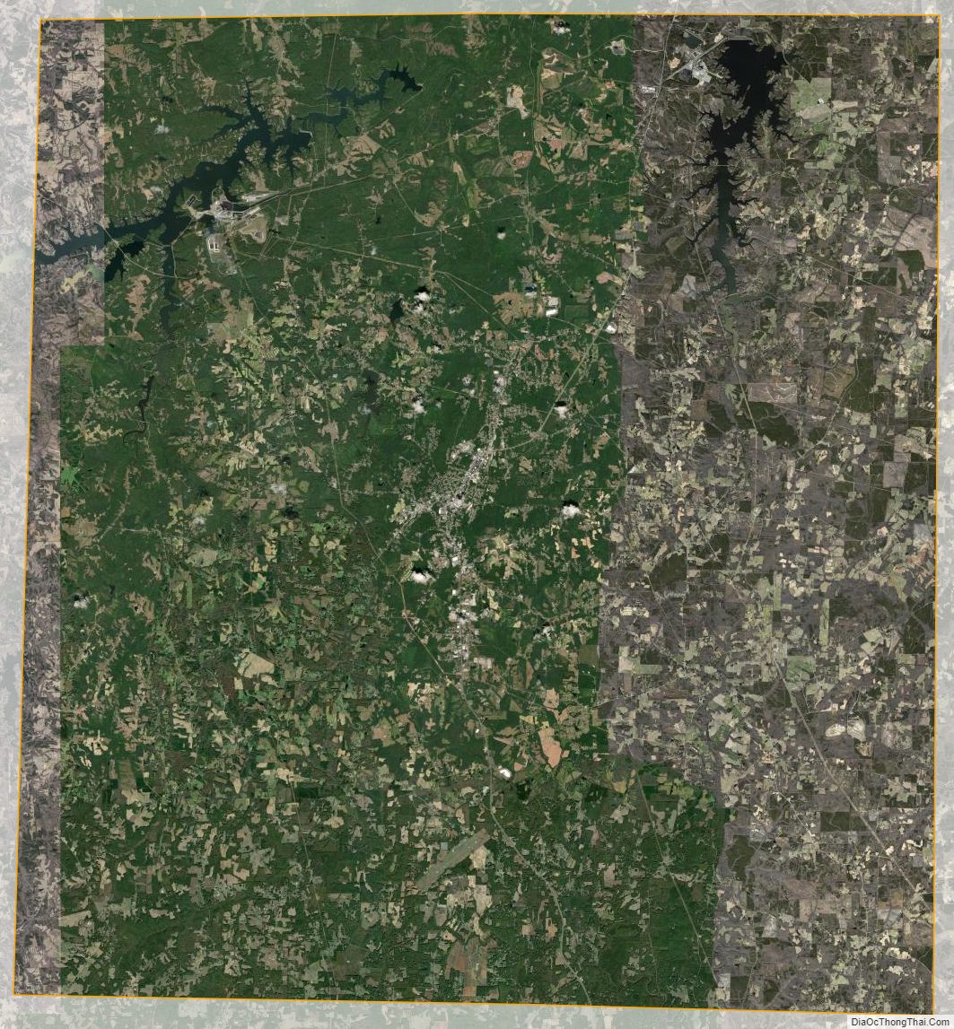
Person County Satellite Map
Person County Outline Map