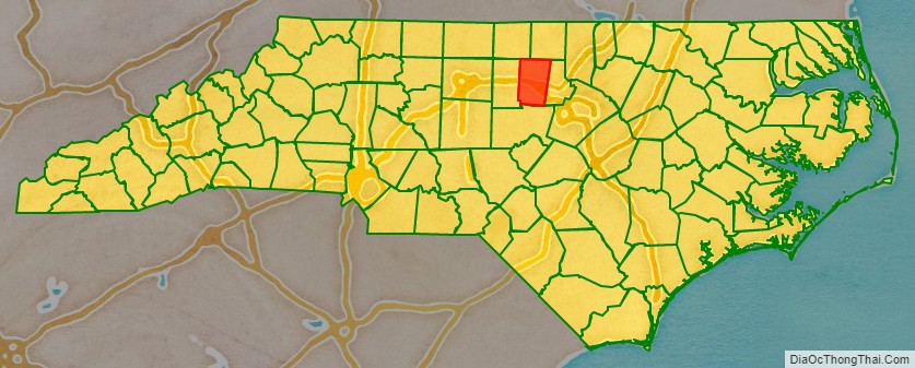
Orange County is a county located in the Piedmont region of the U.S. state of North Carolina. As of the 2020 census, the population was 148,696. Its county seat is Hillsborough.
Orange County is included in the Durham–Chapel Hill, NC Metropolitan Statistical Area, which is also included in the Raleigh–Durham–Chapel Hill, NC Combined Statistical Area. This had a 2012 estimated population of 1,998,808.
It is home to the University of North Carolina at Chapel Hill, the flagship institution of the University of North Carolina System and the oldest state-supported university in the United States.
| Name: | Orange County |
|---|---|
| FIPS code: | 37-135 |
| State: | North Carolina |
| Founded: | 1752 |
| Named for: | William V of Orange |
| Seat: | Hillsborough |
| Largest town: | Chapel Hill |
| Total Area: | 401 sq mi (1,040 km²) |
| Land Area: | 398 sq mi (1,030 km²) |
| Total Population: | 148,696 |
| Population Density: | 374.1/sq mi (144.4/km²) |
| Time zone: | UTC−5 (Eastern) |
| Summer Time Zone (DST): | UTC−4 (EDT) |
| Website: | orangecountync.gov |
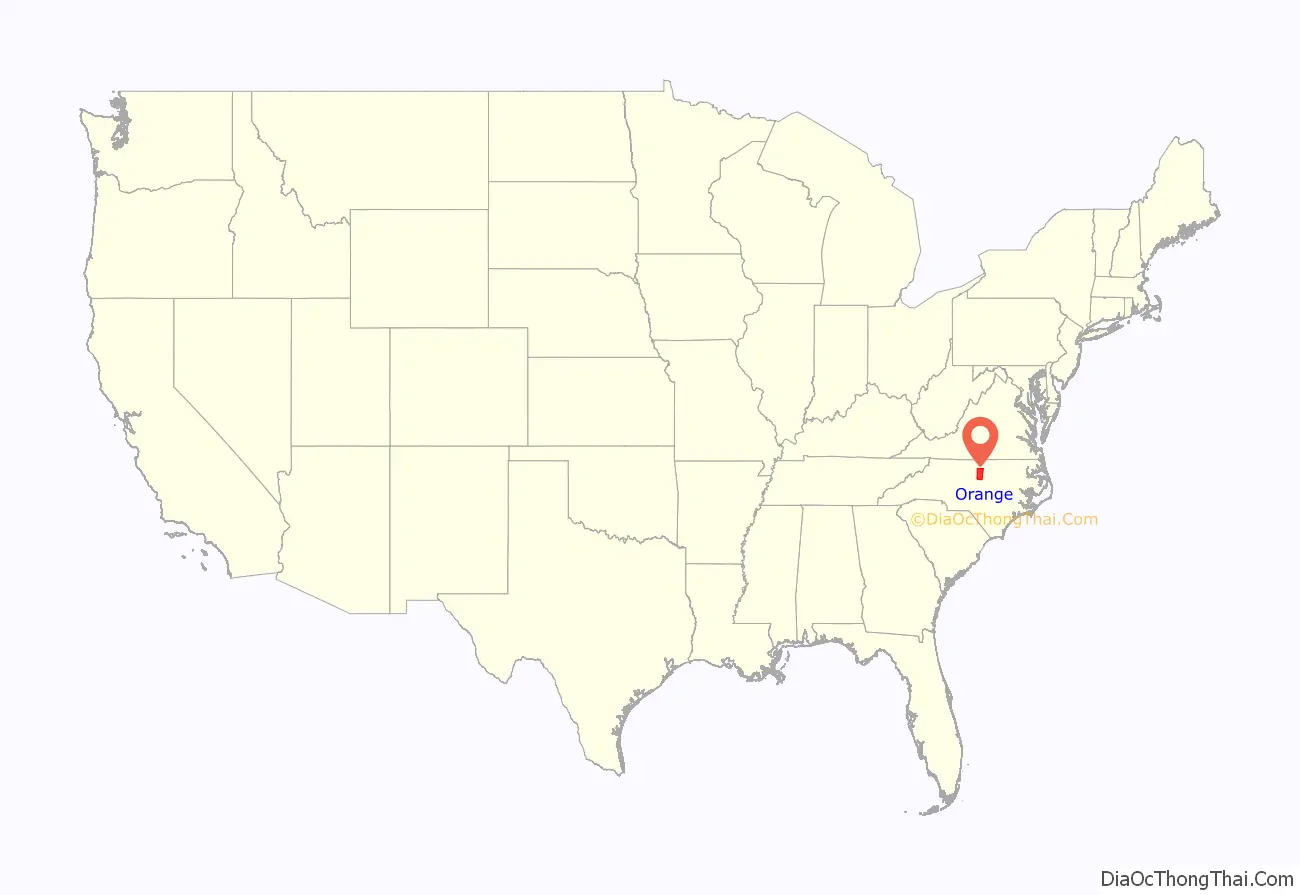
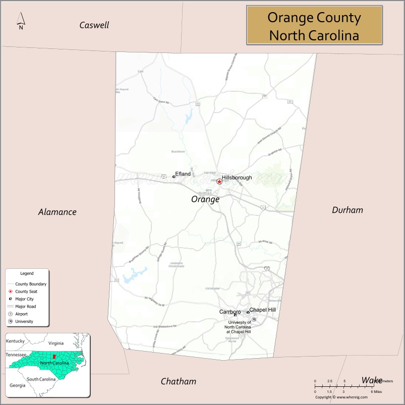
Orange County location map. Where is Orange County?
History
The county was formed in 1752 from parts of Bladen, Granville, and Johnston counties. It was named for the infant William V of Orange, whose mother Anne, daughter of King George II of Great Britain, was then regent of the Dutch Republic.
In 1771, Orange County was greatly reduced in area. The western part of it was combined with the eastern part of Rowan County to form Guilford County. Another part was combined with parts of Cumberland County and Johnston County to form Wake County. The southern part of what remained became Chatham County.
In 1777, the northern half of what was left of Orange County became Caswell County. In 1849, the western county became Alamance County. Finally, in 1881, the eastern half of the county’s remaining territory was combined with part of Wake County to form Durham County.
Some of the first settlers of the county were English Quakers, who settled along the Haw and Eno rivers. Arguably, the earliest settlers in the county were the Andrews family, which would later intermarry with the Lloyd family.
Colonial period and Revolutionary War
The Orange County seat of Hillsborough was founded in 1754 on land where the Great Indian Trading Path crossed the Eno River. This area was first owned, surveyed, and mapped by William Churton (a surveyor for Earl Granville). Originally to be named Orange, it was named Corbin Town (for Francis Corbin, a member of the governor’s council and one of Granville’s land agents), and renamed Childsburgh (in honor of Thomas Child, the attorney general for North Carolina from 1751 to 1760 and another one of Granville’s land agents) in 1759. In 1766, it was named Hillsborough, after Wills Hill, then the Earl of Hillsborough, the British secretary of state for the colonies, and a relative of royal Governor William Tryon.
Located in the Piedmont region, Hillsborough was the site of a colonial court, and the scene of some pre-Revolutionary War tensions. In the late 1760s, conflicts between Piedmont farmers and county officers welled up in the Regulator movement, or as it was also known, the War of the Regulation, which had its epicenter in Hillsborough. Several thousand people from North Carolina, mainly from Orange, Anson, and Granville counties in the western region, were extremely dissatisfied with the wealthy colonial officials whom they considered cruel, arbitrary, tyrannical, and corrupt.
With specie scarce, many inland farmers were cash poor and unable to pay their taxes; they resented the consequent seizure of their property. In addition, local sheriffs sometimes kept taxes for their own gain and sometimes charged twice for the same tax. At times, sheriffs would intentionally remove records of their tax collection to further tax citizens. Rowan, Anson, Orange, Granville, and Cumberland counties were said to be most affected by such corruption. It was a struggle of yeomen farmers and other mostly lower-class citizens, who made up the majority of the population of North Carolina, and the wealthy ruling class, who composed about 5% of the population, yet maintained almost total control of the government. Of the 8,000 people living in Orange County at the time, an estimated 6000 – 7000 of them supported the Regulators.
Governor William Tryon’s conspicuous consumption in the construction of a new governor’s mansion at New Bern fueled resentment of the movement’s members. As the western districts were under-represented in the colonial legislature, the farmers could not obtain redress by legislative means. Ultimately, the frustrated farmers took to arms and closed the court in Hillsborough, dragging those they saw as corrupt officials through the streets and cracking the church bell. Tryon sent troops from his militia to the region, and defeated the Regulators at the Battle of Alamance in May 1771. Several trials were held after the war, resulting in the hanging of six Regulators at Hillsborough on June 19, 1771.
Hillsborough was used as the home of the North Carolina state legislature during the American Revolution. Hillsborough served as a military base by British General Charles Cornwallis in late February 1781. The United States Constitution, drafted in 1787, was controversial in North Carolina. Delegate meetings at Hillsboro in July 1788 initially voted to reject it for antifederalist reasons. They were persuaded to change their minds partly by the strenuous efforts of James Iredell and William Davie and partly by the prospect of adding a Bill of Rights. The Constitution was later ratified by North Carolina at a convention in Fayetteville.
William Hooper, a signer of the Declaration of Independence, was buried in the Presbyterian Church cemetery in October 1790. His remains were later reinterred at Guilford Courthouse Military Battlefield. His original gravestone remains in the town cemetery.
Several large plantations were located in this country in the colonial and antebellum periods, including Green Hill, Ayr Mount, Moorefields, The Elms, Sans Souci, Riverland, Alexander Hogan Plantation, and the Patterson Plantation.
Chartered by the North Carolina General Assembly on December 11, 1789, the University of North Carolina’s cornerstone was laid on October 12, 1793, near the ruins of a chapel, chosen for its central location within the state. Beginning instruction of undergraduates in 1795, UNC is the oldest public university in the United States and the only one to award degrees in the 18th century.
19th century
The Reverend Robert and Margaret Anna Burwell founded and ran a school for girls called the Burwell School from 1837 to 1857 in their home on Churton Street in Hillsborough. Families of planters paid to have their daughters educated here.
When the Civil War began, Hillsborough was reluctant to support secession. However, many citizens went off to fight for the Confederacy. During the war, North Carolina Governor David Lowry Swain persuaded Confederate President Jefferson Davis to exempt some UNC students from the draft, so the university was among the few in the Confederacy that managed to stay open. But, Chapel Hill lost more population during the war than any other village in the South. When student numbers did not recover rapidly enough, the university closed for a period during Reconstruction, from December 1, 1870, to September 6, 1875.
In March 1865, Confederate General Joseph E. Johnston wintered just outside Hillsborough at the Dickson home. This house now serves as the Hillsborough Welcome Center in downtown (the house was moved from its original site in the early 1980s due to commercial development). The main portion of the Confederate Army of Tennessee was encamped between Hillsborough and Greensboro.
While camped in Raleigh after his March to the Sea, Union General William T. Sherman offered an armistice to Johnston, who agreed to meet to discuss terms of surrender. Johnston, traveling east from Hillsborough, and Sherman, traveling west from Raleigh along the Hillsborough-Raleigh Road, met roughly half-way near present-day Durham (then Durham Station) at the home of James and Nancy Bennett. Their farmhouse is now known as the Bennett Place. The two generals met on April 17, 18, and 26, 1865, negotiating terms of Johnston’s surrender. Johnston surrendered 89,270 Southern troops who were active in North Carolina, South Carolina, Georgia, and Florida. This was the largest surrender of troops during the war, and effectively ended the Civil War.
20th century
Occoneechee Speedway, just outside Hillsborough, was one of the first two NASCAR tracks to open, and is the only track remaining from that inaugural 1949 season. Bill France and the early founders of NASCAR bought land to build a one-mile oval track at Hillsborough, but opposition from local religious leaders prevented the track from being built in the town and NASCAR officials built the large speedway Talladega Superspeedway in Talladega, Alabama.
Chapel Hill, along with Durham and Raleigh, makes up one of the three corners of the Research Triangle, so named in 1959 with the creation of Research Triangle Park, a research park between Durham and Raleigh.
The Morehead Planetarium at UNC opened in 1949, when it was one of only a handful of planetariums in the nation. It continues as an important town landmark and destination for Chapel Hill. During the United States’ Mercury, Gemini, and Apollo programs, astronauts were trained there.
During the 1960s, the UNC campus was the location of significant political protest. Prior to passage of the Civil Rights Act of 1964, protests about local racial segregation began quietly in Franklin Street restaurants; activists increased in influence and led mass demonstrations and civil disturbance.
Always suspicious of communist influence in the civil rights movement, the legislature passed the 1963 Speaker Ban Law, prohibiting speeches by communists on state campuses in North Carolina. University Chancellor William Brantley Aycock and University President William Friday criticized the law, but it was not reviewed by the North Carolina General Assembly until 1965. Small amendments to allow “infrequent” visits failed to placate the student body, especially when the university’s board of trustees overruled new Chancellor Paul Frederick Sharp’s decision to allow speaking invitations to Marxist speaker Herbert Aptheker and civil liberties activist Frank Wilkinson. The two speakers came to Chapel Hill anyway. Wilkinson spoke off campus, and more than 1,500 students watched Aptheker’s speech across a low campus wall at the edge of campus, christened “Dan Moore’s Wall” by The Daily Tar Heel, referring to Governor Dan K. Moore. A group of UNC students, along with Aptheker and Williamson, filed a lawsuit in U.S. federal court based on the right to free speech. On February 20, 1968, the Speaker Ban Law was ruled unconstitutional.
In 1968, a year after its public schools became fully integrated, Chapel Hill elected Howard Lee as mayor. This was the first predominantly white municipality in the country to elect an African-American mayor. Lee served from 1969 until 1975. Among other achievements, he helped establish Chapel Hill Transit, the town’s bus system.
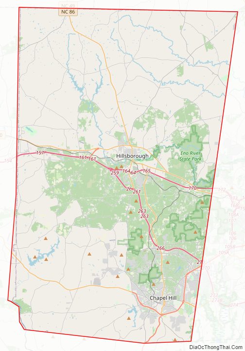
Orange County Road Map
Geography
According to the U.S. Census Bureau, the county has a total area of 401 square miles (1,040 km), of which 398 square miles (1,030 km) is land and 3.5 square miles (9.1 km) (0.9%) is water.
The county is drained, in part, by the Eno River.
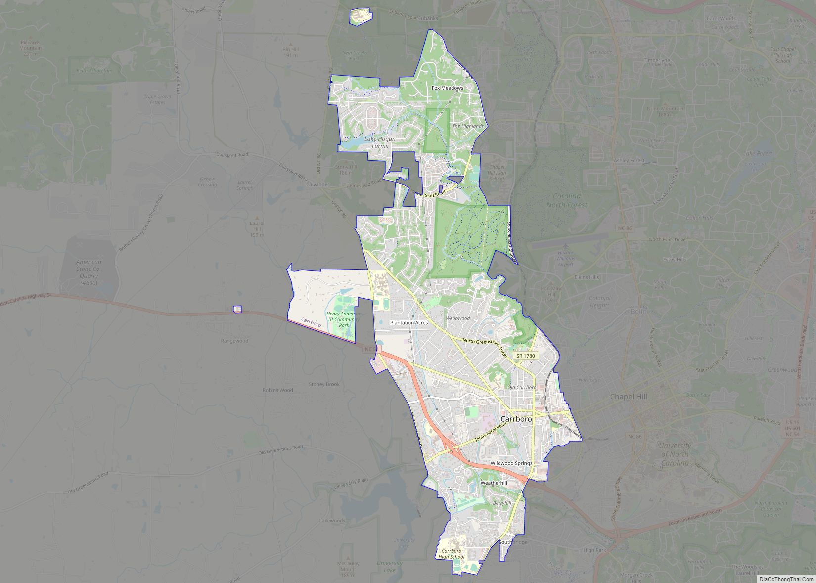
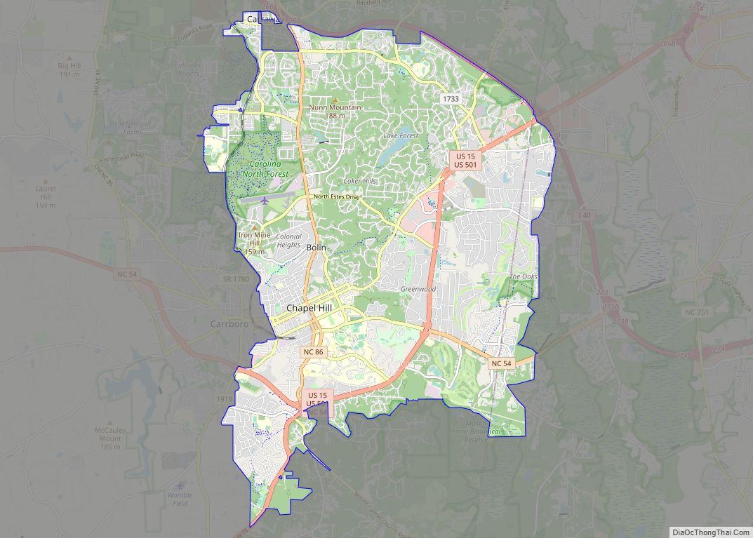
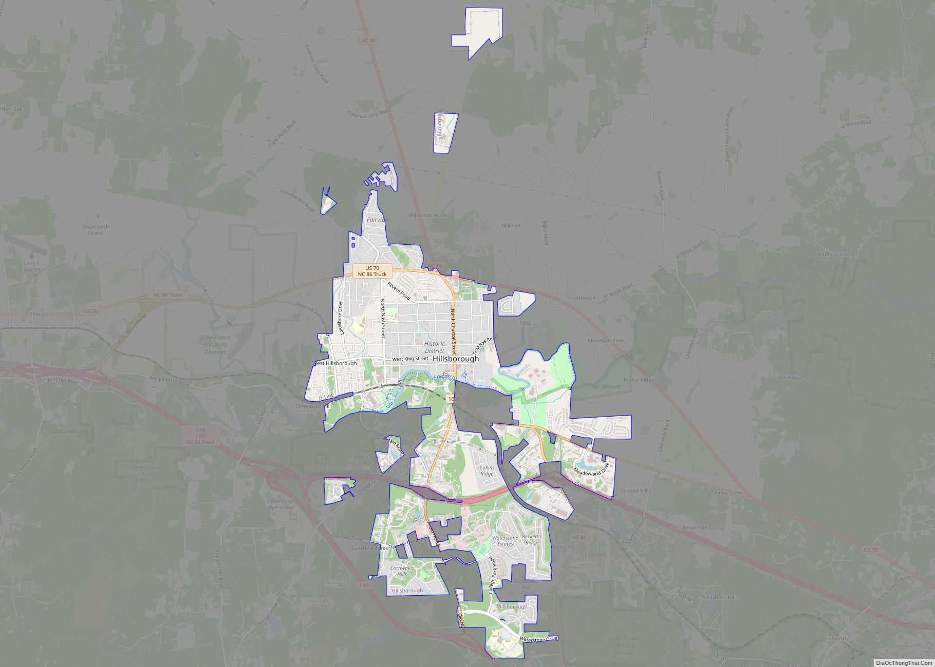
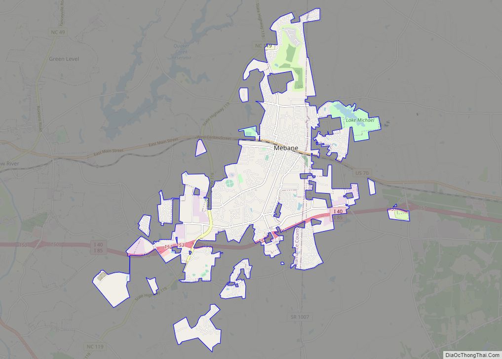
The city of Chapel Hill, is in the southeastern part of Orange County, as is Carrboro. Hillsborough is in the central part of the county and is the county seat.
State and local protected areas/sites
- Brumley Forest Nature Preserve
- Carolina North Forest
- Confluence Natural Area
- Eno River State Park (part)
- Historic Hillsborough
- Historic Occoneechee Speedway Trailhead
- Johnston Mill Nature Preserve
- Lake Michael Park
- Little River Regional Park and Natural Area (part)
- Mason Farm Biological Reserve (part)
- North Carolina Botanical Garden
- Occoneechee Mountain State Natural Area
- White Cross Recreation Center
Major water bodies
- Buffalo Creek
- Cane Creek (Haw River tributary, left bank)
- Cane Creek Reservoir
- Eastwood Lake
- Eno River
- Haw River
- Jordan Lake
- Lake Orange
- Lick Creek
- Little River (Eno River tributary)
- Morgan Creek (New Hope River tributary)
- Mountain Creek
- New Hope Creek
- North Fork Little River
- University Lake
- West Fork Eno River
Adjacent counties
- Person County – northeast
- Durham County – east
- Chatham County – south
- Alamance County – west
- Caswell County – northwest
Major highways
- I-40
- I-85
- US 15
- US 70
- US 70 Bus.
- US 501
- NC 49
- NC 54
- NC 57
- NC 86
- NC 157
- NC 751
Orange County Topographic Map
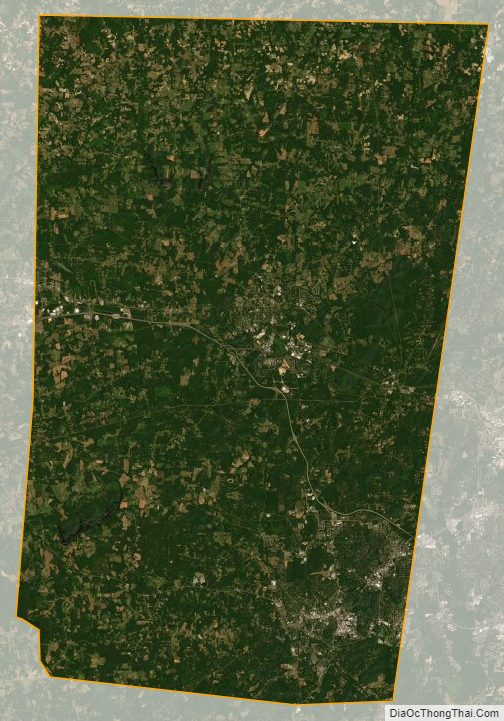
Orange County Satellite Map
Orange County Outline Map