Caswell County is a county in the U.S. state of North Carolina. It is located in the Piedmont Triad region of the state. At the 2020 census, the population was 22,736. Its county seat is Yanceyville.
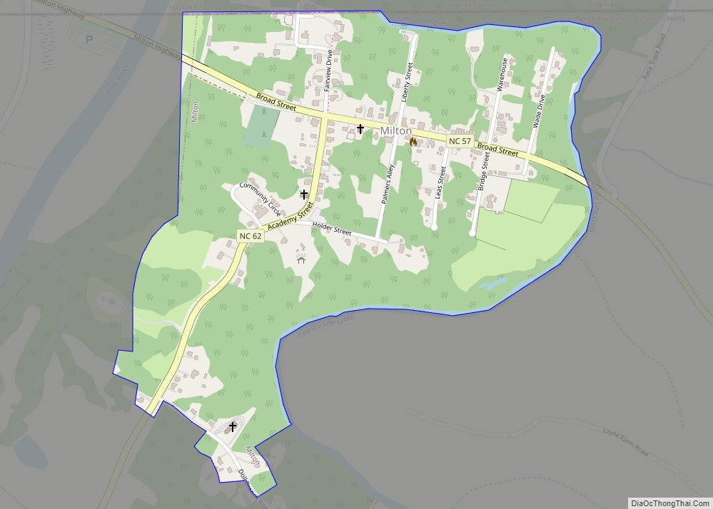
Partially bordering the state of Virginia, the county was formed from Orange County in 1777 and named for Richard Caswell, the first governor of North Carolina. Other Caswell County communities include Blanch, Casville, Leasburg, Milton, Pelham, Prospect Hill, Providence, and Semora.
The Dan River flows through a portion of the county. Hyco Lake is a popular recreational area and key water source.
| Name: | Caswell County |
|---|---|
| FIPS code: | 37-033 |
| State: | North Carolina |
| Founded: | June 1, 1777 |
| Named for: | Richard Caswell |
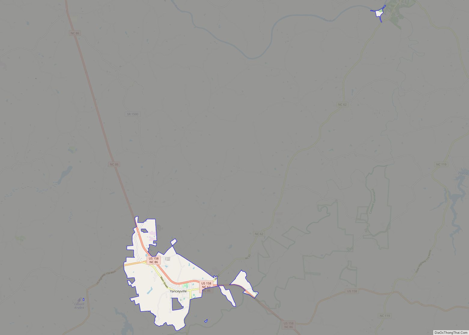
| Seat: | Yanceyville |
| Largest town: | Yanceyville |
| Total Area: | 428 sq mi (1,110 km²) |
| Land Area: | 425 sq mi (1,100 km²) |
| Total Population: | 22,714 |
| Population Density: | 53.4/sq mi (20.6/km²) |
| Time zone: | UTC−5 (Eastern) |
| Summer Time Zone (DST): | UTC−4 (EDT) |
| Website: | www.caswellcountync.gov |
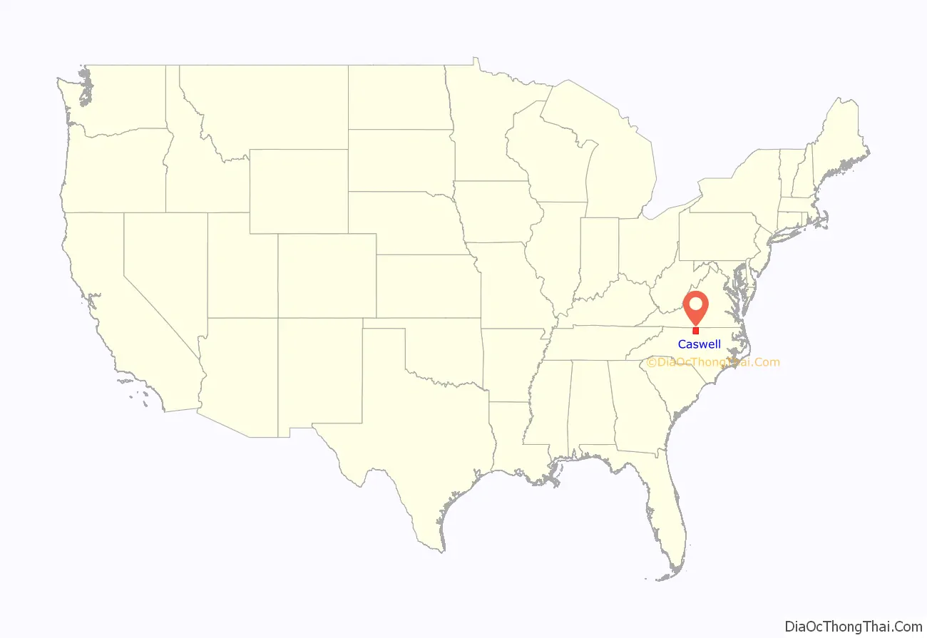
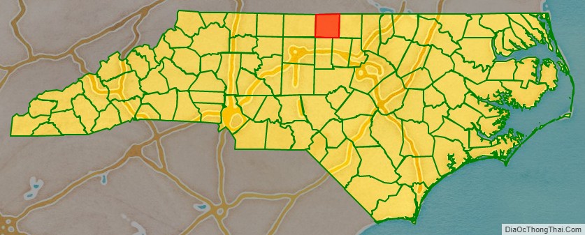
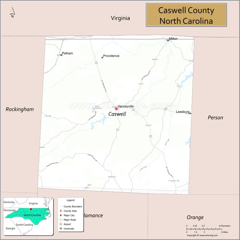
Caswell County location map. Where is Caswell County?
History
Early history
The area was first inhabited by Native Americans over 10,000 years ago. Indigenous residents were of Siouan groups, including the Occaneechi. Abundant evidence of indigenous activity has been found in many parts of Caswell County.
In 1663 and 1665, Charles I of England gave all of what is now North Carolina and South Carolina (named for him) to eight of his noblemen, the Lords Proprietors. Caswell County was originally part of the land grant belonging to Edward Hyde, 1st Earl of Clarendon.
Colonial records show land grants in northern Orange County (later Caswell County) as early as 1748. There were Scotch-Irish, German, and English settlements along the Dan River and Hogans and Country Line creeks by 1751. The first recorded settlement occurred between 1750 and 1755 when eight to ten families migrated from Orange County and Culpeper, Virginia. The primary reason for resettlement was economic. They were searching for fertile land, which the low land of the Dan River and several creeks provided.
After the initial settlements, the area experienced rapid population growth. The free settlers who lived in the county before 1800 were mostly of English, Scotch-Irish, French Huguenot, and German descent. Scotch-Irish and German families traversed the Great Wagon Road, which was the main route for settlement in the region, and had come by way of Virginia and Pennsylvania. English and Huguenot migrants came from settled areas of eastern North Carolina, following the Great Trading Path. English colonists also came from Virginia using the same network of roads and trails. Enslaved Africans were brought to the area by slaveholders and slave-trading agents involved in speculation. By 1800, enslaved persons accounted for nearly one-third (32%) of Caswell County’s population. As they grew in number, substantially so after 1790, they powered more and more of the area’s agricultural and economic development.
The settlers first consisted mainly of yeoman farmers and planters. Middle-class settlers arrived afterward in the 18th century and were called the “new families.” Scotch-Irish and English culture predominated in the area socially, spiritually, educationally, and economically.
Yeoman farmers accounted for more than half the settler population. Few if any were slaveholders at this time. The yeomanry owned small family farms and lived in log homes. They farmed for subsistence, with surpluses going toward debt settlement or bartering for goods. Relying on the skilled and unskilled labor of family members, neighbors, and others, they linked farms to early grist mills and sawmills.
Middle-class families accounted for less than a fifth of the settler population and were chiefly involved in business entrepreneurship, craftsmanship, small-scale commercial farming, export, and trade. They actively promoted business and settlement in and around towns such as Leasburg, Milton, and numerous villages to further local economic development and their own upward social mobility. As the area grew more populated and prosperous, a significant number of middle-class residents transitioned to the upper-middle class.
The planter class constituted the upper class and were the smallest segment of the settler population. Most came from prosperous families and were well versed in the literature of the Enlightenment. Due to their social position, they deeply impacted the county economically, culturally, and politically. The area’s other planters, in contrast, were less prominent and wealthy than the gentry in their midst. They were common or smaller planters with less land and lived more ordinary upper-middle class lives. Several had indentured servants or bound apprentices of mixed race.
No matter their class distinction, planters were the most socioeconomically advantaged inhabitants. They traded commodities with other settlers and were involved in land speculation and the domestic slave trade. They founded mills, sold livestock, and grew profitable crops such as wheat, corn, and oats on farms or plantations. Until the early 1800s, tobacco was harvested mainly as a secondary crop by the settlers depending on changing market demand, pricing, soil exhaustion, and other variables.
During the colonial period from approximately 1761 until 1772, it was common for local planters to receive credit loans from British-owned mercantile companies in the province for the purpose of funding the expansion of agricultural production. The monies went toward purchases of additional land and enslaved labor. Such companies also supplied enslaved workers and consumer items to area planters and managed tobacco exports sent to Virginia warehouses. Their merchants offered good tobacco prices initially but eventually reduced them greatly, causing many planters to fall into substantial debt, which could not be repaid without selling land or enslaved people. Due to the American Revolutionary War, most of these debts were never repaid. After the war, the demand for tobacco rose when new markets were found without such middlemen.
Not long after they arrived, the settlers to the area had been progressive in building homes, businesses, and churches. Prominent planters promoted a culture of education that later saw the creation of private academies in the early 1800s. The older families were generally more politically and fiscally conservative than the newcomers. They usually voted against funds for postwar internal improvements and were not supportive of expenditures that raised the county debt due to an aversion to raising taxes and expanding the role of government.
Before the Revolutionary War, the biggest threats to public safety and social stability in the region were the French and Indian War and the Regulator Movement in present Orange County. While the movement increased class tensions within communities, the settlers came together in support of the American Revolution.
Prior to the Revolution, the Church of England was the most common religious affiliation in the area. Pennsylvania missionary Hugh McAden founded Red House Presbyterian Church possibly as early as 1755. Country Line Primitive Baptist Church was established in 1772. Lea’s Chapel, a Methodist Episcopal church, was organized in 1779.
Creation
Caswell County was formed from a portion of Orange County, effective June 1, 1777. It was created so that governance could be more localized and efficient. The county was named for Richard Caswell who was the first governor of North Carolina after the Declaration of Independence in 1776, a delegate at the First and Second Continental Congresses, and a senior officer of militia in the Southern theater of the Revolutionary War. The legislative act creating Caswell ordered its first court to be held at the homestead of Thomas Douglas and appointed commissioners to find a permanent location to build a county courthouse and prison.
During the prelude to the Battle of Guilford Courthouse in 1781, Lord Cornwallis pursued General Nathanael Greene through Caswell County. Greene’s retreat, called the “Race to the Dan,” was a calculated ploy. His objective was to extend Cornwallis far beyond his supply base in Camden, South Carolina so that his fighting power would be significantly diminished. Cornwallis and his troops marched through Camp Springs and Leasburg, which was the first county seat. They continued on to the Red House Church area of Semora. It is unknown how many locally enslaved people fled to the British for safe haven before the Battle of Yorktown in 1781.
By the war’s end in 1783, Caswell County had made significant contributions in personnel and materiel to the war effort. Little fighting took place locally. County residents renowned for their Revolutionary War service include Lieutenant Colonel Henry “Hal” Dixon, John Herndon Graves, Dr. Lancelot Johnston, and Starling Gunn. By that point no county courthouse had been built, so the General Assembly passed another act authorizing the county to erect public buildings. A courthouse was subsequently established at Leasburg, which was officially incorporated in 1788.
After the war, a small number of free Black families moved to the area. Most of the men had served in the Continental Army or Navy. Usually skilled in a trade, they farmed in a manner similar to yeoman farmers but did not have equal rights.
In 1786, a special state census ranked Caswell County as the second-largest county with a population of 9,839. Halifax County had only 489 more inhabitants.
Approximately six years later in 1792, the eastern half of the county became Person County. After the division, the seat of Caswell County’s government was moved to a more central location. The community hosting the new county seat was originally called Caswell Court House. In 1833, the name was changed to Yanceyville.
Industrialization and growth
In the early 1800s, Caswell County’s wealthy landowners were moving away from diversified farming and accelerating toward tobacco as a single cash crop. This agricultural conversion considerably affected the growth of the enslaved population, which rose 54 percent from 1800 to 1810.
In 1810, the village of Caswell Court House (later Yanceyville) had one store and a hattery, two taverns, and approximately fifteen homes. silversmiths, blacksmiths, wheelwrights, coachmakers, and other tradesmen soon began opening businesses. Attorneys, doctors, preachers, and a number of politicians were also drawn to the growing village and county seat.
Around 1830, the “Boom Era” began, which lasted until the American Civil War. During this period, the county saw the creation of new flour and lumber mills and experienced the furniture output of Thomas Day, a free Black businessman in Milton. A cotton factory, foundry, and silk company were also in operation. In Yanceyville, roads were improved and given names by 1841. The town became wealthy enough by 1852 to charter an independent bank, the Bank of Yanceyville, whose market capitalization ranked among the highest in the state.
In 1839, on Abisha Slade’s farm in Purley, an enslaved man named Stephen discovered the bright leaf tobacco flue-curing process. Slade perfected the curing method in 1856. The following year his farm harvested 20,000 pounds (9,100 kg) of bright leaf tobacco on 100 acres of land and the crop was sold in Lynchburg, Virginia at an exorbitant price. Slade taught the flue-curing technique to many farmers in the area and elsewhere. Bright leaf tobacco became popular with smokers and North Carolina growers gained a dominant position in the tobacco industry as a result.
The tobacco economy, and the industries supported by it, enriched many locals. The lifestyle of many yeoman farmers changed into that of planters. The newly wealthy built impressive homes and sent their children to private academies. However, the majority of Caswell County’s inhabitants did not benefit. In 1850, enslaved African Americans accounted for 52 percent of the county’s population.
By 1856, tobacco overshadowed all other forms of enterprise in Caswell County. Tobacco warehouses and manufacturing & processing plants dotted the skyline, with the largest centers located in Yanceyville and Milton. The growth of the industry and increase in raw tobacco production created an expanding need for labor. The number of enslaved people grew to 9,355 in 1860, from a total of 4,299 in 1810 and 2,788 in 1800.
There were 26 free Black inhabitants residing in Caswell County in 1800, 90 in 1810, and 282 in 1860. The white population declined from a peak of 8,399 in 1850 to 6,578 in 1860. This was due to the western migration of small-scale farmers who were unable to compete with the larger tobacco planters.
In 1858, at the tail end of the opulent Boom Era, construction began on Caswell County Courthouse. Built using enslaved labor, it was completed in 1861 during the onset of the Civil War.
After the war, the county continued its economic dependence on tobacco and was averse to agricultural diversification. The Second Industrial Revolution in varying degrees passed it by. Other than a few tobacco mills, there was an absence of industry and no railroad. The population significantly diminished until 1910 when it began to increase. By then, Yanceyville and Semora had phone service.
The county’s population kept growing through the 1920s. To provide better public facilities, the Caswell County Board of Education initiated school improvement projects. During this time in 1926, The Caswell Messenger began publication.
In 1937, the Yanceyville Rotary Club was founded and members successfully pioneered economic and community development projects. Roosevelt’s New Deal programs during the Depression years, improved farming techniques starting in the 1940s, and the economic impact of World War II also contributed significantly to revitalizing the area.
After World War II, as Caswell County and the world returned to civilian life, it became evident that new efforts were needed to overcome old economic barriers. In the 1950s and 1960s, county leaders saw the world in a new way due to their military service, realizing the need for proactivity in securing a better future for residents. They understood the county’s future depended on the development of water resources sufficient for industrial expansion as well as the need to improve infrastructure such as roads, provide new and various county-wide services, increase cultural resources, and operate local government in a business-like fashion. The history of Caswell County in the second half of the 20th century is characterized by much progress in these areas, but critical needs remained. The heritage of the county’s earlier Boom Era of bright leaf tobacco and Greek Revival architecture represented both an opportunity and a hindrance.
By 1950, Caswell County reached a peak of 20,870 inhabitants, which was not surpassed until the 2000 census. The economic upswing of the 1950s saw new businesses entering the area. This included the opening of a meatpacking operation in 1956 in the county’s southwest corner. Between the mid-1950s and mid-1980s, the county also attracted textile mills to Yanceyville. Such growth enabled the local government to broaden its tax base and see increases in public revenue.
As the county entered the 21st century, it faced the aftermath of a crisis in the tobacco industry, the urgent need for economic development in light of the Information Age, and a national trend toward heritage tourism as a means of economic growth. Caswell County’s economy continued to develop, diversify, and experience growth away from tobacco production. Business and entrepreneurial activity increased due to the area’s location, commercial properties, land primed for development, relatively low property tax rate, and other factors.
Civil War period
In May 1861, North Carolina with some reluctance joined the Confederacy, which by then was at war with the Union. Caswell County provided troops, clothing, food, and tobacco in support of the war effort. Companies A, C, and D of the North Carolina Thirteenth Regiment consisted almost entirely of county enlistments. The area’s soldiers fought in every major Civil War battle and there were many casualties.
In Caswell County in January 1862, a significant number of African Americans fled slavery. Seven patrol squads comprising 34 individuals were dispatched to Yanceyville in search of them. It is unknown if any were able to find safe haven behind Union lines.
In the spring of 1862, salt used for meat preservation was rationed, which was a statewide measure. As the war raged on, the county’s inhabitants faced food shortages. Daily necessities were in short supply. Speculators benefitted while most remained in need.
The minutes of the Caswell County Court of Pleas and Quarter Sessions from January 1863 to July 1866 were either lost or destroyed. Consequently, it is difficult for researchers to ascertain what was occurring in the county’s court system during this period.
At the 1860 U.S. census, 58.7 percent of Caswell County’s population was enslaved. Due to the Emancipation Proclamation in January 1863, enslaved African Americans in Confederate territory were recognized as free individuals by the executive branch of the U.S. federal government. They gained military protection upon crossing into Union-controlled areas or through the advance of federal troops.
Many African Americans likely either fled or attempted to flee the area between 1863 and the war’s end. Most remained confined behind Confederate lines until Union forces occupied much of the state during the Carolinas campaign in 1865.
Reconstruction era
After the Civil War during Reconstruction, the pattern of daily life in Caswell County dramatically changed. The previous plantation way of life had disappeared. Small farmers fell into deeper poverty. Abandoned land and eroded soil permeated the landscape. The area faced a decreased standard of living and insufficient public revenue for services that governments ordinarily provided.
Many whites in the county resented the war’s outcome as did others in the North Carolina Piedmont area. Regional newspapers actively fomented their bitterness. When Congressional Reconstruction was established in 1867, a large segment of residents characterized it as an effort by Radical Republicans to force Black suffrage upon them. A significant number began flocking to the Conservative Party, which was a coalition of the prewar Democratic Party and old-line Whigs.
African Americans in the area had experienced immense jubilation when informed of the Emancipation Proclamation in 1863. Their freedom was then safeguarded by Union troops, the Freedmen’s Bureau, and the protection of the Thirteenth Amendment. However, in 1866 restrictive state laws called “Black Codes” were passed in North Carolina by former Confederate legislators who had returned to power as Conservatives. Enacted to regain control over African Americans, these laws were nullified by congressional civil rights legislation later in 1866.
In 1868 and 1869, the Republican-controlled General Assembly ratified the Fourteenth and Fifteenth Amendments respectively. Ensuring the right to vote regardless of race, color, or previous condition of servitude, the Fifteenth Amendment became a part of the U.S. Constitution in February 1870. In that year’s U.S. census, African Americans represented approximately 59 percent of Caswell County’s population. Over a span of five years from 1865 to 1870, they had gained constitutional protection from slavery and voting rights. They could seek employment, use public accommodations, acquire land, and participate in the political process.
In January 1868, thirteen African American delegates representing 19 majority-Black counties attended the state’s constitutional convention in Raleigh. They were North Carolina’s first Black Caucus. Their members included a Republican legislator from Caswell County named Wilson Carey. At the convention, he spoke out against Conservative proposals to attract white immigrants to North Carolina. Carey felt the focus should instead be on African American North Carolinians who had built up the state.
The 1868 constitutional convention passed resolutions that included the abolition of slavery, the adoption of universal male suffrage, the removal of property and religious qualifications for voting and office holding, and the establishment of a uniform public school system. Because the convention gave North Carolina a new constitution in 1868 that protected the rights of African Americans, the state was readmitted to the Union that same year on July 4 upon ratification of the Fourteenth Amendment.
Enfranchising African Americans with the right to vote in elections was anathema to county and statewide Conservative Party members. This was not only due to their white supremacy but also because it threatened their power. Their animosity toward white and Black Republicans had begun to skyrocket when Republican gubernatorial candidate William W. Holden endorsed universal male suffrage at the party’s state convention in March 1867. The suffrage resolution’s passage and Holden’s victory in 1868 substantially added to the continuing friction. This growing tension helped make Caswell County and the region a hotbed of Ku Klux Klan activity that same year. African Americans and their supporters in the area were subsequently subjected to a heinous campaign of violence, intimidation, and murder to prevent them from voting.
As Klan violence in Caswell County escalated in 1870, the Republican state senator of the area, John W. Stephens, became increasingly fearful of attack. On May 21, he went to the courthouse in Yanceyville to convince the former Democratic county sheriff, Frank A. Wiley, to seek re-election as a Republican with his support and thus achieve a political reconciliation in the county. Wiley had secretly agreed to work with the Klan and lured Stephens into a trap, whereby he was choked with a rope and stabbed to death by Klansmen in a vacant courthouse room. The current sheriff, Jessie C. Griffith, himself a Klansman and prominent Conservative, made little effort to investigate the assassination.
Holden was disgusted by the murder of Stephens. Conferring with his advisers, he decided to raise a militia to combat the Klan in Caswell and nearby Alamance County. On July 8, he declared Caswell County to be in a state of insurrection. About 350 militiamen, led by Colonel George Washington Kirk, arrived on July 18 and established headquarters in Yanceyville. The militia arrested 19 men in the county as well as several dozen more in Alamance County, and Klan activities in both counties promptly ceased. The prisoners were initially denied habeas corpus
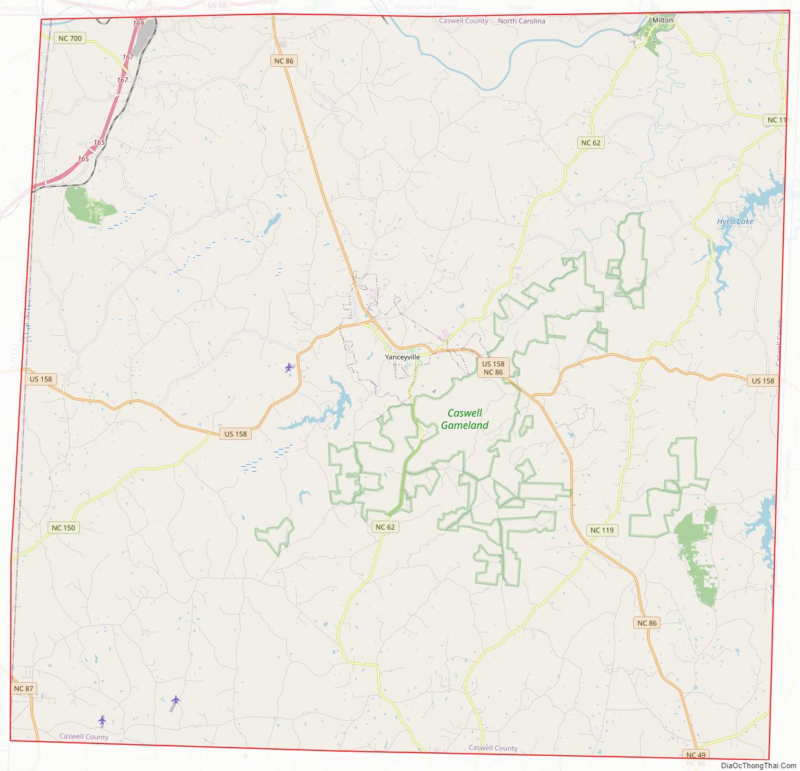
Caswell County Road Map
Geography
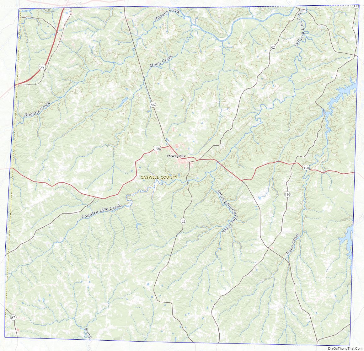
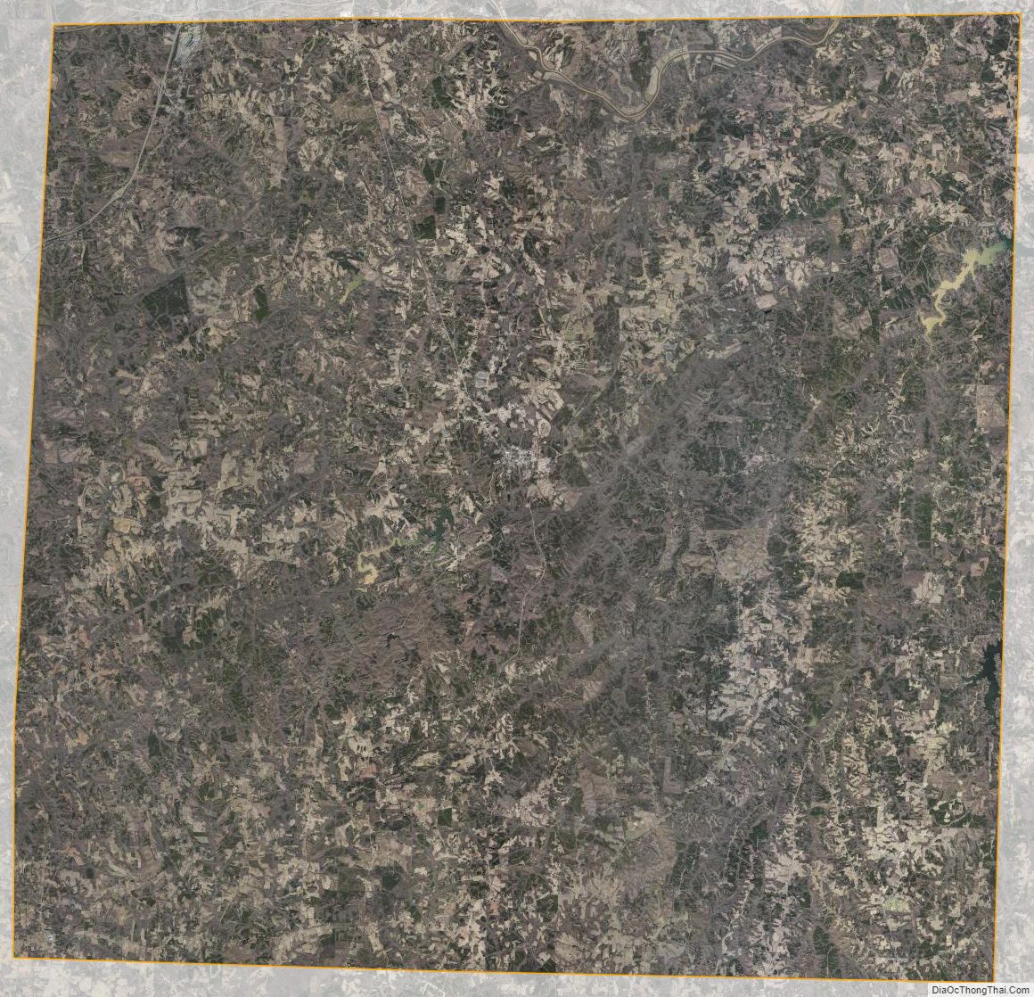
According to the U.S. Census Bureau, the county has a total area of 428 square miles (1,110 km), of which 425 square miles (1,100 km) is land and 3.3 square miles (8.5 km) (0.8%) is water. It is bordered by Person, Orange, Alamance, and Rockingham counties, and the state of Virginia. The Dan River flows through a part of the county. Hyco Lake is an important water source and popular recreational site.
For a comprehensive overview of Caswell County’s geography see When the Past Refused to Die: A History of Caswell County North Carolina 1777–1977, by William S. Powell (1977) at 1–22.
State and local protected area
- Caswell Game Land
Major water bodies
- Country Line Creek
- Dan River
- S.R. Farmer Lake
- Hogans Creek
- Hyco Creek
- Hyco Lake
- Lynch Creek (Hyco Creek tributary)
- Moon Creek
- North Fork Rattlesnake Creek
- South Hyco Creek
- Sugartree Creek (South Hyco Creek tributary)
- Wildwood Lake
Adjacent counties
- Person County – east
- Orange County – southeast
- Alamance County – south
- Rockingham County – west
- Pittsylvania County, Virginia – north
- Halifax County, Virginia – north
- Danville, Virginia (independent city) – north
Caswell County Topographic Map
Caswell County Satellite Map
Caswell County Outline Map