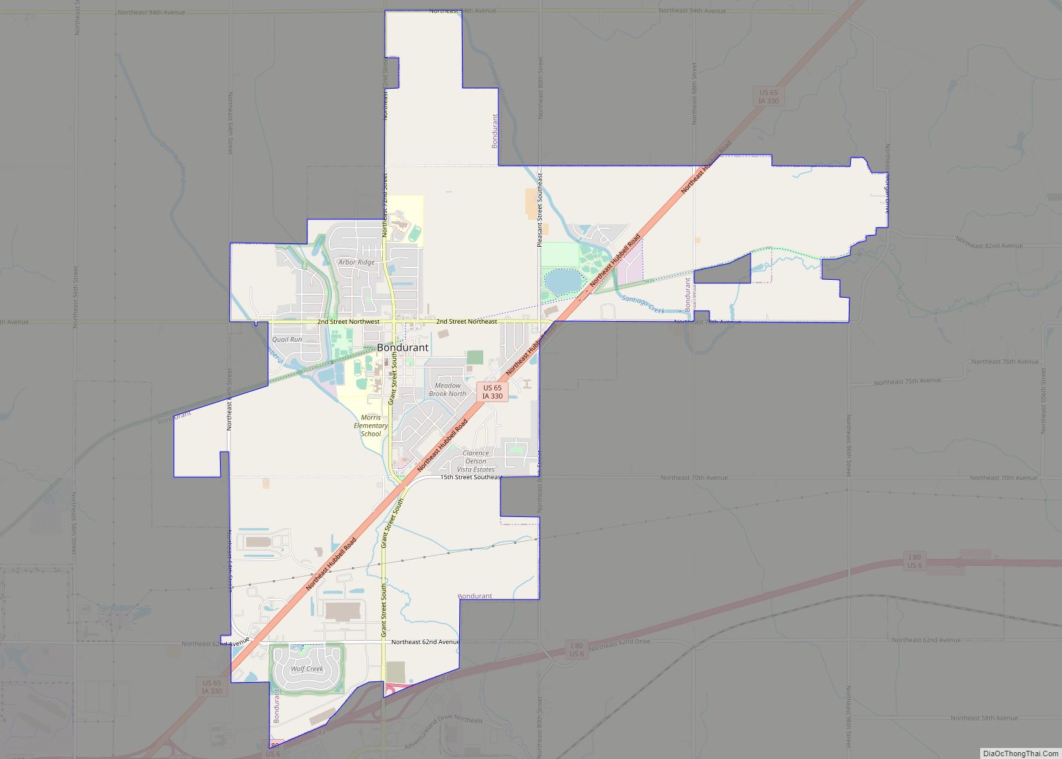
Bondurant (/ˈbɒndʊəˌrænt/) is a city in Polk County, Iowa, United States. The population was 7,365 in the 2020 census, an increase of 90.8% from the 3,860 population in 2010. It is part of the Des Moines–West Des Moines metropolitan statistical area.
| Name: | Bondurant city |
|---|---|
| LSAD Code: | 25 |
| LSAD Description: | city (suffix) |
| State: | Iowa |
| County: | Polk County |
| Elevation: | 971 ft (296 m) |
| Total Area: | 9.07 sq mi (23.50 km²) |
| Land Area: | 9.04 sq mi (23.43 km²) |
| Water Area: | 0.03 sq mi (0.07 km²) |
| Total Population: | 7,365 |
| Population Density: | 814.26/sq mi (314.38/km²) |
| ZIP code: | 50035 |
| Area code: | 515 |
| FIPS code: | 1907390 |
| GNISfeature ID: | 0454745 |
Online Interactive Map
Click on ![]() to view map in "full screen" mode.
to view map in "full screen" mode.
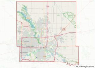
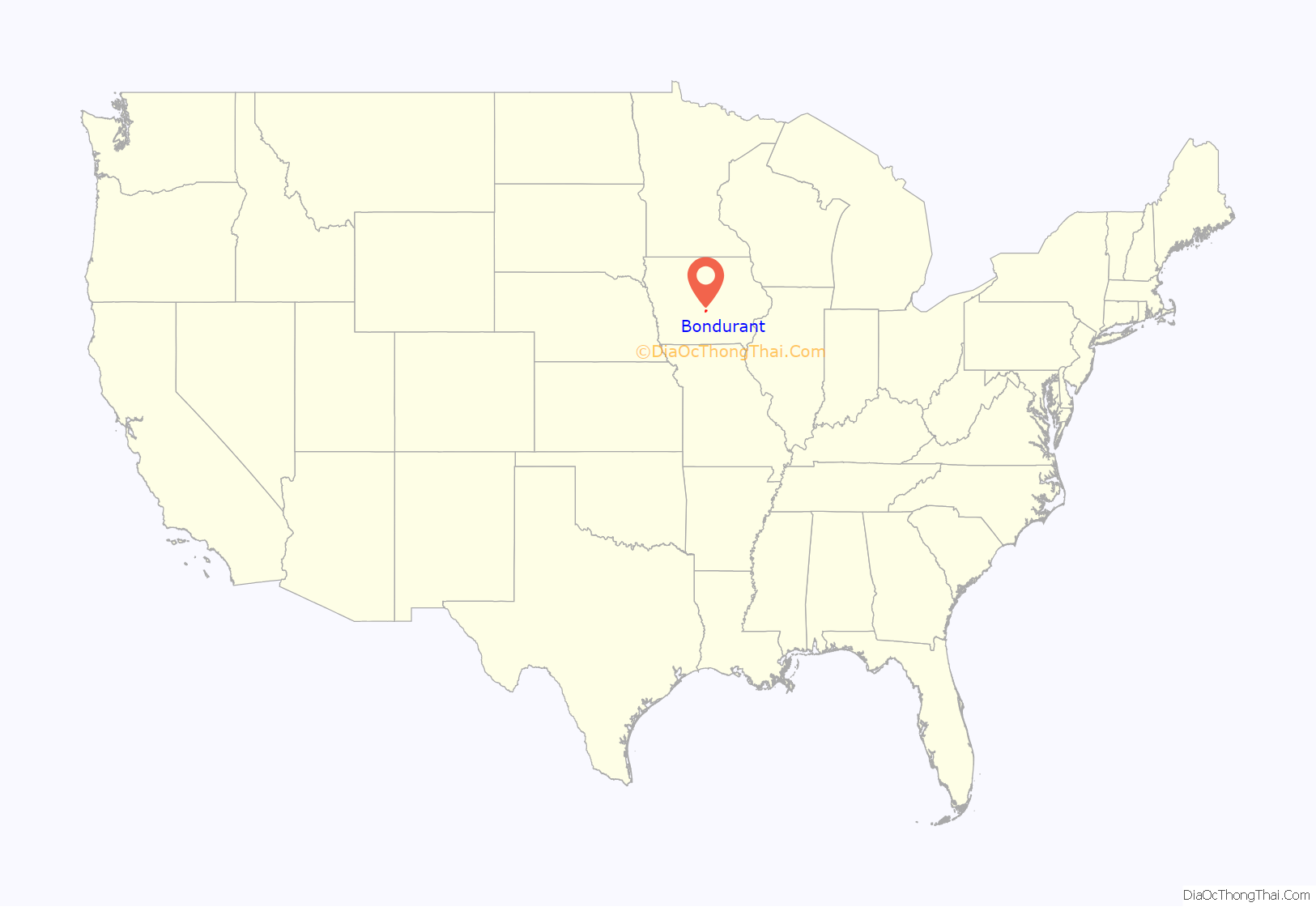
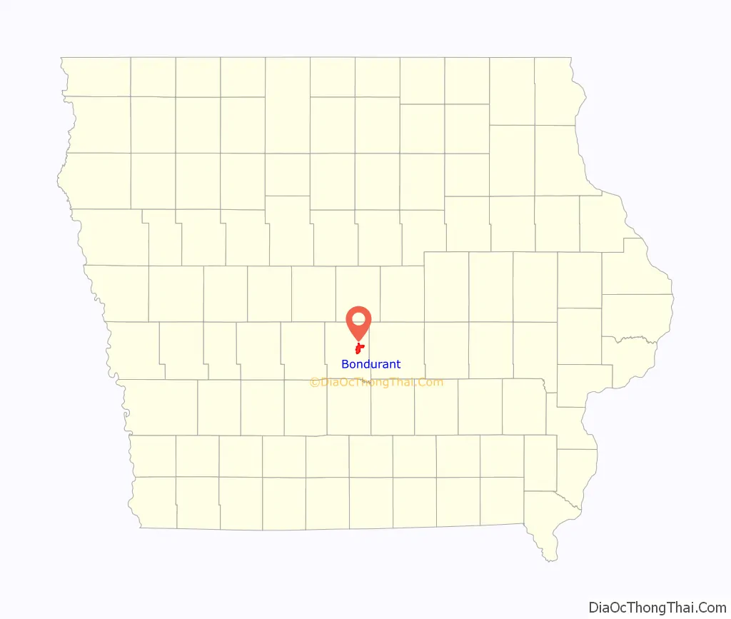
Bondurant location map. Where is Bondurant city?
History
Bondurant was founded in 1884. In 1892, the Chicago Great Western Railway built the Bondurant railway station. Bondurant incorporated as a city on December 23, 1897. The city was named for Alexander C. Bondurant, who was the area’s first settler in 1857.
Tornado
On July 19, 2018, at approximately 3 p.m., an EF2 tornado struck the city and lifted the entire second floor off a house, save for the second-floor bathroom’s toilet. The tornado was the second of two EF2 tornadoes that were on the ground simultaneously. The first tornado, which missed Bondurant, provided a clear warning as the second tornado formed shortly afterwards.
Bondurant Road Map
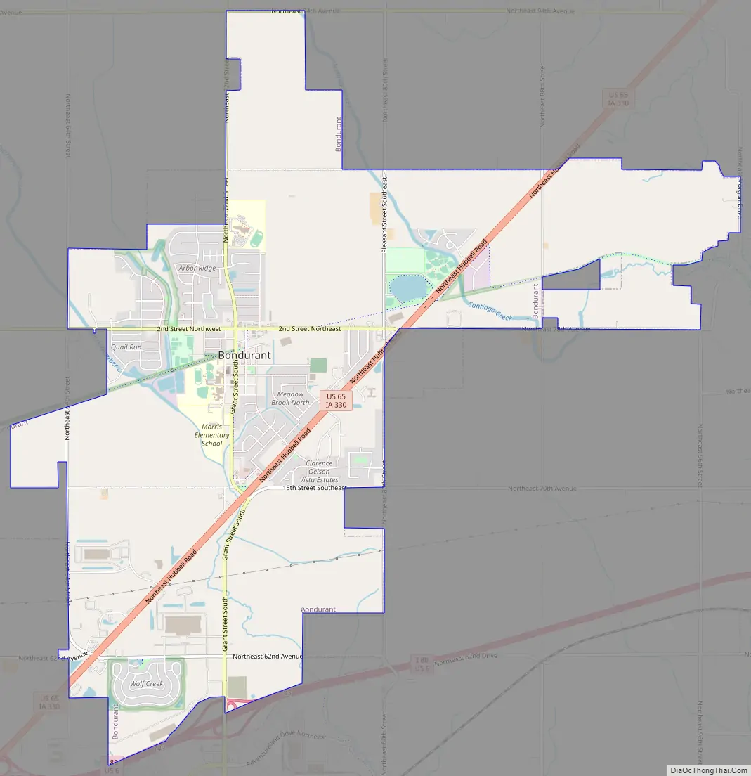
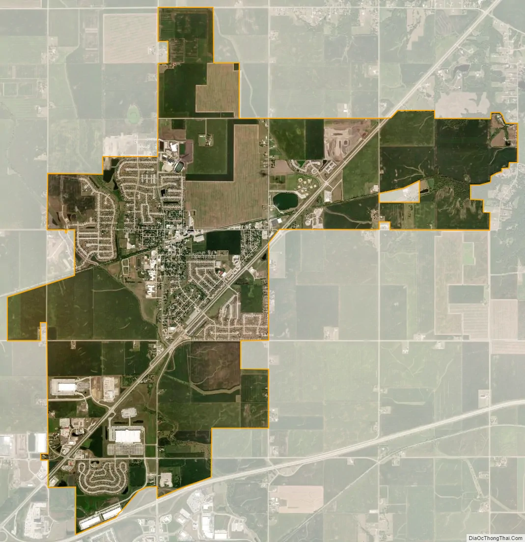
Bondurant city Satellite Map
Geography
Bondurant is located at 41°41′39″N 93°27′41″W / 41.694304°N 93.461488°W / 41.694304; -93.461488 (41.694304, -93.461488).
According to the United States Census Bureau, the city has a total area of 8.40 square miles (21.76 km), of which 8.38 square miles (21.70 km) is land and 0.02 square miles (0.05 km) is water.
Bondurant is located in the heartland of Iowa, and can be directly accessed by U.S. Route 65 (from the northeast or southwest) or NE 78th Ave (from the west).
See also
Map of Iowa State and its subdivision:- Adair
- Adams
- Allamakee
- Appanoose
- Audubon
- Benton
- Black Hawk
- Boone
- Bremer
- Buchanan
- Buena Vista
- Butler
- Calhoun
- Carroll
- Cass
- Cedar
- Cerro Gordo
- Cherokee
- Chickasaw
- Clarke
- Clay
- Clayton
- Clinton
- Crawford
- Dallas
- Davis
- Decatur
- Delaware
- Des Moines
- Dickinson
- Dubuque
- Emmet
- Fayette
- Floyd
- Franklin
- Fremont
- Greene
- Grundy
- Guthrie
- Hamilton
- Hancock
- Hardin
- Harrison
- Henry
- Howard
- Humboldt
- Ida
- Iowa
- Jackson
- Jasper
- Jefferson
- Johnson
- Jones
- Keokuk
- Kossuth
- Lee
- Linn
- Louisa
- Lucas
- Lyon
- Madison
- Mahaska
- Marion
- Marshall
- Mills
- Mitchell
- Monona
- Monroe
- Montgomery
- Muscatine
- O'Brien
- Osceola
- Page
- Palo Alto
- Plymouth
- Pocahontas
- Polk
- Pottawattamie
- Poweshiek
- Ringgold
- Sac
- Scott
- Shelby
- Sioux
- Story
- Tama
- Taylor
- Union
- Van Buren
- Wapello
- Warren
- Washington
- Wayne
- Webster
- Winnebago
- Winneshiek
- Woodbury
- Worth
- Wright
- Alabama
- Alaska
- Arizona
- Arkansas
- California
- Colorado
- Connecticut
- Delaware
- District of Columbia
- Florida
- Georgia
- Hawaii
- Idaho
- Illinois
- Indiana
- Iowa
- Kansas
- Kentucky
- Louisiana
- Maine
- Maryland
- Massachusetts
- Michigan
- Minnesota
- Mississippi
- Missouri
- Montana
- Nebraska
- Nevada
- New Hampshire
- New Jersey
- New Mexico
- New York
- North Carolina
- North Dakota
- Ohio
- Oklahoma
- Oregon
- Pennsylvania
- Rhode Island
- South Carolina
- South Dakota
- Tennessee
- Texas
- Utah
- Vermont
- Virginia
- Washington
- West Virginia
- Wisconsin
- Wyoming