Clive is a city in Dallas and Polk counties in the U.S. state of Iowa. As of the 2020 Census, the population was 18,601. It is part of the Des Moines–West Des Moines Metropolitan Statistical Area. Clive is known for its Greenbelt Park and trail system running through the community. Clive serves as the axis of the western Des Moines suburbs, between Urbandale, Waukee and West Des Moines along the major transportation corridors of I-35, I-80 and I-235. The City of Urbandale is to the north to northwest, the City of West Des Moines is to the southeast to southwest, the City of Waukee in Dallas County is to the west.
| Name: | Clive city |
|---|---|
| LSAD Code: | 25 |
| LSAD Description: | city (suffix) |
| State: | Iowa |
| County: | Dallas County, Polk County |
| Elevation: | 833 ft (254 m) |
| Total Area: | 7.73 sq mi (20.03 km²) |
| Land Area: | 7.64 sq mi (19.80 km²) |
| Water Area: | 0.09 sq mi (0.23 km²) 1.56% |
| Total Population: | 18,601 |
| Population Density: | 2,433.09/sq mi (939.46/km²) |
| ZIP code: | 50325 |
| Area code: | 515 |
| FIPS code: | 1914520 |
| GNISfeature ID: | 0455485 |
| Website: | www.cityofclive.com |
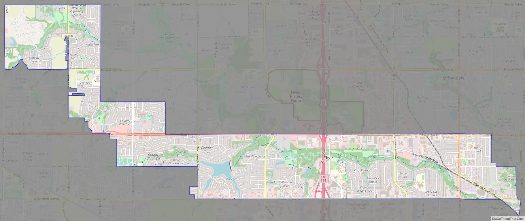
Online Interactive Map
Click on ![]() to view map in "full screen" mode.
to view map in "full screen" mode.
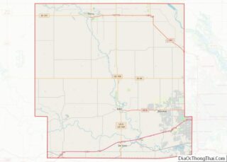
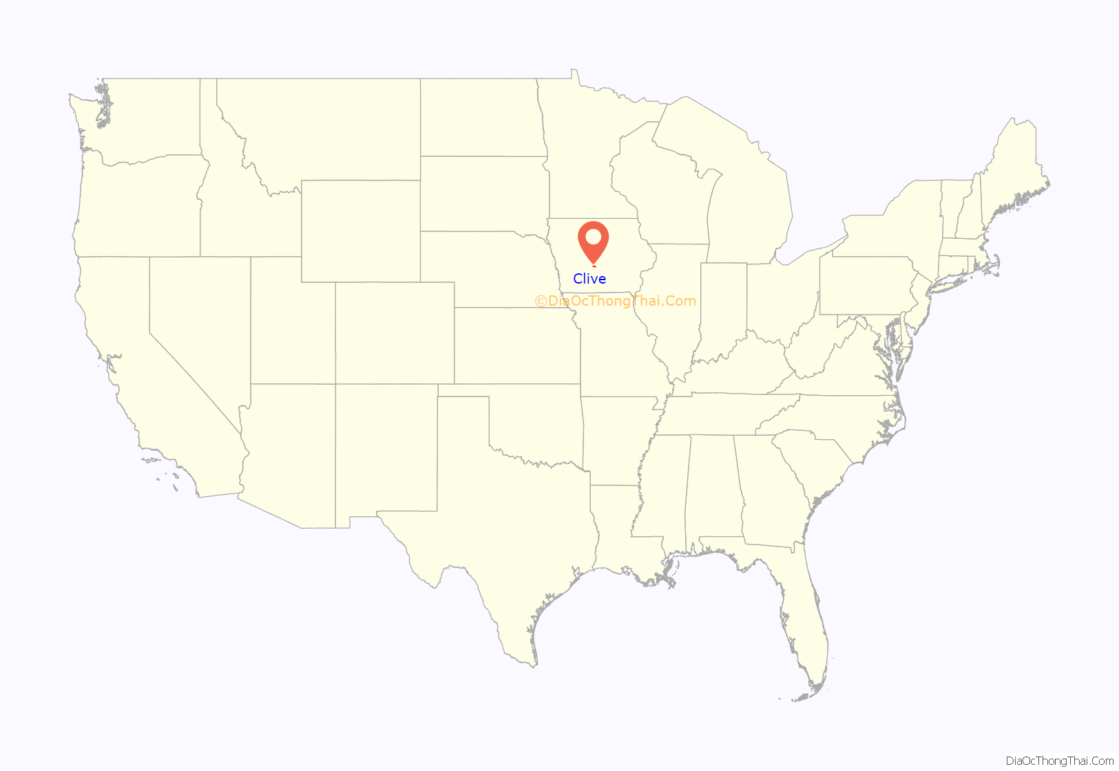
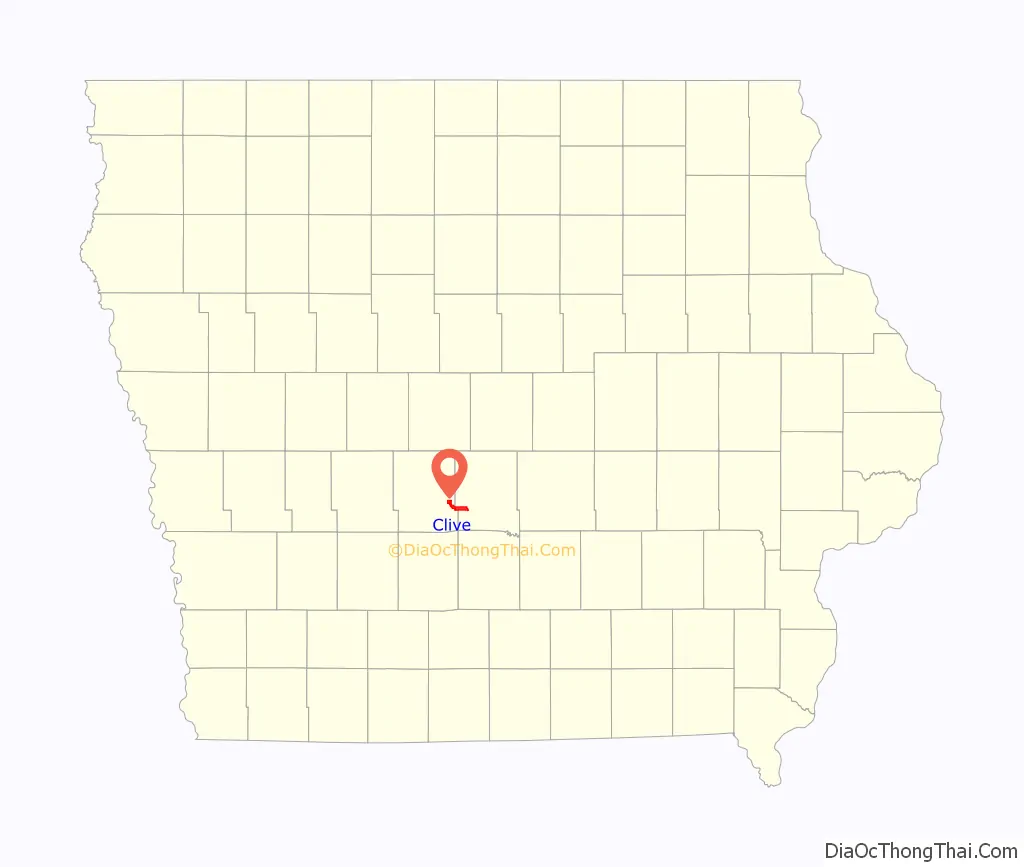
Clive location map. Where is Clive city?
History
Clive was platted in 1882 but did not incorporate as a city until August 18, 1956. While the exact origin of the city’s name is unknown, it is believed to have been named after Robert Clive.
In its early days, Clive was a coal mining town and a railroad shipping point along the St. Louis – Des Moines Northern Railway. The railroad depot, which dates back from 1882, has been restored while the neighboring Swanson House, dating back from 1911, serves as the headquarters for the Clive Historical Society.
After incorporation in 1956, Clive has served as a mostly residential suburb of Des Moines, and the city has grown in both land area and population since that time. Most of Clive’s businesses are along 86th Street, Hickman Road (which forms most of the boundary with Urbandale), and University Avenue (which forms the boundary with West Des Moines). Clive has been part of the West Des Moines School District since 1962; the portion of Clive that is in Dallas County is part of the Waukee School District.
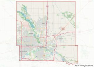
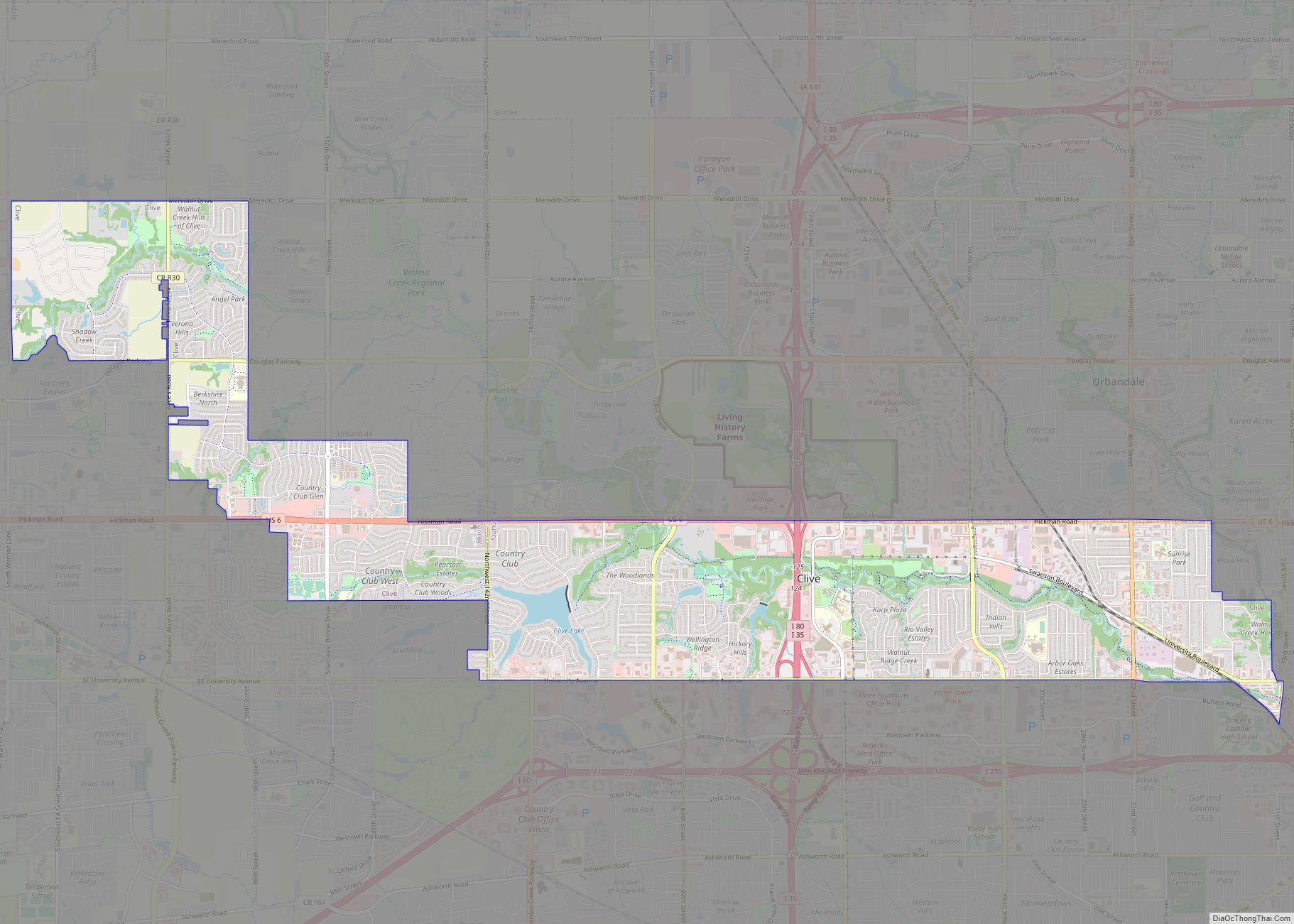
Clive Road Map
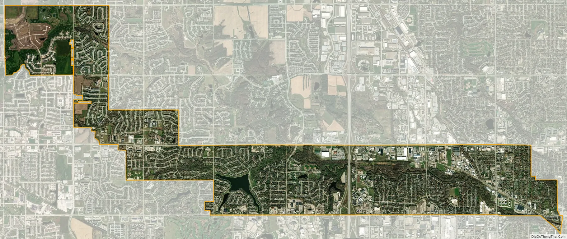
Clive city Satellite Map
Geography
According to the United States Census Bureau, the city has an area of 7.71 square miles (19.97 km), of which 7.59 square miles (19.66 km) is land and 0.12 square miles (0.31 km) is water.
See also
Map of Iowa State and its subdivision:- Adair
- Adams
- Allamakee
- Appanoose
- Audubon
- Benton
- Black Hawk
- Boone
- Bremer
- Buchanan
- Buena Vista
- Butler
- Calhoun
- Carroll
- Cass
- Cedar
- Cerro Gordo
- Cherokee
- Chickasaw
- Clarke
- Clay
- Clayton
- Clinton
- Crawford
- Dallas
- Davis
- Decatur
- Delaware
- Des Moines
- Dickinson
- Dubuque
- Emmet
- Fayette
- Floyd
- Franklin
- Fremont
- Greene
- Grundy
- Guthrie
- Hamilton
- Hancock
- Hardin
- Harrison
- Henry
- Howard
- Humboldt
- Ida
- Iowa
- Jackson
- Jasper
- Jefferson
- Johnson
- Jones
- Keokuk
- Kossuth
- Lee
- Linn
- Louisa
- Lucas
- Lyon
- Madison
- Mahaska
- Marion
- Marshall
- Mills
- Mitchell
- Monona
- Monroe
- Montgomery
- Muscatine
- O'Brien
- Osceola
- Page
- Palo Alto
- Plymouth
- Pocahontas
- Polk
- Pottawattamie
- Poweshiek
- Ringgold
- Sac
- Scott
- Shelby
- Sioux
- Story
- Tama
- Taylor
- Union
- Van Buren
- Wapello
- Warren
- Washington
- Wayne
- Webster
- Winnebago
- Winneshiek
- Woodbury
- Worth
- Wright
- Alabama
- Alaska
- Arizona
- Arkansas
- California
- Colorado
- Connecticut
- Delaware
- District of Columbia
- Florida
- Georgia
- Hawaii
- Idaho
- Illinois
- Indiana
- Iowa
- Kansas
- Kentucky
- Louisiana
- Maine
- Maryland
- Massachusetts
- Michigan
- Minnesota
- Mississippi
- Missouri
- Montana
- Nebraska
- Nevada
- New Hampshire
- New Jersey
- New Mexico
- New York
- North Carolina
- North Dakota
- Ohio
- Oklahoma
- Oregon
- Pennsylvania
- Rhode Island
- South Carolina
- South Dakota
- Tennessee
- Texas
- Utah
- Vermont
- Virginia
- Washington
- West Virginia
- Wisconsin
- Wyoming