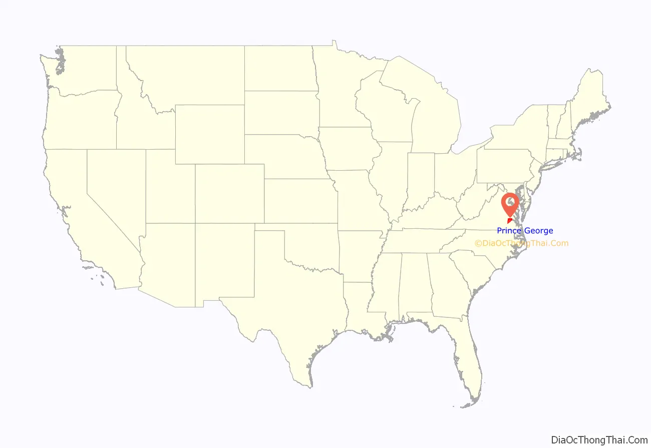
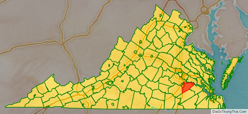
Prince George County is a county located in the Commonwealth of Virginia. As of the 2020 census, the population was 43,010. Its county seat is Prince George.
Prince George County is located within the Greater Richmond Region of the U.S. state of Virginia.
| Name: | Prince George County |
|---|---|
| FIPS code: | 51-149 |
| State: | Virginia |
| Founded: | 1703 |
| Named for: | Prince George of Denmark |
| Seat: | Prince George |
| Total Area: | 282 sq mi (730 km²) |
| Land Area: | 265 sq mi (690 km²) |
| Total Population: | 43,010 |
| Population Density: | 150/sq mi (59/km²) |
Prince George County location map. Where is Prince George County?
History
Prince George County was formed in 1703 in the Virginia Colony from the portion of Charles City County that was south of the James River. It was named in honor of Prince George of Denmark, husband of Anne, Queen of Great Britain.
In 1619, “Charles Cittie” [sic] was one of four “boroughs” or “incorporations” created by the Virginia Company. The first Charles City County courthouses were located along the James River at Westover Plantation on the north side and City Point on the south side. The Virginia Company lost its charter in 1624, and Virginia became a royal colony. Charles City Shire was formed in 1634 in the Virginia Colony by order of Charles I, King of England. It was named as Charles City County in 1643.
Charles Cittie, Charles City Shire, and Charles City County all extended to both sides of the James River, which was the major transportation thoroughfare of the Virginia Colony throughout the 17th century. The original central city of Charles City County was Charles City Point, which was in an area south of the James River at the confluence of the Appomattox River. The name was later shortened to City Point.
In 1703, all of the original area of Charles City County south of the James River was severed to form Prince George County. As population increased, portions were divided and organized as several additional counties. City Point became an incorporated town in Prince George County.
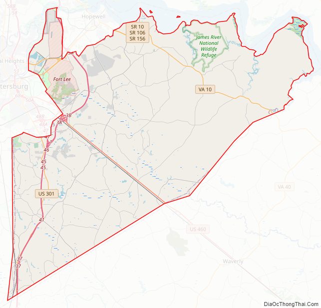
Prince George County Road Map
Geography
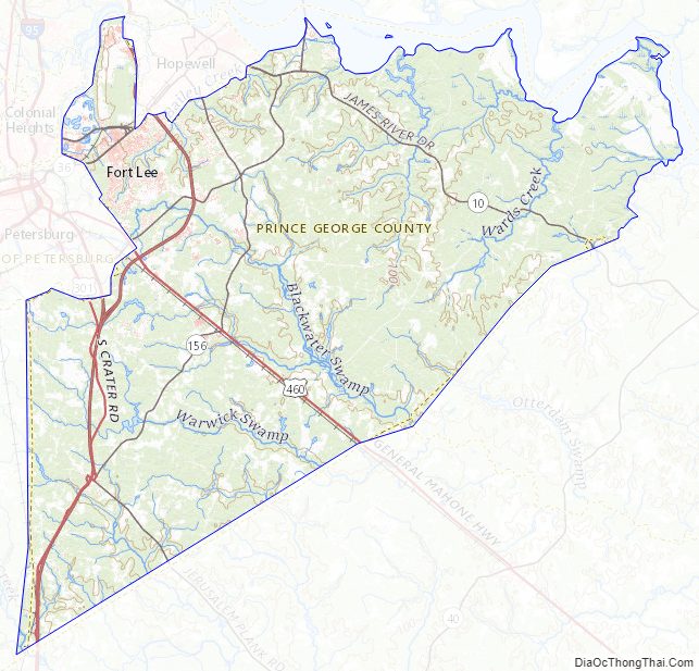
According to the U.S. Census Bureau, the county has a total area of 282 square miles (730 km), of which 265 square miles (690 km) is land and 17 square miles (44 km) (5.9%) is water. The northwestern corner of the county near the cities of Hopewell and Petersburg, and the location of Fort Lee is exurban, but the rest of the county is rural with most land devoted to agriculture and timber production.
Adjacent counties / independent cities
- Petersburg, Virginia – independent city, northwest
- Chesterfield County, Virginia – northwest
- Hopewell, Virginia – independent city, northwest
- Colonial Heights – independent city, northwest
- Charles City County, Virginia – north
- Surry County, Virginia – east
- Sussex County, Virginia – south
- Dinwiddie County, Virginia – west
National protected areas
- James River National Wildlife Refuge
- Petersburg National Battlefield Park (part)
Prince George County Topographic Map
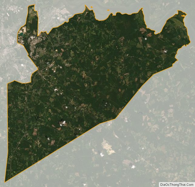
Prince George County Satellite Map
Prince George County Outline Map