| Name: | Charles City County |
|---|---|
| FIPS code: | 51-036 |
| State: | Virginia |
| Founded: | 1619 |
| Named for: | Charles I of England |
| Seat: | Charles City |
| Total Area: | 204 sq mi (530 km²) |
| Land Area: | 183 sq mi (470 km²) |
| Total Population: | 6,773 |
| Population Density: | 33/sq mi (13/km²) |
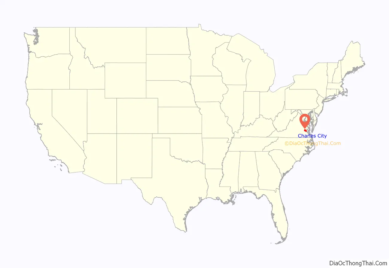
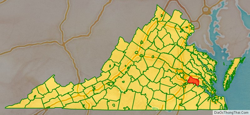
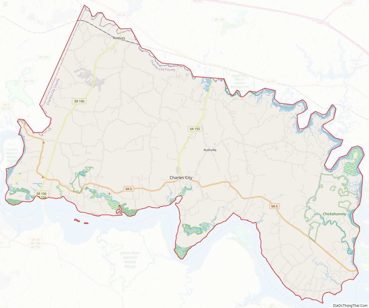
Charles City County location map. Where is Charles City County?
History
Native Americans
Various Indian tribes had used this area for thousands of years. When the region was explored by the English in the 17th century, the Algonquian-speaking Chickahominy tribe inhabited areas along the river that was later named for them by English colonists. The Paspahegh lived in Sandy Point, and the Weanoc lived in the Weyanoke Neck area. The latter two tribes were part of the Powhatan Confederacy. These three were all Algonquian-speaking tribes, the language family of the varied peoples who occupied the Tidewater and low country in Virginia and along the East Coast from Canada to south of the Carolinas.
Algonquian was one of the three major language family groups of American Indians in Virginia. Other tribes located on lands in the interior spoke Siouan and Iroquoian languages.
English colonization
The English began to colonize the area under the auspices of the Virginia Company, a private company formed to support this effort and gain profits from expected development and trade.
In 1619, the Virginia Company established Charles Cittie (sic) as one of the first four “boroughs” or “incorporations” in the region. West of James County, it was named for Prince Charles, second son of King James I of England, who became the Prince of Wales and heir apparent after the death of his older brother Henry in 1612. After his father’s death, he became King Charles I of England.
1619 marked the arrival of the first enslaved Africans in the Tidewater area. They had been captured from a Spanish ship and were taken to Weyanoke Peninsula. They were treated as indentured servants in the colony, and at least one later became a landowner after gaining his freedom. They created the first African community in what became the United States. Weyanoke, Virginia continues as a small, unincorporated community.
The Virginia Company lost its charter in 1624 under King James I, and Virginia became a royal colony. Charles City Shire was formed in 1634 in the Virginia Colony by order of the King. Its name was changed to Charles City County in 1643. It is one of the five original shires in Virginia that are extant in essentially the same political entity (county) as they were originally formed in 1634. Colonists developed the land as tobacco plantations and produced this commodity crop for export.
Cultivation and processing of this crop required intensive labor. The wealthier planters recruited indentured servants from the British Isles and Africa, and later purchased numerous enslaved Africans. In Virginia and the Upper South, historians have classified persons holding 20 or more slaves as planters.
The original central city of the county was Charles City Point, located south of the James River at the confluence of the Appomattox River. The first Charles City County courthouses were located along the James River at Westover on the north side and at City Point on the south side. The latter’s name was shortened from Charles City Point.
Breaking off other counties and cities
In 1634, Charles City Shire became one of the eight original Shires of Virginia established by the British in the Virginia Colony.
Since then, five counties: Prince George County, Brunswick, Dinwiddie, Amelia, and Prince Edward; and three independent cities: Hopewell, Petersburg and Colonial Heights have been formed from the original territory of Charles City Shire.
The most significant division was the organization of Prince George County in 1703, which took in all the land south of the James River formerly assigned to Charles City County. The later divisions of Prince George County yielded most of those other counties and independent cities.
Charles City County was one of the original Virginia shires of 1634. As the population increased, several other counties were formed from this territory. Beginning in 1703, all of the original area of Charles City County south of the James River was severed to form Prince George. This in turn was later divided, in a pattern typical of colonial development, into several other counties. The incorporated town of City Point, then in Prince George County, was annexed by the independent city of Hopewell in 1923.
Prince George County was later divided: Brunswick County was organized in 1732; Amelia County in 1735; and Prince Edward County in 1754, all from territory at one time within the very large Charles City County.
After 1703, Charles City County was limited to land on the north bank of the James River, between James City County (another of the original shires) to its east and Henrico County, another original shire, to its west. On the west, Chesterfield County was organized from Henrico in 1749. Charles City County is bordered by New Kent County to its north and Henrico County to its north-west.
North of the river, the area remained Charles City County. During the late 19th century, numerous crossroads communities developed among the plantations to serve the religious, educational and mercantile needs of the citizenry of rural Charles City County.
Crossroad communities, such as Adkins Store, Cedar Grove, Binns Hall, Parrish Hill, Ruthville and Wayside, typically included a store, church and school. (Public schools were not established until after the Civil War, when the Reconstruction legislature founded the system.)
As in other parts of the Tidewater, common planters and merchants of Charles City County were attracted by the appeal of Methodist and Baptist preachers in the Great Awakening in the late 18th and early 19th centuries. Several Methodist and Baptist churches were established in the early 19th century, mostly in the upland areas of the county. The county also had numerous Quaker settlers. The elite planters of the James River plantations tended to remain Anglican; the United States Episcopal Church was founded after the American Revolution.
The county has no “City”, or any centralized city or town. Charles City Court House, which has a Charles City postal address, is the focal point of government. The building that served as the courthouse was constructed in the 1730s. Used until 2007, it was one of only five courthouses in America that was in continuous use for judicial purposes since before the Revolutionary War. A new courthouse has since been built.
Indigenous Americans
The English named the Weyanoke Peninsula after the Weyanoc tribe, whom they encountered in the area. The Weyanoc were gradually displaced by colonial encroachment. They merged with other, larger tribes about the time of Bacon’s Rebellion.
The Chickahominy River, which forms much of the county’s eastern and northern borders, is named after another tribe of Algonquian-speaking Indians whom English colonists encountered in this area. Their descendants still inhabit the region. Chickahominy means “coarse-pounded corn people” in their Algonquian language. At the time of the earliest English settlement, the independent Chickahominy people occupied territory surrounded by numerous tribes of the powerful Powhatan Confederacy, but they were not part of it.
The Chickahominy and Eastern Chickahominy tribes are among seven tribes officially recognized by the Commonwealth of Virginia, and, since January 2018, among the six in the state recognized by the federal government. Many of their descendants still live in the county. The Chickahominy are the second-largest Indian tribe in Virginia, with just under one thousand members. The Eastern Chickahominy tribe has about 130 members.
English colonials
The majority of the colonists were English people who arrived as indentured servants and who owed labor, often as much as seven years, to wealthy patrons who had paid for their passage to gain land and laborers. The English government offered land grants to these patrons under a headright system, which was a way to encourage settlement in the colony. During the 17th century, for economic times encouraged many to settle in the North American colonies. In the early years, the Chesapeake Bay Colony had many more men than women, but more women entered began emigrating and families were begun.
As the indentured servants worked off their passage, they would be granted land of their own. Some became planters, owning 20 or more slaves, and they chose to settle in the upland section of the county. By then the most successful planter families already controlled the valuable riverfront property. This gave them ready access to the waterways, the transportation system for trade and travel.
African-Americans
With the growth of tobacco as a cash crop, demand for workers increased. Twenty-three African slaves were known to have been brought to Charles City County before 1660. During the late 1600s and early 1700s, African slave labor rapidly supplanted European indentured servants. By the eighteenth century, slaves had become the major source of agricultural labor in the Virginia Colony, then devoted primarily to the labor-intensive commodity crop of tobacco.
The earliest record of a free black living in Charles City County is the September 16, 1677 petition for freedom by a woman named Susannah. The Lott Cary House in the county has long been honored as the birth site of Lott Cary, a slave who purchased his freedom and that of his children. In the 19th century, he became a founding father of the new country of Liberia in Africa.
Beginning as early as the 17th century, some planters freed individual slaves by manumission. Some free mixed-race families, established before the American Revolution, were formed by descendants of unions or marriages between white indentured or free women and African men, indentured, slave or free. Colonial law and the principle of partus sequitur ventrem, provided that children were born into the status of their mother. Thus, the mixed-race children of white women were born free. If illegitimate, they had to serve time in lengthy apprenticeships, but freedom gave them an important step forward.
In the first two decades after the American Revolution, numerous planters in Charles City County freed their slaves, persuaded by Quaker, Baptist and Methodist abolitionists. Many free blacks settled together in today’s Ruthville, Virginia, a crossroads and one of the first free-black communities in present-day Charles City County and the state of Virginia. The unincorporated town of Ruthville was the center of the county’s free black population for many years. Following emancipation, Ruthville became the site of the Mercantile Cooperative Company and the Ruthville Training School. The United Sorghum Growers Club also met here. Known previously by several other names, the name “Ruthville” recalls local resident Ruth Brown. Her name was selected for the local Post Office established there in 1880.
When the Union Army began recruiting black troops during the American Civil War, many African Americans from Charles City County enlisted. In 1864, United States Colored Troops stationed at Fort Pocahontas roundly repelled an attack by 2500 Confederate troops commanded by Major General Fitzhugh Lee, nephew of General Robert E. Lee.
Virginia established statewide legal racial segregation when white Democrats regained control of the state legislature. They disfranchised most blacks at the turn of the century, maintaining this exclusion until after passage of civil rights legislation. In 1968, following passage of the federal Civil Rights Act and Voting Rights Act of the 1960s, and federal enforcement of the black franchise, James Bradby of Charles City County was the first African-American Virginian to be elected to the position of County Sheriff.
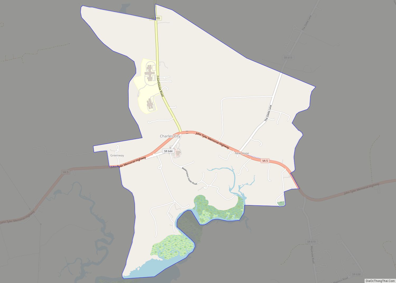
Charles City County Road Map
Geography
According to the U.S. Census Bureau, the county has a total area of 204 square miles (530 km), of which 183 square miles (470 km) is land and 21 square miles (54 km) (10.5%) is water.
Adjacent counties
- New Kent County – north
- James City – east
- Surry County – southeast
- Prince George County – south
- Chesterfield County – southwest
- Henrico County – west
Charles City County Topographic Map
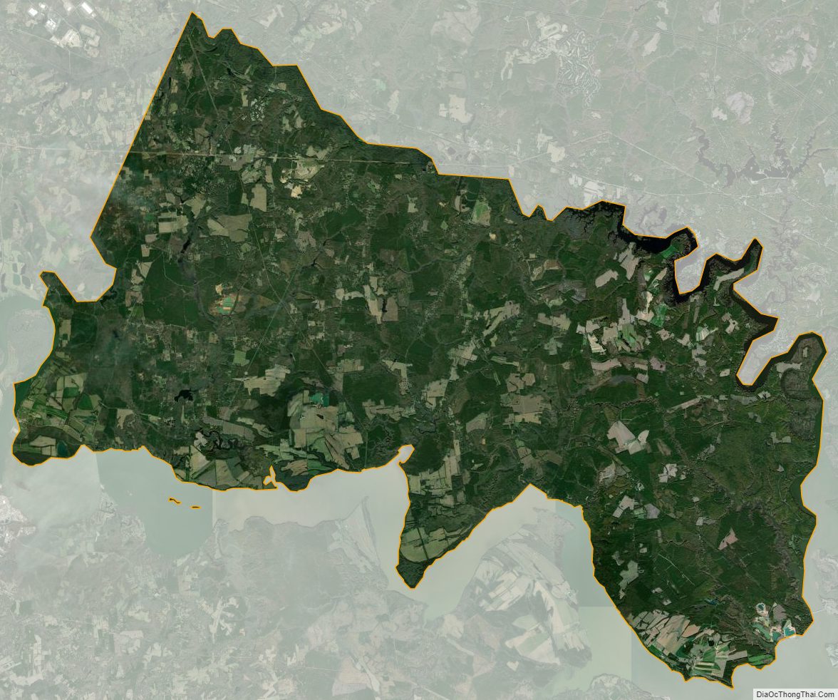
Charles City County Satellite Map
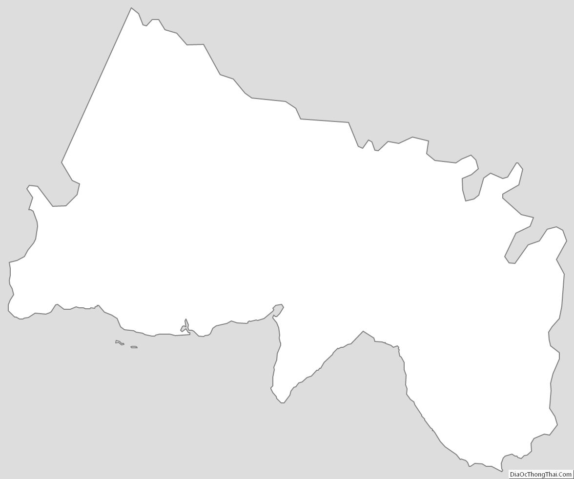
Charles City County Outline Map