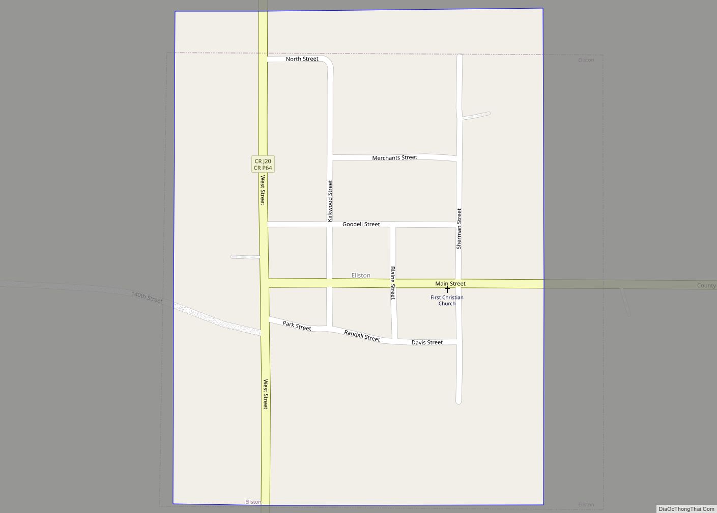
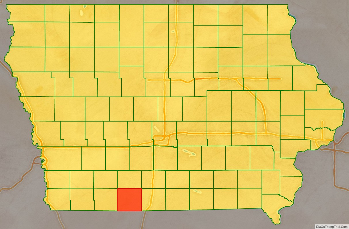
Ringgold County is a county located in the U.S. state of Iowa. As of the 2020 census, the population was 4,663, making it the Iowa county with the second-smallest population. The county seat is Mount Ayr. The county is named after Maj. Samuel Ringgold, a hero of the Battle of Palo Alto fought in May 1846, during the Mexican–American War. It is one of the 26 Iowa counties with a name that is unique across the nation.
| Name: | Ringgold County |
|---|---|
| FIPS code: | 19-159 |
| State: | Iowa |
| Founded: | February 24, 1847 |
| Named for: | Samuel Ringgold |
| Seat: | Mount Ayr |
| Largest city: | Mount Ayr |
| Total Area: | 539 sq mi (1,400 km²) |
| Land Area: | 535 sq mi (1,390 km²) |
| Total Population: | 4,663 |
| Population Density: | 8.7/sq mi (3.3/km²) |
| Time zone: | UTC−6 (Central) |
| Summer Time Zone (DST): | UTC−5 (CDT) |
| Website: | www.ringgoldcounty.iowa.gov |
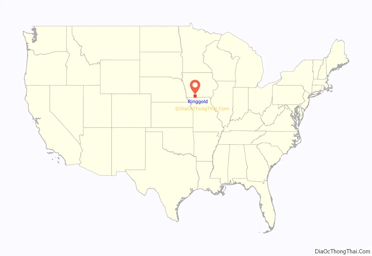
Ringgold County location map. Where is Ringgold County?
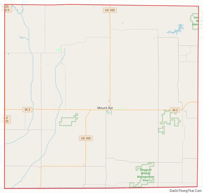
Ringgold County Road Map
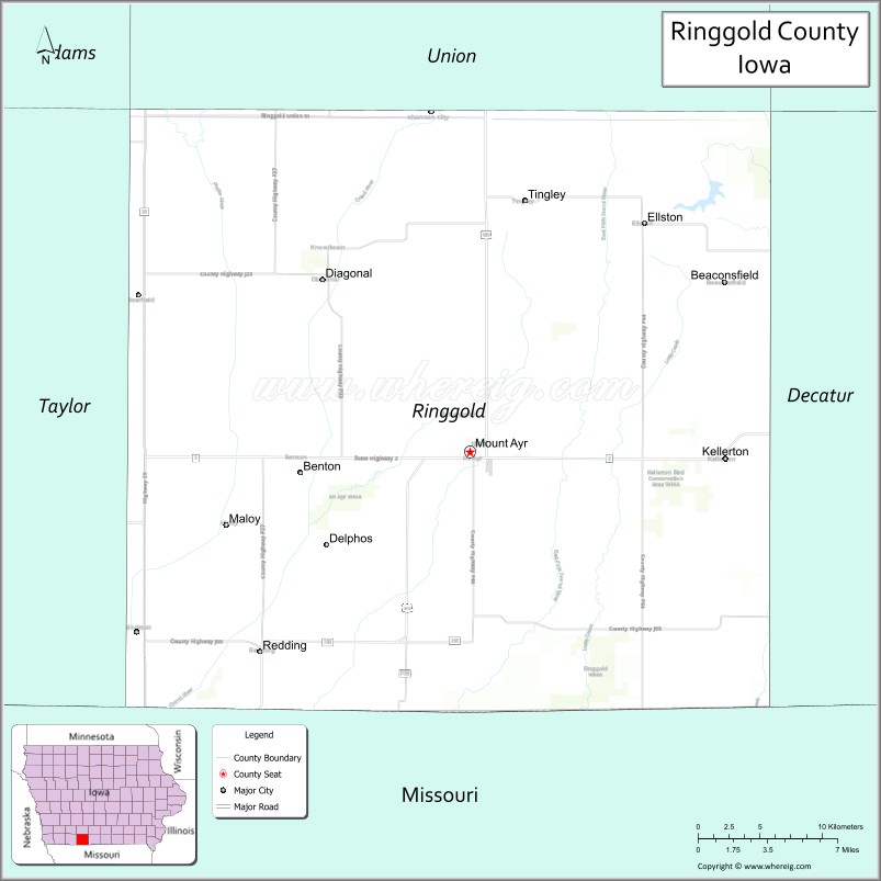
Geography
According to the U.S. Census Bureau, the county has a total area of 539 square miles (1,400 km), of which 535 square miles (1,390 km) is land and 3.4 square miles (8.8 km) (0.6%) is water.
Major highways
- U.S. Highway 169
- Iowa Highway 2
- Iowa Highway 25
Adjacent counties
- Union County (north)
- Decatur County (east)
- Harrison County, Missouri (southeast)
- Worth County, Missouri (southwest)
- Taylor County (west)
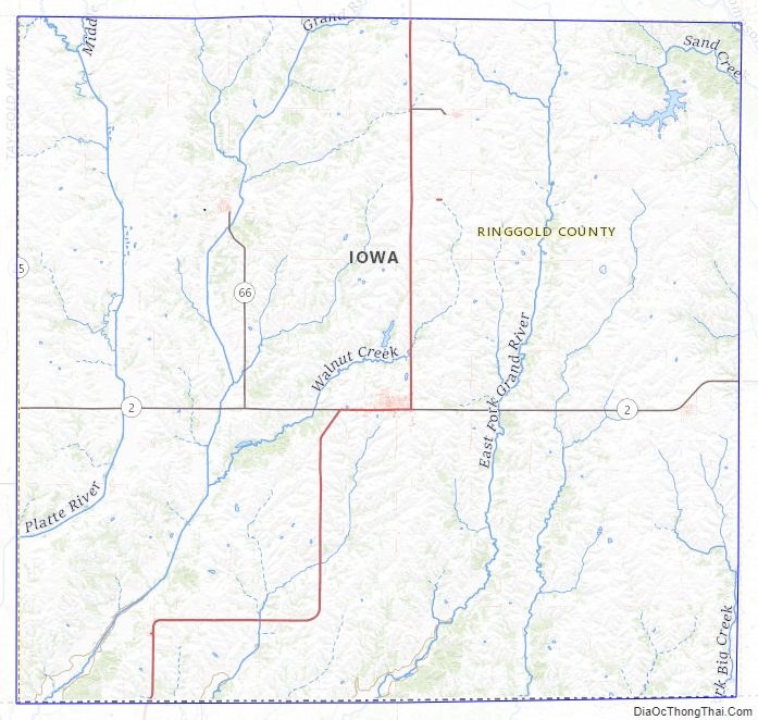
Ringgold County Topographic Map
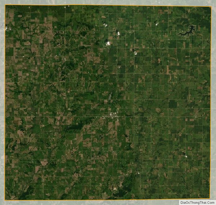
Ringgold County Satellite Map
Ringgold County Outline Map