San Diego County (/ˌsæn diˈeɪɡoʊ/ (listen)), officially the County of San Diego (Spanish: Condado de San Diego), is a county in the southwestern corner of the U.S. state of California. As of the 2020 census, the population was 3,298,634, making it California’s second-most populous county and the fifth-most populous in the United States. Its county seat is San Diego, the second-most populous city in California and the eighth-most populous city in the United States. It is the southwesternmost county in the 48 contiguous United States, and is a border county. It is also home to 18 Native American tribal reservations, the most of any county in the United States.
San Diego County comprises the San Diego-Chula Vista-Carlsbad, CA Metropolitan Statistical Area, which is the 17th most populous metropolitan statistical area and the 18th most populous primary statistical area of the United States as of July 1, 2012. San Diego County is also part of the San Diego–Tijuana transborder metropolitan area, the largest metropolitan area shared between the United States and Mexico.
San Diego County has more than 70 miles (113 km) of coastline. This forms the most densely populated region of the county, which has a mild Mediterranean to semiarid climate and extensive chaparral vegetation, similar to the rest of the western portion of Southern California. Precipitation and temperature extremes increase to the east, with mountains that receive frost and snow in the winter. These lushly forested mountains receive more rainfall than the average in Southern California, while the desert region of the county lies in a rain shadow to the east, which extends into the Desert Southwest region of North America.
There are 16 military installations, of the U.S. Navy, U.S. Marine Corps, and the U.S. Coast Guard in San Diego County. These include Naval Base San Diego, Marine Corps Base Camp Pendleton, Marine Corps Air Station Miramar, Naval Air Station North Island, and Coast Guard Air Station San Diego.
From north to south, San Diego County extends from the southern borders of Orange and Riverside Counties to the Mexico-U.S. border and the Baja California municipalities of Tijuana and Tecate. From west to east, San Diego County stretches from the Pacific Ocean to its boundary with Imperial County, which separated from it in 1907. Since 2010, statewide droughts in California have further strained San Diego County’s water security.
| Name: | San Diego County |
|---|---|
| FIPS code: | 06-073 |
| State: | California |
| Founded: | 1850 |
| Named for: | San Diego de Alcalá |
| Seat: | San Diego |
| Largest city: | San Diego |
| Total Area: | 4,260.9 sq mi (11,036 km²) |
| Land Area: | 3,942 sq mi (10,210 km²) |
| Total Population: | 3,298,634 |
| Population Density: | 837/sq mi (323/km²) |
| Time zone: | UTC–8 (Pacific Time Zone) |
| Summer Time Zone (DST): | UTC–7 (Pacific Daylight Time) |
| Website: | www.sandiegocounty.gov |
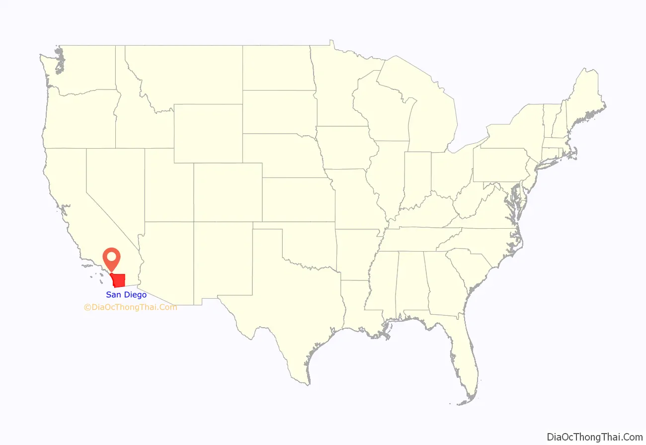
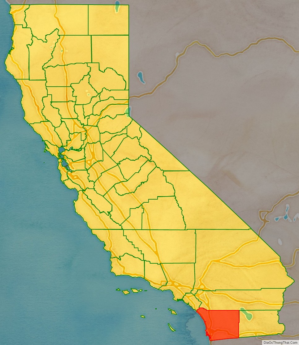
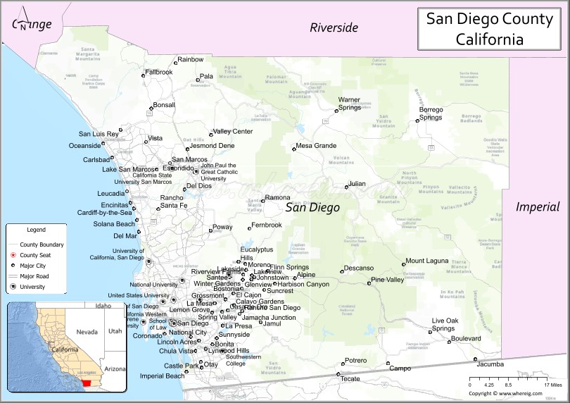
San Diego County location map. Where is San Diego County?
History
The area which is now San Diego County has been inhabited for more than 12,000 years by Kumeyaay (also called Diegueno and Ipai/Tipai), Payómkawichum (Luiseño), Kuupangaxwichem (Cupeño), ʔívil̃uqaletem (Cahuilla), and the Acjachemen (Juaneño) Indians and their local predecessors.
In 1542, the explorer Juan Rodríguez Cabrillo, who may have been born in Portugal but sailed under the flag of Castile, claimed San Diego Bay for the Spanish Empire, and he named the site San Miguel. In November 1602, Sebastián Vizcaíno surveyed the harbor and what are now Mission Bay and Point Loma and named the area for Saint Didacus, a Spaniard more commonly known as San Diego. European settlement in what is now San Diego County began with the founding of the San Diego Presidio and Mission San Diego de Alcalá by Spanish soldiers and clerics in 1769. This county was part of Alta California under the Viceroyalty of New Spain until the Mexican declaration of independence. From 1821 through 1848 this area was part of Mexico.
San Diego County became part of the United States as a result of the Treaty of Guadalupe Hidalgo in 1848, ending the Mexican–American War. This treaty designated the new border as terminating at a point on the Pacific Ocean coast which would result in the border passing one Spanish league south of the southernmost portion of San Diego Bay, thus ensuring that the United States received all of this natural harbor.
San Diego County was one of the original counties of California, created at the time of California statehood in 1850.
At the time of its establishment in 1850, San Diego County was relatively large, and included all of southernmost California south and east of Los Angeles County. It included areas of what are now Inyo and San Bernardino Counties, as well as all of what are now Riverside and Imperial Counties.
During the later part of the 19th century, there were numerous changes in the boundaries of San Diego County, when various areas were separated to make up the counties mentioned above. The most recent changes were the establishments of Riverside County in 1893 and Imperial County in 1907. Imperial County was also the last county to be established in California, and after this division, San Diego no longer extended from the Pacific Ocean to the Colorado River, and it no longer covered the entire border between California and Mexico.
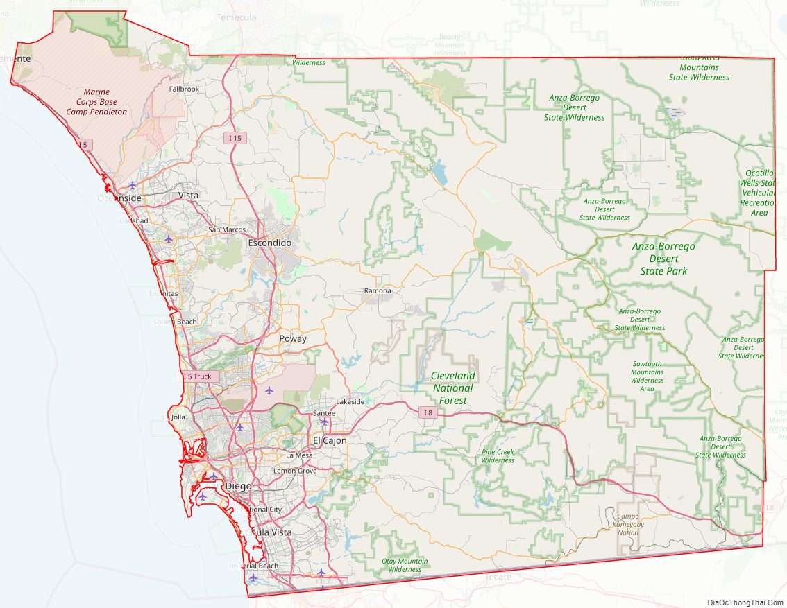
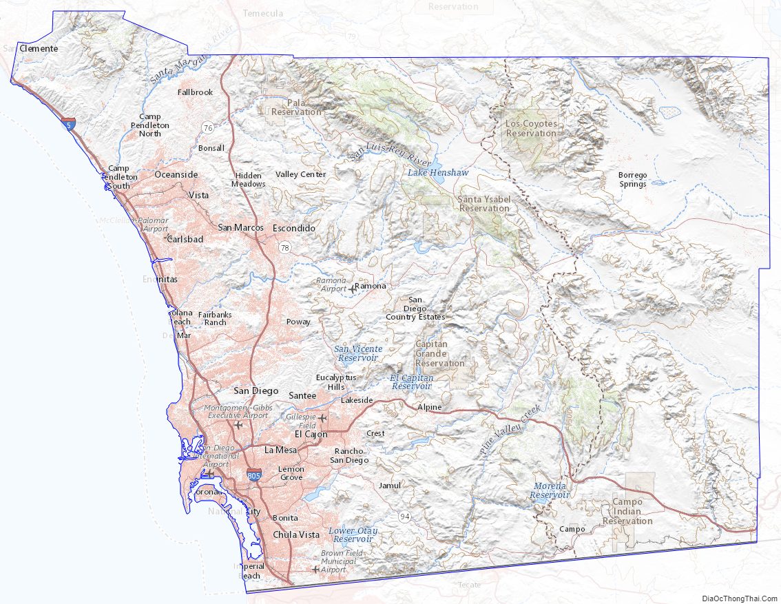
San Diego County Road Map
Geography
According to the U.S. Census Bureau, the county has an area of 4,526 square miles (11,720 km), of which 4,207 square miles (10,900 km) is land and 319 square miles (830 km) (7.0%) is water. The county is larger in area than the combined states of Rhode Island and Delaware.
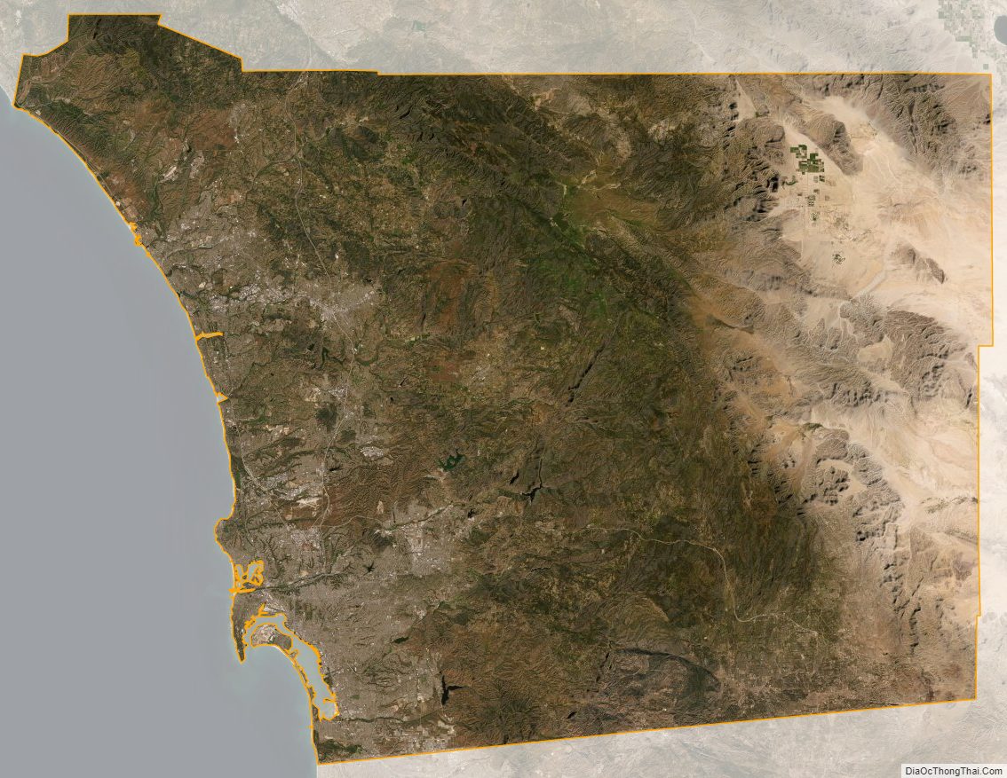
San Diego County has a varied topography. On its western side is more than 70 miles (113 km) of coastline. Most of San Diego between the coast and the Laguna Mountains consists of hills, mesas, and small canyons. Snow-capped (in winter) mountains rise to the east, with the Sonoran Desert farther to the east. Cleveland National Forest is spread across the central portion of the county, while the Anza-Borrego Desert State Park occupies most of the northeast.
Although the county’s western third is primarily urban, the mountains and deserts in the eastern two-thirds are primarily undeveloped backcountry. Most of these backcountry areas are home to a native plant community known as chaparral. San Diego County contains more than 1,000,000 acres (4,000 km) of chaparral, twice as much as any other California county.
Periodically the area has been subject to wildfires that force thousands to evacuate. The most recent are the December 2017 Lilac Fire and the May 2014 San Diego County wildfires; before them was the Witch Creek Fire in 2007 and the Cedar Fire in 2003. California defines a fire season in which fires are most likely to occur, usually between late July and late October (which are the driest months of the area). Signs posted in numerous spots of the county provide information on the level of threats from fires based on weather conditions.
Regions
Northern San Diego County is known as North County; the eastern suburbs are collectively known as East County; the rural areas located further east and extending to the Imperial County line are known as the Mountain Empire; and the southern suburbs, extending to the Mexican border, are collectively known as the South Bay or South County, including South San Diego, an exclave of the city of San Diego which has no land connection to the rest of the city.
Climate
Under the Köppen climate classification system, the urban and suburban San Diego area straddles areas of Mediterranean climate (CSa) to the north and semi-arid climate (BSh) to the south and east. As a result, it is often described as “arid Mediterranean” and “semi-arid steppe.” Farther east, arid desert conditions prevail. Western San Diego’s climate is characterized by warm, dry summers and mild winters with most of the annual precipitation falling between November and March. The city has mild, mostly dry weather, with an average of 201 days above 70 °F (21 °C) and low rainfall (9–13 inches (23–33 cm) annually). Summer temperatures are generally warm, with average highs of 70–78 °F (21–26 °C) and lows of 55–66 °F (13–19 °C). Temperatures exceed 90 °F (32 °C) only four days a year. Most rainfall occurs from November to April. Winter temperatures are mild, with average high temperatures of 66–70 °F (19–21 °C) and lows of 50–56 °F (10–13 °C).
The climate in the San Diego area, like much of California, often varies significantly over short geographical distances resulting in microclimates. In San Diego’s case this is mainly due to the city’s topography (the Bay, and the numerous hills, mountains, and canyons). Frequently, particularly during the “May gray/June gloom” period, a thick marine layer will keep the air cool and damp within a few miles of the coast, but will yield to bright cloudless sunshine approximately 5–10 miles (8.0–16.1 km) inland. This happens every year in May and June. Even in the absence of June gloom, inland areas tend to experience much more significant temperature variations than coastal areas, where the ocean serves as a moderating influence. Thus, for example, downtown San Diego averages January lows of 48 °F (9 °C) and August highs of 77 °F (25 °C). The city of El Cajon, just 10 miles (16 km) northeast of downtown San Diego, averages January lows of 42 °F (6 °C) and August highs of 89 °F (32 °C). Julian, in the mountains, has an average January low of 29 °F (−2 °C) and August high of 85 °F (29 °C). Borrego Springs, in the Colorado Desert, has an average January low of 43 °F (6 °C) and August high of 106 °F (41 °C).
Rainfall along the coast averages about 10 inches (25 cm) of precipitation annually, which occurs mainly during the cooler months of December through April. Though there are few wet days per month during the rainy period, rainfall can be heavy when it does occur. However, the rainfall is greater in the higher elevations of San Diego. Some of the higher areas of San Diego, such as Palomar Mountain and the Laguna Mountains, receive 20–40 inches (51–102 cm) of rain per year, supporting lush forests similar to the Sierra Nevada and California Coast Range. The Colorado Desert portion of the county lies to the east of the mountains, which receives the least amount of precipitation; Borrego Springs, the largest population center in the desert, averages only 5 inches (13 cm), with a high evaporation rate.
- ^ Mean monthly maxima and minima (i.e. the highest and lowest temperature readings during an entire month or year) calculated based on data at said location from 1991 to 2020.
- ^ Official precipitation records for San Diego were kept at the Weather Bureau Office in downtown from October 1850 to December 1859 at the Mission San Diego and from November 1871 to June 1939 and a variety of buildings at downtown, and at San Diego Int’l (Lindbergh Field) since July 1939. Temperature records, however, only date from October 1874. For more information on data coverage, see ThreadEx
Adjacent counties and municipalities
National protected areas
- Cabrillo National Monument
- Cleveland National Forest (part)
- San Diego National Wildlife Refuge Complex, which includes
- San Diego National Wildlife Refuge
- San Diego Bay National Wildlife Refuge
- Tijuana Slough National Wildlife Refuge
- Seal Beach National Wildlife Refuge (located in Orange County)
There are seven official wilderness areas in San Diego County that are part of the National Wilderness Preservation System. Four of these are integral parts of Cleveland National Forest, whereas three are managed by the Bureau of Land Management. Some of these extend into neighboring counties (as indicated below):
- Otay Mountain Wilderness (BLM)
- Pine Creek Wilderness (Cleveland National Forest)
- Hauser Wilderness (Cleveland National Forest)
- Carrizo Gorge Wilderness (BLM)
- Sawtooth Mountains Wilderness (BLM)
- Agua Tibia Wilderness (Cleveland National Forest) partly in Riverside County
- San Mateo Canyon Wilderness (Cleveland National Forest) mostly in Riverside County
State parks and protected areas
- Anza-Borrego Desert State Park (part)
- Torrey Pines State Reserve
- Cuyamaca Rancho State Park
- Palomar Mountain State Park
- San Pasqual Battlefield State Historic Park
- Old Town San Diego State Historic Park
- Border Field State Park
- Tijuana River National Estuarine Research Reserve
- San Onofre State Beach
- Moonlight State Beach
- Carlsbad State Beach
- South Carlsbad State Beach
- Leucadia State Beach
- San Elijo State Beach
- Cardiff State Beach
- Torrey Pines State Beach
- Silver Strand State Beach
Mountains
- Cuyamaca Mountains
- In-Ko-Pah Mountains
- Jacumba Mountains
- Laguna Mountains
- Palomar Mountain
- Peninsular Ranges
- San Ysidro Mountains
- Santa Ana Mountains
- Volcan Mountains
There are 236 mountain summits and peaks in San Diego County including:
- Black Mountain
- Cuyamaca Peak (second highest point in San Diego County)
- Cowles Mountain (highest point in the city of San Diego)
- Mount Helix
- Hot Springs Mountain (highest point in San Diego County)
- Margarita Peak
- Mount Soledad
- Stonewall Mountain
- El Cajon Mountain
Bays and lagoons
- Buena Vista Lagoon
- Agua Hedionda Lagoon
- Batiquitos Lagoon
- San Elijo Lagoon
- Los Peñasquitos Lagoon
- Mission Bay
- San Diego Bay
Lakes
- Lake Cuyamaca
- Lake Hodges
- Santee Lakes
- Sweetwater Reservoir
- Upper Otay Reservoir
- Lower Otay Reservoir
- Lake Wohlford
- El Capitan Reservoir
- Sutherland Reservoir
- Lake Henshaw
- Lake Murray
- San Vicente Reservoir
- Lake Jennings
- Barrett Dam
- Natural Rock Tanks
- Little Laguna Lake
- Big Laguna Lake
- Big Lake
- Twin Lakes
- Jean Lake
- Lost Lake
- Swan Lake
- Lake Miramar
- Lake Poway
- Dixon Lake
- Lindo Lake
Rivers
- San Diego River
- San Luis Rey River
- San Dieguito River
- Sweetwater River
- Otay River
- Tijuana River
- Tijuana River Mouth State Marine Conservation Area
- Santa Margarita River
Environmental risks
More than 1,700 tons of radioactive waste are stored at San Onofre Nuclear Generating Station, which sits in an area where there is a record of past tsunamis.
San Diego County Topographic Map
San Diego County Satellite Map
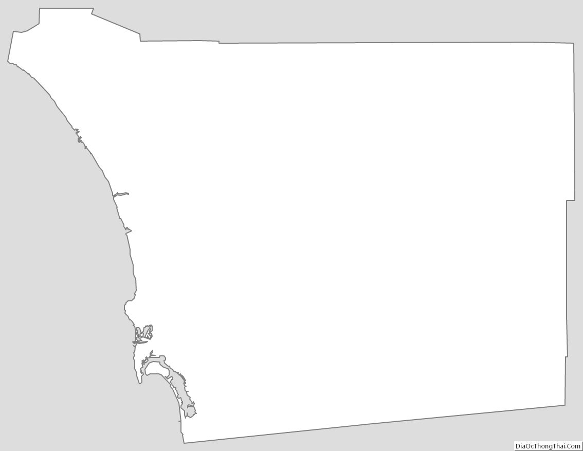
San Diego County Outline Map