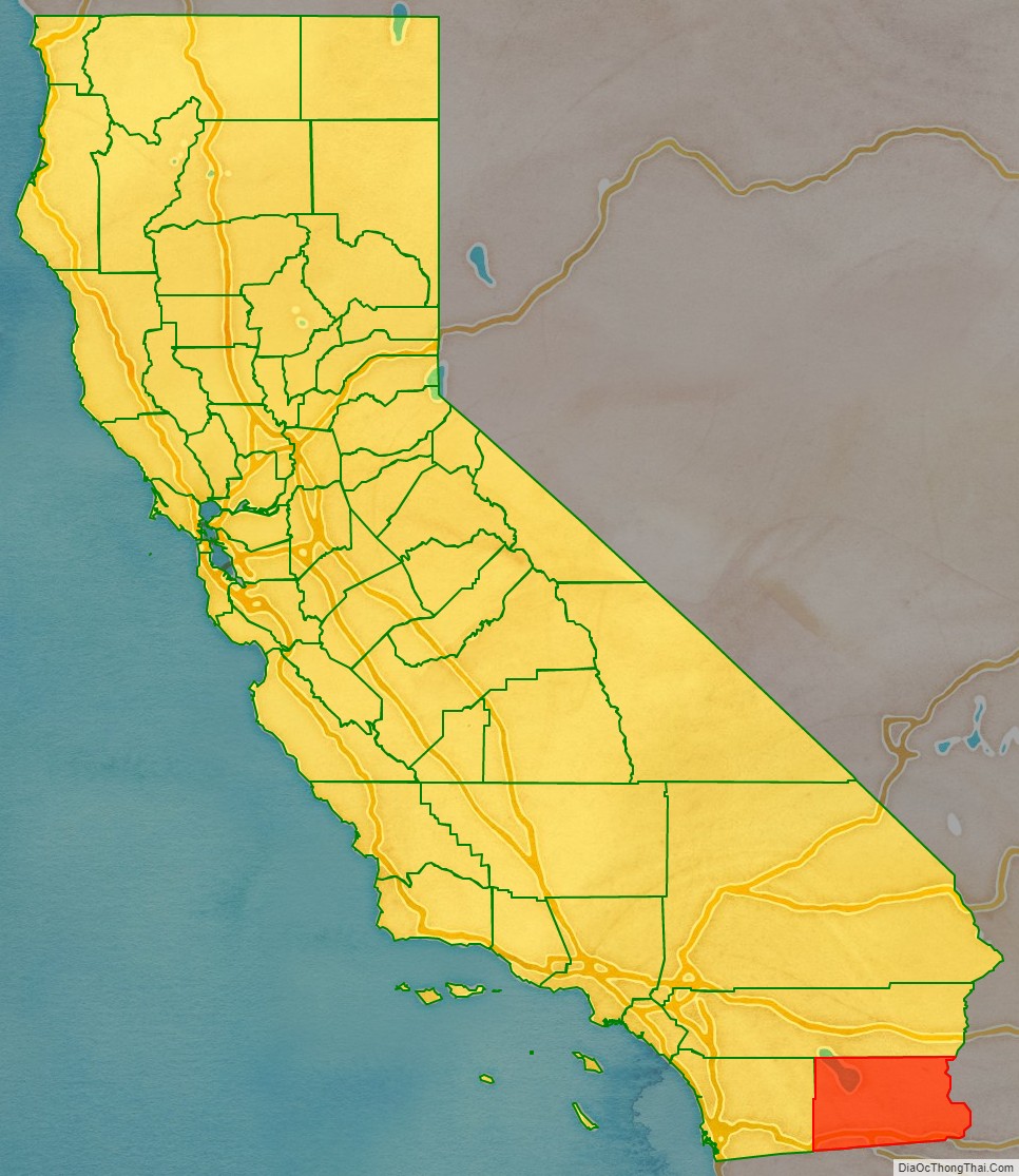
Imperial County (Spanish: Condado de Imperial) is a county located on the southeast border of the U.S. state of California. As of the 2020 census, the population was 179,702, making it the least populous county in Southern California. The county seat is El Centro. Imperial is the most recent California county to be established, as it was created in 1907 out of portions of San Diego County.
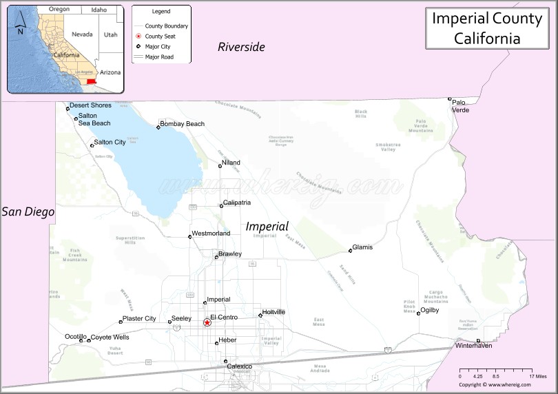
Imperial County is located in the far southeast of California, in the Imperial Valley. It borders San Diego County to the west, Riverside County to the north, the U.S. state of Arizona to the east and the Mexican state of Baja California to the south. It includes the El Centro Metropolitan Statistical Area and is part of the Southern California border region, the smallest but most economically diverse region in the state.
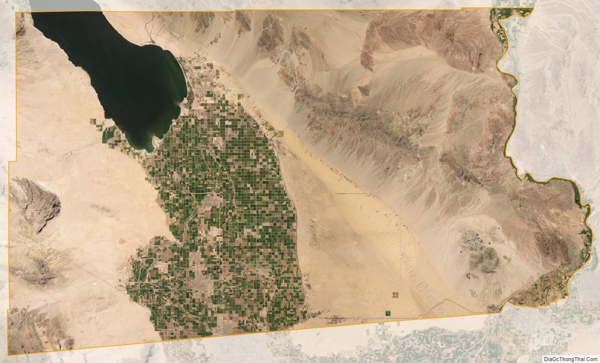
Although this region is a desert, with high temperatures and low average rainfall of 3 inches (76 mm) per year, the economy is strongly based on agriculture. This is supported by irrigation, with water supplied wholly from the Colorado River via the All-American Canal.
The Imperial Valley straddles the border between the United States and Mexico. Imperial County is strongly influenced by Mexican culture. Approximately 80% of the county’s population is Hispanic, with the vast majority being of Mexican origin. The remainder of the population is predominantly non-Hispanic white, in addition to smaller African American, Native American, and Asian minorities.
| Name: | Imperial County |
|---|---|
| FIPS code: | 06-025 |
| State: | California |
| Founded: | 1907 |
| Named for: | Imperial Valley, which was named after the Imperial Land Company |
| Seat: | El Centro |
| Total Area: | 4,482 sq mi (11,610 km²) |
| Land Area: | 4,177 sq mi (10,820 km²) |
| Total Population: | 179,702 |
| Population Density: | 43/sq mi (17/km²) |
| Time zone: | UTC−8 (Pacific Time Zone) |
| Summer Time Zone (DST): | UTC−7 (Pacific Daylight Time) |
| Website: | www.co.imperial.ca.us |
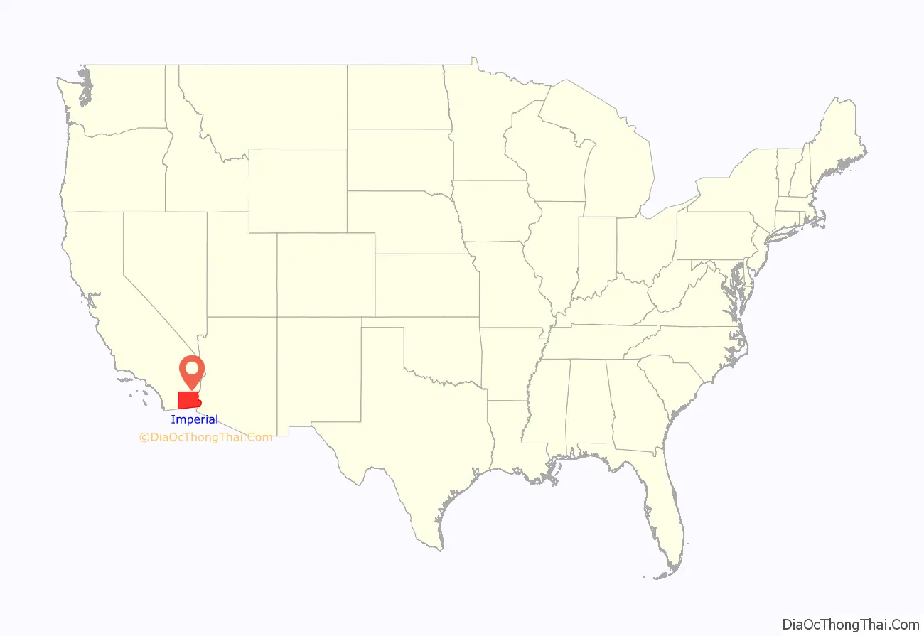
Imperial County location map. Where is Imperial County?
History
Spanish explorer Melchor Díaz was one of the first Europeans to visit the area of the Imperial Valley in 1540. The explorer Juan Bautista de Anza also explored the area in 1776.
Decades later, after the Mexican–American War, the northern half of the valley was annexed in 1848 by the U.S., while the southern half remained under Mexican rule. Small-scale settlement in natural aquifer areas had occurred in the early 19th century (the present-day site of Mexicali), but most permanent settlement (Americans on the U.S. side, Mexicans on the other side) was after 1900.
In 1905, torrential rainfall in the American Southwest caused the Colorado River (the only drainage for the region) to flood, including canals that had been built to irrigate the Imperial Valley. Since the valley is partially below sea level, the waters never fully receded, but collected in the Salton Sink in what is now called the Salton Sea.
Imperial County was formed in 1907 from the eastern portion of San Diego County. The county was named for Imperial Valley. This had been named for the Imperial Land Company, a subsidiary of the California Development Company, which at the turn of the 20th century had claimed the southern portion of the Colorado Desert for agriculture. The Imperial Land Company also owned extensive lands in Mexico (Baja California). Its objective was to develop commercial crop farming.
By 1910, the land company had managed to settle and develop thousands of farms on both sides of the border. The Mexican Revolution soon after severely disrupted the company’s plans. Rival Mexican armies affiliated with different ethnicities killed nearly 10,000 farmers and their families in northern Mexico. Not until the 1920s was the other side of California in the United States sufficiently peaceful and prosperous for the company to earn a return for a large percentage of Mexicans. Some chose to stay and create roots in newly developed communities in the valley.
During the Great Depression and the Dust Bowl, the county attracted migrating “Okies” from drought-ridden farms on the plains by the need of migrant labor. More prosperous job-seekers also arrived from across the U.S. in the 1930s and 1940s. American entry into World War II stimulated the growth of jobs and need to expanded agriculture, and the All American Canal was completed from its source, the Colorado River, to Imperial Valley from 1948 to 1951. By the 1950 census, more than 50,000 residents lived in Imperial County alone, about 40 times the population of 1910. Most of the population was year-round, but would increase every winter by migrant laborers from Mexico. Until the 1960s, the farms in Imperial County provided substantial economic returns to the company and the valley.
During the Great Recession of 2008–11, El Centro had one of the highest unemployment rates (above 30–34%) in the U.S. In the early 2020s, Imperial ranks as one of California’s poorest counties. It has a lower median household income than either the state or national medians.
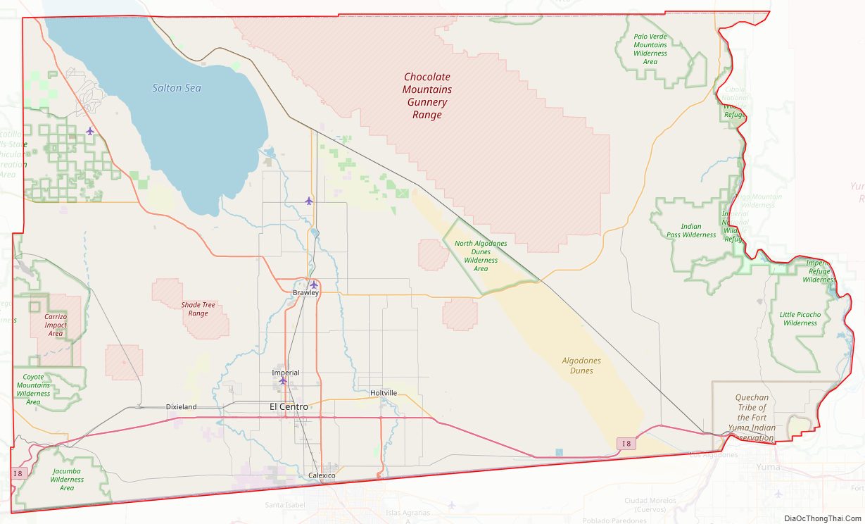
Imperial County Road Map
Geography
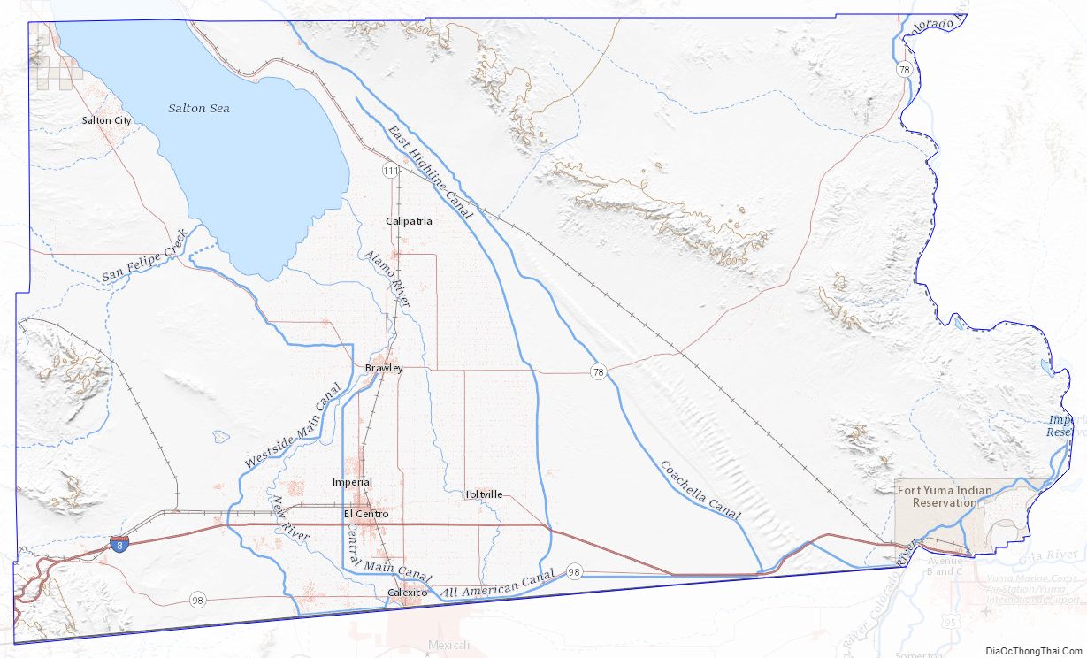
According to the U.S. Census Bureau, the county has a total area of 4,482 square miles (11,610 km), of which 4,177 square miles (10,820 km) is land and 305 square miles (790 km) (6.8%) is water. Much of Imperial County is below sea level. Imperial County is roughly twice the size in total square miles as the State of Delaware.
The county is in the Colorado Desert, an extension of the larger Sonoran Desert.
The Colorado River forms the county’s eastern boundary. Two notable geographic features are found in the county, the Salton Sea, at 235 feet (72 m) below sea level, and the Algodones Dunes, one of the largest dune fields in America.
The Chocolate Mountains are located east of the Salton Sea, and extend in a northwest–southeast direction for approximately 60 miles (97 km).
In this region, the geology is dominated by the transition of the tectonic plate boundary from rift to fault. The southernmost strands of the San Andreas Fault connect the northernmost extensions of the East Pacific Rise. Consequently, the region is subject to earthquakes, and the crust is being stretched, resulting in a sinking of the terrain over time. Related to the active geology are some interesting hydrothermal features.
National protected areas
- Cibola National Wildlife Refuge (part)
- Imperial National Wildlife Refuge (part)
- Sonny Bono Salton Sea National Wildlife Refuge
Imperial County Topographic Map
Imperial County Satellite Map
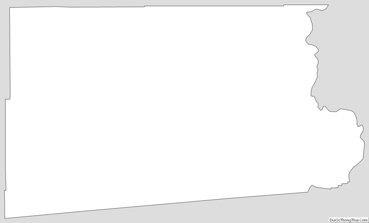
Imperial County Outline Map