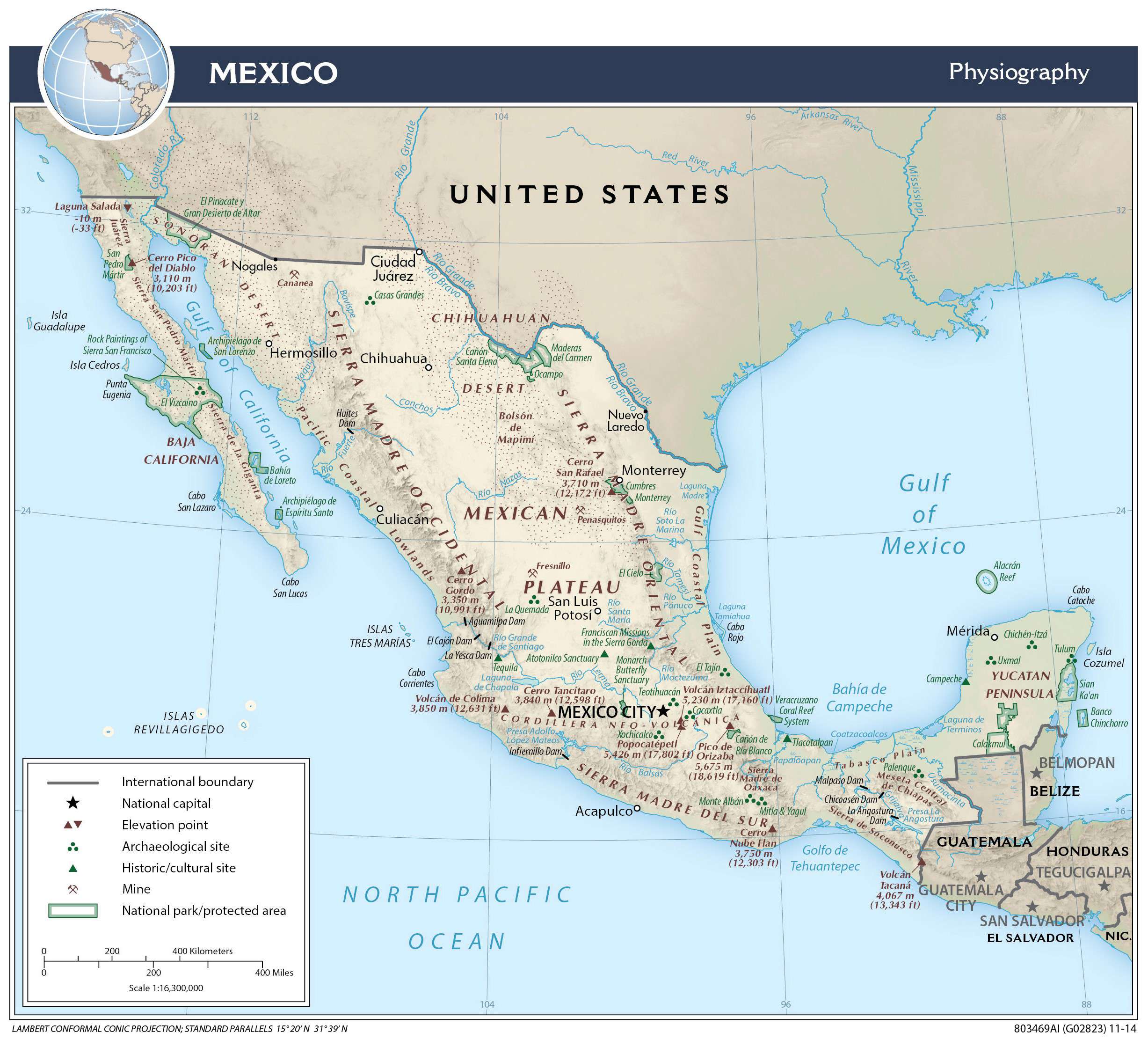
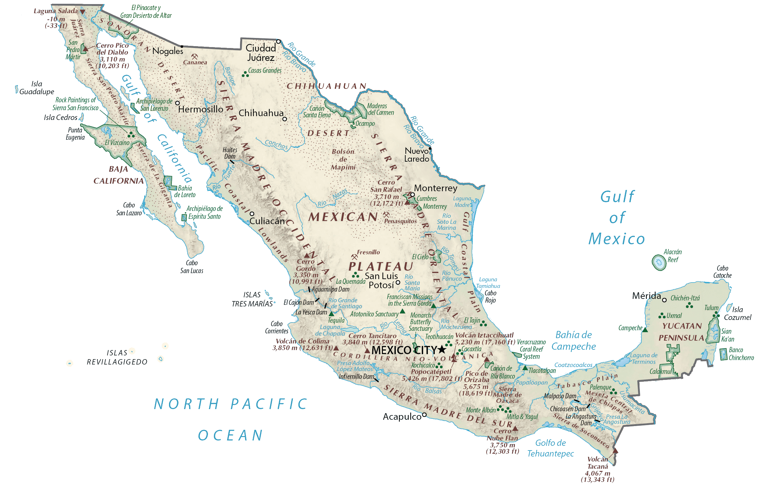
Covering an area of 1,972,550 sq. km (761,610 sq mi), Mexico is a country located in the southern part of North America. As observed on the physical map of Mexico above, the country has an extremely diverse topography.
Mountains: The Sierra Madre Occidental Range runs north to south, from the Sonora-Arizona border southeast through Sonora, Chihuahua, Sinaloa, Durango, Zacatecas, Nayarit, Jalisco, Augascalientes to Guanajuato, where it joins the Sierra Madre del Sur and the Transverse Volcanic Axis of Central Mexico. These steep mountains are cut through with canyons, including Copper Canyon, the deepest in North America. The highest point is Cero Mohinora at 10,662 ft (3,250m). Sierra Madre del Sur is a mountain range in Mexico, extending 1,000m from southern Michoacan east through Guerrero to eastern Oaxaca.
Coastal Plains: The Gulf Coastal Plain lies to the east of the Sierra Madre Occidental range fronting the Gulf of Mexico. The very narrow coastal plain along the Pacific Ocean coastline rises quickly into the foothills of the mountains, while the Gulf of Mexico and Caribbean coastlines are wider and rise gently into the interior.
Plateaus: The Central Mexican Plateau consumer much of Northern and Central Mexico. It extend from the border with the USA on the north to the Cordillera Neovolcanica in the south, with the Sierra Madre Occidental mountain range on the west and the Sierra Madre Oriental on the east. It average 5,988 ft (1,825m) above sea level and is covered mostly by deserts and xeric shrublands.
Volcanoes: A long line of ancient volcanoes (many still active) extends from the Pacific Ocean (north of Guadalajara) on eastward to the Gulf of Mexico, just to the south of Veracruz. Pico de Orizaba Volcano, the 3rd highest mountain in North America and Mexico’s highest point is located here. A yellow triangle shows its position on the map above. It is 5,636 m (18,491 ft) tall.
Peninsulas: As observed on the map above, the mountainous Baja Peninsula extends about 750 miles (1,200km) south from the U.S. border. Mexico’s limestone Yucatan Peninsula is tree-covered, with thick tropical jungles along it’s border collies with Central America countries. The Yucatan Peninsula separates the Caribbean Sea from the Gulf of Mexico. It is east of the isthmus of Tehuantepec, which is a geographic partition separating Central America from the rest of North America.
Rivers: Mexico has nearly 150 rivers; most are small, unnavigable, and 70% drain into the Pacific Ocean. Some of the large rivers include the Balsas, Conchos, Grijalva, Panuco, Papaloapan and Usumacinta. The Rio Grande, rising in the San Juan Mountains of the US State of Colorado, flows generally south to the Gulf of Mexico for 1,885 miles (3,000km) and forms much of Mexico’s northern border with the United States. The two largest lakes in the country of Mexico are: Lake Chapala and Lake Cuitzeo.
| Flag: |  |
|---|---|
| Legal Name: | United Mexican States |
| Capital Value: | Mexico City (Ciudad de Mexico) |
| Official languages: |
|
| Demonym(s): | Mexican |
| Government: | Federal presidentialrepublic |
| Legislature: | Congress |
| Total Area: | 1,964,375 km² |
| Land Area: | 1,943,945 km² |
| Water Area: | 20,430 km² |
| Population: | 127,575,529 |
| Density: | 61/km (158.0/sq mi) (142nd) |
| GDP: | $1.26 Trillion |
| GDP Per Capita: | $9,863.07 |
| Currency Value: | Mexican pesos (MXN) |
| Driving side: | right |
| Calling code: | +52 |
| Internet TLD: | .mx |
Discover the beauty and diversity of Mexico with this interactive map. Explore the Central Plateau (Mexican Altiplano), its deserts, rainforests, cities, roads, islands, lakes, and rivers. Get a better understanding of the geography of Mexico with this elevation map and satellite imagery.
Online Interactive Political Map
Click on ![]() to view map in "full screen" mode.
to view map in "full screen" mode.
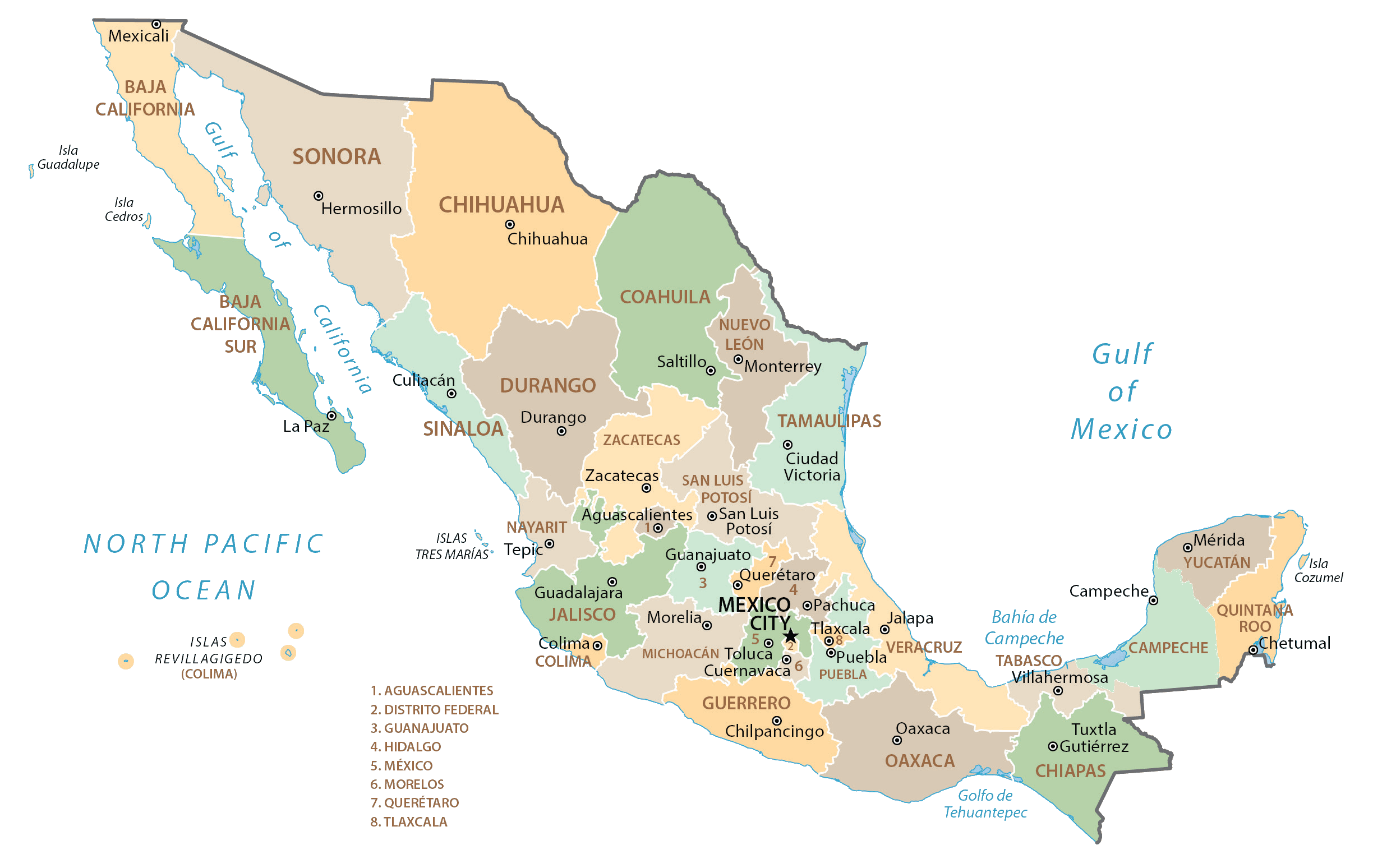
Mexico (officially, the United Mexican States) is divided into 32 federal entities, comprising of 31 states (estados, sing. estado) and 1 capital city. In alphabetical order, the states are: Aguascalientes, Baja California, Baja California Sur, Campeche, Chiapas, Chihuahua, Coahuila, Colima, Durango, Guanajuato, Guerrero, Hidalgo, Jalisco, Mexico, Michoacan, Morelos, Nayarit, Nuevo Leon, Oaxaca, Puebla, Queretaro, Quintana Rao, San Luis Potosi, Sinaloa, Sonora, Tabasco, Tamaulipas, Tlaxcala, Veracruz, Yucatan and Zacatecas. Mexico City is the capital city. The states are further subdivided into a total of 2,448 municipalities (municipios).
Covering an area of 1,972,550 sq. km, it is the 13th largest country in the world and the 3rd largest country in Latin America. Mexico is also the 10th most populous country and the most populous Spanish-speaking nation in the world. Mexico City is the 2nd largest metropolitan area in the Western hemisphere.
Located in the Valley of Mexico in the center of the country is Mexico City – the capital and the largest city in Mexico. It is the administrative, cultural, educational and economic center of the country. It is also the most populous city and an important financial center in North America.
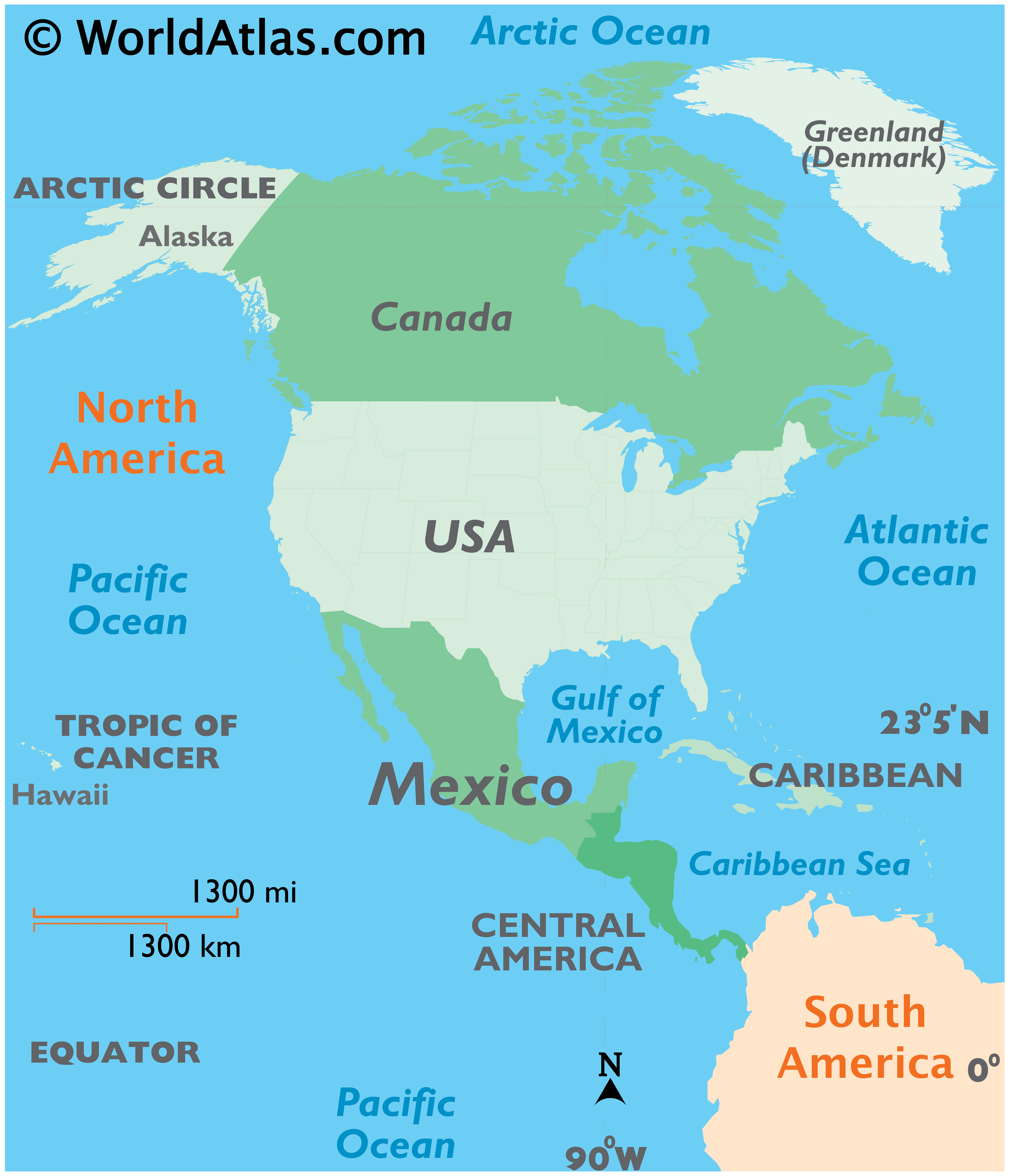
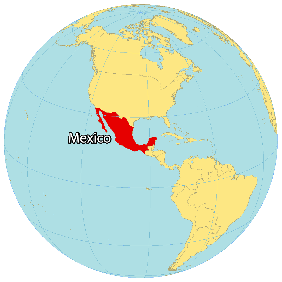
Location Maps
Where is Mexico?
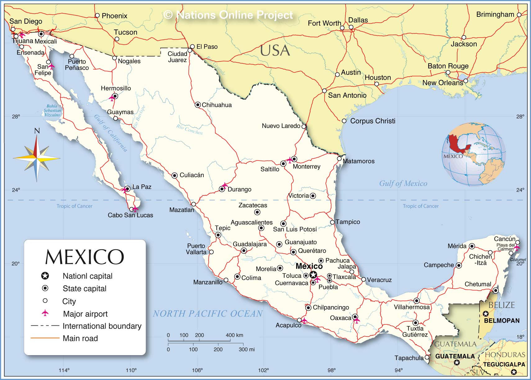
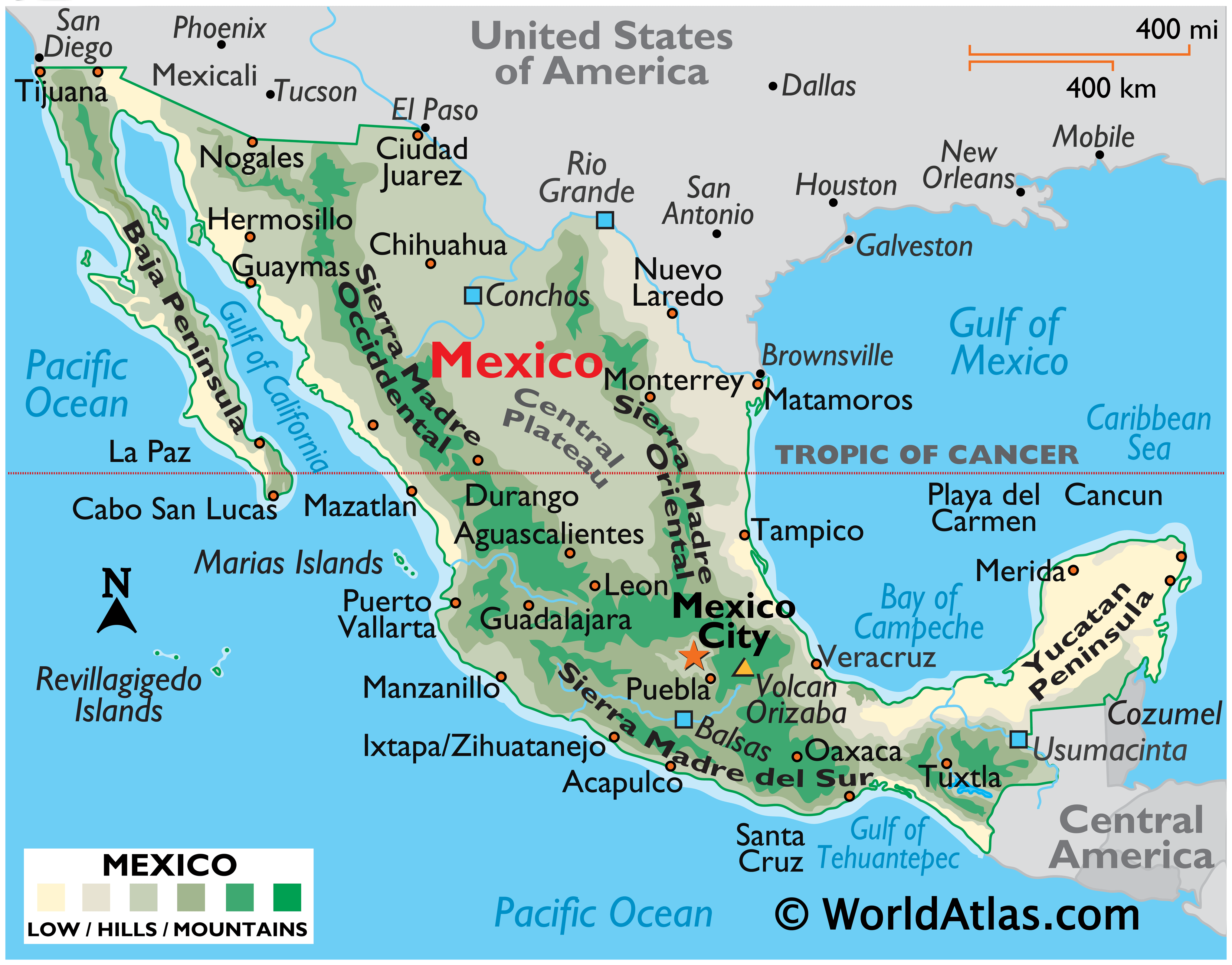
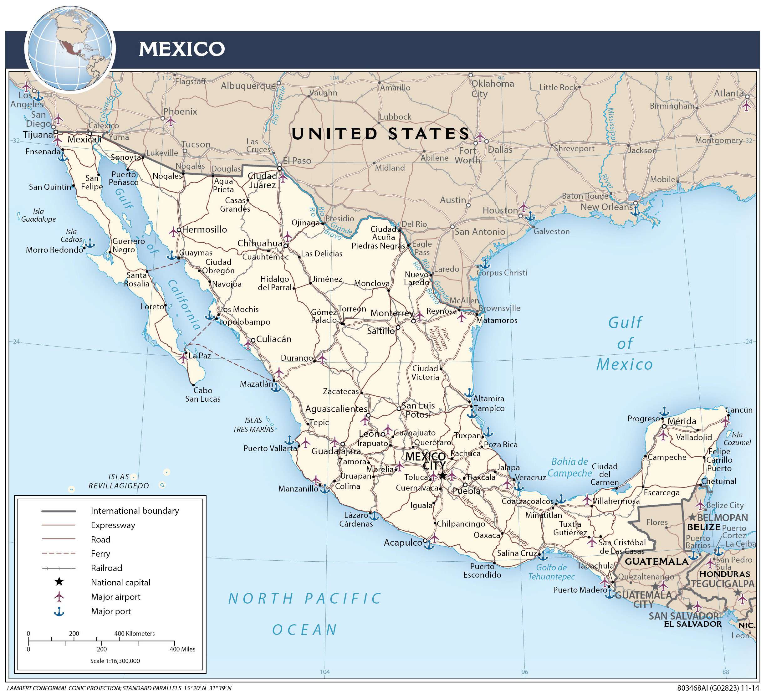
Mexico is located in North America, along the Pacific Ocean and the Gulf of Mexico. Altogether, it borders 3 countries including Belize and Guatemala to the southeast. Also, it borders California, Arizona, New Mexico, and Texas with the United States to the north.
Over 128 million people live in Mexico and it’s the 10th most populous country. In fact, Mexico City is bigger in size and population compared to New York City. The country is known for its Aztec people, festivals like the Day of the Dead, and the largest population of Spanish speakers in the world.
High Definition Political Map of Mexico
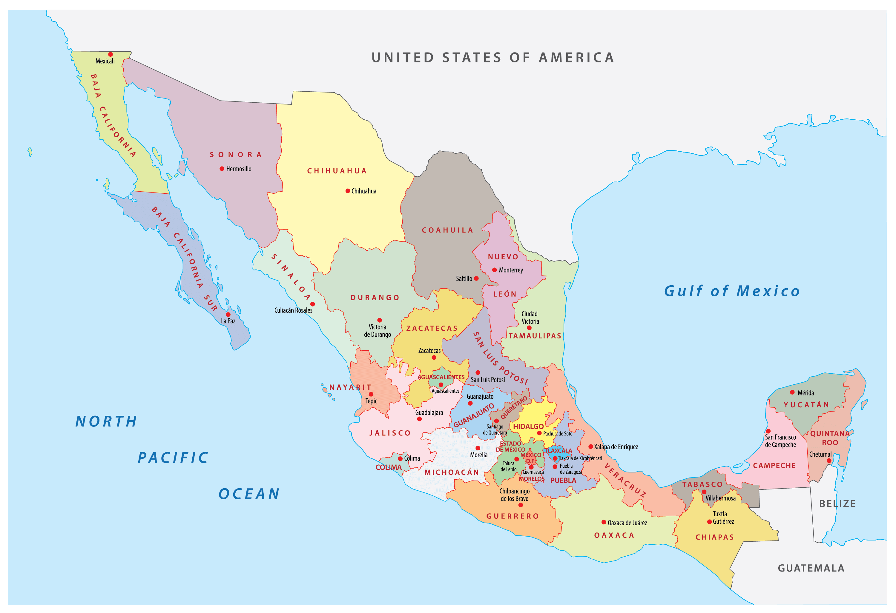
Mexico Administrative Map

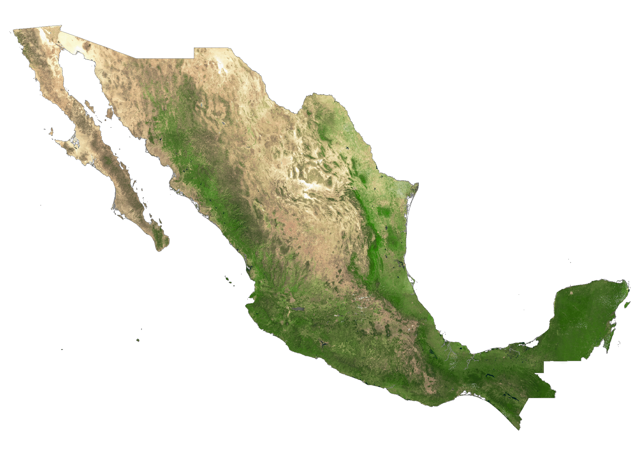
Physical Map of Mexico
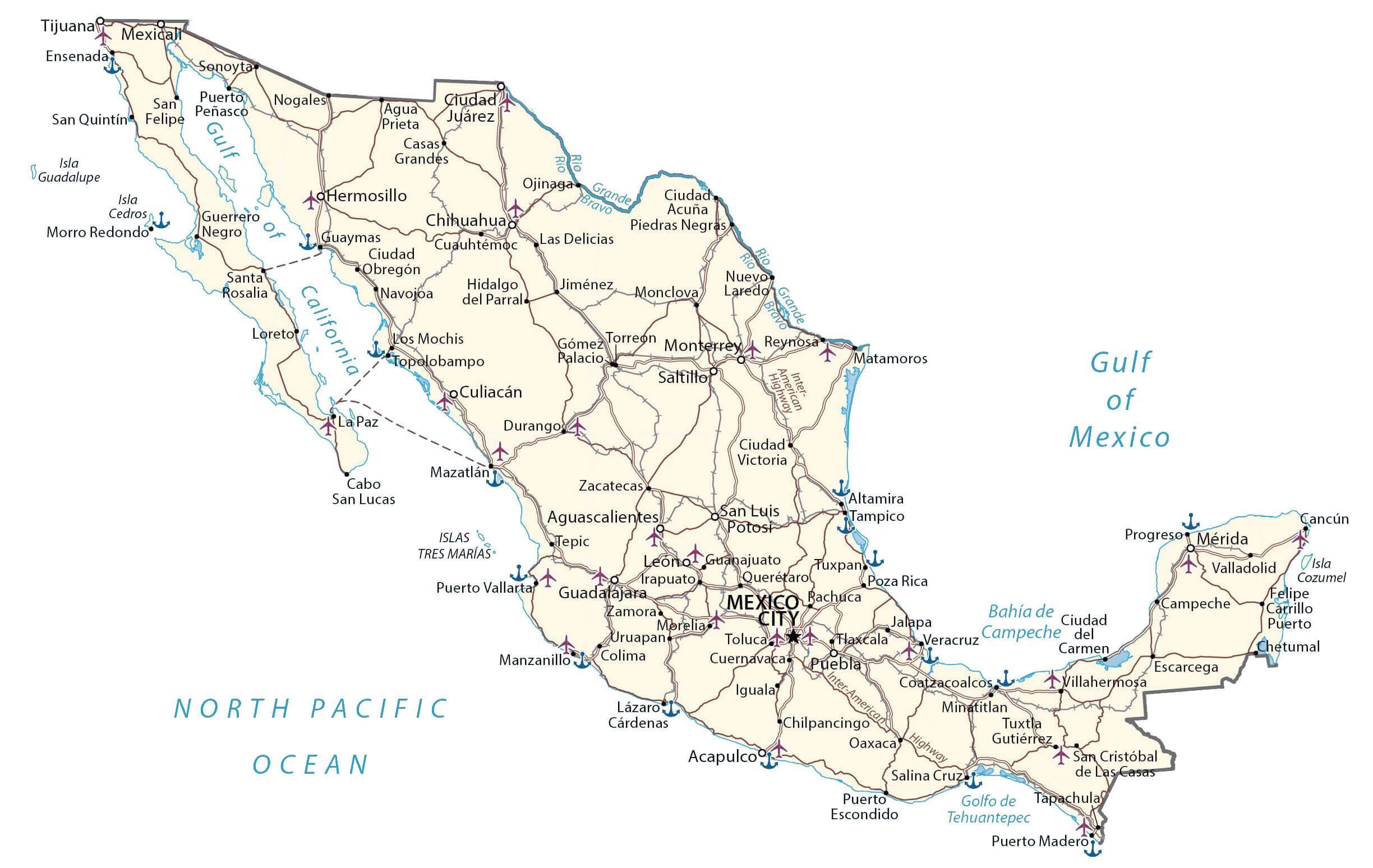
Transportation Map of Mexico
Mexico Satellite Map